- Ōzora, Hokkaidō
-
"Ōzora" redirects here. For the Captain Tsubasa protagonist, see Tsubasa Oozora.For the JR Hokkaido train service, see Super Ōzora.
Ōzora
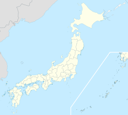
大空町— Town —  Location of Ōzora in Hokkaido
 Ōzora
ŌzoraCoordinates: 43°55′N 144°10′E / 43.917°N 144.167°ECoordinates: 43°55′N 144°10′E / 43.917°N 144.167°E Country Japan Prefecture Hokkaido District Abashiri Government – Mayor Eiji Yamashita Area – Total 343.62 km2 (132.7 sq mi) Population (2008-12-31) – Total 8,394 – Density 24.4/km2 (63.3/sq mi) Time zone Japan Standard Time (UTC+9) City symbols - Tree Japanese Rowan and Japanese White Birch - Flower Mountain Phlox and Lysichite camtschatcense Phone number 0152-74-2111 Address 3-4-1-1 Memanbetsu-nishi, Ōzora-chō, Hokkaidō
099-2392Website www.town.ozora.hokkaido.jp/dd.aspx Ōzora (大空町 Ōzora-chō) is a town in Abashiri District, Okhotsk Subprefecture, Hokkaido, Japan.
Ōzora was formed on March 31, 2006 as a result of the merger of the town of Memanbetsu, and the village of Higashimokoto, both from Abashiri District.
Memanbetsu Village, later Memanbetsu Town, split from the Town of Abashiri (now the City of Abashiri) in 1921, and Higashimokoto Village split from Abashiri Town on February 11, 1947. Therefore all of Ōzora's territory once was a part of Abashiri.
Many places in Ōzora, such as the train stations, the airport, and the high school are named after the former town of Memanbetsu, and Japanese airlines use "Memanbetsu" to refer to "Ōzora" as a destination.[1][2]
Contents
Education
Ōzora operates public elementary and junior high schools.
Hokkaido Prefectural Board of Education operates Memanbetsu High School in Ōzora.
Transportation
Hokkaido Railway Company (JR Hokkaido) operates two stations on the Sekihoku Main Line:
Memanbetsu Airport is located in Ōzora.
References
External links
 Media related to Ozora, Hokkaido at Wikimedia Commons
- Official website (Japanese)
Categories:- Towns in Hokkaidō


Wikimedia Foundation. 2010.