- Clinton County, Ohio
-
Clinton County, Ohio 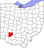
Location in the state of Ohio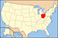
Ohio's location in the U.S.Founded March 1, 1810[1] Named for U.S. Vice-President George Clinton Seat Wilmington Largest city Wilmington Area
- Total
- Land
- Water
412 sq mi (1,068 km²)
411 sq mi (1,064 km²)
1 sq mi (4 km²), 0.34%Population
- (2000)
- Density
40,543
99/sq mi (38/km²)Time zone Eastern: UTC-5/-4 Website co.clinton.oh.us Clinton County is a county located in the state of Ohio, United States. As of the 2010 census, the population was 42,040. [2] The 2008 Census Population Estimate places the figure at 43,200.[2] It is named for former U.S. Vice-President George Clinton.[3] The county seat is Wilmington.[4]
The Wilmington Micropolitan Statistical Area includes all of Clinton County.
Contents
History
Clinton County was formed on February 19, 1810 from sections of Highland County and Warren County. It was named after George Clinton, a soldier, politician, Governor of New York, and Vice President of the United States. According to The Descendants of William Sabin, compiled by Gordon Alan Morris, Thomas J. Prittie, and Dixie Prittie, the first Caucasian child born in the county was Mary Stuart Sabin, daughter of Dr. Warren Sabin, c. 1812.
Geography
According to the U.S. Census Bureau, the county has a total area of 412 square miles (1,067.1 km2). 411 square miles (1,064.5 km2) is land and 1 square mile (2.6 km2) (0.34%) is water.
The entire county lies within the Little Miami River watershed, with the exception of extreme eastern areas, which are within the Scioto River watershed. Clinton County lies within the till plains physiographic region, and is somewhat flat or gently rolling. The northern two thirds of the county were covered with an ice sheet during the Wisconsinan Stage, while the southern third was covered by ice sheets during the much older Illinoian Stage. Because of such a history with ice, glacial features are readily found on the landscape, such as moraines and kames.
The general elevation of the county is roughly 1,050 feet (320 m) above sea level, and there are few areas in the county that deviate from this more than 200 feet (61 m).
The climate of Clinton County can be classified as humid continental. It is one of the coolest and wettest counties in southern Ohio, although differences between it and other southern Ohio counties are usually very slight. Clinton County averages 42 inches (1,100 mm) of precipitation per year, including 30 inches (760 mm) of snow (Note: 1 inch of snow does not equal one inch of precipitation). Average July high temperatures reach the mid and upper 80s F although temperatures above 90 F are common, while lows are typically in the 60s F. January high temperatures typically reach the low and mid 30s F, while lows generally bottom out in the 10s F, although lows in the single digits and even below 0 F are common.
Interstate 71 crosses the northern third of the county, trending Northeast to Southwest. It connects Clinton County to Columbus, Ohio and Cincinnati. Clinton County is part of the Cincinnati-Middletown-Wilmington Combined Statistical Area, although there is little true urban activity in the county. U.S. Route 68 is the major north-south route through the county, while U.S. Route 22 runs east-west. Several other state and local highways serve the residents of Clinton County.
Adjacent counties
- Greene County (north)
- Fayette County (northeast)
- Highland County (southeast)
- Brown County (south)
- Clermont County (southwest)
- Warren County (west)
Demographics
Historical populations Census Pop. %± 1810 2,674 — 1820 8,085 202.4% 1830 11,436 41.4% 1840 15,719 37.5% 1850 18,838 19.8% 1860 21,461 13.9% 1870 21,914 2.1% 1880 24,756 13.0% 1890 24,240 −2.1% 1900 24,202 −0.2% 1910 23,680 −2.2% 1920 23,036 −2.7% 1930 21,547 −6.5% 1940 22,574 4.8% 1950 25,572 13.3% 1960 30,004 17.3% 1970 31,464 4.9% 1980 34,603 10.0% 1990 35,415 2.3% 2000 40,543 14.5% Est. 2007 43,071 6.2% Population 1810-2007.[1] As of the census[5] of 2000, there were 40,543 people, 15,416 households, and 11,068 families residing in the county. The population density was 99 people per square mile (38/km²). There were 16,577 housing units at an average density of 40 per square mile (16/km²). The racial makeup of the county was 95.99% White, 2.19% Black or African American, 0.26% Native American, 0.38% Asian, 0.20% from other races, and 0.97% from two or more races. 0.66% of the population were Hispanic or Latino of any race. 29.3% were of American, 22.2% German, 12.1% English and 10.9% Irish ancestry according to Census 2000.
In 2005 94.7% of the county's population was non-Hispanic whites. Latinos were 1.3% of the population.
There were 15,416 households out of which 34.70% had children under the age of 18 living with them, 57.40% were married couples living together, 10.10% had a female householder with no husband present, and 28.20% were non-families. 23.70% of all households were made up of individuals and 9.90% had someone living alone who was 65 years of age or older. The average household size was 2.56 and the average family size was 3.03.
In the county the population was spread out with 26.40% under the age of 18, 10.20% from 18 to 24, 29.10% from 25 to 44, 22.10% from 45 to 64, and 12.20% who were 65 years of age or older. The median age was 35 years. For every 100 females there were 96.10 males. For every 100 females age 18 and over, there were 92.70 males.
The median income for a household in the county was $40,467, and the median income for a family was $48,158. Males had a median income of $34,448 versus $23,846 for females. The per capita income for the county was $18,462. About 6.40% of families and 8.60% of the population were below the poverty line, including 9.90% of those under age 18 and 11.60% of those age 65 or over.
Government
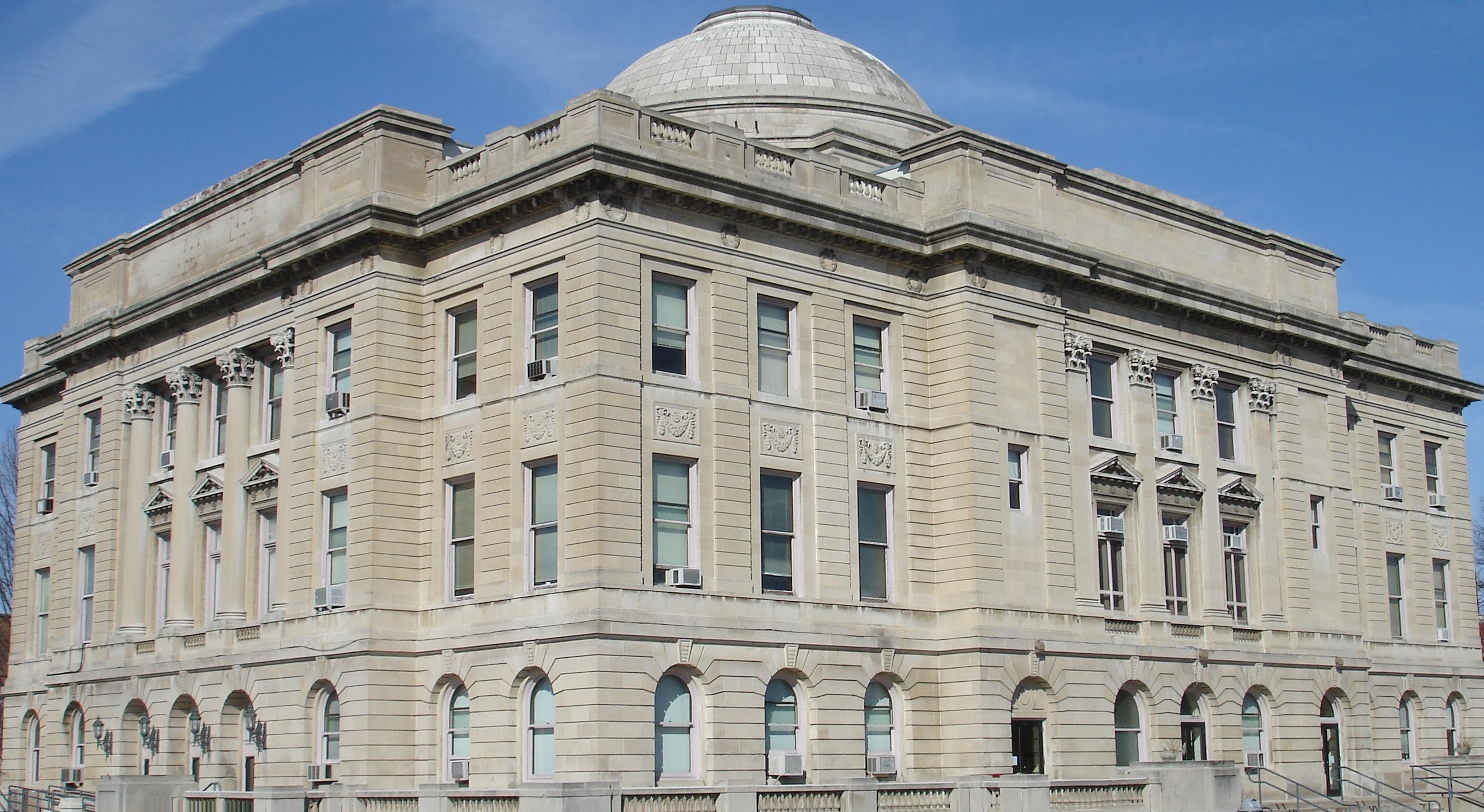
Main article: Ohio county governmentThe Clinton County Courthouse was built in 1915 in Wilmington. The courthouse is located at 53 E. Main Street.
The Wilmington Public Library of Clinton County serves the communities of Clinton County from its administrative offices and main library in Wilmington and its Clinton Massie branch in Clarksville. In 2005, the library loaned more than 161,000 items to its 17,000 cardholders. Total holdings as of 2005 were over 64,000 volumes with over 90 periodical subscriptions.[6]
Communities
 Map of Clinton County, Ohio With Municipal and Township Labels
City
Villages
Townships
Unincorporated communities
- Bloomington
- Burtonville
- Cuba
- Farmers Station
- Gurneyville
- Jonesboro
- Lees Creek
- Lumberton
- McKays Station
- Melvin
- Memphis
- Morrisville
- New Antioch
- North Kingman
- Oakland
- Ogden
- Powder Lick
- Reesville
- Sligo
- South Kingman
- Wallopsburg
- Westboro
School districts
The following school districts have territory in Clinton County. Those primarily in Clinton are in bold, those primarily in other counties are in italics. The county a district is primarily located in is bolded.
- Blanchester Local School District (also in Brown, Clermont, and Warren)
- Clinton Massie Local School District (also in Warren)
- East Clinton Local (also in Fayette, Greene, and Highland)
- Fairfield Local School District (also in Highland)
- Fayetteville-Perry Local School District (also in Brown)
- Greeneview Local School District (also in Greene)
- Lynchburg-Clay Local School District (also in Highland)
- Miami Trace Local School District (also in Fayette)
- Wilmington City School District (also in Greene)
- Xenia City School District (also in Greene and Warren)
Recreation
Clinton County is home to Cowan Lake State Park, where outdoor recreationalists enjoy fishing, swimming, boating, hiking, bicycling, camping, and wildlife viewing. The northwestern border of Clinton County is formed by Caesar Creek Lake, which is part of Caesar Creek State Park. Fossil hunting is popular here, in addition to similar activities enjoyed at Cowan Lake. Wilmington College in Wilmington has several NCAA Division III athletic programs, whose events can be attended by the public. The city is also the home of the Clinton County Corn Festival.
In terms of professional sports, Clinton County is firmly within the Cincinnati market. Many residents are supporters of the baseball Cincinnati Reds and football Cincinnati Bengals. Cincinnati is a one hour or less drive away for nearly all Clinton County residents.
See also
References
- ^ a b "Ohio County Profiles: Clinton County" (PDF). Ohio Department of Development. http://www.odod.state.oh.us/research/FILES/S0/Clinton.pdf. Retrieved 2007-04-28.
- ^ [1] U.S. Census Bureau-American Fact Finder. Accessed 4-18-09
- ^ "Clinton County data". Ohio State University Extension Data Center. http://www.osuedc.org/profiles/profile_entrance.php?fips=39027&sid=0. Retrieved 2007-04-28.[dead link]
- ^ "Find a County". National Association of Counties. http://www.naco.org/Counties/Pages/FindACounty.aspx. Retrieved 2011-06-07.
- ^ "American FactFinder". United States Census Bureau. http://factfinder.census.gov. Retrieved 2008-01-31.
- ^ "2005 Ohio Public Library Statistics:Statistics by County and Town". State Library of Ohio. http://winslo.state.oh.us/publib/2005_stats_by_county.xls. Retrieved October 3, 2006.
External links
- Clinton County Government's website
- Clinton County Ohio Convention and Visitor's Bureau
- Clinton County Genealogical and Historical Societies
- Wilmington Public Library of Clinton County website

Greene County Fayette County Warren County 
 Clinton County, Ohio

Clermont County Brown County Highland County Municipalities and communities of Clinton County, Ohio City 
Villages Blanchester‡ | Clarksville | Lynchburg‡ | Martinsville | Midland | New Vienna | Port William | Sabina
Townships Unincorporated
communitiesCuba | Lees Creek | Reesville
Footnotes ‡This populated place also has portions in an adjacent county or counties
Categories:- Ohio counties
- 1810 establishments in the United States
- Populated places established in 1810
- Clinton County, Ohio


Wikimedia Foundation. 2010.