- Clinton County, Michigan
-
There are several other places named Clinton, Michigan.
Clinton County, Michigan 
Seal
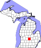
Location in the state of Michigan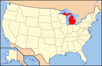
Michigan's location in the U.S.Founded 1831 Named for DeWitt Clinton Seat St. Johns Area
- Total
- Land
- Water
574.57 sq mi (1,488 km²)
571.46 sq mi (1,480 km²)
3.12 sq mi (8 km²), 0.54%Population
- (2010)
- Density
75,382
114/sq mi (44/km²)Time zone Eastern: UTC-5/-4 Website www.clinton-county.org Clinton County is a county in the U.S. state of Michigan, and is part of the Lansing Metropolitan Area. As of the 2010 census, the population was 75,382. It is named after early American politician DeWitt Clinton. The county seat is St. Johns[1].
Contents
Geography
According to the 2000 census, the county has a total area of 574.57 square miles (1,488.1 km2), of which 571.46 square miles (1,480.1 km2) (or 99.46%) is land and 3.12 square miles (8.1 km2) (or 0.54%) is water.[2]
Adjacent counties
- Saginaw County (northeast)
- Gratiot County (north)
- Montcalm County (northwest)
- Shiawassee County (east)
- Ionia County (west)
- Ingham County (southeast)
- Eaton County (southwest)

Montcalm County Gratiot County Saginaw County Ionia County 
Shiawassee County  Clinton County, Michigan

Eaton County Ingham County Demographics
Historical populations Census Pop. %± 1900 25,136 — 1910 23,129 −8.0% 1920 23,110 −0.1% 1930 24,174 4.6% 1940 26,671 10.3% 1950 31,195 17.0% 1960 37,969 21.7% 1970 48,492 27.7% 1980 55,893 15.3% 1990 57,883 3.6% 2000 64,753 11.9% 2010 75,382 16.4% As of the census[3] of 2000, there were 64,753 people, 23,653 households, and 17,976 families residing in the county. The population density was 113 people per square mile (44/km²). There were 24,630 housing units at an average density of 43 per square mile (17/km²). The racial makeup of the county was 96.40% White, 0.63% Black or African American, 0.44% Native American, 0.52% Asian, 0.04% Pacific Islander, 0.81% from other races, and 1.17% from two or more races. 2.61% of the population were Hispanic or Latino of any race. 35.3% were of German, 11.4% English, 10.1% American and 8.5% Irish ancestry according to Census 2000. 96.4% spoke English and 1.9% Spanish as their first language.
There were 23,653 households out of which 37.40% had children under the age of 18 living with them, 64.30% were married couples living together, 8.40% had a female householder with no husband present, and 24.00% were non-families. 19.80% of all households were made up of individuals and 7.10% had someone living alone who was 65 years of age or older. The average household size was 2.70 and the average family size was 3.12.
In the county the population was spread out with 28.10% under the age of 18, 7.30% from 18 to 24, 29.20% from 25 to 44, 24.50% from 45 to 64, and 10.90% who were 65 years of age or older. The median age was 37 years. For every 100 females there were 98.90 males. For every 100 females age 18 and over, there were 95.60 males.
The median income for a household in the county was $52,806, and the median income for a family was $60,491. Males had a median income of $42,379 versus $31,065 for females. The per capita income for the county was $22,913. About 3.30% of families and 4.60% of the population were below the poverty line, including 5.30% of those under age 18 and 6.00% of those age 65 or over.
Transportation
Highways

I-69 travels across southern Clinton County bypassing Lansing on the north. To the south, I-69 continues toward Battle Creek and Fort Wayne, Indiana. Easterly, the highway travels on to Flint and Port Huron. 
I-96 runs through the southwestern corner of the county before turning southerly to bypass Lansing. It connects Grand Rapids and Muskegon to the west with Detroit on the east. 
I-69 Business Loop or BL I-69 is a loop route running through Lansing and East Lansing. A small portion of the route exists in southeastern Clinton County. 
I-96 Business Loop or BL I-96 is a loop route running through Lansing. A small portion of the route exists in southern Clinton County. 
U.S. 127 runs north-south through the center portion of the county, serving both St. Johns and DeWitt. US 127 continues northerly toward Mt. Pleasant and Grayling, and southerly past Lansing and on toward Jackson. 

U.S. 127 Business is a loop route through St. Johns. 
M-21 passes east-west through Fowler, St. Johns, Shepardsville and Ovid. M-21 provides a link to Grand Rapids, approximately 66 miles (106 km) to the west, and Flint, about 45 miles (72 km) to the east. 
M-100. A short segment of M-100 exists in southwestern Clinton Co. From a beginning at I-69 in Eaton County, it terminates as I-96 north of Grand Ledge. Airports
Capital Region International Airport (IATA: LAN, ICAO: KLAN, FAA LID: LAN) is a public, Class C airport located 3 miles (5 km) northwest of downtown Lansing, primarily in DeWitt Township. The airport accessible by Grand River Avenue (Business Route 96) and is located 1.5 miles (2.4 km) south of Interstate 69.
Abrams Municipal Airport (FAA LID: 4D0) is a city-owned, public-use airport located two nautical miles (3.7 km) north of the central business district of Grand Ledge, a city in Eaton County. The airport is accessible by road from Wright Road (M-100), and is located 2.1 miles (3.4 km) south of Interstate 96, just east of M-100.
Government
The county government operates the jail, maintains rural roads, coordinates local emergency management, operates the major local courts, keeps files of deeds and mortgages, maintains vital records, administers public health regulations, and participates with the state in the provision of welfare and other social services. The county board of commissioners controls the budget but has only limited authority to make laws or ordinances. In Michigan, most local government functions — police and fire, building and zoning, tax assessment, street maintenance, etc. — are the responsibility of individual cities and townships.
Clinton County elected officials
- Prosecuting Attorney: Charles D. Sherman
- Sheriff: Wayne Kangas
- County Clerk: Diane Zuker
- County Treasurer: Tina Ward
- Register of Deeds: Carol Wooley
- Drain Commissioner: Phil Hanses
- County Commissioners: Larry Martin (Chairman), Robert Showers (Vice-Chairman), Jack Enderle, Eileen Heideman, Paul McNamara, David Pohl, Adam Stacey
(information as of January 2009)
Cities, villages, and townships
Cities
- DeWitt
- East Lansing (partially)
- Grand Ledge (partially)
- St. Johns
Villages
- Eagle
- Elsie
- Fowler
- Hubbardston (partially)
- Maple Rapids
- Ovid
- Westphalia
Unincorporated
- Bath
- Eureka
- Matherton (partially)
- Shepardsville
- Wacousta
Townships
- Bath Charter Township
- Bengal Township
- Bingham Township
- Dallas Township
- DeWitt Charter Township
- Duplain Township
- Eagle Township
- Essex Township
- Greenbush Township
- Lebanon Township
- Olive Township
- Ovid Township
- Riley Township
- Victor Township
- Watertown Charter Township
- Westphalia Township
See also
References
- ^ "Find a County". National Association of Counties. http://www.naco.org/Counties/Pages/FindACounty.aspx. Retrieved 2011-06-07.
- ^ "Census 2000 U.S. Gazetteer Files: Counties". United States Census. http://www.census.gov/tiger/tms/gazetteer/county2k.txt. Retrieved 2011-02-13.
- ^ "American FactFinder". United States Census Bureau. http://factfinder.census.gov. Retrieved 2008-01-31.
External links
- Clinton County government site
- Clinton County Chamber of Commerce
- Clinton County Economic Alliance
- Clinton Conservation District
- Clarke Historical Library, Central Michigan University, Bibliography on Clinton County
Municipalities and communities of Clinton County, Michigan Cities DeWitt | East Lansing‡ | Grand Ledge‡ | St. Johns
Villages Eagle | Elsie | Fowler | Hubbardston‡ | Maple Rapids | Ovid‡ | Westphalia
Charter
townshipsGeneral law
townshipsUnincorporated
communityFootnotes ‡This populated place also has portions in an adjacent county or counties
Categories:- Michigan counties
- Clinton County, Michigan
- Lansing – East Lansing metropolitan area


Wikimedia Foundation. 2010.