Drumkee

Drumkee

Coordinates: 54°30′36″N 6°40′30″W / 54.510°N 6.675°W / 54.510; -6.675

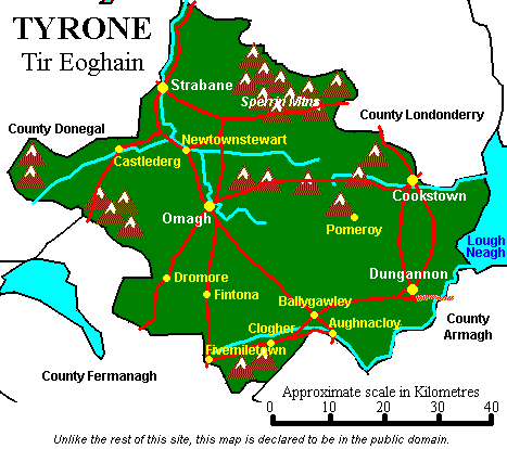
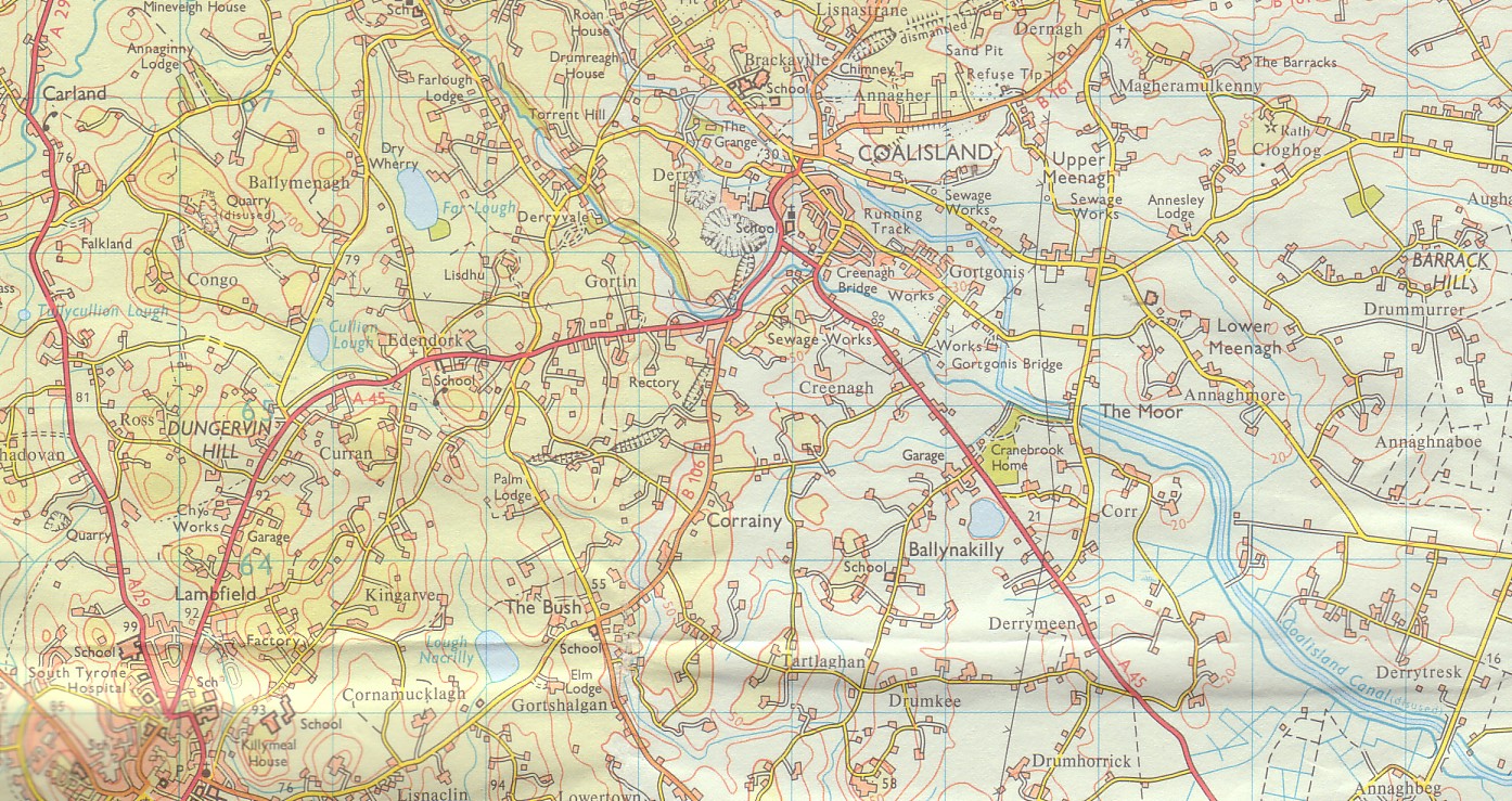
Drumkee is a small townland outside Dungannon in the parish of Killyman in the southeast of County Tyrone, Northern Ireland. It is directly south of the area presently known as Coalisland.[1] It is east, and slightly north, of Dungannon.[2]

It was part of the historic Barony of Dungannon, and the barony's tax records dated 1666 list two families living in Drumkee.[3]

The prefix "Drum" means "ridge" and comes from the Gaelic word droim.[4]

Drumkee presently has a population of around 150, and many of its inhabitants are relations.[citation needed] Surnames which appear on the 1666 list include McRory and Condson.[3] By the mid-19th century, the name Hunter appears in Drumkee burial records.[5] The surname Mullan appears in a 1910 directory of the area.[6]

Drumkee is affiliated with the Killyman Gaelic Athletic Association football club, St. Brigids.[citation needed]

See also

External links

  • Map of County Tyrone showing Dungannon, the closest population center to the township of Drumkee. Accessed July 11, 2007.

References

  1. ^ Coalisland Map. Accessed July 11, 2007.
  2. ^ Dungannon LGD Killyman Ward 95OO17 map from the Northern Ireland Neighbourhood Information Service. Accessed July 11, 2007.
  3. ^ a b Hearth Money Rolls of Barony of Dungannon. Accessed July 11, 2007.
  4. ^ Gaelic Root Words For Irish Town Names. Accessed July 11, 2007.
  5. ^ Killyman Burial Records. Accessed July 11, 2007.
  6. ^ Belfast and Ulster Towns Directory for 1910. Accessed July 11, 2007.


Wikimedia Foundation. 2010.

Игры ⚽ Нужно решить контрольную?

Look at other dictionaries:

  • County Tyrone — Tyrone redirects here. For other uses, see Tyrone (disambiguation). County Tyrone Contae Thír Eoghain Coontie Tyrone …   Wikipedia

  • Omagh — This article is about the town of Omagh. For the film of same name, see Omagh (film). Coordinates: 54°35′N 7°17′W / 54.59°N 7.29°W / 54 …   Wikipedia

  • Cookstown — For other towns of this name, see Cookstown (disambiguation). Coordinates: 54°38′49″N 6°44′42″W / 54.647°N 6.745°W / 54.647; 6.7 …   Wikipedia

  • Drum Manor Forest Park — is a forest in Northern Ireland, south of the Sperrin Mountains and west of Lough Neagh. It was bought from a private owner in 1964 and opened to the public in 1970. See: Forests in the United Kingdom External links Homepage at the Forest Service …   Wikipedia

  • Coalisland — Coordinates: 54°32′31″N 6°41′38″W / 54.542°N 6.694°W / 54.542; 6.694 …   Wikipedia

  • Dungannon — For the town in Virginia, see Dungannon, Virginia. For the thoroughbred racehorse, see Dungannon (horse). For the former barony, see Dungannon (barony). Coordinates: 54°30′N 6°46′W /  …   Wikipedia

  • Clogher — For other uses, see Clogher (disambiguation). Coordinates: 54°25′00″N 7°12′00″W / 54.416667°N 7.2°W / 54.416667; 7.2 …   Wikipedia

  • Dromore, County Tyrone — Not to be confused with Dromore, County Down. Coordinates: 54°30′48″N 7°27′32″W / 54.513309°N 7.458858°W / 54.51 …   Wikipedia

  • Donemana — Donaghedy Parish Church Donemana or Dunnamanagh (named after the townland of Dunnamanagh, from Irish: Dún na Manach meaning stronghold of the monks )[1] …   Wikipedia

  • Moy, County Tyrone — Coordinates: 54°26′N 6°41′W / 54.44°N 6.69°W / 54.44; 6.69 …   Wikipedia

Share the article and excerpts

Direct link
Do a right-click on the link above
and select “Copy Link”