- Clay County, Illinois
-
Clay County, Illinois 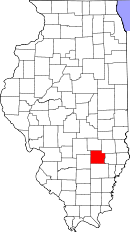
Location in the state of Illinois
Illinois's location in the U.S.Founded 1824 Seat Louisville Largest city Flora Area
- Total
- Land
- Water
469.59 sq mi (1,216 km²)
468.32 sq mi (1,213 km²)
1.28 sq mi (3 km²), 0.27%Population
- (2010)
- Density
13,815
31/sq mi (12/km²)Time zone Central: UTC-6/-5 Clay County is a county located in the U.S. state of Illinois. In 1950, the U.S. Census Bureau placed the mean center of U.S. population in Clay County.[1] According to the 2010 census, it has a population of 13,815, which is a decrease of 5.1% from 14,560 in 2000.[2] Its county seat is Louisville.[3]
Contents
History
Clay County was formed in 1824 out of portions of Wayne, Crawford, and Fayette counties. Its name is in honor of Henry Clay, famous American statesman, member of the United States Senate from Kentucky and United States Secretary of State in the 19th century. Clay was an unsuccessful candidate for President in the year the County was named.
-

Clay County from the time of its creation to 1831
-

Clay County between 1831 and 1841
-

Clay County was reduced to its current size in 1841 by the creation of Richland County.
Geography
According to the 2010 census, the county has a total area of 469.59 square miles (1,216.2 km2), of which 468.32 square miles (1,212.9 km2) (or 99.73%) is land and 1.28 square miles (3.3 km2) (or 0.27%) is water.[4]
Adjacent counties
- Jasper County - northeast
- Richland County - east
- Wayne County - south
- Marion County - west
- Fayette County - northwest
- Effingham County - north
Major highways
 Interstate 57
 US Route 45
 US Route 50
Settlements
Cities
Villages
Townships
Clay County is divided into these twelve townships:
Education
- Clay City Community Unit District 10
- Dieterich Community Unit School District 30
- Effingham Community Unit School District 40
- Flora Community Unit School District 35
- Jasper County Community Unit School District 1
- North Clay Community Unit School District 25
- South Central Community Unit School District 401
- West Richland Community Unit School District 2
Political districts
- Illinois' 19th congressional district
- State House District 108
- State Senate District 54
Demographics
 2000 census age pyramid for Clay County.
Historical populations Census Pop. %± 1900 19,553 — 1910 18,661 −4.6% 1920 17,684 −5.2% 1930 16,155 −8.6% 1940 18,947 17.3% 1950 17,445 −7.9% 1960 15,815 −9.3% 1970 14,735 −6.8% 1980 15,283 3.7% 1990 14,460 −5.4% 2000 14,560 0.7% IL Counties 1900-1990 As of the census[5] of 2000, there were 14,560 people, 5,839 households, and 4,005 families residing in the county. The population density was 31 people per square mile (12/km²). There were 6,394 housing units at an average density of 14 per square mile (5/km²). The racial makeup of the county was 98.52% White, 0.11% Black or African American, 0.23% Native American, 0.52% Asian, 0.01% Pacific Islander, 0.21% from other races, and 0.40% from two or more races. 0.60% of the population were Hispanic or Latino of any race. 38.5% were of American, 23.0% German, 10.5% English and 9.5% Irish ancestry according to Census 2000. 98.8% spoke English and 1.0% Spanish as their first language.
There were 5,839 households out of which 30.60% had children under the age of 18 living with them, 56.40% were married couples living together, 8.60% had a female householder with no husband present, and 31.40% were non-families. 27.90% of all households were made up of individuals and 14.80% had someone living alone who was 65 years of age or older. The average household size was 2.41 and the average family size was 2.94.
In the county the population was spread out with 23.90% under the age of 18, 8.00% from 18 to 24, 25.90% from 25 to 44, 23.00% from 45 to 64, and 19.20% who were 65 years of age or older. The median age was 40 years. For every 100 females there were 92.30 males. For every 100 females age 18 and over, there were 89.10 males.
The median income for a household in the county was $30,599, and the median income for a family was $36,675. Males had a median income of $27,813 versus $20,616 for females. The per capita income for the county was $15,771. About 9.00% of families and 11.80% of the population were below the poverty line, including 12.90% of those under age 18 and 12.30% of those age 65 or over.
Climate and weather
Louisville, Illinois Climate chart (explanation) J F M A M J J A S O N D 2.738212.54425455344.167434.376534.385623.989653.387633.28056369454.155353.44325Average max. and min. temperatures in °F Precipitation totals in inches Source: The Weather Channel[6] Metric conversion J F M A M J J A S O N D 703-6637-41021311051961092412110291799321885311781271377217104132856-4Average max. and min. temperatures in °C Precipitation totals in mm In recent years, average temperatures in the county seat of Louisville have ranged from a low of 21 °F (−6 °C) in January to a high of 89 °F (32 °C) in July, although a record low of −25 °F (−32 °C) was recorded in January 1904 and a record high of 111 °F (44 °C) was recorded in July 1936. Average monthly precipitation ranged from 2.49 inches (63 mm) in February to 4.34 inches (110 mm) in June.[6]
See also
Coordinates: 38°46′N 88°29′W / 38.76°N 88.49°W
References
- United States Census Bureau 2007 TIGER/Line Shapefiles
- United States Board on Geographic Names (GNIS)
- United States National Atlas
- ^ "Mean Center of Population for the United States: 1790 to 2000". United States Census Bureau. http://www.census.gov/geo/www/cenpop/meanctr.pdf. Retrieved 2011-09-17.
- ^ "Clay County QuickFacts". United States Census Bureau. http://quickfacts.census.gov/qfd/states/17/17025.html. Retrieved 2011-11-05.
- ^ "Find a County". National Association of Counties. http://www.naco.org/Counties/Pages/FindACounty.aspx. Retrieved 2011-06-07.
- ^ "Census 2010 U.S. Gazetteer Files: Counties". United States Census. http://www.census.gov/geo/www/gazetteer/files/Gaz_counties_national.txt. Retrieved 2011-11-05.
- ^ "American FactFinder". United States Census Bureau. http://factfinder.census.gov. Retrieved 2008-01-31.
- ^ a b "Monthly Averages for Louisville, Illinois". The Weather Channel. http://www.weather.com/weather/wxclimatology/monthly/graph/USIL0693. Retrieved 2011-01-27.
External links

Fayette County Effingham County Jasper County Marion County 
Richland County  Clay County, Illinois

Wayne County Municipalities and communities of Clay County, Illinois City 
Villages Clay City | Iola | Louisville | Sailor Springs | Xenia
Townships Bible Grove | Blair | Clay City | Harter | Hoosier | Larkinsburg | Louisville | Oskaloosa | Pixley | Songer | Stanford | Xenia
Unincorporated
communitiesGhost town Bethel
Footnotes ‡This populated place also has portions in an adjacent county or counties
Categories:- Illinois counties
- 1824 establishments in the United States
- Populated places established in 1824
- Clay County, Illinois
- Little Egypt
-


Wikimedia Foundation. 2010.