- Clay County, South Dakota
-
Clay County, South Dakota 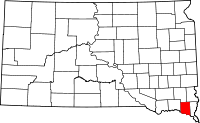
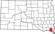
Location in the state of South Dakota
South Dakota's location in the U.S.Founded information needed Seat Vermillion Area
- Total
- Land
- Water
417 sq mi (1,080 km²)
412 sq mi (1,067 km²)
5 sq mi (13 km²), 1.22%Population
- (2010)
- Density
13,864
34/sq mi (13/km²)Website www.claycountysd.org Clay County is a county located in the U.S. state of South Dakota. As of the 2010 census, the population was 13,864. Its name is in honor of Henry Clay, American statesman, member of the United States Senate from Kentucky and United States Secretary of State in the 19th century.[1]
The county seat is Vermillion, which is also home to the University of South Dakota.[2] Clay County is the only county in the Vermillion Micropolitan Statistical Area.
Contents
History
Clay County began forming in 1859 when the land was opened for legal occupation. In 1862 the county was formally organized. The Clay County Courthouse was built in 1912.
Clay County is the name of 17 other counties in the United States; most of them named in honor of Henry Clay.
Geography
According to the U.S. Census Bureau, the county has a total area of 417 square miles (1,080.0 km2), the smallest county in South Dakota, of which 412 square miles (1,067.1 km2) is land and 5 square miles (12.9 km2) (1.22%) is water.
National protected area
Adjacent counties
- Turner County, South Dakota - north
- Lincoln County, South Dakota - northeast
- Union County, South Dakota - east
- Dixon County, Nebraska - southeast
- Cedar County, Nebraska - southwest
- Yankton County, South Dakota - west
Cities and towns
- Burbank
- Dalesburg
- Greenfield
- Irene
- Meckling
- Vermillion - Founded in 1859 and then fully incorporated in 1873. It was named for either the old Fort Vermillion or for the near-by Vermillion River.
- Wakonda
- Westreville
Townships
The county is divided into twelve townships: Bethel, Fairview, Garfield, Glenwood, Meckling, Norway, Pleasant Valley, Prairie Center, Riverside, Spirit Mound, Star, Vermillion.
Major highways
Demographics
Historical populations Census Pop. %± 1870 2,621 — 1880 5,001 90.8% 1890 7,509 50.1% 1900 9,316 24.1% 1910 8,711 −6.5% 1920 9,654 10.8% 1930 10,088 4.5% 1940 9,592 −4.9% 1950 10,993 14.6% 1960 10,810 −1.7% 1970 12,923 19.5% 1980 13,689 5.9% 1990 13,186 −3.7% 2000 13,537 2.7% 2010 13,864 2.4% U.S. Decennial Census As of the census[3] of 2000, there were 13,537 people, 4,878 households, and 2,721 families residing in the county. The population density was 33 people per square mile (13/km²). There were 5,438 housing units at an average density of 13 per square mile (5/km²).
There were 4,878 households out of which 28.00% had children under the age of 18 living with them, 45.00% were married couples living together, 8.10% had a female householder with no husband present, and 44.20% were non-families. 31.00% of all households were made up of individuals and 8.00% had someone living alone who was 65 years of age or older. The average household size was 2.32 and the average family size was 2.93.
In the county, the population was spread out with 18.80% under the age of 18, 31.50% from 18 to 24, 23.80% from 25 to 44, 15.80% from 45 to 64, and 10.10% who were 65 years of age or older. The median age was 25 years. For every 100 females there were 94.30 males. For every 100 females age 18 and over, there were 92.50 males.
Racial/ethnic makeup
The racial makeup of the county was 92.78% White, 1.00% Black or African American, 2.66% Native American, 1.95% Asian, 0.01% Pacific Islander, 0.29% from other races, and 1.31% from two or more races. 0.89% of the population were Hispanic or Latino of any race. 32.0% were of German, 15.6% Norwegian, 9.9% Irish and 5.4% English ancestry.
Religious makeup
From 2000 Census data over 50% consider themselves "unclaimed".[4]
- Mainline Protestant with 3,840 is most common around 28%; mainly Lutheran.
- Catholic with 1820 comes second around 13%
- Evangelical Protestant with 613 would be around 5%; mainly Missouri Synod and Southern Baptist.
Education
- University of South Dakota - In 1862 the territorial legislature located the State University in Vermillion, but nothing was done until 1882 when Clay County voted $10,000 in bonds to construct a building on their campus.[citation needed]
See also
External links
References
- ^ "Clay County, SD - Official site". http://www.claycountysd.org/. Retrieved 2009-01-25.
- ^ "Find a County". National Association of Counties. http://www.naco.org/Counties/Pages/FindACounty.aspx. Retrieved 2011-06-07.
- ^ "American FactFinder". United States Census Bureau. http://factfinder.census.gov. Retrieved 2008-01-31.
- ^ "Clay County, SD Denominational groups". Association of Religion Date Archives (arda). 2000. http://www.thearda.com/mapsReports/reports/counties/46027_2000.asp. Retrieved 2009-01-25.

Turner County Lincoln County Yankton County 
Union County  Clay County, South Dakota

Cedar County, Nebraska Dixon County, Nebraska Municipalities and communities of Clay County, South Dakota Cities Irene‡ | Vermillion
Town Unincorporated
communitiesFootnotes ‡This populated place also has portions in an adjacent county or counties
Categories:- South Dakota counties
- Clay County, South Dakota
- South Dakota counties on the Missouri River


Wikimedia Foundation. 2010.