- Clay County, Kentucky
-
Clay County, Kentucky 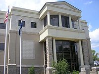 Clay County courthouse in Manchester, Kentucky
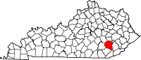
Location in the state of Kentucky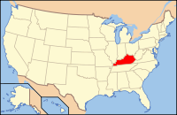
Kentucky's location in the U.S.Founded 1807 Named for Green Clay (1757–1828), military general and surveyor. Seat Manchester Area
- Total
- Land
- Water
471.08 sq mi (1,220 km²)
471.01 sq mi (1,220 km²)
0.07 sq mi (0 km²), 0.01%Population
- (2000)
- Density
24,556
52/sq mi (20/km²)Time zone Eastern: UTC-5/-4 Website www.claycounty.ky.gov Clay County is a county located in the U.S. state of Kentucky. It was formed in 1807. As of 2000, the population was 24,556. Its name is in honor of Green Clay (1757–1826). Clay was a member of the Virginia and Kentucky State legislatures, first cousin once removed of Henry Clay, U.S. Senator from Kentucky and Secretary of State in the 19th century. Its county seat is Manchester, Kentucky.
Contents
Geography
According to the 2000 census, the county has a total area of 471.08 square miles (1,220.1 km2), of which 471.01 square miles (1,219.9 km2) (or 99.99%) is land and 0.07 square miles (0.18 km2) (or 0.01%) is water.[1]
Adjacent counties
- Owsley County (north)
- Perry County (northeast)
- Leslie County (east)
- Bell County (southeast)
- Knox County (southwest)
- Laurel County (west)
- Jackson County (northwest)

Jackson County Owsley County Perry County Laurel County 
Leslie County  Clay County, Kentucky

Knox County Bell County Demographics
Historical populations Census Pop. %± 1810 2,398 — 1820 4,393 83.2% 1830 3,548 −19.2% 1840 4,607 29.8% 1850 5,421 17.7% 1860 6,652 22.7% 1870 8,297 24.7% 1880 10,222 23.2% 1890 12,447 21.8% 1900 15,364 23.4% 1910 17,789 15.8% 1920 19,795 11.3% 1930 18,526 −6.4% 1940 23,901 29.0% 1950 23,116 −3.3% 1960 20,748 −10.2% 1970 18,481 −10.9% 1980 22,752 23.1% 1990 21,746 −4.4% 2000 24,556 12.9% http://ukcc.uky.edu/~census/21051.txt As of the census[2] of 2011, there were 21,000 people, 8,556 households, and 6,442 families residing in the county. The population density was 52 people per square mile (20/km²). There were 9,439 housing units at an average density of 20 per square mile (8/km²). The racial makeup of the county was 93.92% White, 4.80% Black or African American, 0.21% Native American, 0.12% Asian, 0.02% Pacific Islander, 0.23% from other races, and 0.71% from two or more races. 1.36% of the population were Hispanics or Latinos of any race.
There were 8,556 households out of which 36.90% had children under the age of 18 living with them, 58.60% were married couples living together, 12.40% had a female householder with no husband present, and 24.70% were non-families. 22.50% of all households were made up of individuals and 9.00% had someone living alone who was 65 years of age or older. The average household size was 2.62 and the average family size was 3.06.
The age distribution was 25.40% under the age of 18, 9.20% from 18 to 24, 32.60% from 25 to 44, 22.50% from 45 to 64, and 10.30% who were 65 years of age or older. The median age was 35 years. For every 100 females there were 111.70 males. For every 100 females age 18 and over, there were 112.60 males.
The median income for a household in the county was $16,271, and the median income for a family was $18,925. Males had a median income of $24,164 versus $17,816 for females. The per capita income for the county was $9,716. About 35.40% of families and 39.70% of the population were below the poverty line, including 47.60% of those under age 18 and 31.30% of those age 65 or over. The county's per-capita income and median household income make it one of the poorest counties in the United States. Among counties whose population contains a non-Hispanic white majority, it is the poorest by per-capita income and second to another county in the same Kentucky region, Owsley County, by median household income.
Elections
The county has been solidly Republican for decades.[3] In the last 16 years the only Republican to receive less than 60% was Bob Dole, who still won the county by nearly 25%. In 2008 John McCain received 77.5% of the vote.[4]
Death of census worker
In 2009, a census worker, Bill Sparkman, was found dead, hanged from a tree with the word "fed" scrawled on his chest, after conducting door-to-door interviews in the area.[5] On November 24, 2009, Kentucky State Police announced that their investigation revealed Mr. Sparkman had committed suicide and staged the scene to look like a homicide.[6]
Health
In July 2010 the Washington Post named Clay county the unhealthiest county in Kentucky, and one of the unhealthiest in the Nation, The county has a high obesity rate
Cities and towns
- Manchester
- Oneida
- Burning Springs
- Goose Rock
- Fogertown
See also
References
- ^ "Census 2000 U.S. Gazetteer Files: Counties". United States Census. http://www.census.gov/tiger/tms/gazetteer/county2k.txt. Retrieved 2011-02-13.
- ^ "American FactFinder". United States Census Bureau. http://factfinder.census.gov. Retrieved 2008-01-31.
- ^ David Leip Presidential Atlas (Election maps for Kentucky)
- ^ The New York Times Electoral Map (Zoom in on Kentucky)
- ^ Devlin Barrett, Jeffrey McMurray, "Feds probe US Census worker hanging in Kentucky", wkov.com, Associated Press, Retrieved Sep. 24, 2009.
- ^ "Police: Kentucky census worker committed suicide, staged scene", CNN, Retrieved Nov. 24, 2009.
External links
Municipalities and communities of Clay County, Kentucky City Communities Eastern Mountain Coal Fields Counties Cities and towns
10k-25kCities and towns
5k-10kCities and towns
1k-5kBarbourville • Beattyville • Catlettsburg • Clay City • Cumberland • Elkhorn City • Evarts • Grayson • Greenup • Harlan • Hazard • Jackson • Jeffersonville • Jenkins • Louisa • Manchester • Olive Hill • Paintsville • Pineville • Prestonsburg • Raceland • Russell • Salyersville • South Shore • Stanton • West Liberty • Wheelwright • Whitesburg • Worthington • WurtlandCities and towns
under 1kAllen • Bellefonte • Benham • Blackey • Blaine • Booneville • Buckhorn • Camargo • Campton • Cedarville • Coal Run Village • Fleming-Neon • Frenchburg • Hindman • Hyden • Inez • Lakeview Heights • Loyall • Lynch • Martin • McKee • Pippa Passes • Sandy Hook • Vicco • Wallins Creek • Warfield • WaylandStatistical areas Categories:- Kentucky counties
- 1807 establishments in the United States
- Populated places established in 1807
- Clay County, Kentucky


Wikimedia Foundation. 2010.