- Norton, Doncaster
-
Coordinates: 53°37′59″N 1°10′30″W / 53.633°N 1.175°W
Norton 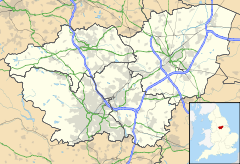
 Norton
Norton shown within South YorkshirePopulation 4,381 Parish Norton Metropolitan borough Doncaster Metropolitan county South Yorkshire Region Yorkshire and the Humber Country England Sovereign state United Kingdom Post town DONCASTER Postcode district DN6 Dialling code 01302 Police South Yorkshire Fire South Yorkshire Ambulance Yorkshire EU Parliament Yorkshire and the Humber UK Parliament Doncaster North List of places: UK • England • Yorkshire Norton is a civil parish in the Metropolitan Borough of Doncaster (part of South Yorkshire, England), on the border with North Yorkshire. The northern boundary of the parish is marked by the River Went, while the Great North Road forms the western boundary. It has a population of 4,381.[1]
Norton contains the following settlements:
Contents
Campsall
 St. Mary Magdalene's church, Campsall
Campsall is a village to the north-west of Askern. It is located at approximately 53°37′20″N 1°10′30″W / 53.62222°N 1.175°W, at an elevation of around 50 feet above sea level. The village contains Campsall Country Park. Campsall is the central village in the former Campsall Parish located in the West Riding of Yorkshire. The Parish also includes the settlements of Norton (North settlement) and Sutton (South settlement), which are to the north and south respectively. The Parish is situated on the “Magnesian Limestone Belt”, a landscape feature formed by a narrow north-south trending escarpment. The Magnesian Limestone Belt is typified by well drained and fertile soils which were ideal for agriculture and the establishment of settlements like Campsall. Prior to the industrial revolution, the area to the east was occupied by the inaccessible and waterlogged marshes of the Humberhead Levels, whilst to the west was the Barnsdale Forest, an area associated with the legend of Robin Hood and various outlaws and bandits who preyed upon travellers on the Great North Road.
Following the departure of the Romans, who had a small fort two miles to the west which guarded the crossing of the River Skell by the Great North Road, an early wooden Saxon church was established at Campsall, although nothing of this remains today. Following the Conquest a large Norman church was built out of local stone to serve the local population who were engaged with agricultural and rural employment during the mediaeval period. During this time Campsall was rapidly growing in importance and was granted a Royal Charter in 1294 entitling it to a weekly Thursday market and an annual four-day fair. These had ceased by 1627.[2] A public house, the Ring of Bells (now called the Old Bells) was opened near the church and this pub is believed to be one of the oldest in Yorkshire.
During the 18th century the village was dominated by the landed gentry. At opposite ends of the village, the Bacon-Franks constructed Campsall Hall and the Cooke-Yarboroughs built Campsmount. The villagers were still mostly employed with farming and working on the two estates and even the establishment of nearby Askern Colliery in 1910 had little impact on the work force of Campsall.
It was not until the 1950s that major changes began to affect the village. During this time the Bacon-Franks abandoned Campsall Hall; it was rumoured that Mrs Bacon-Frank was growing tired of the view of Askern Colliery from the Hall. From 1956 the local authority and the National Coal Board developed a large area of housing in Campsall Park and Campsall Hall was converted into flats until 1986 when it was demolished. The Cooke-Yarboroughs had left Campsmount in the late 1930s and the building was used as a military hospital until demolition in the 1950s. A private housing estate was built during the 1970s in the grounds of Campsmount Park.
Today Campsall has become established as a village of two parts. There is the old village near the church which still retains some of its rural charm, its cottages occupied by commuters who work in Leeds, Sheffield, Pontefract and Doncaster. There is also the newer part of Campsall formed in the 1950s from the Council and NCB housing projects. Askern Colliery ceased production in 1993 and after several years of relatively high unemployment the local people are beginning to find new employment opportunities, although many of the social problems associated with former mining areas remain.
Campsall hosts the secondary school Campsmount, which over the past 5 years has undergone large scale change. Now being classed as 'Campmount Technology College' there has been financial advantages, leading to structural development including a new sports hall named the 'David Ashton Sports Hall' after the legendary PE teacher who worked there for over 30 years. However, the school caught fire at around 1:30 a.m. on 13 December 2009, and has suffered unrepairable damage with only the 'David Ashton Sports Hall' and The Expressive Arts block/ Library surviving the devastating blaze.[3]
Campsall is famous for the number of high speed MGF racers who frequent the local side roads and meet regularly at the Old Bells public house.
Norton
The village of Norton is located at approximately 53° 38' North, 1° 10' 30" West, at an elevation of around 33 feet above sea level.
Although the Sutton Common Iron Age site officially falls within its parish, little is known about Norton until it was recorded in the Domesday Survey of 1086 when it probably had a population of 100 who were solely concerned with agriculture. During the medieval period that followed, Robin Hood was associated with Barnsdale Forest to the west whilst the nearby village of Campsall grew in importance, gaining a chartered market and Norman church. However, Norton gets few mentions in any surviving records from this time.
At a later date, Norton Priory was developed on the banks of the River Went but this never grew to be particularly significant and was subsequently demolished following the dissolution of the monasteries in 1588. In 1745, Mary Ramsden of Norton died and left 50 shillings to the poor of Norton and ‘several estates’ to the master and fellows of Catherine Hall, Cambridge. Thus a Cambridge College became the Lord of the Manor of Norton and a handsome manor house was built in the village. In the 1800s the Forrester’s Arms and the School Boy Inn were both established to serve the local population which would still be devoted to agriculture.
Following the industrial revolution and the expansion of the railways, a station was opened in Norton in 1855 on the Lancashire & Yorkshire Railway’s Knottingley Branch. At the start of the 20th century there were rumours of the development of collieries at nearby Kirk Smeaton and Askern. As Norton was located between the two, a number of rows of red brick terraces were erected speculatively to house the anticipated influx of miners. Subsequently, Askern Colliery was opened in 1910 and a new red brick pub, the Royal Hotel, was built in Norton to serve the colliers of the village.
Throughout the 20th century small areas of housing have been built throughout the village and many of the original stone cottages with their long gardens have been demolished, and infilled with housing. The Manor House was pulled down in the 1970s and other older buildings have suffered the same fate since then, e.g. Hope Farm was demolished in 2002 to be replaced a small development of private housing.
In the 21st century Norton serves as a commuter village for people working in the nearby towns such as Doncaster and Pontefract. It retains two pubs, a post office and two village shops but the only structure left of historic importance is the Grade 2 listed village water pump.
'Norton' means North Farm in old English.
Sutton
Sutton or 'South Farm' in old English, is a small village to the south-west of Askern, and is located at approximately 53° 36' 20" North, 1° 10' West, at an elevation of around 26 feet above sea level.
References
- ^ Office for National Statistics : Census 2001 : Parish Headcounts : Doncaster Retrieved 2009-08-27
- ^ David Hey, Medieval South Yorkshire
- ^ "Fire crews battle to save South Yorkshire school". The Star. Johnston Press Digital Publishing. 13 December 2009. http://www.thestar.co.uk/news/BREAKING-Fire-crews-battle-to.5907617.jp. Retrieved 2009-12-14.
Ceremonial county of South Yorkshire Yorkshire Portal Metropolitan districts Major settlements Askern • Barnsley • Bawtry • Brierley • Conisbrough • Dinnington • Doncaster • Edlington • Hatfield • Hoyland • Maltby • Mexborough • Penistone • Rotherham • Sheffield • South Kirkby and Moorthorpe • Stainforth • Stocksbridge • Swinton • Thorne • Tickhill • Wath upon Dearne • Wombwell
See also: List of civil parishes in South YorkshireRivers Topics Castles • Grade I listed buildings • People • Monastic houses • Windmills • MuseumsCategories:- Villages in Doncaster


Wikimedia Foundation. 2010.