- Pennsylvania Route 31
-
"PA 31" redirects here. PA 31 may also refer to Pennsylvania's 31st congressional district or the Piper PA-31 Navajo.
PA Route 31

Route information Maintained by PennDOT Length: 74.74 mi[2] (120.28 km) Existed: 1927[1] – present Major junctions West end:  PA 136 near West Newton
 I-70 near Turkeytown

 I-70/76/PA Tpk in Donegal
East end:  US 30 near Bedford
Location Counties: Westmoreland, Fayette, Somerset, Bedford Highway system Roads in Pennsylvania
Interstate • US • State • Legislative← US 30PA 32  →
→Pennsylvania Route 31 is a 74-mile (119 km) long state highway located in Western Pennsylvania, paralleling U.S. Route 30 and the Pennsylvania Turnpike for most of its length. The designation begins at PA 136 near West Newton and ends at US 30 near Bedford.
Contents
Route description
Westmoreland County
West Newton to Mount Pleasant
PA 31's designation begins at Pennsylvania Route 136 near West Newton.[3] It travels east, interchanging with Interstate 70.[4] After that interchange, PA 31 does not intersect any more numbered roads until it interchanges U.S. Route 119 in the western part of Mount Pleasant.[5] When PA 31 interchanges US 119, it turns from a two-lane surface road into first a four-lane road, and then into a city street as it goes through Mount Pleasant.[6][7]
As PA 31 progresses through Mount Pleasant, it forms a concurrency with Pennsylvania Route 981.[8] After that, it intersects Pennsylvania Route 819 before leaving the borough and entering the township.[8]
Mount Pleasant to Donegal
The first intersection with a numbered road after entering the township is Pennsylvania Route 982.[9] This is the only major intersection until it reaches Donegal.[10] When it does reach Donegal, there is an entrance ramp to the Pennsylvania Turnpike, and immediately following that is the western terminus of the concurrency with Pennsylvania Route 711.[11]
2 miles (3 km) later, PA 31 intersects Pennsylvania Route 381. This marks the eastern terminus of the concurrency with PA 711, and the western terminus of PA 381. It is also the northern terminus of the PA 381/711 concurrency as well.[12] Before leaving Donegal Township, PA 31 approaches the eastern terminus of the concurrency with PA 381. This is the last major intersection before PA 31 winds its way through rural Pennsylvania to Somerset.[13]
Somerset County
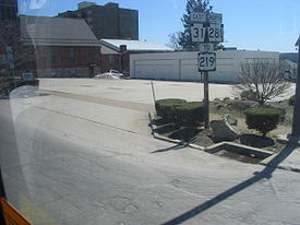
 A view of southbound PA 281 at the western terminus of the concurrency.
Somerset
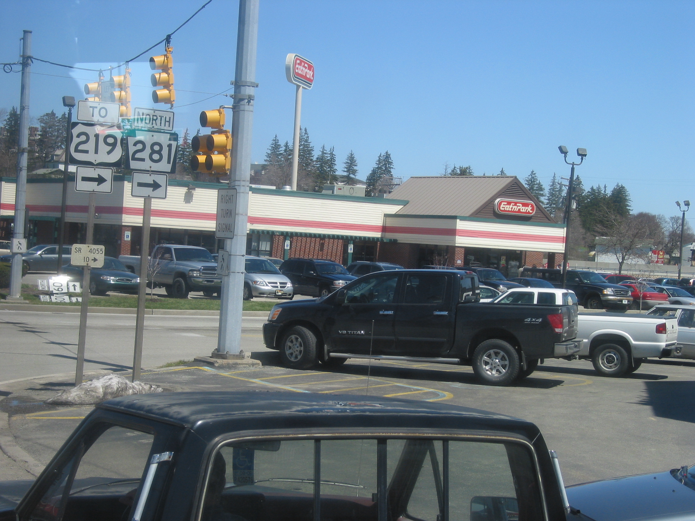
 A view of the PA 31/281 concurrency eastbound.
After winding past rural Westmoreland and Fayette Counties, PA 31 enters Somerset County and encounters the borough of Somerset.[14] Immediately after entering Somerset, PA 31 intersects Pennsylvania Route 281 and forms a concurrency on one-way pairs.[15] While being concurrent, both highways intersect the southern terminus of Pennsylvania Route 601.[15] Not a long while after, PA 31/281 end the concurrency, as PA 281 splits north, while PA 31 continues east.[15]
 A view of the eastern terminus of the concurrency.
Past the downtown area, PA 31 weaves through the Pennsylvania Turnpike and passes over U.S. Route 219.[16] PA 31 continues toward Roxbury.
Roxbury
The intersection with Pennsylvania Route 160 is the last intersection in Somerset County and the only one in Roxbury.[17] After this intersection, PA 31 generally parallels the Turnpike and winds through hilly terrain.
Bedford County
Entering Bedford County, there are no major intersections with any numbered roads until PA 31 enters Manns Choice. Instead, it winds through hilly terrain that parallels the Turnpike.[18]
Manns Choice to Bedford
As PA 31 nears Manns Choice, it intersects Pennsylvania Route 96 and is concurrent for 1.81 mi (2.91 km).[19] After separating, PA 31 continues for 3.44 mi (5.54 km) before terminating at U.S. Route 30.[20]
History
As early as 1772, a road called Glades Road had originally led from Somerset to Bedford, which were the places of two underground railroad stations. The road would become PA 31 and would go through the towns of West Newton, Mount Pleasant, Monongahela, and Washington that had also organized underground railroad stations.[21]
Sproul Road Bill
In 1911, the Sproul Road Bill defined Legislative Route 181 for the segment between Washington and West Newton, LR 186 between West Newton and Somerset, LR 364 between Somerset and Dividing Ridge, and LR 49 between Dividing Ridge and Bedford.[22][23]
1927-1940
The PA 31 designation began appearing on road maps and signage in 1927.[24][1] At that time, the western terminus was at the West Virginia line at West Virginia Route 27. The east end back then was still at US 30, unchanged from today.[25] On its way eastward, PA 31 met the southern terminus of PA 28 near Avella, was concurrent with PA 18 and US 19, and traded paths with US 40 in Washington. The stretch from the West Virginia line to PA 18 is now PA 844.
Major intersections
County Location Mile[2] Destinations Notes Westmoreland West Newton 0.00 PA 136 (Mt. Pleasant Road, Walnut Lane)[3]Western terminus, former routing of PA 71.[25] South Huntingdon Township 3.14 I-70[4]Exit 51. Mount Pleasant 11.49  US 119[8]
Interchange. 12.06  PA 981 south (Morewood Street)[8]
West end of PA 981 concurrency. 12.43 PA 981 north (North Church Street)[8]East end of PA 981 concurrency. 12.62  PA 819 (Diamond Street)[8]
Northern terminus of PA 819 Fayette Bullskin Township 15.71  PA 982[9]
Westmoreland Donegal 21.85 I-70 / I-76 / Penna. Tpk.[11]Donegal Interchange (exit 91). 22.15  PA 711 north[11]
West end of PA 711 concurrency Donegal Township 24.02  PA 381 south / PA 711 south (Jones Mill Road)[12]
West end of PA 381 concurrency,
East end of PA 711 concurrency24.69 PA 381 north[12]East end of PA 381 concurrency. Somerset Somerset 40.33  PA 281 south (Franklin Avenue)[15]
West end of PA 281 concurrency 40.68  PA 601 (Central Avenue)[15]
Southern terminus of PA 601,
Former routing of US 219 through Somerset.[26]40.90 PA 281 north (Pleasant Avenue)[15]East end of PA 281 concurrency 41.23 Berlin Plank Road Formerly US 219 Business Roxbury 50.99  PA 160[17]
Former routing of US 219.[26] Bedford Juniata Township 65.29 Buena Road Formerly PA 131[25] Manns Choice 69.49  PA 96 north (Shawnee Road)[19]
West end of PA 96 concurrency 71.30 PA 96 south (Hyndman Road)[19]East end of PA 96 concurrency Bedford Township 74.74 US 30 (Lincoln Highway)[20]1.000 mi = 1.609 km; 1.000 km = 0.621 mi Attractions
Glades Pike Inn
The Glades Pike Inn is a notable inn situated on the Glades Pike section of PA 31 in Somerset. Since 1842, the inn was a place for weary travelers to unhitch their horses for a good place to eat and sleep. The modern day visitors of the inn use it for different reasons of traveling. The inn is located in the Laurel Mountains recreational area.[27][28]
Glades Pike Winery
The Glades Pike Winery is situated on the section of PA 31 known as Glades Pike, between Somerset and Donegal. Established in 1994, the winery is the place where visitors are offered samples of the award-winning wine varieties.[29]
Notes
- ^ May be hard to see, as it is a JPEG map scan.
References
- ^ Pennsylvania Highways - Pennsylvania Route 31
- ^ a b DeLorme. Street Atlas USA measuring tool (Map) (2007 ed.).
- ^ a b Google, Inc. Google Maps – West Newton, PA (Map). Cartography by Google, Inc. http://maps.google.com/maps?f=q&hl=en&q=West+Newton,+PA&layer=&ie=UTF8&z=14&ll=40.20523,-79.741087&spn=0.045165,0.080338&om=1. Retrieved 2007-04-29.
- ^ a b Google, Inc. Google Maps – South Huntingdon, PA (Map). Cartography by Google, Inc. http://maps.google.com/maps?f=q&hl=en&q=Mount+Pleasant,+PA&layer=&ie=UTF8&om=1&z=14&ll=40.188775,-79.70212&spn=0.045176,0.080338&iwloc=addr. Retrieved 2007-04-29.
- ^ Google, Inc. Google Maps – PA 31 between I-70 and US 119 (Map). Cartography by Google, Inc. http://maps.google.com/maps?f=q&hl=en&q=Seven+Springs,+PA&ie=UTF8&om=1&ll=40.179529,-79.628735&spn=0.090365,0.160675&z=13&iwloc=addr. Retrieved 2007-05-09.
- ^ "PA 31/US 119 interchange (west)". Microsoft. USGS. 1993-04-11. http://www.terraserverusa.com/image.aspx?T=1&S=11&Z=17&X=1555&Y=11115&W=2&qs=%7cMount+Pleasant%7cPA%7c. Retrieved 2007-05-09.
- ^ "PA 31/US 119 interchange (east)". Microsoft. USGS. 1993-04-11. http://www.terraserverusa.com/image.aspx?T=1&S=11&Z=17&X=1557&Y=11114&W=2&qs=%7cMount+Pleasant%7cPA%7c. Retrieved 2007-05-09.
- ^ a b c d e f Google, Inc. Google Maps – Mount Pleasant, PA (Map). Cartography by Google, Inc. http://maps.google.com/maps?f=q&hl=en&q=Mount+Pleasant,+PA&layer=&ie=UTF8&z=15&ll=40.15126,-79.545479&spn=0.022601,0.040169&om=1. Retrieved 2007-04-29.
- ^ a b Google, Inc. Google Maps – Mount Pleasant (Borough) (Map). Cartography by Google, Inc. http://maps.google.com/maps?f=q&hl=en&q=Mount+Pleasant,+PA&layer=&ie=UTF8&z=14&ll=40.164117,-79.498272&spn=0.045193,0.080338&om=1. Retrieved 2007-04-29.
- ^ Google, Inc. Google Maps – PA 31 between PA 982 and the Turnpike (Map). Cartography by Google, Inc. http://maps.google.com/maps?f=q&hl=en&q=Seven+Springs,+PA&ie=UTF8&om=1&ll=40.133216,-79.426174&spn=0.090427,0.160675&z=13&iwloc=addr. Retrieved 2007-05-09.
- ^ a b c Google, Inc. Google Maps – Donegal, PA (Map). Cartography by Google, Inc. http://maps.google.com/maps?f=q&hl=en&q=Donegal,+PA&layer=&ie=UTF8&om=1&z=16&ll=40.109982,-79.379997&spn=0.011307,0.020084. Retrieved 2007-04-29.
- ^ a b c Google, Inc. Google Maps – Jones Mills, PA (Map). Cartography by Google, Inc. http://maps.google.com/maps?f=q&hl=en&q=Jones+Mills,+PA&layer=&ie=UTF8&z=15&ll=40.089399,-79.343219&spn=0.022621,0.040169&om=1. Retrieved 2007-04-29.
- ^ Google, Inc. Google Maps – PA 31 between PA 381 and PA 281 (Map). Cartography by Google, Inc. http://maps.google.com/maps?f=q&hl=en&q=Seven+Springs,+PA&ie=UTF8&om=1&ll=40.055213,-79.207993&spn=0.18106,0.32135&z=12. Retrieved 2007-05-09.
- ^ "History of Somerset Borough". Somerset, PA. Archived from the original on 2007-05-06. http://web.archive.org/web/20070506102646/http://www.somersetborough.com/ourhistory.htm. Retrieved 2007-05-13.
- ^ a b c d e f Google, Inc. Google Maps – Somerset, PA (Map). Cartography by Google, Inc. http://maps.google.com/maps?f=q&hl=en&q=Somerset,+PA&layer=&ie=UTF8&z=14&ll=40.009209,-79.066458&spn=0.045296,0.080338&om=1. Retrieved 2007-04-29.
- ^ "PA 31 (middle) running east–west weaving through Turnpike and overpassing US 219". Microsoft. USGS. 1993-04-27. http://www.terraserverusa.com/image.aspx?T=1&S=13&Z=17&X=418&Y=2767&W=2&qs=%7cSomerset%7cPA%7c. Retrieved 2007-04-29.
- ^ a b Google, Inc. Google Maps – Roxbury, PA (Map). Cartography by Google, Inc. http://maps.google.com/maps?f=q&hl=en&q=Somerset,+PA&layer=&ie=UTF8&om=1&z=14&ll=39.948174,-78.907585&spn=0.045336,0.080338. Retrieved 2007-04-29.
- ^ Google, Inc. Google Maps – PA 31 between PA 160 and PA 96 (Map). Cartography by Google, Inc. http://maps.google.com/maps?f=q&hl=en&q=Seven+Springs,+PA&ie=UTF8&om=1&ll=39.948437,-78.749313&spn=0.181344,0.32135&z=12. Retrieved 2007-05-10.
- ^ a b c Google, Inc. Google Maps – Manns Choice, PA (Map). Cartography by Google, Inc. http://maps.google.com/maps?f=q&hl=en&q=Manns+Choice,+PA&layer=&ie=UTF8&z=14&ll=40.001977,-78.593445&spn=0.0453,0.080338&om=1&iwloc=addr. Retrieved 2007-04-29.
- ^ a b Google, Inc. Google Maps – Napier, PA (Map). Cartography by Google, Inc. http://maps.google.com/maps?f=q&hl=en&q=Manns+Choice,+PA&layer=&ie=UTF8&om=1&z=14&ll=40.039838,-78.558512&spn=0.045275,0.080338. Retrieved 2007-04-29.
- ^ Switala, William J. (2001). Underground Railroad in Pennsylvania. Stackpole Books. ISBN 0811716295.
- ^ PennDOT. Sproul Road Bill (Map) (1911 ed.). ftp://ftp.dot.state.pa.us/public/pdf/BPR_pdf_files/Maps/Statewide/Historic_OTMs/1911.pdf. Retrieved 2007-05-12.
- ^ PennDOT. Somerset County (Map) (1915 ed.). ftp://ftp.dot.state.pa.us/public/pdf/BPR_PDF_FILES/Maps/Type_10_GHS_Historical_Scans/Somerset_1915.pdf. Retrieved 2007-05-12.
- ^ Cram (1927). Official Paved Roads of East Central States (Map). http://www.mapsofpa.com/roadcart/1927_2043m.jpg. Retrieved 2007-05-27.
- ^ a b c PennDOT. Pennsylvania Highways (Map) (1930 ed.). ftp://ftp.dot.state.pa.us/public/pdf/BPR_pdf_files/Maps/Statewide/Historic_OTMs/1930fr.pdf. Retrieved 2007-05-12.
- ^ a b PennDOT. Somerset County (Map) (1941 ed.). Section 2. ftp://ftp.dot.state.pa.us/public/pdf/BPR_PDF_FILES/Maps/Type_10_GHS_Historical_Scans/Somerset_1941_Sheet_2.pdf. Retrieved 2007-05-09.
- ^ "Glades Pike Inn". ExplorePAHistory.com. http://www.explorepahistory.com/attraction.php?id=678. Retrieved 2007-05-13.
- ^ "Glades Pike". gladespike.com. http://www.gladespike.com/. Retrieved 2007-05-13.
- ^ "~GLADES PIKE WINERY~". Glades Pike winery. http://www.gladespikewinery.com/. Retrieved 2007-05-13.
External links
- "Termini of PA 31". state-ends.com. http://www.state-ends.com/paends/state/31.html. Retrieved 2007-04-29.
Categories:- State highways in Pennsylvania


Wikimedia Foundation. 2010.