- Vormsi
-
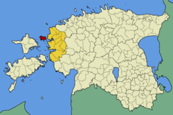
Estonia's fourth largest island, Vormsi (German: Worms, Swedish: Ormsö), is located between Hiiumaa and the mainland with a total area of 93 square kilometers. It is part of a rural municipality Vormsi Parish. From mainland, Vormsi is separated by a narrow strait – Voosi Kurk, and from Hiiumaa by a bit wider Hari Kurk.
Contents
History
Vormsi's history as an inhabited island dates back as far as the 13th century. During most of its history, the island has been inhabited by Estonian Swedes ("rannarootslased" in Estonian or "coastal Swedes" in English), whose population reached 2,500 before World War II. During the war, nearly all of Vormsi's population, along with other Swedes living in Estonia, were evacuated, or fled, to Sweden. The island's current population is approximately 300inhabitants.
Vormsi’s coastal Swedish history is witnessed by the St Olav’s church and wheel-crosses in the Cemeteries as well as foreign-sounding place names. Vormsi’s name is of Scandinavian origin. It is believed that the island was named by an Icelandic Viking Orm (in Estonian: Madu, in English: Snake). Swedes have always called the island Ormsö, after Orm the pirate.
The island's Estonian name Vormsi is derived from its German name Worms or its Swedish name Ormsö ("snake island"). Swedish influence can also be seen in other placenames, as in villages like Hullo (the administrative center), Sviby (the main port), Söderby, Norrby, Diby, Rälby, Förby, Borrby, Kärrslätt, Saxby, Busby, Suuremõisa (Magnushof) and Rumpo; and lakes like Prästvik.
Life on Vormsi
Life on the Vormsi island among natural beauty is peaceful and safe. As of 2011, 406 inhabitants are registered to Vormsi. The island is surrounded by cultural and environmental value, natural and safe environment. Vormsi has modern infrastructures: the road network and harbours are constantly renovated.
Community economy is based on local resources (potatoes, berries, mushrooms, honey, cattle, timber material, game, fish). We get more and more engaged in agriculture, take care of the coastal meadows and grow cattle and sheep. Well-known people are also tempted to buy summer houses on Vormsi due to the positive image of the island amongst Estonians.
We have well-preserved coastal Swedish cultural heritage, which we strive to jointly use in the image of Vormsi. Our society activities, appreciation for traditions and cultural cooperation is turning global. We keep and appreciate our nature, due to that a biosphere landscape protection area is found – the Natura 2000 network. [1].
Nature
30 smaller islands belong to the island of Vormsi so the total of dry land is 93 km2. The oldest and also the highest parts of Vormsi rose from the sea about 3000 years ago. As the land rose, the former sea coves turned into the lakes of Prästviigi, Diby and Kärrslati.
A hundred kilometres of coastline
Coastline of the island is very jointed, long peninsulas in turn with deep coves. At the northern coast, sea deepens quickly while at the southern coast the water remains up to the knees for a long distance. The western and northern coast are pebbly, sandy coast can be found under the village of Rumpo; island’s eastern and western part have turf and are often covered in reed.
Bedding of the island is of limestone. Relatively even relief is varied by eskers and old coast banks running through the island on north-western – south-eastern direction. Vormsi’s highest point is the mound near Huitberg rising 13 metres above the sea level.
Varied landscape
Alvar and juniper fields are characteristic for the island’s western part; the eastern part is lower and boggy. Over half of the island’s area is covered with forest. As a result of traditional farming, coastal pasturelands, i.e. wooded meadows, have evolved and are still preserved; on these meadows you can find several flora and fauna species that are endangered or have completely disappeared in Estonia and whole Europe.
Copious vegetation
The island has very rich vegetation. Over 900 species of different trees, bushes and herbaceous plants, 60 of which are under different protection classes (for instance, Lady’s slipper, Narrow-leaved and Red Helleborine, Fly Orchid, Club spikemoss (Selaginella selaginoides), wall-rue (Asplenium ruta-muraria), Angelica palustris and many others). The island’s moss species are numerously described; the island’s lichen flora with its 301 species is of special interest.
Vormsi fauna
The are 3 reptile and 3 amphibian species registered on the island. The Natterjack Toad (Epidalea calamita formerly Bufo calamita) living in coastal puddles with low water deserves mentioning. Out of protected species, Long-eared bat (Plecotus auritus) also lives here. 25 species of larger and smaller mammals have been sighted, including lynx. Wild swine representation is quite large.
211 bird species
211 bird species have been written down on Vormsi; out of those special mentioning is deserved by White-tail Eagles and Common Cranes. Here dwells the Peregrine falcon, Bubo bubo, Eurasian Bittern, Dunlin (Calidris alpina). There is a numerous amount of Corn Crake who is seldom seen elsewhere in Europe. Two important migration routes go right across Vormsi: one takes over Haapsalu Tagalahe and Noarootsi peninsula up by Väinameri (Sea of Straits) towards the Gulf of Riga and the other one runs from Põõsaspea cape over Vormsi’s northern coast towards Tahkuna. During springs and autumns, Barnacle Goose and other wild gooses while migrating deserve to be seen; during autumns the fields turn grey in Common Cranes [2].
References
Literature
- Kanarbik, Madis, Ormsö. De estlandssvenska böndernas kamp mot godsägarna under 1700- och 1800-talet [Nordistica Tartuensia; 9] (Tartu, 2003)
- Beyer, Jürgen, 'Whom should one thank for a narrow escape? Lessons drawn from a perilous journey from Vormsi and Noarootsi to Finland in 1796', Pro Ethnologia 17 (2004), 175-95
Gallery
-

Saxby lighthouse -

Paddoc, Rälby -

Old windmill, Rälby -

Woodman's cottage, Hullo -

Beach area in Rumpo
See also
External links
- Vormsi vald (Vormsi municipality)
- Vormsi photo gallery
- How to get to Vormsi?
Islands of Estonia Abruka · Adralaid · Aegna · Ahelaid · Aherahu · Ahessäär · Ahtra · Aksi · Allirahu · Allu · Alumine Vaika · Anekäbrud · Ankrurahu · Annilaid · Antsulaiud · Anulaid · Auklaid · Eerikukivi · Eerikulaid · Elmrahu · Esirahu · Gretagrund · Hanemaa · Hanerahu · Hanikatsi laid · Hara · Harilaid (islet) · Harilaid (peninsula) · Hellamaa rahu · Hiiumaa · Härjakare · Härjamaa · Hobulaid · Hõralaid · Hülgelaid · Hülgerahu · Imutilaid · Innarahu · Juksirahu · Kadakalaid · Kaevatsi · Kahtla · Kajakarahu · Käkimaa · Käkirahu · Kakralaid · Kakrarahu · Karirahu · Kassari · Kasselaid · Keri · Keskmine Vaika · Kesselaid · Kihnu · Kitselaid · Koerakuiv · Kõinastu laid · Koipsi · Kõrgelaid · Kõrksaar · Kõverlaid · Kreenholm · Kriimi laid · Kräsuli · Kuivarahu · Külalaid · Kullilaid · Kullipank · Kumari · Kungli · Kunnatilaid · Kuradisäär · Kurgurahu · Külalaid · Küllisäär · Laasirahu · Laidu · Läkumätas · Langekare · Leemetikare · Liia · Liisi · Liivakari · Linnusitamaa · Loonalaid · Luigerahu · Maakrirahu · Manilaid · Mardirahu · Maturahu · Mihklirahu · Mohni · Mondelaid · Muhu · Munaderahu · Munasaar · Mustarahu · Mustpank · Mustpank (Vaika) · Nabralaid · Naissaar · Naistekivi maa · Ninalaid · Noogimaa · Nootamaa · Nosurahu · Öakse · Oitma · Ojurahu · Öörahu · Orikalaid · Osmussaar · Paelaid · Pakri Islands · Pakulaid · Papilaid · Papirahu · Pasilaid · Pedassaar · Pihanasu · Pihlakare · Pihlalaid · Piirissaar · Pikknasv · Piskumadal · Prangli · Puhtulaid · Puningalaid · Põdvalaid · Põiksäär · Pühadekare · Rammu · Rannasitik · Riinurahu · Ristlaid · Rohurahu · Rohusi saar · Rooglaid · Ruhnu · Rukkirahu · Rusulaid · Saare ots · Saaremaa · Saarnaki laid · Salava · Sangelaid · Seasaar · Selglaid · Sepasitik · Sillalaid · Sipelgarahu · Sitakare · Sokulaid · Sorgu · Suuregi laid · Suurepoldi · Suurlaid · Suur-Pakri · Suurrahu · Sõmeri · Taguküla laid · Tarja · Tauksi · Telve · Tiirloo · Tondirahu · Tondisaar · Täkulaid · Täkunasv · Udrikulaid · Uhtju saar · Uhtju saared · Ulkkarri · Umalakotid · Ülemine Vaika · Umblu · Urverahu · Uuluti laid · Uus-Nootamaa · Vahase · Vahelmisrahu · Vaika saared · Väike-Pakri · Väike-Tulpe · Vaindloo · Valgerahu · Vareslaid (Käina) · Vareslaid (Väinameri) · Varesrahu · Vasikalaid · Vesiloo · Vesitükimaa · Viirelaid · Vilsandi · Vissulaid · Vohilaid · Vormsi · Võilaid · Võiste · Võnnu · Võrgukare ·
Inhabited islands in the Baltic Sea Denmark Estonia Finland Archipelago Sea Islands (Åland Islands) · Hailuoto · Kimitoön · Laajasalo · Lauttasaari · Replot · SuomenlinnaGermany Poland Russia Sweden Categories:- Islands of Estonia
- Lääne County


Wikimedia Foundation. 2010.