- Moodiesburn
-
Coordinates: 55°55′06″N 4°05′12″W / 55.918333°N 4.08666°W
Moodiesburn 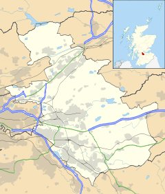
 Moodiesburn
Moodiesburn shown within North LanarkshirePopulation 6,614 [1] (2001 census) OS grid reference NS6960871434 Council area North Lanarkshire Lieutenancy area Lanarkshire Country Scotland Sovereign state United Kingdom Post town GLASGOW Postcode district G69 Dialling code 01236 Police Strathclyde Fire Strathclyde Ambulance Scottish EU Parliament Scotland UK Parliament Coatbridge, Chryston and Bellshill Scottish Parliament Coatbridge and Chryston List of places: UK • Scotland • Moodiesburn is a residential suburb located 8 miles north-east of Glasgow city centre, in the North Lanarkshire council area of Scotland. It is situated on the A80 road, between Stepps and Cumbernauld.
Contents
Landmarks
The suburb includes a community centre and library, a miners' welfare club (the Auchengeich Miners Welfare), a multi-denominational school (Glenmanor Primary), a denominational school (St. Michael's Primary), a Church of Scotland parish church, a Roman Catholic church, and an independent evangelical church called New Beginnings that meets in the community centre. There is also a public house (the Silver Larch), a Knights of Saint Columba social club and a coffee shop called The Coffee House.
Moodiesburn House Hotel - previously the site of the Bedlay Dowager House - was closed in early 2008 and its entire contents put up for auction. In March 2008 the function hall of the hotel was vandalised and set on fire.[2]
Bedlay Cemetery is the local cemetery for Moodiesburn. The nearby Bedlay Castle has stood since the late 16th century.[3][4]
Moodiesburn is also home to the headquarters of Devro, as well as a number of youth football teams, including Moodiesburn Red Star and Bridgend Boys club.
Stoneyetts
Within Moodiesburn lies Stoneyetts: a remote, once highly-populated area that is surrounded by woodland. Stoneyetts Hospital (formerly Stoneyetts Certified Institution for Mental Defectives[5]), was a certified psychiatric institution, originally for mentally deficient people under the Mental Deficiency and Lunacy (Scotland) Act of 1913. It opened in 1913 and, despite much petitioning,[6] was demolished in 1992.[7] Live-in homes for resident hospital staff were also destroyed. Some elements of the hospital grounds, such as brickwork, founds, staircases, unpowered street lighting and woodland, still exist; the desolate area has become a location for vandalism,[8] fly-tipping,[8] suicides[9] and tragic accidents[10] since the hospital's closure. The formerly linked Stoneyetts Bowling Club, adjacent to the hospital grounds, continues to run occasional events.[11]
Auchengeich controversy
In September 2009, a memorial was erected by the Auchengeich Miners Welfare honouring the forty-seven men who lost their lives in the Auchengeich mining disaster of 18 September 1959. In the early hours of 19 November 2009, part of the memorial – an uninsured bronze representation of a miner, worth between £35,000 and £40,000 – was stolen. Councillor William Hogg branded the theft a "mindless crime", adding: "I would like to assure everyone that the council will do everything possible to ensure that the statue will be replaced. I would appeal to anyone with any information about this theft to contact Strathclyde Police immediately."[12][13]
External links
References
- ^ "scrol.gov.uk". http://www.scrol.gov.uk/scrol/browser/profile.jsp?profile=Population&mainArea=Moodiesburn&mainLevel=Locality. Retrieved 2009-12-07.
- ^ "Fire ravages derelict A80 hotel". BBC News. 13 March 2008. http://news.bbc.co.uk/1/hi/scotland/glasgow_and_west/7293503.stm. Retrieved 2009-12-08.
- ^ Mason, Gordon The Castles of Glasgow and the Clyde, Goblinshead, 2000 (p.51)
- ^ Coventry, Martin The Castles of Scotland (3rd Edition), Goblinshead, 2001 (p.83)
- ^ Stoneyetts Hospital, Glasgow. The National Archives. Retrieved 23 June, 2011.
- ^ Stoneyetts Hospital. The Herald. 23 September, 1991. Retrieved 23 June, 2011.
- ^ Tough, Alistair. Records of Stoneyetts Hospital, Chryston (and others). NHS Greater Glasgow and Clyde Archives. 23 July, 1998. Retrieved 23 June, 2011.
- ^ a b "Bowlers in safety plea". Kirkintilloch Herald. 6 July, 2004. Retrieved 13 June, 2011.
- ^ Halliday, Ron Glasgow's Ghosts (partially re-distributed 2000: Haunted Glasgow) Fort, 1996 (p.77)
- ^ Lowry, Kevin. "Tree-climbing dare leaves 11-year-old Stephen dead". The Mirror. Archived at TheFreeLibrary. 27 September, 1999. Retrieved 16 August, 2011.
- ^ Stoneyetts Bowling Club. Official Site. Retreieved 23 June, 2011.
- ^ "£40K statue stolen from Auchengeich tavern memorial", Airdrie and Coatbridge Advertiser, 20 November 2009
- ^ "Mining disaster's memorial stolen". BBC News. 19 November 2009. http://news.bbc.co.uk/1/hi/scotland/glasgow_and_west/8368273.stm. Retrieved 2009-12-07.
Principal Towns (Over 10,000) 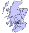
Other towns and villages Allanton · Auchinloch · Annathill · Banton · Bargeddie · Bonkle · Cardowan · Calderbank · Caldercruix · Carfin · Carnbroe · Chapelhall · Chryston · Cleland · Forrestfield · Garrion Bridge · Gartcosh · Glenboig · Harthill · Holytown · Longriggend · Mollinsburn · Moodiesburn · Mossend · Muirhead · Newarthill · Newhouse · Newmains · New Stevenston · Overtown · Plains · Queenzieburn · Ravenscraig · Riggend · Salsburgh · Shotts · Stepps · ViewparkPlaces of interest Airdrie Public Observatory · Bedlay Castle · Carfin Grotto · Clyde Valley · Dalzell House · Dalziel Park · Drumpellier · M&Ds · Newhouse Research Site · Ravenscraig Regional Sports Facility · Summerlee, Museum of Scottish Industrial Life · Strathclyde Country Park ·Categories:- North Lanarkshire
- Villages in North Lanarkshire


Wikimedia Foundation. 2010.