- Montgomery County, Mississippi
-
Montgomery County, Mississippi 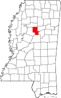
Location in the state of Mississippi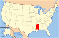
Mississippi's location in the U.S.Founded 1871 Seat Winona Largest city Winona Area
- Total
- Land
- Water
407.86 sq mi (1,056 km²)
406.85 sq mi (1,054 km²)
1.02 sq mi (3 km²), 0.25%Population
- (2010)
- Density
10,925
31/sq mi (12/km²)Montgomery County is a county located in the U.S. state of Mississippi. As of 2010, the population was 10,925. It was either named in honor of Richard Montgomery, an American Revolutionary War general killed in 1775 while attempting to capture Quebec City, Canada, or for Montgomery County, Tennessee, from which an early settler came. In that latter case, it would have been indirectly named for John Montgomery, a settler in Montgomery County, Tennessee, who founded the city of Clarksville, Tennessee, in that county. Its county seat is Winona. The character Dill in "To Kill a Mockingbird" is from here.[1].
Contents
Geography
According to the 2000 census, the county has a total area of 407.86 square miles (1,056.4 km2), of which 406.85 square miles (1,053.7 km2) (or 99.75%) is land and 1.02 square miles (2.6 km2) (or 0.25%) is water.[2]
Major highways
 Interstate 55
 U.S. Highway 51
 U.S. Highway 82
Adjacent counties
- Grenada County (north)
- Webster County (northeast)
- Choctaw County (east)
- Attala County (south)
- Carroll County (west)

Grenada County Webster County Carroll County 
Choctaw County  Montgomery County, Mississippi

Attala County Demographics
Historical populations Census Pop. %± 1880 13,348 — 1890 14,459 8.3% 1900 16,536 14.4% 1910 17,706 7.1% 1920 13,805 −22.0% 1930 15,009 8.7% 1940 15,703 4.6% 1950 14,470 −7.9% 1960 13,320 −7.9% 1970 12,918 −3.0% 1980 13,366 3.5% 1990 12,388 −7.3% 2000 12,189 −1.6% 2010 10,925 −10.4% MS Counties 1900-1990
GeoHive - 2000 & 2010 statisticsAs of the census[3] of 2000, there were 12,189 people, 4,690 households, and 3,367 families residing in the county. The population density was 30 people per square mile (12/km²). There were 5,402 housing units at an average density of 13 per square mile (5/km²). The racial makeup of the county was 54.25% White, 44.95% Black or African American, 0.08% Native American, 0.25% Asian, 0.02% Pacific Islander, 0.07% from other races, and 0.37% from two or more races. 0.85% of the population were Hispanic or Latino of any race.
There were 4,690 households out of which 32.60% had children under the age of 18 living with them, 48.50% were married couples living together, 18.80% had a female householder with no husband present, and 28.20% were non-families. 26.10% of all households were made up of individuals and 13.60% had someone living alone who was 65 years of age or older. The average household size was 2.57 and the average family size was 3.10.
In the county the population was spread out with 26.80% under the age of 18, 8.90% from 18 to 24, 25.30% from 25 to 44, 22.40% from 45 to 64, and 16.70% who were 65 years of age or older. The median age was 37 years. For every 100 females there were 86.40 males. For every 100 females age 18 and over, there were 81.10 males.
The median income for a household in the county was $25,270, and the median income for a family was $31,602. Males had a median income of $26,590 versus $17,639 for females. The per capita income for the county was $14,040. About 21.90% of families and 24.30% of the population were below the poverty line, including 34.80% of those under age 18 and 25.40% of those age 65 or over.
Communities
- Cities
- Towns
- Unincorporated places
- Lodi
- Poplar Creek
- Stewart
- Sweatman
Education
- Public School Districts
- Private Schools
- Winona Christian School
See also
References
- ^ "Find a County". National Association of Counties. http://www.naco.org/Counties/Pages/FindACounty.aspx. Retrieved 2011-06-07.
- ^ "Census 2000 U.S. Gazetteer Files: Counties". United States Census. http://www.census.gov/tiger/tms/gazetteer/county2k.txt. Retrieved 2011-02-13.
- ^ "American FactFinder". United States Census Bureau. http://factfinder.census.gov. Retrieved 2008-01-31.
Municipalities and communities of Montgomery County, Mississippi Cities 
Towns Unincorporated
communitiesLodi | Poplar Creek | Stewart | Sweatman
Categories:- Mississippi counties
- Montgomery County, Mississippi


Wikimedia Foundation. 2010.