- Multibeam echosounder
-
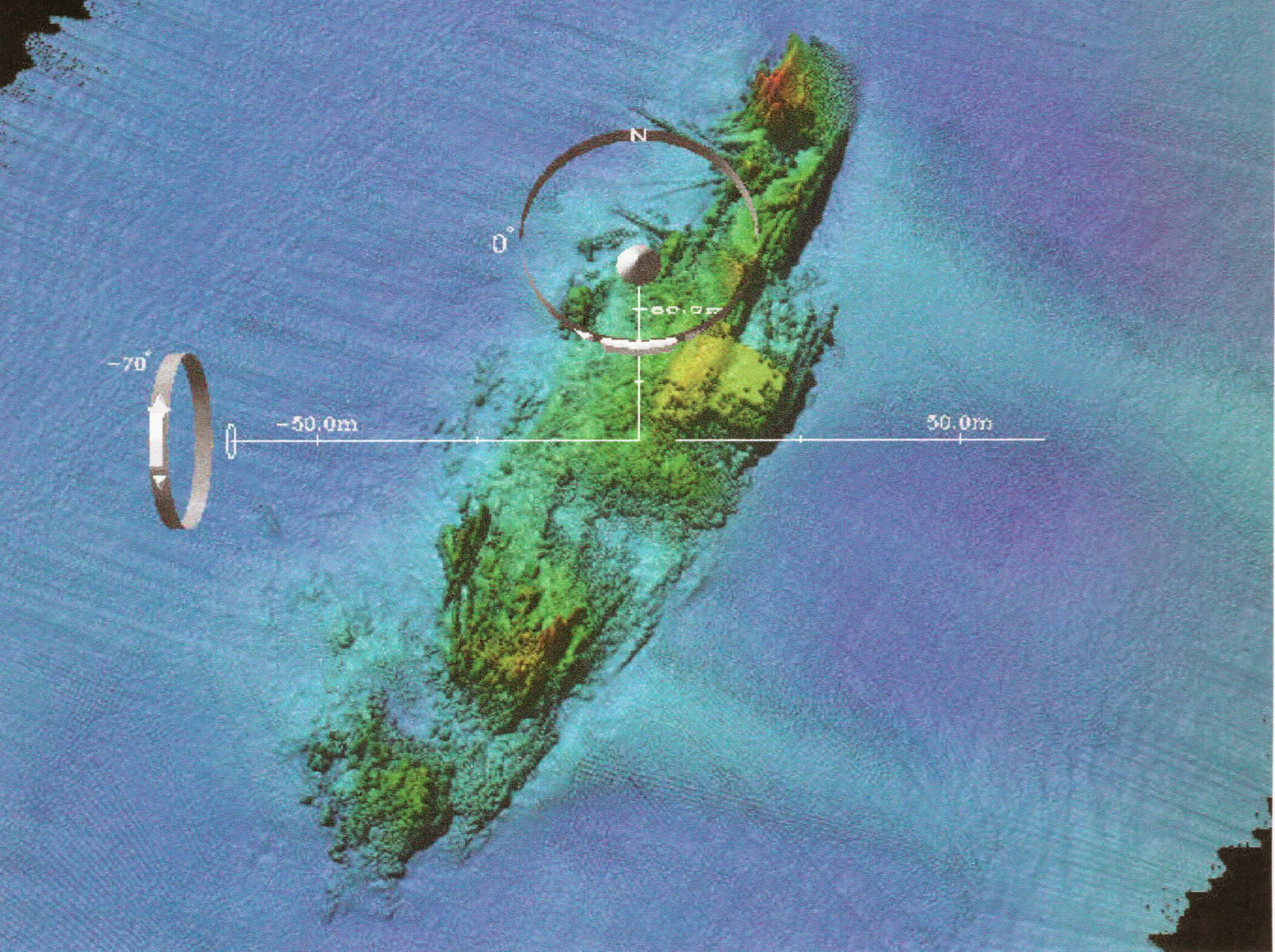
 A multibeam image of the USS Susan B. Anthony (AP-72) shipwreck off coast of France.
History and Progression
Multibeam echosounders, also known as Swathe (British English) or Swath (American English) echosounders, originated in the late 1950s, originally for military applications. They were developed in the 1970s by the US Navy, in conjunction with General Instruments to map large swaths of the ocean floor to assist the underwater navigation of its submarine force. Starting in the 1970s, companies such as General Instruments (now SeaBeam Instruments, part of L3/Klein) in the United States, Krupp Atlas (now Atlas Hydrographic) and Elac Nautik (now part of L3 Communications) in Germany, Simrad (now Kongsberg Maritime) in Norway and RESON in Denmark developed systems that could be mounted to the hull of large ships, and then small boats (as technologies improved and operating frequencies increased).
The first commercial multibeam is now known as the SeaBeam Classic and was put in service in May 1977 (Farr, Marine Geodesy, Volume 4, Issue 2 1980 , pages 77 – 93) on the Australian survey vessel HMAS Cook. This system produced up to 16 beams across a 45-degree swath.
The second SeaBeam Classic installation was on the French Research Vessel Jean Charcot sometime after the Cook. The SB Classic arrays on the Charcot were damaged in a grounding and the SeaBeam was replaced with an EM120 in 1991. Although it seems that the original SeaBeam Classic installation was not used much, the others were widely used, and subsequent installations were made on many vessels.
SeaBeam Classic systems were subsequently installed on the US academic Research Vessels Thomas Washington (Scripps Institution of Oceanography, University of California), the Robert D. Conrad (Lamont-Doherty Earth Observatory of Columbia University) and the Atlantis II (Woods Hole Oceanographic Institution.)
The (retronym) term "SeaBeam Classic" was coined after the manufacturer developed newer systems such as the SeaBeam 2000 and the SeaBeam 2112 in the late 1980s.
As technology improved in the 1980s and 1990s, higher-frequency systems suitable for high-resolution mapping in shallow water were developed, and such systems are widely used for shallow-water hydrographic surveying in support of navigational charting. Multibeam echosounders are also commonly used for geological and oceanographic research, and since the 1990s for offshore oil and gas exploration and seafloor cable routing.
In 1989, Atlas Electronics (Bremen, Germany) installed a second-generation deep-sea multibeam called Hydrosweep DS on the German research vessel Meteor. The Hydrosweep DS (HS-DS) produced up to 59 beams across a 90-degree swath, which was a vast improvement and was inherently ice-strengthened. Early HS-DS systems were installed on the Meteor (Germany), the Polarstern (Germany), the Maurice Ewing (US) and the Sagar Kanya (India) in 1989 and 1990 and subsequently on a number of other vessels including the Thomas Thompson (US) and Hakurei Maru (Japan.)
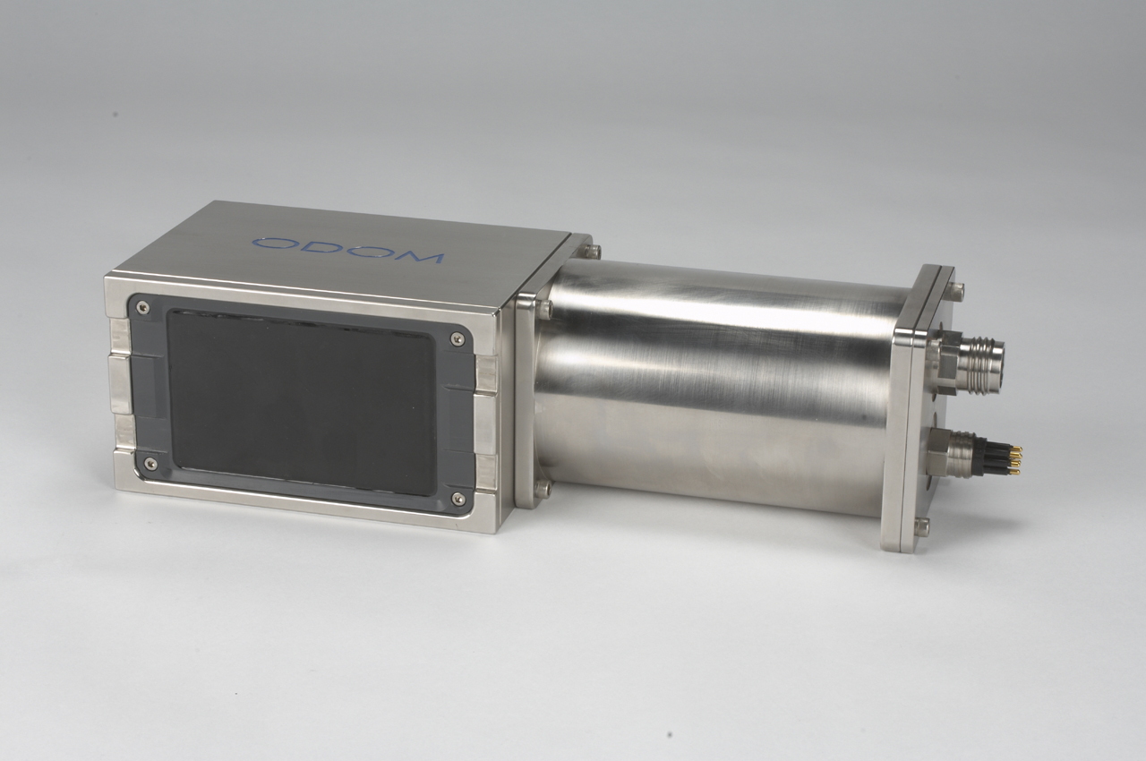
As the cost of components has decreased, the number of multibeam systems sold and in operation worldwide has increased significantly. Smaller, portable systems can be operated on a small launch or tender vessel unlike the older systems that required considerable time and effort to attach to a ship's hull. Some multibeam echosounders such as the Teledyne Odom ES3 also incorporate a motion sensor at the face of the acoustic transducer, allowing even faster installation on small vessels. Multibeam echosounders like this are allowing many smaller hydrographic survey companies to move from traditional single beam echosounders to swath systems.
 A multibeam echosounder (black rectangle) with motion sensor attached (cylinder) - Odom ES3PT-M
Theory of Operation
A multibeam echosounder is a device typically used by hydrographic surveyors to determine the depth of water and the nature of the seabed. Most modern systems work by transmitting a broad acoustic pulse from a specially designed transducer across the full swath acrosstrack then forming a receive beam that is much narrower (around 1 degree depending on the system) to establish a two way travel time of the acoustic pulse. If the speed of sound in water is known for the full water column, the depth and position of the return signal can be determined from the receive angle and the two-way travel time.
In order to determine the transmit and receive angle of each beam, a multibeam echosounder requires accurate measurement of the motion of the sonar relative to a cartesian coordinate system. The measured values are typically heave, pitch, roll, and heading.
External links
- Echoscope
- Teledyne Odom
- Seabeam Instruments
- Atlas Hydrographic
- Kongsberg Multibeams
- Reson SeaBat
- Elac Multibeam Sonars
- MB-System open source software for processing multibeam data
- News and application articles of multibeam equipment on Hydro International; Product Survey Multibeam Shallow Water; Product Survey Multibeam Deep Water
- Tritech International Ltd
Categories:
Wikimedia Foundation. 2010.