- Strážske
Geobox|Settlement
name = Strážske
category = Town
etymology =
official_name =
motto =
nickname =

image_caption = Laborec river near Strážske
symbol = Strážske CoA.svg
symbol_type =
country = Slovakia
country_
state =region = Košice
district = Michalovce
municipality =
landmark =
river = Laborec
location =
elevation = 135
prominence =
lat_d =48 | lat_m =52 | lat_s =02 | lat_NS =N
long_d =21 | long_m =49 | long_s =28 | long_EW =E
highest =
highest_location = | highest_region = | highest_state =
highest_elevation =
highest_lat_d = | highest_lat_m = | highest_lat_s = | highest_lat_NS =
highest_long_d = | highest_long_m = | highest_long_s = | highest_long_EW =
lowest =
lowest_location = | lowest_region = | lowest_state =
lowest_elevation =
lowest_lat_d = | lowest_lat_m = | lowest_lat_s = | lowest_lat_NS =
lowest_long_d = | lowest_long_m = | lowest_long_s = | lowest_long_EW =
length = | length_orientation =
width = | width_orientation =
area = 24.773
area_land =
area_water =
area_urban =
area_metro =
population =4551 | population_date =31 December 2006
population_urban =
population_metro =
population_density = auto
population_density_urban =
population_density_metro =
established =1337
established_type = First mentioned
date =
government =
government_location = | government_region = | government_state =
government_elevation =
government_lat_d = | government_lat_m = | government_lat_s = | government_lat_NS =
government_long_d = | government_long_m = | government_long_s = | government_long_EW =
mayor = Vladimír Dunajčák
leader =
timezone =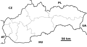
map_caption = Location in Slovakia
map_background = Slovakia - background map.png
map1 = Košice Region - outline map.svg
map1_caption = Location in the Košice Region
map1_background = Košice Region - background map.png
commons = Strážske
statistics = [http://www.statistics.sk/mosmis/eng/prvav2.jsp?txtUroven440807&lstObec523101&Okruhzaklad MOŠ/MIS]
website = http://www.strazske.sk
footnotes =Strážske ( _de. Straschke (rare); _hu. Őrmező) is a small
town andmunicipality inMichalovce District in theKosice Region of easternSlovakia . It is located to the very north ofMichalovce District .History
In historical records the town was first mentioned in 1337.
Geography
The town lies at an
elevation of 135 metres and covers an area of 24.773 km². Themunicipality has a population of about 4460 people. The town lies on theLaborec River .Demographics
According to the 2001
census , the town had 4,474 inhabitants. 96.38% of inhabitants wereSlovaks , 1.07% Roma, 0.87% Czechs, 0.45%Rusyns and 0.40% Ukrainian.cite web | title = Municipal Statistics | publisher = Statistical Office of the Slovak republic | url = http://www.statistics.sk/mosmis/eng/run.html | accessdate = 2008-02-17] The religious makeup was 63.59%Roman Catholics , 21.77%Greek Catholics , 7.58% people with no religious affiliation, 2.82% Orthodox and 1.41%Lutherans .Government
The town has its own birth registry and a
police force .Economy and facilities
The town has a number of food stores, a doctors' surgery, an outpatient facility for children and
adolescent s, and a resident stomatologist. It also has a Slovakcommercial bank andinsurance company .Culture
The town has a
public library ,Disco bar called Broadway,Ice-ring and afootball pitch. It also has aDVD rental store and a town cinema. In park is old amanor-house and the oldestLime-tree in Slovakia.Transport
The town has a
railway station andbus station .References
External links
*http://www.strazske.sk/


Wikimedia Foundation. 2010.