- Cuiabá
-
Cuiabá — Municipality — The Municipality of Cuiabá From the top, left to right: Cuiabá Cathedral, Santo Antônio Hill behind the city, Nossa Senhora do Bom Despacho Church, SESC Arsenal Museum, Aecim Tocantins Gymnasium, Historiador Rubens de Mendonça Avenue with Miguel Sutil Avenue, and overview of the city downtown from Sérgio Motta Bridge

Flag
SealNickname(s): "Green City" Location of Cuiabá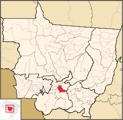
Coordinates: 15°35′45″S 56°05′49″W / 15.59583°S 56.09694°WCoordinates: 15°35′45″S 56°05′49″W / 15.59583°S 56.09694°W Country  Brazil
Region Central-West State  Mato Grosso
Founded January 1. 1727 Government - Mayor Francisco Bello Galindo Filho (PSDB) Area - Total 3,538 km2 (1,366 sq mi) Elevation 165 m (541 ft) Population (2010) - Total 542,861 - Density 153.4/km2 (397.3/sq mi) Time zone UTC-4 (UTC-4) - Summer (DST) UTC-3 (UTC-3) Postal Code 78000-000 Area code(s) +55 65 Website Cuiabá, Mato Grosso Cuiabá (Portuguese pronunciation: [kujaˈba]) is the capital city of the Brazilian state of Mato Grosso. It is located in the exact centre of South America and forms the metropolitan area of the state, along with the neighbouring town of Várzea Grande.
The name is of obscure South American Indian origin, reportedly meaning "arrow-fishing", and alludes to the Bororo custom of using arrows to fish. Another version says that there was an Indian tribe called Ykuiapá. Others say that, while a Portuguese man was once taking a bath in the river using a kind of plate made with half a coconut (named cuia), the stream carried it away, prompting the man to exclaim "Cuia ba" (something like "the cuia is gone"). Cuiabá is the largest centre for tourism, business, agribusiness, trade, and culture in Mato Grosso.
The new Marechal Rondon International Airport connects Cuiabá with many Brazilian cities and also operates some international flights.
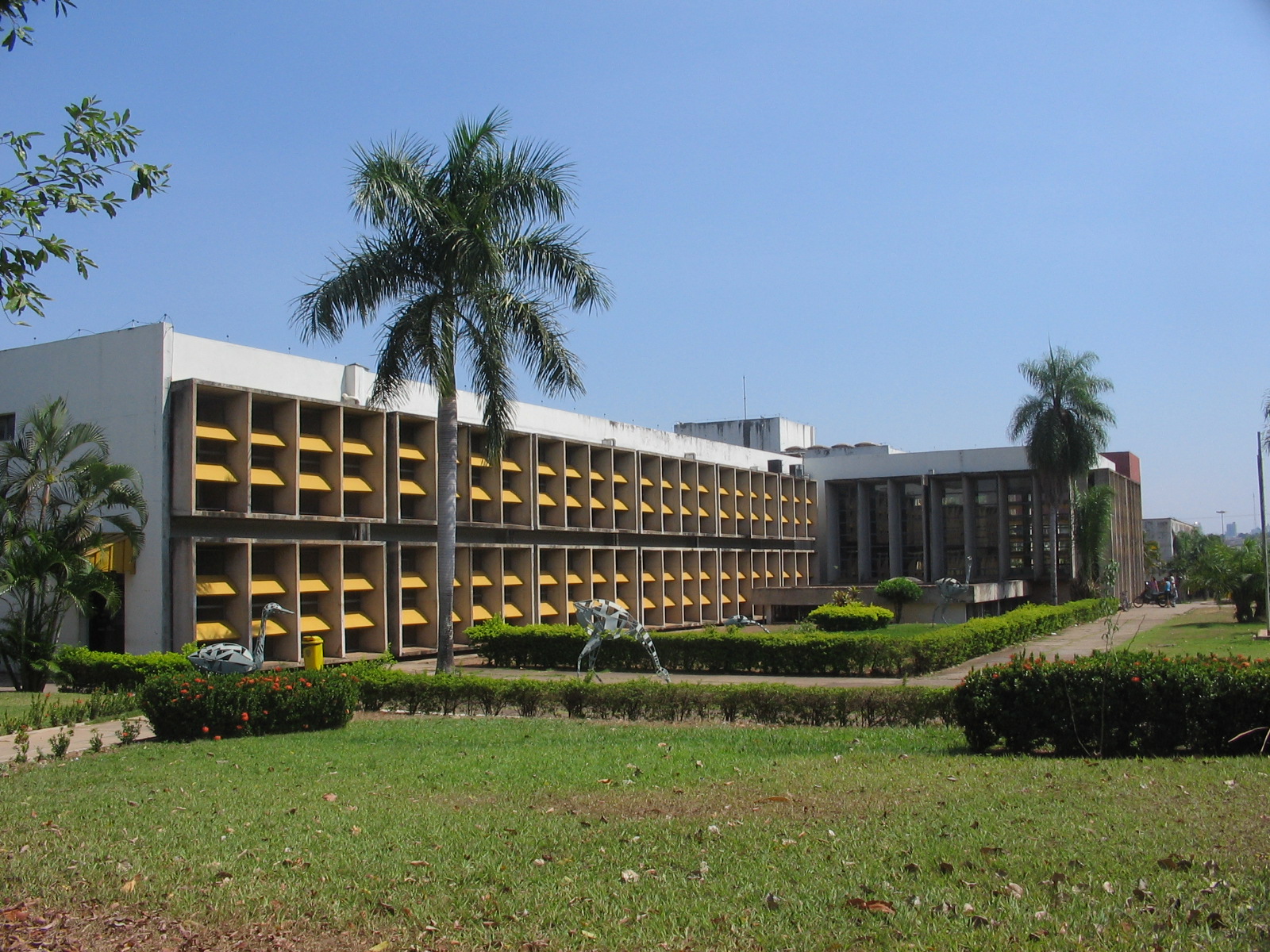
The city is home to the Federal University of Mato Grosso.
Contents
History
 View of Cuiabá, from the City Hall. In the front, the church of "Nosso Senhor dos Passos", behind, the Church of Our Lady of the Rosary and the Saint Benedict's Chapel.
Cuiabá was founded on January 1, 1727 by Rodrigo César de Menezes, then the "captain" of the captaincy of São Paulo in the aftermath of the discovery of gold mines. It was given township status in 1818 and became the capital in 1835.
From the late eighteenth century, until the time of the Paraguay War, the town remained small and was in decline. The war, however, brought some infrastructure and a brief period of economic boom, supplying sugar, foodstuffs and timber to the Brazilian troops.
After the war, the town was once again forgotten by the rest of the country, to such an extent that the Imperial and later the Republican governments of Brazil used to use it as a site of exile for troublesome politicians. Isolation allowed it to preserve many of the oldest Brazilian ways of life until well into the twentieth century.
Starting in 1930, isolation shrank with the construction of roads and later with the advent of aviation. The town became a city and would grow quite rapidly from 1960 onwards, after the establishment of the newly built Brazilian capital in Brasilia.
 View of Cuiabá.
In the 1970s and 1980s, the pace of growth would continue to increase as agriculture became commercialized, using the roads to transport soybeans and rice produced in the state in order to be sold abroad. The growth was such that from 1960 to 1980 the small town of 50,000 inhabitants grew into a giant, with more than a quarter of a million inhabitants (including those from the surrounding area and towns).
Since 1990, the rate of population growth has decreased, as other towns in the state have begun to attract more immigration than the capital. Tourism has emerged as a source of income and environmental issues have become a concern for the first time.
Geography
 Sunset in Cuiabá.
 Church of Our Lady of "Bom Despacho".
Cuiabá borders the towns of Chapada dos Guimarães, Campo Verde, Santo Antônio do Leverger, Várzea Grande, Jangada and Acorizal. The city is an intersection of many major roads and waterways. However, on account of sand banks along the river, these waterways no longer support medium or large ships.
The third most important airport of the Brazilian Mid-West region is located in Cuiabá, and the city is the centre of an important and productive agricultural region. It is also the geographic centre of South America and is famous throughout Brazil as one of the country's hottest metropolises, where temperatures are often above 40°C (104°F).
The town sits in a transition zone between three of the most characteristic Brazilian ecosystems: Amazonia, Cerrado and Pantanal. It is also close to the mountain range known as Chapada dos Guimarães (which blocks polar masses and causes the extremely hot weather).
Cuiabá is also known as the Southern gate to the Amazon.
Climate
Cuiabá Climate chart (explanation) J F M A M J J A S O N D 21033231993323171332312333225432201631189.63217113418583422115342315431231943323Average max. and min. temperatures in °C Precipitation totals in mm Source: World Climate Charts Imperial conversion J F M A M J J A S O N D 8.391747.891736.791734.891722.189670.687640.489620.493652.393724.593736.188737.69173Average max. and min. temperatures in °F Precipitation totals in inches Under the Koppen climate classification, Cuiaba features a tropical wet and dry climate. Cuiabá is famous for its searing heat, although temperatures in winter can arrive sporadically at 10 degrees, indeed atypical, caused by cold fronts coming from the south, and that may only last one or two consecutive days, to then return to usual heat. The average temperature in Cuiabá is around 24 ° C. The climate is tropical and humid. Rainfall is concentrated from September to May, while the rest of the year the mass of dry air over the center of Brazil rainy inhibit the formations. The cold fronts when dissipate the heat associated with the smoke produced by fires set at the time, does the relative humidity drops to very low levels, sometimes below 15%, increasing cases of respiratory diseases. The average annual rainfall is 1469.4 mm, with maximum intensity in January, February and March. The mean maximum temperature reaches 35 ° C, but the absolute maximum can reach 40 ° C in warmer months and muffled; on rainy days, the maximum temperature is only 28 degrees. The average low in July, the coldest month is 16.0 ° C with wind chill of 11 ° C. According to INMET (1961-1990), the lowest recorded temperature was 5 ° C on July 18, 1997 and the highest 43.1 ° C on October 16, 2009.
Vegetation
Cerrado includes various types of vegetation. It is characterized by extensive savanna formations crossed by gallery forests and stream valleys. Humid fields and "buriti" palm paths are found where the water table is near the surface. Alpine pastures occur at higher altitudes and mesophytic forests on more fertile soils.
"Cerrado" trees have characteristic twisted trunks covered by a thick bark, and leaves which are usually broad and rigid. Many herbaceous plants have extensive roots to store water and nutrients. The plant's thick bark and roots serve as adaptations for the periodic fires which sweep the cerrado landscape. These adaptations protect the plants from destruction and make them capable of sprouting again after the fire.
Economy
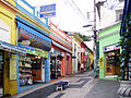
 Street trading.
The economy of Cuiabá is concentrated on commerce, services and industry. Commerce and services based in Cuiabá are important to the whole state, since the population is divided in several small agriculture-centered cities. People from these smaller cities often travel to the capital to access these services and buy goods not sold anywhere else. The industrial sector is represented, basically, by agribusiness, particularly food processing. Many industries, mainly those that should be maintained far from the populous areas, have been set up in the Industrial District of Cuiabá (DIICC), which was founded in 1978. Even though it is located in one of the most agriculturally focused states of Brazil, Cuiabá itself only grows small vegetable farms, mainly family- or cooperative-based. The city, with a GDP of 4.75 billion reals in 2003, according to the IBGE, is responsible for 21.99% of the total of the state GDP. Greater Cuiabá possesses, currently, four shopping centers registered in the HUGS (Brazilian Association of Shopping Centers), and another 8 commercial galleries.
The GDP for the city was R$ 7,189,521,000 (2006).[1]
The per capita income for the city was R$ 13,244 (2006).[2]
Education
 Federal University of Mato Grosso in Cuiabá.
Portuguese is the official national language, and thus the primary language taught in schools. But English is part of the official high school curriculum.
Educational Institutions
- Universidade de Várzea Grande (UNIVAG) (private)
- Universidade Federal de Mato Grosso (UFMT) (Public);
- Universidade de Cuiabá (Unic) (Private);
- Universidade Cândido Rondon (Private);
- and many others (mostly private).
Culture
 Cultural Centre of Sesc in Cuiabá.
 Historical Museum of Mato Grosso.
There is a very rich local culture based on Portuguese, African and Indian influences. Cuiabá is home to an interesting Indian (native American) influenced cuisine, native dances, craftwork and music. Local dance and music were traditionally connected to the worship of Catholic saints, like Saint Benedict (the city's patron), but today is secular. In August 2007, an important Italian wind orchestra performed the Orchestra Fiati Giovanile Italiana e Coro "I Music Piemonteis" conducted by Ugo Bairo and his choir, conducted by Carmelo Luca Sambataro.
Museums
- Museum Hill of the Box Of water;
- Memorial of Mato Grosso;
- Museum of the Image and Sound of Cuiabá;
- Artisan's home;
- Museum of Rio Cuiabá and Municipal Aquarius;
- Memorial of the Waters;
- Museum of the Education and Teatro Maria of Arruda Müller;
- Museum of Sacred Art of Cuiabá;
- Museu Couto Magalhães;
- Memorial Papa João Paulo II;
- Historical and Geographical institute of Mato Grosso and Museu Barão of Melgaço;
- Institute of the Historical and Environmental Patrimony National–Cuiabá;
- Palace of the Instruction;
- Museum of the History of Mato Grosso;
- Cine Teatro of Cuiabá and Museum of the Movies;
- SESC/Arsenal and Museum of the Swampland.
Carnival
The four-day period before Lent leading up to Ash Wednesday is carnival time in Brazil. As with other capitals in Brazil, there are parties everywhere (os Bailes de Carnaval). Also like many other cities in Brazil, Cuiabá holds its own off-season Carnaval ("Carnaval fora de época", or "micareta"), called Micarecuia.
Sports
See also: 2014 FIFA World CupCuiabá is one of 12 cities chosen to host games of the 2014 FIFA World Cup, which take place in Brazil.
International Airport
Marechal Rondon International Airport connects Cuiabá with many Brazilian cities and also operates some international flights. The runway at Marechal Rondon International Airport was opened to traffic in 1956. In February 1975, Infraero took over the airport's administration and began various upgrades to meet the needs of the airport complex. As of 1996, Marechal Rondon Airport, located 10 km (6.2 mi) from the city center, started receiving international flights. Currently it serves more than 900 thousand passengers a year.
Images
-
-

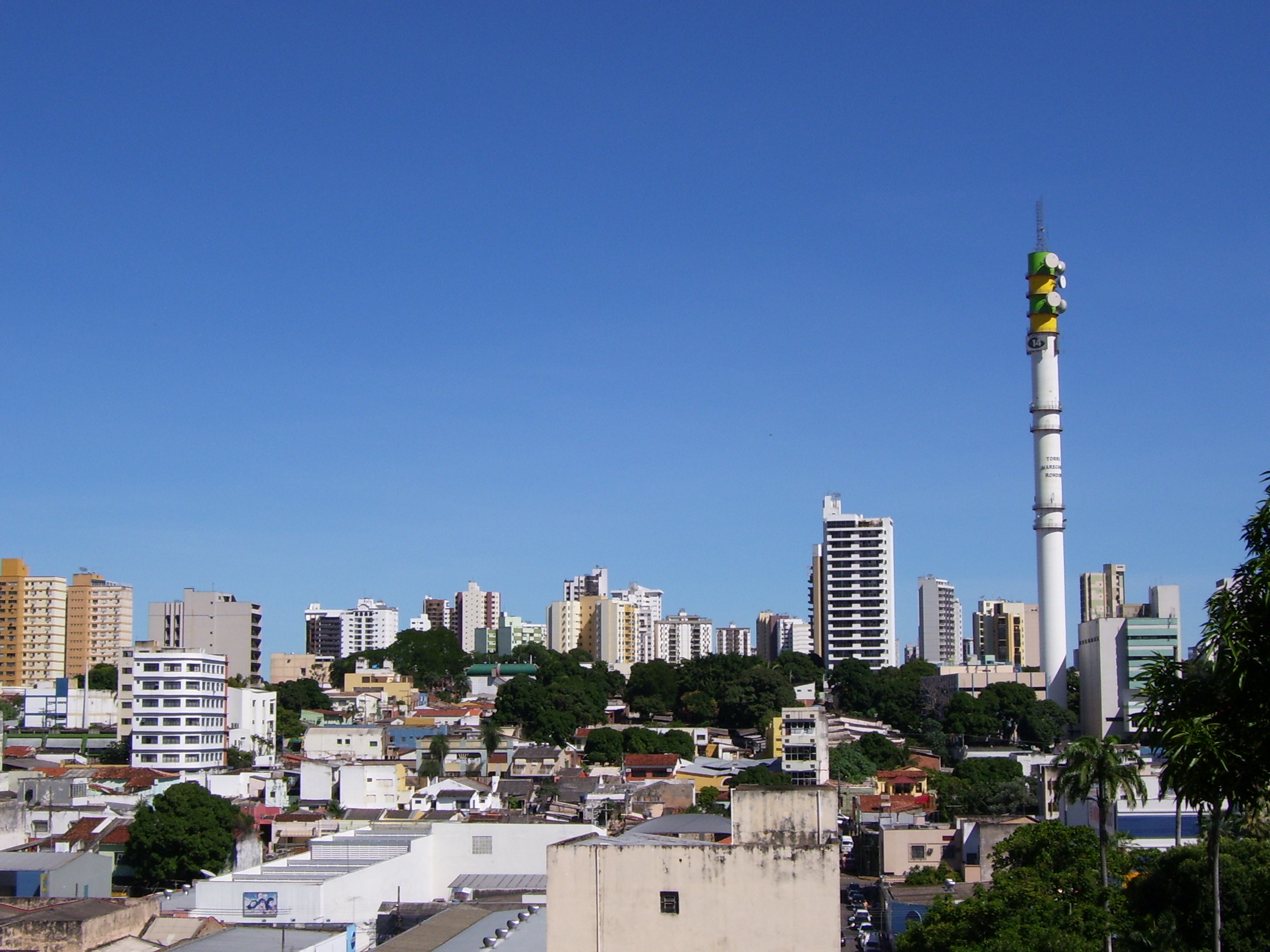
Cuiaba's Skyline.
-

Americas Garden.
-
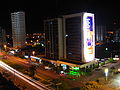
The city at night.
-

Street Art in Cuiabá.
-

Palms on June 13 Street.
-

City Skyline.
-

Sérgio Motta Bridge.
References
- ^ (in Portuguese) (PDF) GDP. Cuiabá, Brazil: IBGE. 2006. ISBN 85-240-3919-1. http://www.ibge.gov.br/home/presidencia/noticias/noticia_impressao.php?id_noticia=1288. Retrieved 2009-07-18.
- ^ (in Portuguese) (PDF) per capita income. Cuiabá, Brazil: IBGE. 2006. ISBN 85-240-3919-1. http://www.ibge.gov.br/home/presidencia/noticias/noticia_impressao.php?id_noticia=1288. Retrieved 2009-07-18.
Distances
From São Paulo - 1,690 km (1,050 mi) From Rio de Janeiro - 2,090 km (1,300 mi) From Brasília - 1,130 km (700 mi)
External links
- (Portuguese) Official Website
- (Portuguese) Local Newspaper Diário de Cuiabá Site
- Cuyaba - Catholic Encyclopedia article on the diocese

Acorizal Rosário Oeste Chapada dos Guimarães Jangada 
Campo Verde  Cuiabá

Várzea Grande Santo Antônio do Leverger Rondonópolis BrazilHistory First inhabitants · Colonization · Empire · Old Republic · Vargas Era · Second Republic · Military rule · ContemporaryGeography Regions · States · Mesoregions · Microregions · Municipalities · Islands · Coastline · Climate · Environment · Extreme points · Protected areas · CapitalsGovernment Constitution · Federal government · President · National Congress · Foreign relations · Law · Law enforcement · MilitaryPolitics Economy Society Demographics · People · Languages · Religion · Immigration · Education · Health · Crime · Social issues · Largest cities · ApartheidCulture  Category ·
  Portal ·
  WikiProject
Demographics of Brazil Economic and social Apartheid · Attractions · Law · Crime · Education · GDP · Health · Human Development · Human Rights (LGBT Rights) · Immigration · Languages · People · Politics · Poverty · Races · Religions · Traditions · Wealth
Ethnic groups BrazilAfricaAmericasNorth AmericaCaribbeanHaitianSouth AmericaAsiaBy EthnicityBy Country
or RegionEasternSouthernEast IndianWesternEuropeBy EthnicityBy Country
or RegionNorthernWesternCentralSouthernBalkanEasternCapitals of Brazilian states Brasília Federal Capital (DF) Northern Northeast Center-West Southeast South 50 largest cities of Brazil by population Municipalities of Mato Grosso Capital: Cuiabá Centro-Sul Mato-Grossense Alto PantanalBarão de Melgaço • Cáceres • Curvelândia • PoconéAlto ParaguaiAlto Paraguai • Arenápolis • Nortelândia • Nova Marilândia • Santo AfonsoCuiabáChapada dos Guimarães • Cuiabá • Nossa Senhora do Livramento • Santo Antônio do Leverger • Várzea GrandeRosario OesteAcorizal • Jangada • Rosário Oeste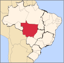
Nordeste Mato-Grossense CanaranaÁgua Boa • Campinápolis • Canarana • Nova Nazaré • Nova Xavantina • Novo São Joaquim • Querência • Santo Antônio do LesteMedio AraguaiaAraguaiana • Barra do Garças • CocalinhoNorte AraguaiaAlto Boa Vista • Bom Jesus do Araguaia • Canabrava do Norte • Confresa • Luciára • Novo Santo Antônio • Porto Alegre do Norte • Ribeirão Cascalheira • Santa Cruz do Xingu • Santa Terezinha • São Félix do Araguaia • São José do Xingu • Serra Nova Dourada • Vila RicaNorte Mato-Grossense Alta FlorestaAlto Teles PiresIpiranga do Norte • Itanhangá • Lucas do Rio Verde • Nobres • Nova Mutum • Nova Ubiratã • Santa Rita do Trivelato • Sorriso • TapurahArinosJuara • Nova Maringá • Novo Horizonte do Norte • Porto dos Gaúchos • São José do Rio Claro • TabaporãAripuanãColíderColíder • Guaranta do Norte • Matupá • Nova Canaã do Norte • Nova Guarita • Novo Mundo • Peixoto de Azevedo • Terra Nova do NorteParanatingaGaúcha do Norte • Nova Brasilândia • Paranatinga • Planalto da SerraParecisComodoro • Campo Novo do Parecis • Campos de Júlio • Diamantino • SapezalSinopCláudia • Feliz Natal • Itaúba • Marcelândia • Nova Santa Helena • Santa Carmem • Sinop • União do Sul • VeraSudeste Mato-Grossense Alto AraguaiaAlto Araguaia • Alto Garças • Alto TaquariPrimavera do LesteCampo Verde • Primavera do LesteRondonópolisDom Aquino • Itiquira • Jaciara • Juscimeira • Pedra Preta • Rondonópolis • São José do Povo • São Pedro da CipaTesouroAraguainha • General Carneiro • Guiratinga • Pontal do Araguaia • Ponte Branca • Poxoréo • Ribeirãozinho • Tesouro • TorixoréuSudoeste Mato-Grossense Alto GuaporeConquista d'Oeste • Nova Lacerda • Pontes e Lacerda • Vale de São Domingos • Vila Bela da Santíssima TrindadeJauruAraputanga • Figueirópolis d'Oeste • Glória d'Oeste • Indiavaí • Jauru • Lambari d'Oeste • Mirassol d'Oeste • Porto Esperidião • Reserva do Cabaçal • Rio Branco • Salto do Céu • São José dos Quatro MarcosTangará da SerraBarra do Bugres • Denise • Nova Olímpia • Porto Estrela • Tangará da SerraCategories:- Municipalities of Brazil
- Populated places in Mato Grosso
- State capitals in Brazil


Wikimedia Foundation. 2010.