- Malheur River
-
Malheur River  Malheur River flowing through Harney County
Name origin: From the French malheur (bad fortune), applied by French Canadian hunters whose cache of furs near the river were stolen[1] Country United States State Oregon County Malheur, Harney, Grant Tributaries - left North Fork Malheur River,
Bully Creek, Willow Creek- right South Fork Malheur River Source Blue Mountains - coordinates 44°8′5″N 118°37′14″W / 44.13472°N 118.62056°W [2] Mouth Snake River - elevation 2,133 ft (650 m) [2] - coordinates 44°3′33″N 116°58′31″W / 44.05917°N 116.97528°W [2] Length 190 mi (306 km) Basin 4,700 sq mi (12,173 km2) [3] Discharge for near Vale, Oregon - average 203 cu ft/s (6 m3/s) - max 20,800 cu ft/s (589 m3/s) - min 0 cu ft/s (0 m3/s) 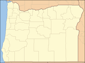
 Location of the mouth of the Malheur River in Oregon
The Malheur River (local pronunciation: "MAL-hyure") is a 190-mile-long (306 km)[4] tributary of the Snake River in eastern Oregon in the United States. It drains a high desert area, between the Harney Basin and the Blue Mountains and the Snake.
Despite the similarity of name, the river does not flow into nearby Malheur Lake, which is located in the enclosed Harney Basin southwest of the watershed of the river.
Contents
Course
The Malheur River rises in the southern Blue Mountains of southern Grant County, south of Strawberry Mountain in the Strawberry Mountain Wilderness. It flows south through Malheur National Forest, then southeast past Drewsey and through Warm Springs Reservoir. At Riverside in eastern Malheur County it receives the South Fork Malheur River from the south, then turns sharply back northward to Juntura, where it receives the North Fork Malheur River form the north. From Juntura it flows generally east past Vale, joining the Snake from the west approximately 2 mi (3 km) north of Ontario, Oregon. The mouth of the Malheur River is approximately at Snake river mile (RM) 370 or river kilometer (RK) 600.[3]
River modifications
 Bully Creek Dam in height perspective with human subjects.
The lower Malheur River is used for irrigation in the agricultural potato-growing in the Snake River Plain along the Idaho-Oregon border.
There are approximately 370 miles (600 km) of irrigation-related canals and ditches in the lower basin of the Malheur River and its tributary Willow Creek. The streamflow of the Malheur and its tributaries is heavily influenced by a complex system of irrigation diversions, siphons, and canals, which begin near Malheur river mile 65, near Namorf and Harper, Oregon. This irrigation system extends downstream to the mouth of the Malheur at Ontario, Oregon. Irrigation is used on about 132,000 acres (530 km2) within the Malheur River basin. The irrigation system is part of the Bureau of Reclamation's Vale Project, which includes a number of water impoundments, the largest of which are Warm Springs Reservoir on the mainstem Malheur River, Beulah Reservoir on the North Fork Malheur, Bully Creek Reservoir on Bully Creek, and Malheur Reservoir on Willow Creek. The project is operated and maintained by the Vale-Oregon Irrigation District.[3]
Agricultural runoff has resulted in a phosphorus pollution problem in its lower reaches.
History
The name of the river is derived from the French for "misfortune." The name was attached to the river by French Canadian voyageur trappers working for the North West Company on the Snake County Expeditions of Donald Mackenzie as early as 1818 for the unfortunate circumstance that some beaver furs they had cached there were discovered and stolen by Indians. The name first appears in the record in 1826 when Peter Skene Ogden, a fur trapper with the Hudson's Bay Company, referred to it as "River au Malheur (unfortunate River)" and thereafter as "Unfortunate River."
The river lived up to its name a second time in 1845, when mountain man Stephen Meek, seeking a faster route along the Oregon Trail, led a migrant party up the river valley into the high desert along a route that has since become known as the Meek Cutoff. After leaving the river valley the party was unable to find a water supply and lost 23 people by the time they reached The Dalles on the Columbia River.
In 1853, 1854 and 1859 the river was used more successfully as the route of the Elliott Cutoff. The emigrants followed the ruts of Stephen Meek until they reached Harney Basin. From here they sought more direct routes to the Deschutes River, where they turned south until reaching the Free Emigrant Road. The road was built over the Cascades through Willamette Pass and brought emigrants into Central Oregon.
Natural history
The Malheur River watershed was once a major spawning ground for anadromous fish such as salmon. In the early 20th century a number of dams on the Snake River blocked fish migration.[3]
Protected area
Part of the Malheur River became protected as wild and scenic in 1988. Located on National Forest System lands, the protected area covers 3,758 acres (15.21 km2) along 12 miles (19 km) of the river.[5]
See also
- List of Oregon rivers
- List of longest streams of Oregon
- List of National Wild and Scenic Rivers
References
- ^ McArthur, Lewis A.; McArthur, Lewis L. (2003) [1928]. Oregon Geographic Names, 7th ed. Portland, Oregon: Oregon Historical Society Press. pp. 606–07. ISBN 0-87595-277-1.
- ^ a b c "Malheur River". Geographic Names Information System. United States Geological Survey. November 28, 1980. http://geonames.usgs.gov/pls/gnispublic/f?p=gnispq:3:::NO::P3_FID:1145769. Retrieved January 11, 2011.
- ^ a b c d Watershed Professionals Network, L.L.C. (2004). "Malheur River Subbasin Assessment and Management Plan for Fish and Wildlife Mitigation" (PDF). Northwest Power and Conservation Council. http://www.nwcouncil.org/fw/subbasinplanning/malheur/plan/MgmtPlan.pdf. Retrieved January 11, 2011.
- ^ "National Hydrography Dataset high-resolution flowline data". United States Geological Survey. http://viewer.nationalmap.gov/viewer/. Retrieved May 3, 2011.
- ^ "Malheur National Forest: Wild and Scenic Rivers". United States Forest Service. August 18, 2005. http://www.fs.fed.us/r6/malheur/recreation/rivers.shtml. Retrieved January 11, 2011.
External links
Categories:- Rivers of Oregon
- Wild and Scenic Rivers of the United States
- Tributaries of the Snake River
- Landforms of Malheur County, Oregon


Wikimedia Foundation. 2010.