- River Ribble
Infobox River | river_name = River Ribble
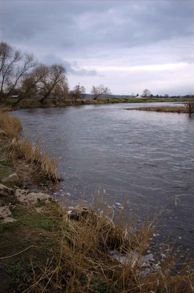
caption = The River Ribble atRibchester . Photograph by [http://www.flickr.com/people/stubbsuk Stuart Grimshaw]
origin = Confluence of Gayle Beck and Cam Beck, Selside
mouth =Irish Sea atLytham
basin_countries =England
length = 121 km (75 miles)
elevation = 246 m (807 ft)
discharge =
watershed =The River Ribble is a river that runs through
North Yorkshire andLancashire , in the North ofEngland . The river's watershed also includes parts ofGreater Manchester aroundWigan .Geography
The Ribble begins at the confluence of the "Gayle Beck" and "Cam Beck" near the famous viaduct at
Ribblehead , in the shadow of theYorkshire three peaks .It flows through
Settle ,Clitheroe andPreston , before emptying into theIrish Sea betweenLytham St. Annes andSouthport , a length of 75 miles.The main tributaries of the Ribble are the Hodder and Calder which join the river near Great Mitton, the
River Darwen which joins atWalton-le-Dale and theRiver Douglas which joins nearHesketh Bank .The
Ribble Way is a long-distance footpath which follows the river for much of its course. The Ribble marked the northernmost extent of the ancient kingdom ofMercia . [ [http://www.merseybasin.org.uk/information.asp?page=1&pagesize=5&confirmed=1&id=0&docid=72. River Ribble Information (pdf file).] Mersey Basin Campaign Official Website. Retrieval Date:January 26 ,2008 .] At the time of theDomesday Book , the river formed the northern boundary of an area of land (known as "Inter Ripam et Mersham") that was included in the Domesday information forCheshire , [Morgan (1978). pp.269c–301c,d.] though it was probably not formally part of the county of Cheshire. [Harris and Thacker (1987). write on page 252: quotation|Certainly there were links between Cheshire and south Lancashire before 1000, when Wulfric Spot held lands in both territories. Wulfric's estates remained grouped together after his death, when they were left to his brother Aelfhelm, and indeed there still seems to have been some kind of connexion in 1086, when south Lancashire was surveyed together with Cheshire by the Domesday commissioners. Nevertheless, the two territories do seem to have been distinguished from one another in some way and it is not certain that the shire-moot and the reeves referred to in the south Lancashire section of Domesday were the Cheshire ones.] [Phillips and Phillips (2002). pp. 26–31.] [Crosby, A. (1996). writes on page 31: quotation|The Domesday Survey (1086) included south Lancashire with Cheshire for convenience, but the Mersey, the name of which means 'boundary river' is known to have divided the kingdoms of Northumbria and Mercia and there is no doubt that this was the real boundary.]The river is connected to both the
Leeds and Liverpool Canal and theLancaster Canal (via theRibble Link ). The river downstream of Preston was actively dredged when Preston was an active port; this is no longer done and silt from the river is now spreading more widely over the (sand) beaches around Fairhaven andSt. Annes .Its estuary forms part of the
Ribble and Alt Estuaries Special Protection Area for wildlife.Public works
The River Ribble catchment is covered by the
Mersey Basin Campaign , a partnership which was established in1985 to improve water quality and encourage waterside regeneration.Preston City Council have published controversial plans to build a barrage across the River Ribble, in their 'Riverworks' proposals. The aim of these proposals is to build a water sports park on a section of the Ribble, coupled with over 4000 units of high quality housing and businesses in the river's flood plain. Some local residents are opposing these plans, arguing that they endanger wildlife, increase flood risk to local housing and damage greenbelt areas. These residents have set up the 'Save The Ribble' campaign. Parts of the river are a County Biological Heritage Site.
The Ribble would appear to have been known in Roman times as the
Belisama , [Hutton, p. 218] possibly giving its name toSamlesbury .Ptolemy 's "Belisama aest." seems to represent the estuary of the Ribble.History
The banks of the Ribble have been posited as a possible location for
King Arthur 's tenth battle, on the banks of a river "Tribruit", as alluded to in hisHistoria Brittonum byNennius . [ [http://www.mun.ca/mst/heroicage/issues/2/ha2lac.htm Malcor, L.A. (1999). "Lucius Artorius Castus"] Retrieval Date:January 26 ,2008 .]ettlements
*
Horton in Ribblesdale
*Stainforth
*Stackhouse
*Langcliffe
*Giggleswick
*Nappa
*Settle
*Halton West
*Paythorne
*Sawley
*West Bradford
*Horrocksford
*Clitheroe
*Great Mitton
*Little Town
*Ribchester
*Samlesbury
*Walton-le-Dale
*Preston
*Penwortham
*Lytham Tributaries
Estuary to Preston
Estuary to Douglas
*Crossens Pool
**The Sluice
***Middle Drain
***Back Drain
***Ring Ditch
***Boundary Drain
***Tarleton Runner
****Mere Brow
*****School Drain
****Pale Ditch
***Mere Brow Watercourse
***Midge Hall Drain
***Boat House Sluice
****Langley's Brook
***Rufford Boundary Sluice
**Three Pools Waterway
***Fine Jane's Brook
****Holly Brook
****Sandy Brook
****Old Canal
***Boundary Brook
****New Cut Brook
***Sandy Brook
****The Old Pool
****Black Brook
****Drummersdale Drain
*****Brook Cut and Mill Stream
****Bullen's Brook
****Eas Brook
*****Hurlston Brook
*Main Drain
**Liggard Brook
**Wrea Brook
*Hundred End Gutter
*Pool StreamRiver Douglas watershed
*
River Douglas or River Asland
**Longton Brook
**Centre Drain
**Carr Heys Watercourse
**Tarra Carr Gutter
***Hall Pool
**Dunkirk Dib
**Rakes Brook
**Carr Brook
**Strine Brook
**River Yarrow
***River Lostock
****Wymott Brook
****Clayton Brook
****Slack Brook
****Whave's Brook
***Spent Brook
***Syd Brook
****Howe Brook
****Pye Brook
***Culbeck Brook
****Chapel Brook
*****Ransnap Brook
*****German Brook
***Hodge Brook
***River Chor
***Clancutt Brook
****Tanyard Brook
****Whittle Brook
***Eller Brook
****Moss Ditch
***Black Brook
****Tan House Brook
****Warth Brook
*****Brinscall Brook
*****Fill Brook
***Roaring Lum
***Dean Brook
****Hall Brook
****Cote Slack
***Limestone Brook
***Green Withins Brook
**The Sluice
***Mill
***Old Reed Brook
**Main Ditch
**Eller Brook
***Wham Ditch
***Black Brook
***Abbey Brook
****New Park Brook
****Castle Brook
****Sefton Brook
*****Dungeon Brook
*****Dicket's Brook
******Goose Brook
**Mill Ditch
***New Reed Brook
***Bentley Brook
**River Tawd
***Slate Brook
***Grimshaw Brook
**Middlehurst Brook
**Dock Brook
**Alder Lane Brook
**Sprodley Brook
**Calico Brook
**Lees Brook
**Dean Brook
***Sand Brook
**Ackhurst Brook
**Mill Brook
**Bradshaw Brook
**Close Brook
**Barley Brook
**Smithy Brook
***Poolstock Brook
****Ince Brook
*****Hawkley Brook
*****Reed Brook
******Park Brook
**Clarington Brook
**Bradley Brook
**Bucklow Brook
***Moss Ditch
***Buckow Brook
****Hic-bibi Brook
*****Stars Brook
******Almond Brook
******Tunley Brook
**Pearl Brook
**Arley BrookDouglas to Preston
*
Freckleton Pool
**Dow Brook
***Spen Brook
***Carr Brook
****Wrongway Brook
**Middle Pool
*Savick Brook
**Deepdale Brook
**Lady Head Runnel
**Sharoe Brook
***Moss Leach Brook
**Eaves Brook
*Mill Brook
*The Mains BrookRiver Darwen watershed
*
River Darwen
**Hennel Brook
***Cockshott Brook
**Many Brooks
***Black Brook
****Hatchwood Brook
***Fowler Brook
****Drum Head Brook
*****Gorton Brook
*****Mill Brook
****Bank Head Brook
**Old Darwen
**Beeston Brook
***Quaker Brook
**Hole Brook
***Huntley Brook (North)
***Huntley Brook (South)
**Alum House Brook
***Arley Brook
**Trout Brook
**River Roddlesworth
***Finnington Brook
***Stockclough Brook
****Whitehalgh Brook
*****Shaw Brook
*****Chapels Brook
*****Sheep Bridge Brook
***Rake Brook
***Calf Hey Brook
***Ferny Bed Springs
**River Blakewater
***Snig Brook
***Audley Brook
***Little Harwood Brook
****Royshaw Clough
****Seven Acre Brook
***Knuzden Brook
**Scotshaw Brook
***Moss Brook
***Badger Brook
**Higher Croft Brook
***Newfield Brook
**Davy Field Brook
***Flash Brook
***Grimshaw Brook
****Waterside Brook
*****Mean Brook
******Sapling Clough
*****Hoddlesden Moss Brook
******Far Scotland Brook
*****Pickup Bank Brook
******Moss Brook
******Twitchells Brook
**Sunnyhurst Brook
***Stepback Brook
**Bold Venture Brook
***High Lumb Brook
****Livesey Brook
**Kebbs Brook
***Green Lowe Brook
**Bury Fold Brook
***Old Briggs Brook
****Duckshaw Brook
**Grain Brook
***Bent Hall Brook
***Deadman's CloughPreston to Whalley
*Swill Brook
*Bezza Brook
**Wilcock Brook
***Mellor Brook
*Tun Brook
*Stydd Brook
**Boyce's Brook
***Cowley Brook
***Page Brook
**Duddel Brook
*Starling Brook
*Dean Brook
**Bailey Brook
**Brownslow Brook
*Dinckley Brook
**Park Brook
***Blockers BrookFact|date=September 2007
***Showley Brook
****Knotts Brook
***Tottering Brook
***Zechariah BrookRiver Calder watershed
*River Calder
**Bushburn Brook
**Dean Brook
**Egg Syke Brook
**Rodger Hey Brook
**Sabden Brook
***Badger Well Water
***Wood House Brook
***Cock Clough
**Clough Syke Brook
**Hyndburn Brook
***Harwood Brook
****Causeway Brook
***Norden Brook
***Spaw Brook
***Shaw Brook
***Bottom Syke
***River Hyndburn
****Church Brook
*****Accrington Brook
******Woodnook Water
*******Warmden Brook
*******Tom Dale Clough
***White Ash Brook
****Wolfenden Syke
****Lottice Brook
***Tinker Brook
****Whams Brook
****Jackhouse Brook
*****Cocker Brook
******White Syke
*****Cocker Lumb
**Syke Side Brook
***Clough Brook
**Simonstone Brook
**Shorten Brook
**Dean Brook
***Huntroyde Brook
**Castle Clough Brook
***Castle Clough
**Green Brook
***Shaw Brook
***Sweet Clough
***Hapton Clough
****Thorny Bank Clough
****Tower Brook
***Habergham Clough
****New Barn Clough
*****Helm Clough
****Micklehurst Clough
*****Long Syke
**Whitaker Clough
***Fir Trees Brook
****West Close Clough
****Acres Brook
**Moor Isles Clough
**Spurn Clough
**Pendle Water
***Old Laund Clough
***Edge End Brook
***Walverden Water
****Bradley Syke
****Head Beck
*****Dobson Syke
****Catlow Brook
*****Pighole Clough
*****Pathole Beck
*****New Laithe Clough
*****Float Bridge Beck
*****Swains Plat Clough
***Colne Water
****Swinden Clough
****Wanless Water
*****Slipper Hill Clough
*****Houses Beck Moss
******Moss Houses Beck
****Guy Syke
****Church Clough Brook
****Trawden Brook
*****Beardshaw Beck
*****Round Hole Beck
*****Will Moor Clough
****River Laneshaw
*****High Laith Beck
******Sykes Beck
******Shawhead Beck
*****Monkroyd Beck
*****Hullown Beck
*****Swamp Syke
*****Laneshaw Brook
******Round Holes Beck
******Cat Stone Clough
****Wycoller Beck
*****Ratten Clough
*****Smithy Clough
******Deep Clough Beck
******Nan Hole Clough
*****Turnhole Clough
******Butter Leach Clough
******Saucer Hill Clough
***Blacko Water
****Castor Gill
****Claude's Clough
****Admergill Water
*****Wicken Clough
*****Greystone Clough
*****Sandyford Clough
***White Hough Water
****Dimpenley Clough
****Bird Holme Clough
****Barley Water
*****Deep Clough
*****Black Moss Water
******Water Gate
******Warth Beck
****Ogden Clough
*****Boar Clough
*****White Slacks
*****Dry Clough
**Barden Clough
**River Brun
***River Don
****Walshaw Clough
****Thursden Brook
*****Ell Clough
*****Black Clough
******Hey Stacks Clough
******Tom Groove
***Swinden Water
****Hell Clough
***Hurstwood Brook
****Smallshaw Clough
***Rock Water
****Cant Clough Beck
**Everage Clough
***Hole House Clough
****Buck Clough
**Dick Clough
**Easden Clough
**Black Clough
**Green Clough
***Copy Clough
****Sheddon CloughRiver Hodder watershed
*
River Hodder
**Cow Ark Brook
***Mill Brook
***Hagg Clough
**River Loud
***Leagram Brook
****Hill Clough
****Burnslack Brook
***Chipping Brook
**Greystoneley Brook
***Hell Clough
***Dinkling Green Brook
**Withins Clough
**Red Syke
**Fielding Clough
**Langden Brook
***Hareden Brook
****Lane Foot Brook
*****Fog Hill Clough
*****Cherry Gutter
****Crackling Syke
****Dimples Clough
***Losterdale Brook
****Trough Brook
***Mere Clough Wham
***Bleadale Water
***Stransdale Brook
****Stransdale Gutter
**Robin Clough
**River Dunsop
***Brennand River
****Round Hill Water
*****Brown Syke
***Whitendale River
****Sandy Gutter
**Black Brook
**Rough Syke
**Grey Gill
**Heaning Brook
**Birkett Brook
***Crimpton Brook
**Foulscales Brook
***Bonstone Brook
***Crag Beck
**Easington Brook
***Sough Clough
***Rye Clough
***Skelshaw Brook
***Langcliff Cross Brook
****Tinklers Brook
*****Anna Land Brook
***Harrop Brook
***Dean Slack Brook
**King Syke
**Dunnow Syke
**Croasdale Brook
***Eller Beck
***Lanshaw Brook
****Davison's Syke
****Clough Beck
****Dunsop Brook
***Hill Wood Syke
***Moor Syke
****Round Hill Syke
***Black Brook
****Hind Slack
**Barn Gill
***Park Beck
***Dugdale Syke
**Phynis Beck
***Wain Hill Syke
**Bottoms Beck
***Hesbert Hall Syke
***Hindley Head Clough
***Thorp Syke
***Dob Dale Beck
****Nursery Beck
*****Brock Clough Beck
****Brown Hills Beck
*****Ash Clough Swamp
**Hasgill Beck
***Cowgill Syke
***Rigg Gill Syke
**Copter Syke
**Hare Clough Beck
**White Syke
**Kearsden Holes
**Red SykeWhalley to Paythorne
*Barrow Brook
*Pig Hill Brook
*Barrow Clough
*Pendleton Brook
**Mearley Brook
***Shaw Brook
***Worston Brook
****Rad Brook
**Howcroft Brook
*Bashall Brook
**Hollins Clough
**Cow Hey Brook
***Sandy Ford Brook
**Braddup Clough
**Elm Clough
*Waddington Brook
**Coplow Brook
*Greg Sike
*West Bradford Brook
**Brocklehurst Brook
**Drakehouse Brook
***Porters Brook
****Bradford Brook
*Moor Roads Sike
*West Clough Brook
*Grindleton Brook
*Chatburn Brook
*Smithies Brook
**Swanside Beck
***Stankhill Beck
****Gazegill or Rimington Beck
*****Thistleber Beck
******Eel Beck
*******Widow Hill Beck
*****Skell Banks Syke
*****Howgill Beck
******Whytha Beck
******Collaver Syke
*****Crag Clough
***Dudland Syke
****Cow Gill Beck
**Ings Beck
***Twiston Beck
****Pendle Hill Brook
***Clough Beck
***Gill Beck
*Rathmill Sike
*Hollins Syke
*Skinners Sike
*Sliping Brook
**Hell Syke
**Hill Brook
*Skirden Beck
**Holden Beck
***Mear Gill
****Fell Brook
*****Bay Gate Brook
*****Far Fields Brook
*****Black Brook
****Holden Beck
*****Threap Green Brook
**Kirk Beck
***Fox Gill Beck
****Gill Bottom Beck
**Bier Beck
***Hungrill Beck
****Higher Syke
*****Bleara Syke
*****Varleys Syke
***Cuddy Syke
**Monubent Beck
***Hen Gill Beck
****Agden Beck
*****Mere Syke
**Grunsagill Beck
***Tosside Beck
****Holden Beck or Moor End Beck
**New Gill Beck
***Bond Beck
****Little Beck
****Sandy Syke
***Walkers Clough
*Fooden Gill
*Park House Beck
*Wheatley Beck
*Ellenthorpe GillPaythorne to source
*
Stock Beck
**Spittle Syke
**Horton Beck
**Bottom Beck
***Lodge Hill Syke
****Old Park Syke
*****Wedacre Syke
*****Hesketh Rough Syke
**Flush Beck
**Hell Forest Dike
***Turpit Gate Syke
***Hayfield Dike
****Tosber Syke
**Fools Syke
***Ray Gill Water
****Ray Gill
***Horrox Gill
**Crownest Syke
**Gillians Beck
***Moor Side Beck
*East Beck
**Carholme Beck
*Ray Gill
*Ged Beck
*Swinden Gill Beck
**Mallardale Beck
*Mansell Beck
*Pan Beck
**Hellifield Beck
**Gallaber Syke
***Bend Gate Syke
**Kell Well Beck
*Candle Rush Beck
*Deep Dale Syke
*Long Preston Beck
**Bookil Gill Beck
**Scaleber Beck
*Old Field Syke
**Crow Hill Syke
*Wigglesworth Beck
**Tofts Syke
**Rough Syke
*Rathmell Beck
**Hollow Gill Beck
**Rathmell Goit
*Skir Beck
*Mear Beck
*Swaw Beck
**Carr Beck
*Tems Beck
**Huntworth Beck
*Lodge Gill
*Stainforth Beck
**Catrigg Beck
***Cowside Beck
**Tongue Gill
***Fornah Gill
*How Beck
*Blind Beck
*Turn Dub
*Selside Beck
**Gillgarth Beck
*Coppy Gill
*Cosh Knott WellPre-Ribble
Cam Beck
*Cam Beck (aka Ling Gill Beck)
**Brow Gill Beck
**Ling Gill Beck
**Labour Gill
**Poverty Gill
**Hard Turf Gill
**Dry Gill
**Little Bank Gill
***Foul Gutter
**Rush Gill
**Lamb Fold Gill
**Little Intake Gill
**Middle Gill
**Tur Gill
**Grainings Gill
**Red Sike
**Pot Close GillGayle Beck
*Gayle Beck
**Axletree Gill
**Gate Cote Gill
**White Earth Gill
**High Springs
**Lat Gill
**Long Gill
***Mares Gill
***Far Mares Gill
***Shivery Gill
***Jam Sike
**Ouster GillName
The River Ribble gives its name to the local government borough of
Ribble Valley and the Ribble Valley parliamentary constituency, as well as the Borough ofSouth Ribble . The Ribble Bus Company once operated throughoutNorth West England . The Ribble also lends its name to theRibble Steam Railway ,Ribble Cycles , a bicycle manufacturer based inPreston , and Ribble Valley Inns.References
Notes
Bibliography
*Crosby, A. (1996). "A History of Cheshire." (The Darwen County History Series.) Chichester, West Sussex, UK: Phillimore & Co. Ltd. ISBN 0850339324.
*Harris, B. E., and Thacker, A. T. (1987). "The Victoria History of the County of Chester. (Volume 1: Physique, Prehistory, Roman, Anglo-Saxon, and Domesday)." Oxford: Oxford University Press. ISBN 0197227619.
*Hutton, R. (1991) "The Pagan Religions of the Ancient British Isles", Oxford : Blackwell, ISBN 0631172882
*Morgan, P. (1978). "Domesday Book Cheshire: Including Lancashire, Cumbria, and North Wales". Chichester, Sussex: Phillimore & Co. Ltd. ISBN 0850331404.
*Phillips A. D. M., and Phillips, C. B. (2002), "A New Historical Atlas of Cheshire". Chester, UK: Cheshire County Council and Cheshire Community Council Publications Trust. ISBN 0904532461.External links
* [http://www.preston.gov.uk/Category.asp?cat=785 Riverworks]
* http://save-the-ribble.blogspot.com/
Wikimedia Foundation. 2010.