- Doncaster East, Victoria
-
Doncaster East
Melbourne, Victoria
Map of Doncaster East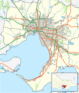
 Doncaster East
Population: 26,698 (2006)[1] Established: 1860s, (later 1970s) Postcode: 3109 Area: 11.4 km² (4.4 sq mi) Location: 29 km (18 mi) from Melbourne LGA: City of Manningham State District: Doncaster, Bulleen Federal Division: Menzies Suburbs around Doncaster East: Templestowe Templestowe Warrandyte Doncaster Doncaster East Donvale Box Hill North Blackburn North Nunawading Doncaster East is a suburb in Melbourne, Victoria, Australia, 19 km north-east from Melbourne's central business district. Its Local Government Area is the City of Manningham. At the 2006 Census, Doncaster East had a population of 26,698.
It is located in the hills between the Koonung Creek and the Mullum Mullum Creek.
Contents
History
See also: City of Doncaster & Templestowe#HistoryThe area was originally occupied by the Wurundjeri, Indigenous Australians of the Kulin nation, who spoke variations of the Woiwurrung language group. After European settlement, the area was used for agriculture, predominantly orchards. A small settlement was established in the 1860s known as Waldau, which was home to many German settlers who planted the large areas of pine trees that still exist today. German Lane was the original name for George Street, and Bismarck Street the original name for Victoria Street. The names were replaced during the First World War and the present names adopted.
The Post Office opened on 8 August 1887. A Tunstall Square office was open from 1965 until 1990.[2]
Like much of the City of Manningham, Doncaster East was predominantly covered in fruit orchards for some time before subdivision began and it became a contiguous part of Melbourne. Housing estates began to replace orchards in the 1960s, generally along Doncaster Road, in the southern half of the suburb. The north half of the suburb was developed through the 1970s and 1980s, with the last orchard being removed in the 1990s. As the young parents who moved into these estates now retire and move away, many houses from the 60s and 70s are being converted into units. Today land prices continue to rise and it is not uncommon to see medium density residential apartments/units under construction somewhere at any time of the year.
Today
Today, the suburb hosts an abundance of recreational parks and small sporting facilities. It borrows its current name from the neighbouring suburb of Doncaster, to which it lies east of. It is commonly referred to by locals as East Doncaster or East Donnie, however its official name is Doncaster East. The suburb is heavily vegetated with non-native species. There is little remnant native bushland left, with the exception of the area around the Mullum Mullum Creek in the north-east of the suburb, which includes Currawong Bush Park. Septic tank seepage from properties in the suburb is one of the major causes of pollution in both the Mullum Mullum and Koonung Creeks.
As a result of the suburb's continuous development from the 1960s onward, East Doncaster has a versatile array of architectural styles. Many fine examples of 1970s and 1980s architecture can be seen in the northern sections of the suburb, while further south towards Doncaster Road and between Doncaster Road and the Eastern Freeway, there is an abundance of Early Modern and L-Shape styles. Due to development of large tracts of land in the north of the suburb in the 1970s, there are many good examples of some of the first speculation built houses in Melbourne. Today, Doncaster East houses 24% of the total population of Manningham.
Geography
The area of land that is occupied by Doncaster East mostly consists of rolling hills, creek valleys and short ridges. Andersons Creek Road runs along an unnamed ridge that when atop, gives views of Mount Dandenong to the east and the further rolling hills of Templestowe to the west.
Three main watercourses flow through or border the suburb:
- Mullum Mullum Creek
- Koonung Creek
- Ruffey Creek
The native vegetation of Doncaster East has been almost totally cleared, notable exceptions being the north-east of the suburb around the Mullum Mullum Creek where small areas of native riparian bushland remain. Many small areas of Pine Trees were planted by early German settlers and can be found all over the suburb particularly around George & Victoria Streets and to the south-east, in many places they were used as wind breaks or property boundaries for agriculture and serve as a good indicator of historical property boundaries. Many European deciduous trees were planted in the 1970s and 1980s and have since matured on roadsides and on private properties, invasive species remain as one of the suburbs major environmental problems.
Political geography
The suburb boundaries roughly form the shape of an L flipped horizontally, bordered by Wetherby Road, Victoria Street and Blackburn Road to the west adjoining Doncaster and Templestowe, the Mullum Mullum Creek, Springvale Road and Tunstall Road in the east adjoining Warrandyte and Donvale, and the Koonung Creek to the south adjoining Blackburn North. The north-east section of the suburb sits on the western side of the Mullum Mullum Valley and is very occasionally referred to as being whole or part of West Warrandyte and rarer still; East Templestowe. There are many small anecdotal localities that have established individual community identities within the suburb, some of these include:
- Donburn - Around the Blackburn Road/George Street intersection
- Deep Creek - The northernmost area of the suburb near the Mullum Mullum Creek
- Milgate - Milgate Park and surrounds
- Tunstall - Around Tunstall Square and Tunstall Road
- Waldau - Historically, the area surrounding George and Victoria Streets
- The Pines - The area north of The Pines Shopping Centre
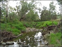 The Mullum Mullum Creek in Doncaster East
Community
Doncaster East has had a significant Chinese minority for many years and several restaurants of note are found in Doncaster East - one of the few areas outside Chinatown in Little Bourke Street to have exceptional Chinese cuisine.
The suburb contains a fitness centre, Anglican, Baptist, Catholic, Gospel, Islamic and Uniting places of worship, an athletics track, three Australian rules football/cricket ovals, soccer grounds, small to medium commercial services, a childcare centre, kindergarten, library, indoor sporting facilities, various playgrounds, retirement villages, medical centres, a small community hall, Donvale Rehabilitation Centre, many restaurants and strip shops, and The Pines Shopping Centre.
Educational services in Doncaster East:
- Onemda Day Training Centre
- Milgate Primary School
- Doncaster Gardens Primary School
- East Doncaster Secondary College
- Donburn Primary School
- St. Peter & St. Pauls School
- Beverley Hills Primary School
Shopping Strips and Centres in Doncaster East:
- Stockland The Pines
- Donburn Shops A.K.A. The Blackie Road shops
- Jacksons Court
- Devon Plaza
- Commercial Services either side of Doncaster Road near the intersection of Blackburn Road
- Tunstall Square
Transportation
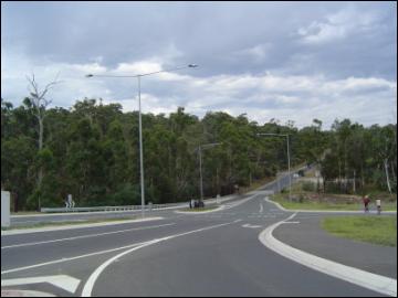
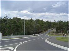 Reynolds Road heading towards the crossing of the Mullum Mullum Creek and over into Warrandyte, 2004.
Public transportation in the City of Manningham consists of regular bus services that cover most of the suburb. Plans for a railway line to Doncaster East were scrapped by Cain Labor Government, and as a result local residents rely heavily on the use of cars.
The suburb is serviced primarily by the Eastern Freeway to the south, and Reynolds Road in the north. Through traffic consists primarily of cars and buses traveling to neighbouring Warrandyte and Donvale through the use of Heidelberg - Warrandyte Road, Reynolds Road and Tindals Road (Old Warrandyte Road)
Within the suburban boundaries, Doncaster East is serviced by George Street, King Street and Victoria Street. Running north-south is Blackburn Road which holds most of the flow of traffic during weekday peak hour times, together with Springvale Road as residents travel from their homes to the Eastern Freeway and into the city.
Education
Beverley Hills Primary School, located on Cassowary Street, is a government primary school established in 1959.
Development
The EastLink tollway project, which extends the Eastern Freeway to Ringwood, Victoria and then south to join with the Monash and Mornington Peninsula Freeways, has recently been completed. This enables residents of Doncaster East increased ease of travel throughout Melbournes eastern and south-eastern suburbs.
Certain areas of land are currently awaiting development including the former Box Hill Institute TAFE East Doncaster campus, now a newly subdivided small housing estate, and a large area surrounding the Cherry Hill Tavern, which is proposed for a reception centre.
There are several vacant blocks of land in the suburb, many surrounding the Pines Shopping Centre. Various uses have been proposed and many applications for restaurants or fast food providers have been met with opposition from surrounding residents.
Sport and recreation
Many people are active members of certain clubs or facilities in Doncaster East. Popular activities include Scouts, Athletics, Football (AFL), Soccer, Lawn Bowls, Walking, Bike Riding and Dog Walking. The waters of the Mullum Mullum Creek are too shallow for swimming in the summer months, however, this does not stop exploration or walks on the paths around the creek.
The suburb has an Australian Rules football team, The Doncaster East Sharks, competing in the Eastern Football League.[3] The Manningham Cricket Club plays at Rieschiecks Reseve and competes in the Eastern Cricket Association MacGibbon Shield.
Parks and gardens
- Deep Creek Reserve (Baseball)
- Linear Park Reserve
- Prowes Reserve
- The Pines Reserve
- Mullum Mullum Creek Linear Park (Bicycle & Walking) - Mullum Mullum Creek Trail
- Mullum Mullum Wetlands
- Anderson Park (Soccer)
- Pinehill Reserve
- Landscape Drive Reserve
- Milgate Park Estate
- Cat Jump Park
- Zerbes Reserve (Football Oval, Scouts/Guides & Proposed Skate Park)
- Rieschiecks Reserve (Football Oval, Athletics, Scouts and Schramms Cottage)
- Doncaster Reserve (Football Oval)
- Bullen Street Reserve
- St. Clems Reserve
- Koonung Creek Park
- Boronia Grove Reserve (Scouts)
Notable people
- Alisa Camplin - aerial skier, Olympic gold medallist
- Michele Timms - basketballer, Olympic silver medallist
External resources
See also
References
- ^ Australian Bureau of Statistics (25 October 2007). "Doncaster East (State Suburb)". 2006 Census QuickStats. http://www.censusdata.abs.gov.au/ABSNavigation/prenav/LocationSearch?collection=Census&period=2006&areacode=SSC21233&producttype=QuickStats&breadcrumb=PL&action=401. Retrieved 2007-09-29.
- ^ Premier Postal History, Post Office List, https://www.premierpostal.com/cgi-bin/wsProd.sh/Viewpocdwrapper.p?SortBy=VIC&country=, retrieved 2008-04-11
- ^ Full Point Footy, Doncaster East, http://www.fullpointsfooty.net/doncaster_east.htm, retrieved 2008-10-21
- Melway Edition 33 2006 (Pages 34 & 48)
- Manningham Municipal Council Offices. See - City of Manningham
Coordinates: 37°47′17″S 145°09′25″E / 37.788°S 145.157°E
Suburbs of the City of Manningham | Melbourne | Victoria Bulleen · Doncaster · Doncaster East · Donvale · Park Orchards · Templestowe · Templestowe Lower · Warrandyte · Warrandyte South · Wonga Park
Categories:- Suburbs of Melbourne


Wikimedia Foundation. 2010.