- U.S. Route 301 in Maryland
-
This article is about the section of U.S. Route 301 in Maryland. For the entire length of the highway, see U.S. Route 301.
U.S. Route 301

Route information Maintained by MDSHA Length: 123.30 mi[1] (198.43 km) Existed: 1940 – present Major junctions South end:  US 301 at Governor Harry W. Nice Memorial Bridge
 MD 5 in Brandywine
 MD 4 in Upper Marlboro
 US 50 in Bowie
 I-97 in Annapolis
 MD 2 in Annapolis
 MD 18 near Queenstown
 MD 213 near Centreville
 MD 313 near Galena
North end: US 301 in WarwickHighway system United States Numbered Highways
List • Bannered • Divided • ReplacedMaryland highway system
Interstate • US • State • Minor • Former • Turnpikes←  MD 300
MD 301  →
→- "Blue Star Memorial Highway (Maryland)" redirects here. See also, U.S. Route 50 in Maryland#Blue Star Memorial Highway
U.S. Route 301 in Maryland is a major highway that runs from Delaware to the Governor Harry W. Nice Memorial Bridge into Virginia. It passes through three of Maryland's four main regions: the Eastern Shore, the Baltimore-Washington Metropolitan Area, and Southern Maryland. US 301 serves mainly as a bypass of Baltimore and Washington from Delaware to Virginia.
Contents
Route description
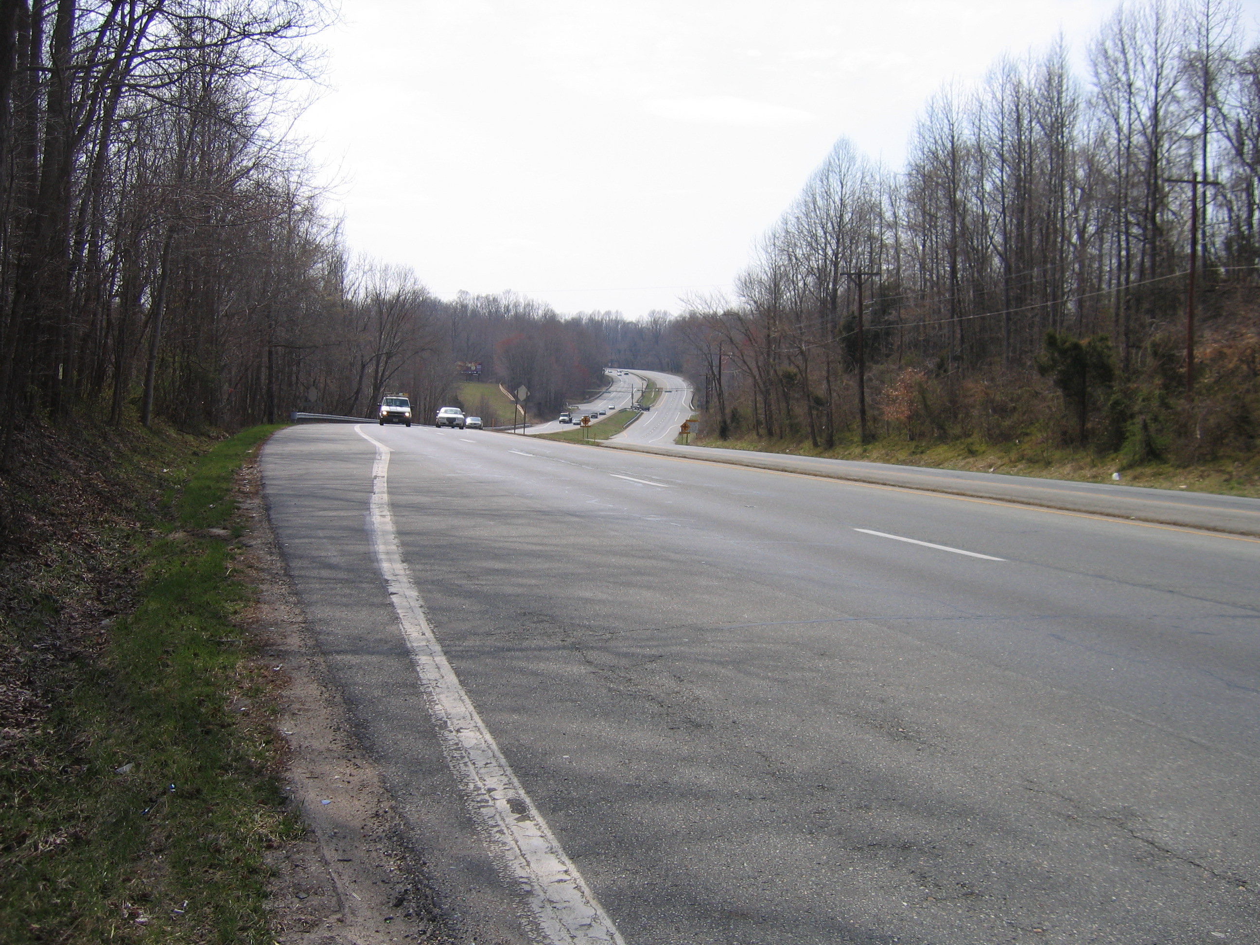
Robert Crain Highway
 The Robert Crain Highway in Prince George's County
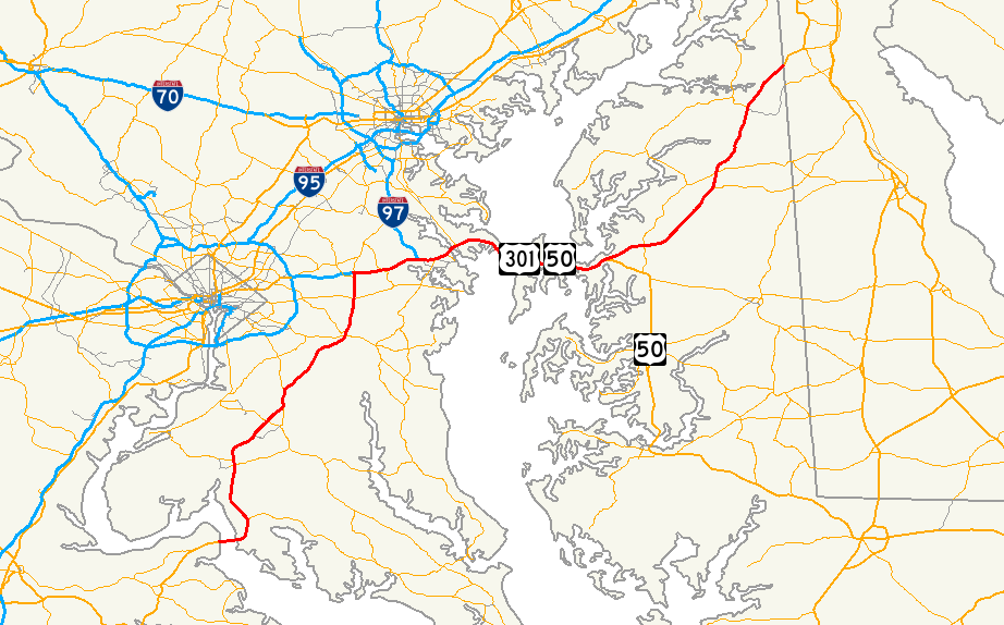
US 301 is a minimum of four lanes throughout the state of Maryland. It enters the state via the Governor Harry W. Nice Memorial Bridge and joins the original route of Maryland Route 3 near the town of Newburg in Charles County. Between the Potomac River and the city of Bowie, the route is known as the Robert Crain Highway. Running north, the highway serves the towns of La Plata, Waldorf (where it briefly overlaps MD 5), Brandywine, Upper Marlboro (where it interchanges with MD 4), and Bowie before joining US 50 in Bowie and meeting the southern terminus of MD 3, which continues along the Crain Highway to I-97 and MD 32.
John Hanson Highway

Now following US 50 (and secret I-595) east along the John Hanson Highway, the route serves Annapolis and crosses the Severn River via the Pearl Harbor Memorial Bridge before traversing Sandy Point State Park to the foot of the Chesapeake Bay Bridge. The route meets the southern terminus of Interstate 97, which connects to the highway near the western terminus of MD 665, a freeway spur into downtown Annapolis. US 301 connects to other local highways such as MD 450, MD 2 (which joins the route at this interchange), and MD 70. At MD 70, secret I-595 ends, and US 50, US 301 and MD 2 continue across the Severn River. Both highways form an effective freeway bypass of Annapolis, but both highways also experience enormous backups in the eastbound direction during the summer months due to heavy tourist traffic attempting to cross the Chesapeake Bay. Along the Annapolis section, the freeway takes on a blue star memorial highway designation.
Blue Star Memorial Highway
After crossing the Severn River, the blue star memorial highway designation becomes the road's name, Blue Star Memorial Highway. Upon crossing the Chesapeake Bay, US 301 enters Queen Anne's County at Kent Island. Continuing east, the highway leaves the island and enters the Delmarva Peninsula as it crosses the Kent Narrows via a high-level bridge (with MD 18 making use of the original drawbridge). US 301 and US 50 separate near Queenstown. At the split, US 50 continues as the Ocean Gateway to Ocean City. The segment between the Chesapeake Bay Bridge and the 50-301 split is noted for the many right-in/right-out interchanges with MD 18 and MD 835, a legacy of the days when the route was a four-lane at-grade expressway.
Downgrading from a six-lane freeway to a four-lane at-grade expressway, the route runs north, serving as one of the backbones of the Delmarva Peninsula. Still known as the Blue Star Memorial Highway, the route connects with several major highways in the northern segment of the Eastern Shore, including MD 213 and MD 313. It narrows abruptly to a two-lane country road as it enters the state of Delaware.
History


In 1940, the completion of the Harry W. Nice Memorial Bridge heralded the entry of US 301 into Maryland. A short connector between the northern end of the bridge and MD 3 resulted in the majority of the latter route being taken over by US 301, with only a small portion remaining signed as MD 3 (this portion is now MD 257).
Originally, the route went all the way along former MD 3 into Baltimore and ended near present-day Maryland Route 295 Russell Street. As US 301, it was upgraded into a four- and six-lane divided highway throughout in the 1940s and 1950s. In the 1960s, the route was rerouted along US 50 to the Eastern Shore where it was routed up former Maryland Route 71 into Delaware. Today, Route 301 is a multi-lane highway throughout its path through the state with the exception of the Governor Harry W. Nice Memorial Bridge; the nine miles (14 km) of MD 3 between US 50 and Interstate 97 is also a four- and six-lane divided highway and is part of the same continuous physical route.
The segment of the highway between the eastern end of the Chesapeake Bay Bridge and the US 50/US 301 split in Queenstown was originally built as a four-lane at-grade divided expressway. By the late 1980s, traffic levels were so high that the route was upgraded into a six-lane grade-separated limited-access expressway, with most of the intersections converted into right-in/right-out interchanges, and a few others being converted into more standard interchanges. The upgrade of the route was completed by the early 1990s.
Future developments
- As the route enters Delaware, it becomes a two-lane roadway. However, plans exist to replace U.S. Route 301 in Delaware with a tolled freeway that will link the divided US 301 in Maryland with Delaware Route 1, providing a multi-lane alternative to Interstate 95 between Northern Delaware and Washington, D.C.
- A group known as the Eastern Shoreway Alliance is seeking to have US 301 from Queenstown to the Delaware line redesignated as the Eastern Shoreway [1], similar to the Ocean Gateway designation of US 50 to the south.
Junction list
County Location Mile Exit Destinations Notes Governor Harry W. Nice Memorial Bridge over Potomac River Charles Newburg 3.8  MD 257 east (Rock Point Road) – Cobb Island
Former MD 3 5.7  MD 234 east (Budds Creek Road) – Chaptico
 To MD 6 (Chapel Point Road, Bel Alton Newtown Road) – Newtown, Chapel Point State Park
La Plata 14.8 MD 6 (Port Tobacco Road, Charles Street) – Port Tobacco, Charlotte Hall15.5  MD 225 west (Hawthorne Road) – Indian Head
White Plains 19.6  MD 227 west (Marshall Corner Road) – Pomfret
Waldorf 20.8  MD 925 north (Old Washington Road)
Former US 301 23.3 


 MD 5 Bus. east (Leonardtown Road) / MD 228 north (Berry Road) – Accokeek, Bryantown
26.3 MD 5 south (Mattawoman Beantown Road) – BryantownSouth end of MD 5 overlap Prince George's Brandywine 28.9 
 MD 5 north (Branch Avenue) to I-95 to I-495 - Andrews Air Force Base
North end of MD 5 overlap 29.2  MD 381 east (Brandywine Road) – Aquasco
Cheltenham Frank Tippett Road north - Cheltenham Veterans Cemetery 36.6  MD 382 south (Croom Road) – Croom
 To MD 202 (Old Crain Highway north) – Upper Marlboro
Former US 301 Upper Marlboro 40.4 MD 4 (Pennsylvania Avenue) to I-95 to I-495 – Dunkirk, Washington D.C.Interchange 46.2  MD 978 (Old Central Avenue) – Davidsonville, Largo
Former MD 214 46.3  MD 214 (Central Avenue) to I-95 to I-495 – Davidsonville, Washington D.C.
Interchange Bowie 49.4  MD 197 north (Collington Road) – Laurel
50.3  US 50 west (John Hanson Highway) to I-95 to I-495 / MD 3 north (Robert Crain Highway) – Crofton, Washington D.C.
South end of US 50/unsigned I-595 overlap
Mileposts switch to US 50 seriesSouth end of expressway section Anne Arundel 16.5 16  MD 424 (Davidsonville Road) – Davidsonville, Crofton
Annapolis 21.2 21  I-97 north / MD 665 east – Baltimore, Downtown Annapolis
23.0 22 
 MD 450 (Defense Highway) to MD 178 – Parole, Crownsville
23.5 23 MD 2 south (Solomons Island Road) – EdgewaterSouth end of MD 2 overlap 24.8 24A-B  MD 70 south (Rowe Boulevard-Bestgate Road) – Annapolis
Signed as exits 24A (MD 70 south) and 24B (Bestgate Road) westbound
Eastern terminus of unsigned I-595Pearl Harbor Memorial Bridge over Severn River Arnold 26.7 27 MD 2 north / MD 450 south (Governor Ritchie Highway) – Baltimore, Severna Park, Naval AcademySigned as exits 27A (MD 450 south) and 27B (MD 2 north) westbound;
North end of MD 2 overlap MD 648 north (Baltimore-Annapolis Boulevard)
direct turnoff from westbound carriageway 27.6 28 Bay Dale Drive - Bay Hills Golf Club 29.2 29 

 MD 179 / MD 908 / MD 931 (St. Margarets Road, Busch's Frontage Road, Cape St. Claire Road, East College Parkway)
Signed as exits 29A (MD 179) and 29B (Cape St. Claire Road) eastbound Sandy Point 30.6 31 MD 908 east (Whitehall Road)direct turnoff from eastbound carriageway 31.4 32 MD 908 north (Oceanic Drive) - Sandy Point State ParkChesapeake Bay Bridge over Chesapeake Bay Queen Anne's Stevensville 37.2 37  MD 8 (Romancoke Road) to MD 18 – Stevensville, Romancoke
37.9 38A  MD 835A north (Thompson Creek Road, Duke Street)
Thomspon Creek Rd: roundabout on ramp, eastbound exit and entrance;
Duke Street: westbound entrance and exit (right-in/right-out)38.9 38B Shopping Center Rd. - to Main St. westbound entrance and exit 39.0 39A MD 18 (Castle Marina Road, Cox Neck Road)Castle Marina Rd: westbound entrance and exit;
Cox Neck Rd: eastbound exit and entranceChester 39.5 39B  MD 552 (Dominion Road, Chester Station Lane) to MD 18
MD 552: eastbound exit and entrance;
Chester Station Ln: westbound entrance and exit40.1 40A Piney Creek Road right-in/right-out entrance/exit 40.5 40B Dundee Avenue eastbound exit and entrance Kent Narrows 40.8 41 MD 18 (Main Street, Piney Narrows Road) – Kent Narrows WestMD 18: eastbound exit and entrance;
Piney Narrows Rd: westbound entrance and exitKent Narrows Bridge over Kent Narrows 41.9 42  MD 18 (Main Street) / MD 835 west (Kent Narrows Road) – Kent Narrows East
MD 18: eastbound entrance and exit;
MD 835: westbound entrance and exitGrasonville 42.8 43A MD 18 (Main Street) / MD 835 (Long Point Road, Jackson Creek Road) – GrasonvilleMD 18: eastbound entrance and exit;
MD 835: westbound entrance and exit43.4 43B To MD 18 to MD 835 (Chester River Beach Road)westbound entrance; eastbound entrance and exit 43.8 44A To MD 18 (Station Lane, VFW Avenue)Station Ln: eastbound exit and entrance;
VFW Ave: westbound entrance and exit44.2 44B MD 835 (Winchester Creek Road, Evans Avenue) to MD 18MD 835: westbound entrance and exit;
Evans Ave: eastbound exit and entrance44.5 45A To MD 18 to MD 835 (Homeport Drive, Hess Road)Homeport Dr: westbound entrance and exit; Hess Rd: eastbound exit and entrance 44.9 45B To MD 18 to MD 835 (Nesbit Road)Queenstown 46.1 46 US 50 east (Ocean Gateway) – Wye Mills, Salisbury, Ocean Cityeastbound exit and westbound entrance;
North end of US 50 overlap
Mileposts return to US 301 seriesNorth end of expressway section Queen Anne's Queenstown 84.4 MD 18 (Main Street)84.9  MD 456 (Del Rhodes Avenue) to US 50
89.5 MD 213 (Centreville Road) – Centreville, Wye MillsInterchange 92.5  MD 304 (Ruthsburg Road) – Centreville, Ruthsburg
Carville 94.2  MD 305 (Hope Road) – Centreville
98.6  MD 405 (Station Road) – Church Hill, Ruthsburg
100.6  MD 19 (Roberts Station Road) to MD 213 to MD 313 – Roberts, Church Hill, Ingleside
102.1  MD 302 (Barclay Road, Hall Road) – Barclay
104.5 MD 300 (Sudlersville Road) to MD 213 to MD 313 – Church Hill, Sudlersville106.5  MD 290 (Dudley Corners Road) – Dudley Corners, Crumpton
Interchange
Former MD 301110.0  MD 544 (Mcginnes Road) to MD 313 – Mcginnes
Kent 112.0  MD 291 (River Road) – Millington
Interchange;
routes connected via MD 701115.8 MD 313 (Galena Road) – Galena, Massey119.2 MD 290 (Galena Sassafras Road) – Galena, SassafrasInterchange Cecil 122.0 
 MD 299 (Sassafras Road) to MD 282 – Sassafras, Warwick
Delaware state line Notes

The numbering of US 301 coincidentally fits into the Maryland State Highway System as it passes through the area on the Eastern Shore where a route numbered MD 301 would be found, in Kent County and northern Queen Anne's County. It also crosses Maryland Route 300, Maryland Route 302 and even the former Maryland Route 301.
Related routes
- Interstate 97
- U.S. Route 50 in Maryland
- Maryland Route 3
- Maryland Route 71
See also
- List of numbered highways in Maryland
- U.S. Route 301 in Delaware
- U.S. Route 301 in Virginia
References
- ^ MDRoads: US 301 URL accessed 17 June 2008
External links
U.S. Route 301Previous state:
VirginiaMaryland Next state:
DelawareRoads in Charles County, Maryland State highways 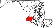
U.S. Highways 301Roads in Prince George's County, Maryland Maryland State Highways 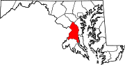
U.S. Routes Interstate Highways Roads by name Categories:- U.S. Highways in Maryland
- U.S. Route 301
- Roads in Cecil County, Maryland
- Roads in Kent County, Maryland
- Roads in Queen Anne's County, Maryland
- Roads in Anne Arundel County, Maryland
- Roads in Prince George's County, Maryland
- Roads in Charles County, Maryland


Wikimedia Foundation. 2010.