- NG postcode area
-
Nottingham postcode area 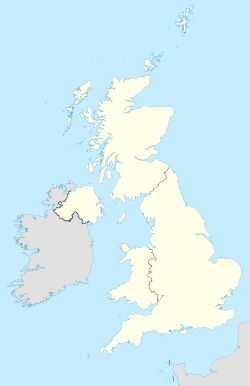
 NG
NGPostcode area NG Postcode area name Nottingham Post towns 7 Postcode districts 32 Postcode sectors 166 Postcodes (live) 28,390 Postcodes (total) 33,943 Statistics as at October 2006 [1] The NG postcode area, also known as the Nottingham postcode area,[2] is a group of postcode districts around Nottingham that covers Nottinghamshire (except for the Bassetlaw district and the far southwest of Rushcliffe borough), south east Derbyshire, south west Lincolnshire and part of north east Leicestershire.
Contents
Coverage
The approximate coverage of the postcode districts:
Postcode district Post town Coverage Local authority area NG1 NOTTINGHAM Nottingham City Centre Nottingham NG2 NOTTINGHAM Nottingham City Centre, Sneinton, The Meadows, West Bridgford Nottingham, Rushcliffe NG3 NOTTINGHAM Carlton, Sneinton, St Ann's, Mapperley Gedling, Nottingham NG4 NOTTINGHAM Carlton, Gedling Village, Netherfield Gedling NG5 NOTTINGHAM Sherwood, Arnold, Bestwood, Carrington, Top Valley, Rise Park Nottingham, Gedling NG6 NOTTINGHAM Bestwood Village, Bulwell, Old Basford Nottingham, Gedling NG7 NOTTINGHAM New Basford, Forest Fields, Hyson Green, Radford, Lenton Nottingham NG8 NOTTINGHAM Aspley, Wollaton, Whitemoor, Bilborough Nottingham NG9 NOTTINGHAM Beeston, Stapleford, Lenton Abbey, Chilwell, Trowell Broxtowe, Nottingham NG10 NOTTINGHAM Long Eaton, Sawley, Sandiacre Erewash NG11 NOTTINGHAM Clifton, Ruddington, Gotham, Kingston on Soar Nottingham, Rushcliffe NG12 NOTTINGHAM Cotgrave, Radcliffe on Trent, Keyworth Rushcliffe NG13 NOTTINGHAM Bingham, Whatton, Bottesford, Aslockton Rushcliffe, Melton NG14 NOTTINGHAM Calverton, Lowdham Gedling NG15 NOTTINGHAM Hucknall, Ravenshead, Newstead Ashfield, Gedling NG16 NOTTINGHAM Kimberley, Eastwood, Nuthall, Langley Mill, Pinxton, Selston, Awsworth, Ironville, Jacksdale, Underwood, Brinsley, Watnall Broxtowe, Amber Valley NG17 NOTTINGHAM, SUTTON-IN-ASHFIELD Sutton-in-Ashfield, Kirkby-in-Ashfield, Stanton Hill, Skegby Ashfield NG18 MANSFIELD Mansfield Mansfield NG19 MANSFIELD Mansfield Woodhouse Mansfield NG20 MANSFIELD Shirebrook, Market Warsop Bolsover NG21 MANSFIELD Rainworth, Edwinstowe, Clipstone Newark and Sherwood NG22 NEWARK Newark-on-Trent Newark and Sherwood NG23 NEWARK Newark-on-Trent Newark and Sherwood NG24 NEWARK Newark-on-Trent Newark and Sherwood NG25 SOUTHWELL Southwell Newark and Sherwood NG31 GRANTHAM Grantham South Kesteven NG32 GRANTHAM Grantham, Croxton Kerrial, Sedgebrook South Kesteven, Melton NG33 GRANTHAM Grantham, Castle Bytham, Corby Glen South Kesteven NG34 SLEAFORD Sleaford North Kesteven NG70 MANSFIELD Special Business Reply Service Mansfield NG80 NOTTINGHAM Experian Nottingham NG90 NOTTINGHAM Boots the Chemists Broxtowe, Nottingham Adjacent areas
Adjacent postcode areas S DN LN 
DE  NG
NG 
PE 
LE Clockwise from the east, the adjacent postcode areas are: PE (Peterborough), LE (Leicester), DE (Derby), S (Sheffield), DN (Doncaster), LN (Lincoln).
See also
References
- ^ "National Statistics Postcode Directory" (PDF). Office for National Statistics Postcode Directory (November 2006). Office for National Statistics. November 2006. http://www.statistics.gov.uk/geography/downloads/NSPDVersionNotes.pdf. Retrieved 2009-05-29.
- ^ Royal Mail, Address Management Guide, (2004)
Postcode areas in the United Kingdom, Channel Islands and Isle of Man AB AL B BA BB BD BH BL BN BR BS BT BX CA CB CF CH CM CO CR CT CV CW DA DD DE DG DH DL DN DT DY E EC EH EN EX FK FY G GIR GL GU GY HA HD HG HP HR HS HU HX IG IM IP IV JE KA KT KW KY L LA LD LE LL LN LS LU M ME MK ML N NE NG NN NP NR NW OL OX PA PE PH PL PO PR RG RH RM S SA SE SG SK SL SM SN SO SP SR SS ST SW SY TA TD TF TN TQ TR TS TW UB W WA WC WD WF WN WR WS WV YO ZE
Categories:- Nottingham
- Postcode areas covering the East Midlands

Wikimedia Foundation. 2010.