- Menindee, New South Wales
-
Menindee
New South Wales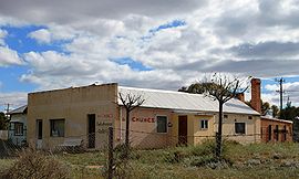
Ah Chung's Bakehouse Gallery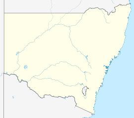
 Menindee
Population: 633(2006)[1] Postcode: 2879 Coordinates: 32°24′S 142°26′E / 32.4°S 142.433°ECoordinates: 32°24′S 142°26′E / 32.4°S 142.433°E Elevation: 61.0 m (200 ft) Location: - 1006 km (625 mi) from Sydney
- 622 km (386 mi) from Adelaide
- 112 km (70 mi) from Broken Hill
- 245 km (152 mi) from Wentworth
LGA: Central Darling Shire State District: Murray-Darling Federal Division: Farrer Mean max temp Mean min temp Annual rainfall 25.7 °C
78 °F11.0 °C
52 °F242.3 mm
9.5 inMenindee is a small town in the far west of New South Wales, Australia, in Central Darling Shire, on the banks of the Darling River, with a sign-posted population of 980.
Contents
History
It is the oldest European settlement in western New South Wales, and the first town to be established on the Darling River. The first European to visit the area was the surveyor and explorer Major Thomas Mitchell in 1835. He was followed by Charles Sturt in 1844 and the town was the advance base for the Burke and Wills expedition in 1860.
Burke and Wills
Main article: Burke and Wills expeditionThe Burke and Wills expedition camped at Menindee on their journey to cross Australia from Melbourne to the Gulf of Carpentaria. They arrived here on 14 October 1860, crossed the Darling River at Kinchega Station and made Camp XXXIV (their thirty-fourth camp since leaving Melbourne). There was dissent within the party and the deputy-leader George Landells resigned. Robert O'Hara Burke split the party, heading north to Cooper Creek with half the men, stores and animals. The remaining men, stores and animals made a depot camp at Pamamaroo Creek and a sign and cairn mark the site of the camp. This camp was used for the remainder of 1860 and for most of 1861. While in Menindee, Burke stayed at the Maiden's Hotel, which was then owned by Thomas Pain and was known as Pain's Hotel.
Geography
Menindee is located where the transcontinental railway line crosses the Darling River. The town is serviced by the CountryLink 'Outback Xplorer' passenger train from Sydney to Broken Hill on Monday, returning from Broken Hill to Sydney on Tuesday. The GSR Indian Pacific also stops twice-weekly in each direction on request. The railway line is about 900 km west of Sydney and about 110 kilometres south-east of Broken Hill.
A weir on the Darling River near Menindee diverts water from the river into a series of shallow, otherwise dry, overflow lakes. The Menindee Lakes, also known as the Menindee Water Storage Scheme, regulate the river flow for irrigation downstream into South Australia. Situated on the western edge of town is the Kinchega National Park.
References
- ^ Australian Bureau of Statistics (25 October 2007). "Menindee (State Suburb)". 2006 Census QuickStats. http://www.censusdata.abs.gov.au/ABSNavigation/prenav/LocationSearch?collection=Census&period=2006&areacode=SSC18029&producttype=QuickStats&breadcrumb=PL&action=401. Retrieved 2007-10-01.
External links
- Burke & Wills Web A comprehensive website containing many of the historical documents relating to the Burke & Wills Expedition.
- The Burke & Wills Historical Society The Burke & Wills Historical Society.
- Menindee Guide Guide to Menindee and its attractions.
Preceding station CountryLink Following station Broken HillTerminusCountryLink Western Broken Hill Outback XplorerDarnicktowards SydneyPreceding station Great Southern Railway Following station Broken Hilltowards East PerthIndian Pacific towards SydneyTowns in the Central Darling Shire Local Government Area Ivanhoe · Menindee · Tilpa · White Cliffs · Wilcannia
Categories:- Towns in New South Wales
- Australian Aboriginal placenames
- Populated places on the Darling River


Wikimedia Foundation. 2010.