- Montezuma National Wildlife Refuge
-
Montezuma National Wildlife Refuge IUCN Category IV (Habitat/Species Management Area) US state of New York
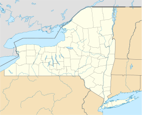
 Montezuma NWR
Location Seneca County, New York Nearest city Seneca Falls, New York Coordinates 42°58′N 76°44′W / 42.97°N 76.74°WCoordinates: 42°58′N 76°44′W / 42.97°N 76.74°W Area 7,000 acres (2,800 ha) Established 1937 Governing body U.S. Fish and Wildlife Service Montezuma National Wildlife Refuge is a wildlife preserve operated by the United States Fish and Wildlife Service, encompassing part of the Montezuma Swamp at the north end of Cayuga Lake. The refuge lies between the cities of Rochester and Syracuse, New York (5 miles (8 km) east of Seneca Falls, and 10 miles (16 km) west of Auburn), including parts of Seneca, Cayuga, and Wayne Counties. Most of the refuge lies in the Town of Tyre, in the northeast corner of Seneca County.
The Montezuma Marshes were designated a National Natural Landmark in May 1973; the citation notes that "A small, 100-acre area within the site is one of the best examples of undisturbed swamp woodlands in New York or New England."[1]
The New York Northern Montezuma Wildlife Management Area borders the national wildlife refuge and protects additional parts of the Montezuma Swamp.
A significant spot along the Atlantic Flyway, the Refuge provides crucial habitat for migratory waterfowl and other birds.[2]
Contents
History
The Finger Lakes Region was formed by the melting glaciers of the last glacial period, over ten thousand years ago. The northern and southern ends of the lakes gradually developed into extensive marshes. First the Algonquin Indians and later the Cayugas of the Iroquois Nation were the earliest known inhabitants to reap the rewards of the bountiful life in the marsh. The name "Montezuma" was first used in 1806 when Dr. Peter Clark named his hilltop home "Montezuma" after the palace of the Aztec Emperor Montezuma[disambiguation needed
 ] in Mexico City. Eventually the Marsh, the Village, and the Refuge all acquired the name.[3]
 Parker Pond, Montezuma Marsh, September 1910
There were no dramatic changes in the marsh until the development of the Erie Canal in the 19th century, when it became apparent that feeder canals from Seneca Lake and Cayuga Lake would in time link these lakes with the main line. With canal construction, there arose the possibility of draining the marshes, and an act was passed relative to the draining of the Cayuga Marshes. Work first began on the canal system on July 4, 1817, and the completion was marked by the first passage from Lake Erie to New York City on October 26, 1825. Construction of the Seneca-Cayuga canal began in 1818 and by 1828 boats passed from Geneva to the Erie Canal at Montezuma. The Erie Canal did not greatly affect the marshes as the Seneca River still flowed directly from Cayuga Lake into the marshes.[3]
In 1910, the widening and reconstruction of the Seneca and Cayuga extension of the New York State Barge Canal altered the marshes. A lock was built at the north end of Cayuga Lake and a dam was constructed at the outlet of the lake. This effectively lowered the level of the river by eight to ten feet (about 3 m) and the waters drained from the marshes. The meandering rivers were straightened and deepened, thereby creating additional drainage-ways.[3]
In 1937 the Bureau of Biological Survey, which later became the US Fish and Wildlife Service, purchased 6,432 acres (26.03 km2) of the former marsh. The Civilian Conservation Corps began work on a series of low dikes which would hold water and restore part of the marsh habitat that had once existed.[3]
The refuge was opened in 1938 as the Montezuma Migratory Bird Refuge. President Franklin D. Roosevelt signed Executive Order 7971 which established the Bird Refuge on September 12, 1938.[4] The refuge provides a stopping point for waterfowl and other migratory birds. The refuge restored marsh land lost to drainage from the construction of the Cayuga and Seneca Canal that linked the Finger Lakes to the Erie Canal.
In May, 1973, the refuge was designated as the Montezuma Marshes National Natural Landmark by the Secretary of the Department of the Interior.
The refuge today
The 7,000 acre (28 km2) preserve is composed of swamps, pools and channels and is a stopping point for migratory birds. Planners hope to increase the size of the preserve through donations and purchases of surrounding properties.
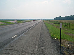 The Thruway passing through the refuge
The New York State Thruway passes through the north end of the preserve. While passing motorists can glimpse the preserve as they speed along the Thruway, they may obtain a better view from the 3.5 mile (6 km) road that begins at the visitors center south of the Thruway.
The refuge also has an area where Bald Eagles have been nesting in recent years.[2]
Enjoying the refuge
In addition to providing wildlife habitat, the refuge also provides opportunities for people to observe wildlife. The refuge is open during daylight hours seven days a week. There are no bicycling facilities at Montezuma.
The 3.5 mile (6 km) Wildlife Drive is a one-way auto tour that provides many opportunities to observe and photograph wildlife. The main feature of the drive is the 1600 acre (6.5 km2) wetland which hosts a rich diversity of waterfowl, waterbirds and other wildlife.[5] The drive is open most of the year with the exception of winter, when the road may not be passable.
Hikers and walkers can enjoy the 2 mile (3 km) Esker Brook Trail and the 3/4 mile (1 km) Oxbow Trail.
The Visitor Center and gift shop are open from April 1 to December 1 and have educational brochures, exhibits and specimens about the refuge and its wildlife.[6]
See also
References
- ^ "Montezuma Marshes" entry in registry of National Natural Landmarks. National Park Service website. Retrieved July 27, 2007.
- ^ a b "Wildlife". Montezuma National wildlife Refuge. USFWS. http://www.fws.gov/r5mnwr/wildlife.html. Retrieved 2009-09-18.
- ^ a b c d Gable, Walter (2004). "The Montezuma National Wildlife Refuge". Seneca County, N.Y.. http://www.co.seneca.ny.us/history/Montezuma%20National%20Wildlife%20Refuge.doc.. Retrieved 2009-09-18.
- ^ "Franklin D. Roosevelt - 1938". The Federal Register. The National Archives. http://www.archives.gov/federal-register/executive-orders/1938.html. Retrieved 2009-09-18.
- ^ "Wildlife Tour". Montezuma National Wildlife Refuge. USFWS. http://www.fws.gov/r5mnwr/wd.html. Retrieved 2009-09-18.
- ^ "Visitor Center". Montezuma National Wildlife Refuge. USFWS. http://www.fws.gov/r5mnwr/vc.html. Retrieved 2009-09-18.
External links
- Montezuma National Wildlife Refuge webpage
- New York State's Northern Montezuma Wildlife Management Area webpage
- Friends of the Montezuma Wetlands Complex
Protected Areas of New York Federal Eleanor Roosevelt • Home of Franklin D. Roosevelt • Kate Mullany House • Martin Van Buren • Saint Paul's Church • Sagamore Hill • Saratoga National Historical Park • Theodore Roosevelt Birthplace • Theodore Roosevelt Inaugural • Thomas Cole House • Vanderbilt Mansion • Women's Rights National Historical Park
African Burial Ground • Castle Clinton • Federal Hall National Memorial • Fort Stanwix • General Grant National Memorial • Governors Island • Hamilton Grange National Memorial • Statue of Liberty
Appalachian Trail • North Country National Scenic Trail
Amagansett • Conscience Point • Elizabeth A. Morton • Iroquois • Montezuma • Oyster Bay • Sayville • Seatuck • Shawangunk Grasslands • Target Rock • Wallkill River • Wertheim
State Allen H. Treman • Allegany • Amherst • Battle Island • Bayard Cutting Arboretum • Bayswater Point • Bear Mountain • Beaver Island • Beechwood • Belmont Lake • Bethpage • Betty & Wilbur Davis • Big Six Mile Creek • Blauvelt • Bonavista • Bowman Lake • Braddock Bay • Brentwood • Bristol Beach • Brookhaven • Buckhorn Island • Buffalo Harbor • Burnham Point • Buttermilk Falls • Caleb Smith • Camp Hero • Canandaigua Lake • Canoe-Picnic Point • Captree • Catharine Valley Trail • Caumsett • Cayuga Lake • Cedar Island • Cedar Point • Chenango Valley • Cherry Plain • Chimney Bluffs • Chittenango Falls • Clarence Fahnestock • Clark Reservation • Clay Pit Ponds • Cold Spring Harbor • Coles Creek • Conesus Lake • Connetquot River • Crab Island • Croil Island • Cumberland Bay • Darien Lakes • De Veaux Woods • Dean's Cove • Delta Lake • Devil's Hole • Dewolf Point • Donald J. Trump • Earl W. Brydges • Eel Weir • Emma Treadwell Thacher • Empire – Fulton Ferry • Evangola • Fahnestock • Fair Haven Beach • Fillmore Glen • Fort Niagara • Four Mile Creek • Franklin D. Roosevelt • Frenchman Island • Galop Island • Gantry Plaza • Gilbert Lake • Gilgo • Glimmerglass • Golden Hill • Goosepond Mountain • Grafton Lakes • Grass Point • Green Lakes • Hamlin Beach • Harriet Hollister Spencer • Harriman • Haverstraw Beach • Heckscher • Hempstead Lake • High Tor • Highland Lakes • Higley Flow • Hither Hills • Honeoye • Hook Mountain • Hudson Highlands • Hudson River Islands • Hudson River • Hunt's Pond • Iona Island • Irondequoit Bay • Jacques Cartier • James Baird • Jamesport • John Boyd Thacher • Jones Beach • Joseph Davis • Keewaydin • Keuka Lake • Knox Farm • Kring Point • Lake Erie • Lake Superior • Lake Taghkanic • Lakeside Beach • Letchworth • Lock 32 • Lodi Point • Long Island • Long Point - Finger Lakes • Long Point - Thousand Islands • Long Point on Lake Chautauqua • Macomb Reservation • Margaret Lewis Norrie • Mark Twain • Mary Island • Max V. Shaul • Mexico Point • Midway • Mine Kill • Minnewaska • Montauk Downs • Montauk Point • Moreau Lake • Napeague • Newtown Battlefield • Niagara Falls • Nissequogue River • Nyack Beach • Oak Orchard • Ogden Mills & Ruth Livingston Mills • Old Croton Aqueduct • Old Erie Canal • Oquaga Creek • Orient Beach • Peebles Island • Pinnacle • Pixley Falls • Point Au Roche • Reservoir • Riverbank • Robert G. Wehle • Robert H. Treman • Robert Moses - Long Island • Robert Moses - Thousand Islands • Robert V. Riddell • Roberto Clemente • Rockefeller • Rockland Lake • Sampson • Sandy Island Beach • Saratoga Lake • Saratoga Spa • Schodack Island • Schunemunk Mountain • Selkirk Shores • Seneca Lake • Shadmoor • Shaver Pond Nature Center • Silver Lake • Sonnenberg Gardens & Mansion • Southwick Beach • St. Lawrence • State Park at the Fair • Sterling Forest • Steuben Memorial • Stony Brook • Storm King • Sunken Meadow • Taconic Outdoor Education Center • Taconic - Copake Falls Area • Taconic - Rudd Pond Area • Tallman Mountain • Taughannock Falls • Theodore Roosevelt Nature Center • Thompson's Lake • Tioga • Trail View • Valley Stream • Verona Beach • Waterson Point • Watkins Glen • Wellesley Island • Westcott Beach • Whetstone Gulf • Whirlpool • Wildwood • Wilson-Tuscarora • Wonder Lake • Woodlawn Beach
Bennington Battlefield • Caumsett • Clermont • Clinton House • Crailo • Crown Point • Darwin Martin House • Fort Montgomery • Fort Ontario • Ganondagan • Grant Cottage • Herkimer Home • Hyde Hall • John Brown Farm and Gravesite • John Burroughs Memorial (Woodchuck Lodge) • John Hay Homestead • Johnson Hall • Knox's Headquarters • Lorenzo • New Windsor Cantonment • Olana • Old Croton Aqueduct • Old Erie Canal • Old Fort Niagara • Oriskany Battlefield • Philipse Manor Hall • Plantings Fields Arboretum -- Coe Hall Historic House Museum • Sackets Harbor Battlefield • Schoharie Crossing • Schuyler Mansion • Senate House • Sonnenberg Gardens & Mansion • Staatsburgh • Steuben Memorial • Stony Point Battlefield • Walt Whitman Birthplace • Washington's Headquarters
Allen Lake • Altmar • Ambler • Armlin Hill • Arnold Lake • Artic China • Ashland Pinnacle • Baker School House • Bald Mountain • Balsam • Balsam Swamp • Barbour Brook • Basswood • Basswood Pond • Bates • Battenkill • Battle Hill • Beals Pond • Bear Creek • Bear Swamp • Bearpen Mountain • Beartown • Beaver Creek • Beaver Dams • Beaver Flow • Beaver Meadow • Beebe Hill • Berlin • Big Brook • Big Buck • Birdseye Hollow • Black Creek • Blenheim • Bobell • Bombay • Bonaparte's Cave • Boutwell Hill • Boyce Hill • Brasher Falls • Brokenstraw • Brookfield Railroad • Broome • Bryant Hill • Buck Hill • Bucks Brook • Buckton • Bucktooth • Bully Hill • Bumps Creek • Burnt-Rossman Hills • Burnt Hill • Bush Hill • Cadyville • Cairo Lockwood • Calhoun Creek • California Hill • California Road • Cameron Mills • Cameron • Canacadea • Canada Creek • Canaseraga • Cascade Valley • Cat Hollow • Cattaraugus • Catherineville • Catlin • Chalres E. Baker • Charleston • Chateaugay • Chautauqua Gorge • Chenango • Cherry Valley • Chestnut Woods • Cinnamon Lake • Clapper Hollow • Clark Hill • Cliffside • Clinton • Cobb Brook • Cobb Creek State Forest • Cold Creek • Cold Spring Brook • Cole Hill • Columbia Lake • Coon Hollow • Cotton Hill • Cotrell • Coventry • Coyle Hill • Coyote Flats • Crab Hollow • Crary Mills • Cuyler Hill • Daketown • Danby • Dannemora • Decatur • Deer River • Degrasse • Delaware • Depot Hill • Deruyter • Dobbins • Dog Hollow • Donahue Woods • Downerville • Dry Run • Dunkin's Reserve • Dutch Settlement • Dutton Ridge • Earlville • East Branch Fish Creek • East Osceola • East Otto • Edwin Hollow • Edwin Mountain • Eldridge Swamp • Elkdale • English Hill • Exeter • Fall Brook • Fairfield • Farmersville • Featherstonhaugh • Fire Fall • Fish Creek • Five Streams • Flat Rock • Florence Hill • Fort Jackson • Frank E. Jadwin • Franklin • Franklin 10 • Frozen Ocean • Furnace Creek • Gas Springs • Gates Hill • Gee Brook • Genegantslet • Gillies Hill • Glenmeal • Golden Hill • Goose Egg • Gorton Lake • Gould Corners • Groundry Hill • Grafton Lakes • Granger • Grant Powell • Grantville • Greenwood • Greenwood Creek • Griggs Gulf • Hall Island • Hammond Hill • Harris Hill • Harry E Dobbins • Hartwick • Harvey Mountain • Hatch Creek • Hawkins Pond • Hemlock Ridge • Hewitt • Hickok Brook • Hickory Lake • High Flats • High Knob • High Towers • High Woods • Hill Higher • Hiltonville • Hinckley • Hogsback • Honey Hill • Hooker Mountain • Hoxie Gorge • Huckleberry Ridge • Huntersfield • Hunts Pond • Independence River • Indian Pipe • Italy Hill • Jackson Hill • Jenksville • Jersey Hill • Karr Valley Creek • Kasoag • Keeney Swamp • Kennedy • Kerryville • Ketchumville • Kettlebail • Keyserkill • Klipnocky • Klondike • Knapp Station • Lafayetteville • Lake Desolation • Lassellsville • Lebanon • Leonard Hill • Lesser Wilderness • Lincklaen • Lincoln Mountain • Line Brook • Lonesome Bay • Long Pond • Lookout • Lost Nation • Lost Valley • Ludlow Creek • Lutheranville • Lyon Brook • Macomb Reservation • Mad River • Mallet Pond • Maple Hill • Maple Valley • Marisposa • Marsh Pond • McCarthy Hill • McDonough • Meads Creek • Melondy Hill • Michigan Hill • Middle Grove • Milford • Mohawk Springs • Montrose Point • Moon Pond • Morgan Hill • Morrow Mountain • Moss Hill • Mount Hunger • Mount Pisgah • Mount Pleasant • Mount Tom • Mount Washington • Muller Hill • Murphy Hill • Nanticoke Lake • Nelson Swamp • Newfield • New Michigan • Nimham Mountain • Nine Mile Creek • North Harmony • O'Hara • Oak Ridge • Oakley Corners • Ohisa • Onjebonge • Orebud Creek • Orton Hollow • Ossian • Otselic • Otsquago • Otter Creek • Palmer's Pond • Peck Hill • Painter Hill • Panama • Papish Pond • Partridge Run • Patria • Pease Hill • Penn Mountain • Perkins Pond • Petersburg • Phillips Creek • Pigeon Hill • Pigtail Hollow • Pinckney • Pine Hill • Pine Ridge • Pitcher Springs • Pittstown • Plainfield • Plattekill • Pleasant Lake • Plum Bottom • Point Rock • Popple Pond • Potato Hill • Pulpit Rock • R. Milton Hick • Raecher • Rakph Road • Raymondville • Red Brook • Relay • Rensselaer Number 3 • Rensselaerville • Robinson Hollow • Rock City • Rock Creek • Rockwood • Roeliff Jansen Kill • Roosa Gap • Roseboom • Rural Grove • Rush Creek • Saint Lawrence • Saint Regis • Salmon River • Sand Bay • Sand Flats • Sandy Creek • Scott Patent • Sears Pond • Shawangunk • Shindagin Creek • Shindagin Hollow • Silver Hill • Skinner Hill • Skyline Drive • Slader Creek • Snow Bowl • Sodom • Sonyea • Spring Brook • South Bradford • South Hammond • South Hill • South Mountain • South Valley • Southville • Stammer Creek • Steam Mill • Steuben Hill • Stewart • Stissing Mountain • Stockton • Stone Barn • Stone Hill • Stone Store • Stoney Pond • Sugar Hill • Summer Hill • Susquehanna • Swancott Mill • Swift Hill • Taconic Hereford • Taconic Ridge • Tassell Hill • Taylor Creek • Taylor Valley • Terry Mountain • Texas Hill • Texas Hollow • Texas School House • Three Springs • Tibbetts • Titusville Mountain • Tomannex • Toothaker Creek • Tracy Creek • Tri-County • Triangle • Trout Brook • Trout Lake • Trout River • Tug Hill • Tuller Hill • Turkey Hill • Turkey Point • Turkey Ridge • Turnpike • Urbana • Ushers Road • Vandermark • Vernooykill • Wagner Farm • Wassaic • Webster Hill • Wellman • West Branch • West Hill • West Mountain • West Oscela • West Parishville • Whalen • Whaupaunaucau • Whippoorwill Corners • Whiskey Flats • White Pond • Whittacker • Wiley Brook • Windfall Creek • Winona • Wolf Brook • Wolf Lake • Woodhull • Wurtsboro Ridge • Yatesville Falls • Yellow Barn • Yellow Lake
Wild ForestsAldrich • Balsam • Black River • Blackhead • Blue Mountain • Bluestone • Cherry Ridge • Colgate Lake • Cranberry Lake • Crystal Lake • Debar Mountain • Dry Brook • Ferris Lake • Fulton Chain • Grass River • Halcott Mountain • Hammond Pond • Horseshoe • Hunter Mountain • Independence River • Jessup River • Kaaterskill • Lake George • Middle Mountain • Moose River Plains • Overlook Mountain • Phoenica • Raquette Boreal • Saranac Lakes • Sargent Ponds • Shaler Mountain • Shandaken • Sundown • Taylor Pond • Vanderwhacker Mountain • Watson East Triangle • White Hill • Wilcox Lake • Willowemoc • Windham High Peak
Other Nature ConservancyEugene and Agnes Meyer Nature Preserve • Santanoni Preserve • Arthur W. Butler Memorial Sanctuary • Indian Brook Assemblage • Marrion Yarrow Preserve • Mildred E. Grierson Memorial Wildlife Sanctuary • Mount Holly Preserve • Long Pond Preserve • Mianus River Gorge Nature Preserve • Henry Morgenthau Preserve • Mount Holly Sanctuary • Otter Creek Preserve • Uplands Farm Nature Sanctuary • Atlantic Double Dunes • Pine Neck Nature Sanctuary • Long Island Center for Conservation • Ruth Wales Sanctuary • Calverton Ponds • Accabonac Harbor • Peconic Estuary Big Woods Preserve • Mashomack Nature Preserve • Montauk Mountain Preserve • Shadmoor Preserve • Andy Warhol Visual Arts Preserve • Coon Mountain Preserve • Gadway Sandstone Pavement Barrens • Silver Lake Bog Preserve • Spring Pond Bog Preserve • Everton Falls Preserve • Clintonville Pine Barrens • O.D. von Engeln Preserve at Malloryville • El Dorado Beach Preserve • Chaumont Barrens Preserve • Freund Wildlife Sanctuary • Lewis A. Swyer Preserve • Hannacroix Ravine Preserve • Kenrose Preserve • Limestone Rise Preserve • Whitbeck Memorial Grove • Stewart Preserve • Lordsland Conservancy • Nellie Hill Preserve • Pawling Nature Reserve • Roger Perry Memorial Preserve • Thompson Pond and Stissing Mountain Preserve • Schunemunk Mountain Preserve • Sam's Point Preserve • Christman Sanctuary • Lisha Kill Natural Area • Moccasin Kill Sanctuary • Denton Sanctuary • Lower Poultney River and Saddles Preserves • West Branch Preserve
New York State Office of Parks, Recreation and Historic Preservation • New York State Department of Environmental Conservation Categories:- IUCN Category IV
- National Wildlife Refuges in New York
- National Natural Landmarks in New York
- U.S. Route 20
- Protected areas of Seneca County, New York
- Protected areas of Wayne County, New York
- Protected areas of Cayuga County, New York


Wikimedia Foundation. 2010.