- Plat
thumb|A_contemporary_plat_map_showing_the_location_of_a_lot for sale.map , drawn to scale, showing the divisions of a piece of land. U.S.General Land Office surveyors drew township plats to show the distance and bearing between survey corners, and sometimes included topographic or vegetation information. City, town or village plats show subdivisions into blocks withstreet s andalley s. Further refinement often splits blocks into individual lots, usually for the purpose of selling the described lots; this has become known as subdivision. After the filing of a plat, legal descriptions can refer to block and lot-numbers rather than portions of sections.In order for plats to become legally valid, a local governing body, such as a
public works department,urban planning commission, orzoning board must normally review and approve them.Types of plats
A Plat of Consolidation originates when a
landowner takes over several adjacentparcel s of land and consolidates them into a single parcel. In order to do this, the landowner will usually need to make a survey of the parcels and submit the survey to the governing body that would have to approve the consolidation.A Plat of Subdivision appears when a landowner or municipality divides land into smaller parcels. If a landowner owns an
acre of land, for instance, and wants to divide it into three pieces, a surveyor would have to take precise measurements of the land and submit the survey to the governing body, which would then have to approve it.A Correction Plat or Amending Plat records minor corrections to an existing plat, such as correcting a
surveying mistake or a scrivener's error. Such plats can sometimes serve to relocate lot-lines or other features, but laws usually tightly restrict such use.A Vacating Plat functions to legally void a prior plat or portion of a plat. The rules normally allow such plats only when all the platted lots remain unsold and no construction of buildings or public improvements has taken place.
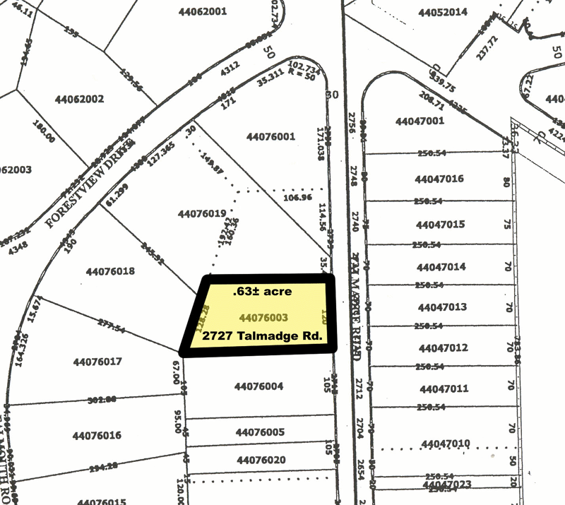
Other names associated with Parcel Maps are: Land Maps, Tax Maps, Real Estate Maps, Landowner Maps, Lot and Block Survey System and Land Survey Maps. Parcel maps, unlike any other public real estate record, have no federal, state or municipal oversight with their development.
Reasons for platting
* Designation of
road s or other rights of way.* Ensuring that all property has access to a public right of way. Without such access, a property owner may be unable to utilize his or her property without having to
trespass to reach it. The platting process restricts thefraud ulent practice of knowingly selling lots with no access to public right of way.* Creation or vacation of
easements .* Dedication of land for other public uses, such as
parks or areas needed forflood protection.* Ensuring compliance with
zoning . Zoning regulations frequently contain restrictions that govern lot sizes and lot geometry. The platting process allows the governing authorities to ensure that all lots comply with these regulations.* Ensuring compliance with a land use plan established to control the development of a
city .* Ensuring that all property has access to
public utilities .Reading a Plat
Plats contain a number of informational elements:
* The property boundaries are indicated by bearing and distance. The bearing is in the format of degrees, minutes, seconds with compass point letters before and afterward to indicate the compass quadrant. For example N 38 00 00 E is 38 degrees into the northeast quadrant or 38 degrees east ofnorth . Similarly S 22 00 00 W is 22 degrees west of south. Note thatnorth here is true north, so magnetic orientation must be corrected formagnetic declination . ( [http://www.residentialsurveying.com/plat.htm#bd Explanatory graphic] )
*The certification note provides information on the surveyor and is the location where recent US plats place the flood survey code in accordance with theNational Flood Insurance Act of 1968 .
*Thenorth arrow is familiar to most map readers
* The title block and lot numbers provide information specific to a development or land use plan
* Aneasement is usually indicated by a dashed line, although it is also common to have to look them up in supplementary documents (such as a title report)
* Streets are usually indicated by a graphical outline of theright of way , and sometimes depicts the paved area.History
The word "plat" in medieval English (and ever since) refers to a piece (or "plot") of land.
The creation of a plat map marks an important step in the process of incorporating a
town orcity according toUnited States law. Because the process of incorporation sometimes occurred at acourthouse , the incorporation papers for many American cities may be stored hundreds of miles away in another state.For example, to view the original plat for the city of
San Francisco, California , filed in 1849, one must visit the Clackamas County courthouse inOregon City, Oregon , then the capital of theOregon Territory and the site of the closest federal land office. This happened becauseCalifornia did not gainstatehood until 1850.ee also
*
Lot and Block survey system
*plat of Zion External links
* [http://www.archives.gov The U.S. National Archives and Records Administration]
Wikimedia Foundation. 2010.