- Djenné
-
Djenné — Commune and town — 
 Djenné
Coordinates: 13°54′N 4°33′W / 13.9°N 4.55°WCoordinates: 13°54′N 4°33′W / 13.9°N 4.55°W Country  Mali
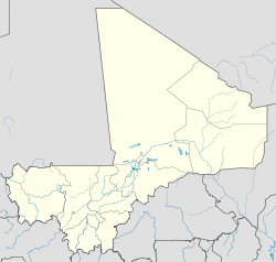
MaliRegion Mopti Region Cercle Djenné Cercle Area[1] - Total 302 km2 (116.6 sq mi) Population (2009)[2] - Total 32,944 - Density 109.1/km2 (282.5/sq mi) Djenné (also Djénné, Jenné and Jenne) is an Urban Commune and town in the Inland Niger Delta region of central Mali. In the 2009 census the commune had a population of 32,944. Administratively it is part of the Mopti Region.
The history of Djenné is closely linked with that of Timbuktu. Between the 15th and 17th centuries much of the trans-Saharan trade in goods such as salt, gold and slaves that moved in and out of Timbuktu passed through Djenné. Both towns became centres of Islamic scholarship. Djenné's prosperity depended on this trade and when the Portuguese established trading posts on the African coast, the importance of the trans-Saharan trade and thus of Djenné declined.
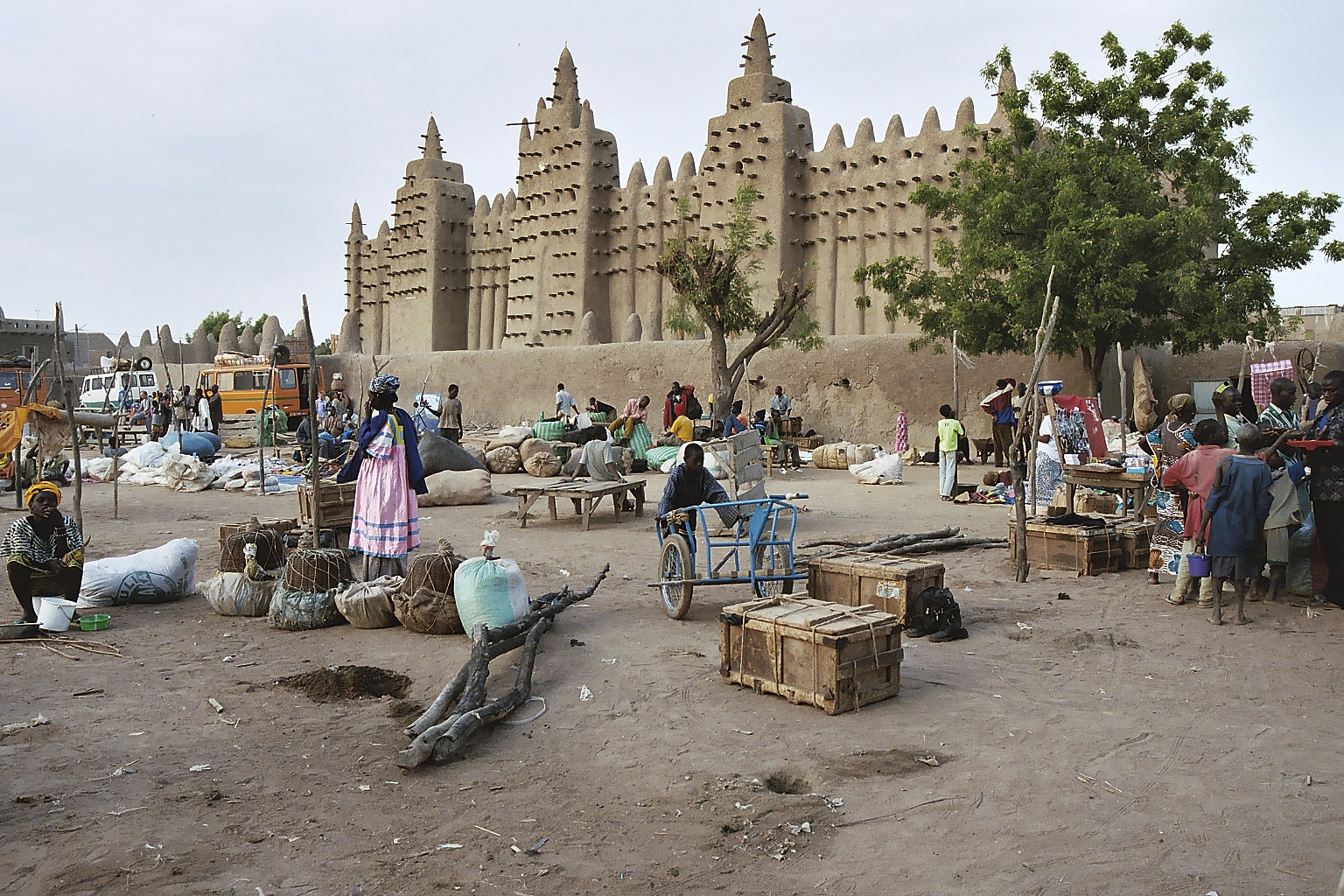
The town is famous for its distinctive mud-brick (adobe) architecture, most notably the Great Mosque which was built in 1907 on the site of an earlier mosque. To the south of the town is Djenné-Jéno, the site of one of the oldest known towns in sub-Saharan Africa. Djenné together with Djenné-Jéno were designated a World Heritage Site by UNESCO in 1988.
Contents
Geography
Djenné is situated 398 km (247 mi) north-east of Bamako and 76 km (47 mi) south-west of Mopti. The town sits on the floodplain between the Niger and Bani rivers at the southern end of the Inland Niger Delta. The town has an area of around 70 ha and during the annual floods becomes an island that is accessed by causeways. The Bani river is 5 km (3.1 mi) south of the town and is crossed by ferry.
For administrative purposes the town forms part of the Urban Commune of Djenné which covers an area of 302 km2 and consists of the town itself and the surrounding villages: Ballé, Diabolo, Gomnikouboye, Kamaraga, Kéra, Niala, Soala, Syn, Velingara and Yenleda.[1] The population figures are for the commune and include these villages. The commune is bounded to the north by the communes of Ouro Ali and Derary, to the south by the commune of Dandougou Fakala, the east by the communes of Fakala and Madiama and to the west by the commune of Pondori.[3]
Climate
The weather is hot and dry throughout much of the year. Average daily maximum temperatures in the hottest months, April and May, are around 40 °C. Temperatures are slightly cooler, though still very hot, from June through September, when practically all of the annual rainfall occurs. Only the winter months of December and January have average daily maximum temperatures below 32 °C. Between December and March the warm dry north-easterly Harmattan wind blows from the Sahara. When it blows strongly the dust-laden wind reduces visibility and creates a persistent haze. The annual rainfall is around 550 mm but varies greatly from year to year. August is normally the wettest month.[4]
Annual flood
In Djenné the annual flood produced by Bani and Niger rivers begins in July and reaches a maximum in October. During this period the town of Djenné becomes an island and the Souman-Bani channel which passes just to the east of the town fills and connects the Bani and Niger rivers. The year to year variation in the height of the flood leads to a large variation in the area of land that is flooded. This has important consequences for the local agriculture. The drought that began in the early 1970s resulted in a big reduction in the volume of water flowing in the Niger and Bani rivers. The effect on the Bani was particularly severe as the reduction in flow was much greater than the reduction in rainfall. The annual discharge of the river has not returned to the volumes experienced in the 1950s and 1960s.[5] It is only during the flood season (mid-July till December) that the Bani river between Djenné and Mopti is easily navigable. At other times of the year, sandbars lie close to the water surface. The French explorer René Caillié made the journey to Mopti in a small boat in March 1828 and was "obliged several times to unload the vessel in order to pass over sandbanks."[6]
Talo dam
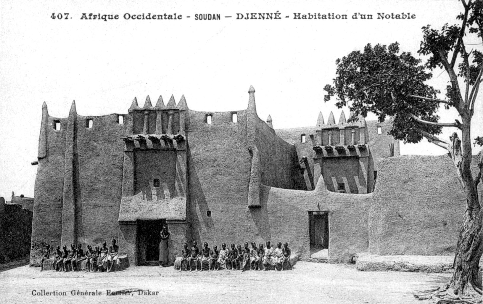
 A house in Djenné with a Toucouleur-style facade. From a postcard by Edmond Fortier published in 1906.
In 2006 the Talo Dam was constructed on the Bani River to irrigate parts of the floodplain near the town of San. The dam is located 43 km west of San and 110 km upstream from Djenné.[7] The dam functions as a weir in that water can flow over the top of the retaining wall. The construction of the dam was highly controversial.[8][9] The environmental impact assessment commissioned by the African Development Bank[10] was criticised for not fully taking into account the hydrological impact downstream of the dam.[11] The 0.18 km3 of water retained by the dam represents 1.3% of the average annual discharge of the river (the average for the period 1952–2002 is 13.4 km3).[12][13] From the published information it is unclear how much of the total discharge will be diverted for irrigation and, of the diverted water, how much will drain back into the river. The downstream effect of the dam will be to delay the arrival of the annual flood and to reduce its intensity.
Djenné dam
In May 2009 the African Development Bank approved funding for an irrigation dam/weir to be built on the Bani near Soala, a village within the commune situated 12 km south of Djenné.[14][15] The dam is one element in a 6 year 33.6 billion CFA franc (66 million USD) program that also includes the building of a dam on the Sankarani River near Kourouba and the extension of the area irrigated by the Talo dam. The proposed Djenné dam will retain 0.3 km3 of water, significantly more than the Talo dam.[16] It will allow the "controlled flooding" of 14,000 ha of the Pondori floodplain (on the left bank of the river to the south of Djenné) to allow the cultivation of rice and the irrigation of an additional 5000 ha for growing 'floating grass' (Echinochloa stagnina known locally as bourgou) for animal feed.
History
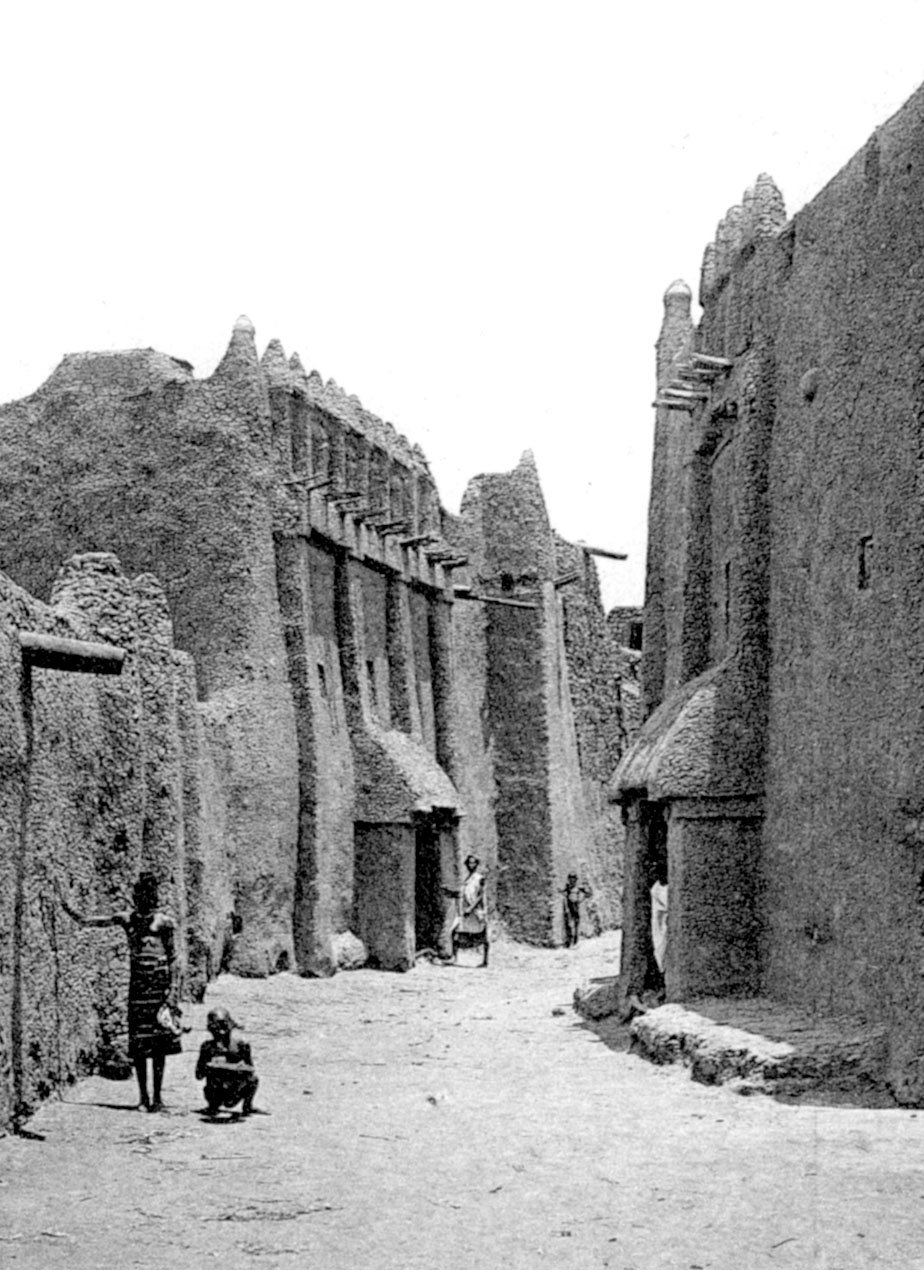
 Houses in Djenné with Toucouleur-style facades. From a postcard by Edmond Fortier published in 1906.See also: Jenné-Jeno
Lying 2.5 km south-east of the present town is the archaeological site of Djenné-Jéno or Djoboro.[17] Excavations undertaken by Susan and Roderick McIntosh in 1977 and 1981 indicate that Djenné-Jéno was first settled around 200 BC. It had developed into a large walled urban complex by 850 AD, but after 1100 AD the population of the town declined and by 1400 the site had been abandoned.[18][19] Many smaller settlements within a few kilometres of Djenné-Jéno also appear to have been abandoned around this date. Preliminary archaeological excavations at sites within modern Djenné indicate that the present town was first settled after 1000 AD.[20]
The town of Djenné may have started out as the furthermost western outpost of the Songhay people's migration from the east, and converted to Islam around 1050. The sack of the Ghana Empire by the Almoravids in 1076 allowed Djenné to surge forward as a major town in the region. Between the 11th and 13th C., Arab sources identified Djenné as the dominant commercial center of west Africa, the major terminus of the gold, salt and slave trade of the Trans-Saharan trade route. Lying much further south, with other populations in between, Djenné's name never made as much a magical impression in Europe as the Sahelian towns of Oualata and Timbuktu (at this time, they were smaller outpost along the route, established for Djenné trade). Some scholars believe Djenné is the source of the Arabic term Guinauha, which would be later translated by Europeans to Guinea.[21] Djenné was also a chief center of Sudanese Islam in this period, its Great Mosque built 11th C. (destroyed 1830) being an important center of religious life.
Djenné brief period of dominance came to an end in the 13th C., with the rise of the Mali Empire, which invaded the upper lands from the west, disrupted the old routes and redirected the trade to Timbuktu, thus catapulting that hitherto small outpost above its mother city. Djenné's fortunes never recovered and declined gradually thereafter, and it was eventually reduced to a tributary state of the Mali Empire.
During the fourteenth century, Timbuktu was known as the major southern terminus of the trans-Saharan trade in gold, salt and slaves.[22] The first direct mention of Djenné in European sources is in connection with this trans-Saharan trade to . In a letter written in Latin in 1447 by Antonio Malfante from the Saharan oasis of Tuwat to a merchant in Genoa, Malfante reports on what he had learnt from an informant about the trans-Saharan trade. He lists several 'states' including one called 'Geni' and describes the Niger River "Through these lands flows a very large river, which at certain times of the year inundates all these lands. This river passes by the gates of Thambet [Timbuktu]. ... There are many boats on it, by which they carry on trade."[23]
Djenné probably had a tribute-paying fiefdom status during the time of the Mali Empire (mid 13th to early 15th century). Seventeenth century indigenous Arabic chronicles give different accounts of the status of the town. Al-Sadi in his Tarikh al-Sudan claims that the Malians attacked the town ninety-nine times but that Djenné was never conquered[24] while the other major chronicle, the Tarikh al-fattash, describes the chief of Djenné as a humble vassal of the Malian emperor.[25]
The town was conquered by Sonni Ali (reigned 1464–1492) during his expansion of the Songhai Empire. According to al-Sadi, the siege of Djenné lasted 7 months and 7 days and culminated in the surrender of the town and the death of the chief.[26] The chief's widow then married Sonni Ali, and peace was restored.
The town is mentioned by Leo Africanus in his Descrittione dell’Africa completed in 1526 but not published until 1550.[27] He had visited Mali with an uncle in around 1510 and perhaps again 3 years later. At several places in his book Leo Africanus describes the Niger River as flowing westwards from Timbuktu to Djenné. This has led some scholars to suggest that his account of Djenné was unlikely to be based on first hand observations and was probably based on information obtained from other travellers.[28] He describes Djenné as a village with houses constructed of clay with straw roofs. He mentions an abundance of barley, rice, livestock, fish and cotton and also the importance of trade with north Africa in which merchants exported cotton and imported European cloth, copper, brass, and arms. In the trade with Timbuktu merchants visited during the annual flood using small narrow canoes. Unstamped gold was used for coinage.[29]
Between the 14th and 17th centuries Djenné and Timbuktu were important entrepôts in a long distance trade network. Salt was mined at Taghaza in the Sahara and transported south via Timbuktu and Djenné.[30] Gold from the Akan goldfields in the forested area between the Komoé and Volta rivers was traded at the town of Begho (Bitu) and then transported north through Djenné and Timbuktu and across the Sahara to North Africa where it was exchanged for merchandise such as cloth, copper and brass.[30] However, by the early sixteenth century, the Portuguese had established trading posts along the African coast and were shipping large quantities of gold from Elmina in present day Ghana.[31] This maritime trade competed with the trans-Saharan gold trade.
The Moroccan sultan, Ahmad al-Mansur, wanted to control the export of gold and in 1590 sent an army of 4,000 mercenaries across the Sahara led by the converted Spaniard Judar Pasha.[32] The Songhai were defeated at the Battle of Tondibi in 1591 and this led to the collapse of their empire.
In the 17th century Djenné was a thriving centre of trade and learning. In his chronicle al-Sadi describes the town in 1655, 70 years after the Moroccan conquest:
Jenne is one of the great markets of the Muslims. Those who deal in salt from the mine of Taghaza meet there with those who deal in gold from the mine of Bitu. ... This blessed city of Jenne is the reason why caravans come to Timbuktu from all quarters-north, south, east and west. Jenne is situated to the south and west of Timbuktu beyond the two rivers. When the river is in flood, Jenne becomes an island, but when the flood abates the water is far from it. It begins to be surrounded by water in August, and in February the water recedes again.[33]
 A house in Djenné. From Timbuctoo: the Mysterious by Félix Dubois published in 1896.
Despite the initial success of the Moroccan occupation, the logistics of controlling a territory across the Sahara soon became too difficult and by 1630 the Saadians had lost control.[34] The collapse of a centralised kingdom able to maintain order over a wide area led to a lack of security and a decline in the movement of traders and scholars. Djenné changed hands several times over the following centuries. The town formed part of the Segou kingdom from 1670 to 1818 and the Massina Empire under the Fulani ruler Seku Amadu between 1818 and 1861.
In 1828 René Caillié became the first European to visit Djenné. He published a detailed description in his book Travels through Central Africa to Timbuctoo:
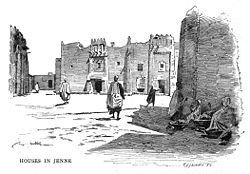
The town of Jenné is about two miles and half in circumference; it is surrounded by a very ill constructed earth wall, about ten feet high, and fourteen inches thick. There are several gates, but they are all small. The houses are built of bricks dried in the sun. The sand of the isle of Jenné is mixed with a little clay, and it is employed to make bricks of a round form which are sufficiently solid. The houses are as large as those of European villages. The greater part have only one storey ... They are all terraced, have no windows externally, and the apartments receive no air except from an inner court. The only entrance, which is of ordinary size, is closed by a door made of wooden planks, pretty thick, and apparently sawed. The door is fastened on the inside by a double iron chain, and on the outside by a wooden lock made in the country. Some however have iron locks. The apartments are all long and narrow. The walls, especially the outer, are well plastered with sand, for they have no lime. In each house there is a staircase leading to the terrace; but there are no chimneys, and consequently the slaves cook in the open air.[35]
In 1861 the town became part of the Toucouleur Empire under Umar Tall and then in April 1893 French forces under the command of Louis Archinard occupied the town.[36] The French journalist, Félix Dubois, visited the town in 1895, two years after the occupation. He published an account of his travels, together with many illustrations, in his book, Timbuctoo: the mysterious.[37] At the time of his visit the town was still encircled by a mud-brick wall. It was through this book, and the French edition published in 1897, that Djenné and its architecture became known in Europe and the United States.
The French chose to make Mopti the regional capital and as a result the relative importance of Djenné declined.
Architecture
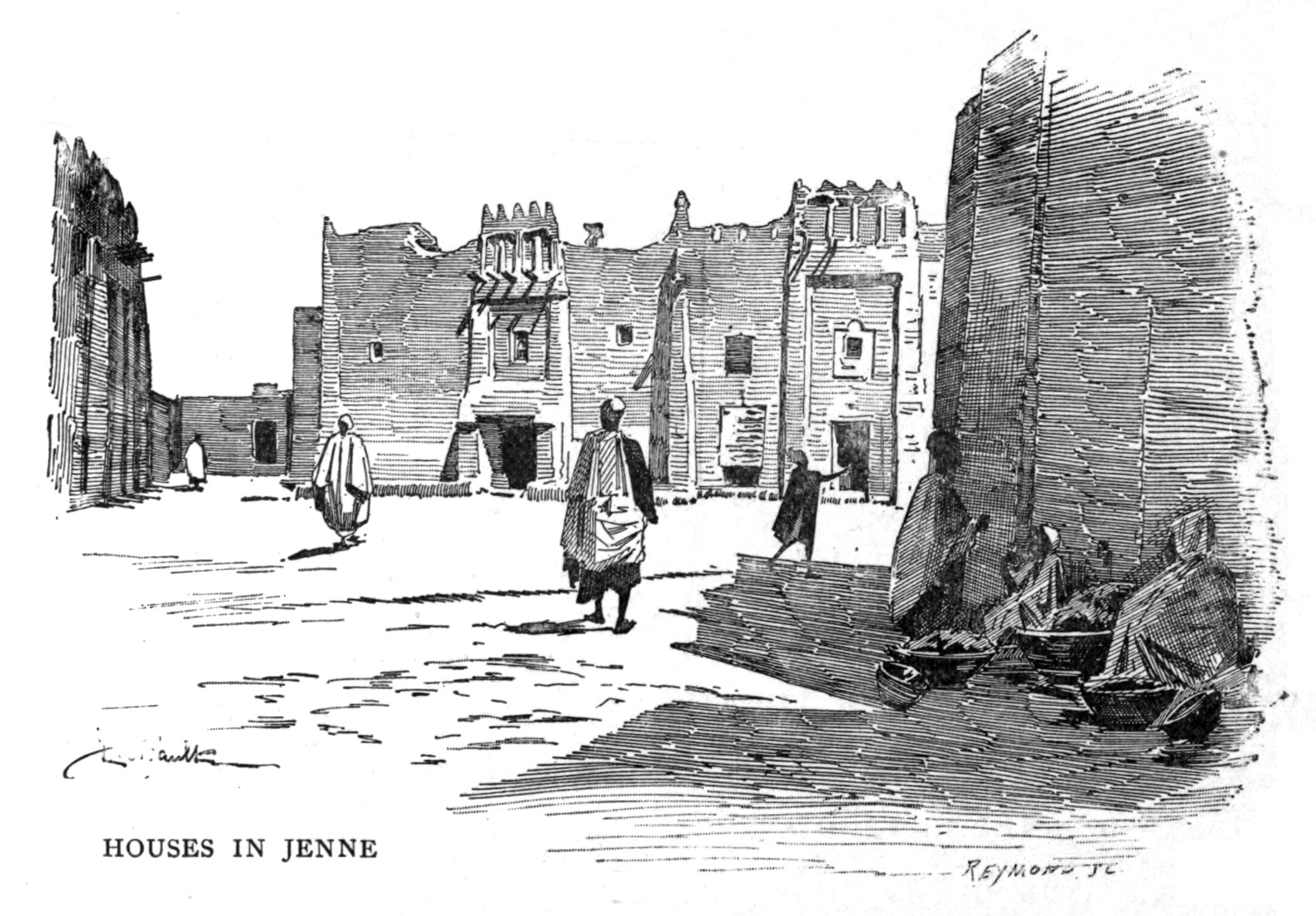
 A street scene in Djenné from Timbuctoo: the Mysterious by Félix Dubois published in 1896.
Djenné is famous for its Sudanese-style architecture. Nearly all of the buildings in the town, including the Great Mosque, are made from sun-baked mud bricks which are coated with mud plaster.
The traditional flat roofed two-storey houses are built around a small central courtyard and have imposing facades with pilaster like buttresses and an elaborate arrangement of pinnacles forming the parapet above the entrance door.[38] The facades are decorated with bundles of rodier palm (Borassus aethiopum) sticks, called toron, that project about 60 cm from the wall. The toron also serve as readymade scaffolding.[39] Ceramic pipes also extend from the roofline and ensure that the rain water from the roof does not damage the walls.
Some of the houses built before 1900 are in the Toucouleur-style and have a massive covered entrance porch set between two large buttresses. These houses generally have a single small window onto the street set above the entrance door. Many of the more recent two-storey houses are in the Moroccan-style and have small ornate windows but lack the covered entrance porch.
The sun-dried bricks are made on the river bank using a wooded mold and a mixture of mud and chopped straw. They are typical 36 x 18 x 8 cm in size and when laid are separated by 2 cm of mud mortar.[40] Up to the 1930s hand molded cylindrical bricks were used called djenné-ferey. All the brickwork is covered with a protective layer of plaster consisting of a mixture of mud and rice husks.
In Djenné the mud-brick buildings need to be replastered with mud at least every other year and even then the annual rains can cause serious damage. The Great Mosque is replastered every year and yet in 2009 one of the minarets collapsed after a period of heavy rainfall.[41] The older buildings are often entirely rebuilt. A survey of the town in 1984 identified 134 two-storey buildings of significant architectural importance, yet by 1995, in spite of restrictions resulting from the town's World Heritage status, 30% of the buildings on the list had been demolished, with most having been replaced with entirely new mud-brick buildings.[42] Between 1996 and 2003 the Dutch government funded a project to restore around 100 of the older buildings in the town.[43][44] For some buildings the restoration work involved little more than replastering the facade while for others it involved demolition and rebuilding. The total cost was 430 million FCFA (655,000 Euro).[45]
In the early 1980s foreign aid organizations funded a system to supply drinking water to both public taps and private homes. However, no wastewater disposal system was installed at the time and, as a result, wastewater was discharged into the streets. This was both unsightly and unhygienic. Between 2004 and 2008 the German government funded a project to construct gravel filled trenches outside each home to allow the wastewater to infiltrate the soil.[46] By 2008 1,880 homes had been provided with these local infiltration systems.[47]
Great Mosque
Main article: Great Mosque of DjennéIn 1906 the French colonial administration arranged for the present Great Mosque to be built on the site of an earlier mosque. Different views have been expressed as to what extent the design was influenced by the colonial administration. The journalist Félix Dubois revisited the town in 1910 and was horrified by what he considered to be a French design with three minarets resembling bell towers[48] while Jean-Louis Bourgeois has argued that the French had little influence except perhaps for the internal arches and that the design is "basically African".[49]
World heritage status
Old Towns of Djenné * UNESCO World Heritage Site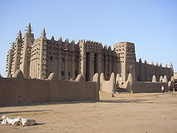
The Great MosqueCountry Mali Type Cultural Criteria iii, iv Reference 116 Region ** Africa Inscription history Inscription 1988 (12th Session) * Name as inscribed on World Heritage List
** Region as classified by UNESCOThe Republic of Mali initially submitted a nomination to UNESCO for World Heritage status for Djenné in 1979 but the advisory committee (ICOMOS) observed that the "anarchic urbanization has modified the environment of the most significant complexes" and recommended that any decision be deferred until information on the urban development of the town and the protection of historic sites had been provided by the Malian government.[50]
After a further review, the ICOMOS committee recommended that the nomination should be broadened to include the town of Djenné together with the surrounding archaeological sites of Djenné-Djéno, Hambarketolo, Tonomba and Kaniana. The committee argued that "the definition of a large zone of protection can only help Malian authorities to control urban development and conserve the archaeological reserves and the natural site of the inland delta."[50] The Republic of Mali submitted a broadened nomination which was approved by the UNESCO World Heritage Committee in 1988 as the "Old Towns of Djenné".[51] For the archaeological sites the Committee cited Criterion (iii): "bear a unique or at least exceptional testimony to a cultural tradition or to a civilization which is living or which has disappeared" while for the town they cited Criterion (iv): "be an outstanding example of a type of building, architectural or technological ensemble or landscape which illustrates (a) significant stage(s) in human history".[52]
Since 2005 the reports of the World Heritage Committee have contained criticism of what the committee considered to be a the lack of progress in tackling the problems arising from the conservation status of the town. In its 2005 report, while praising the efforts in restoring the mud brick building and improving the sanitation, the Committee commented on the lack of a development plan and requested that the World Heritage Centre, ICOMOS and the ICCROM undertake, in collaboration with the Malian Government a study of alternative solutions to relieve urban development pressure.[53]
The 2006 report produced by the Committee was more critical. It commented that "The inhabitants and the elected officials have the impression of living in a protected area where, in their view, nothing is allowed." and provided a list of issues that it considered to be the consequences of the intense development pressure. These included the lack of respect for building regulations, the inappropriateness of houses with regards to comfortable living areas and family composition, the desire of the population to transform the spatial organisation of the houses using modern materials, the lack of technical and financial resources and competence within the Djenné to resolve the city’s urban development and sanitation problems.[54] The Committee made a number of recommendations including the preparation of a management plan and the production of a map identifying the boundaries of the archaeological sites.
Economy
Although historically Djenné had been an important commercial and trading centre, in the 20th century commerce in the town declined due to its relatively isolated position. The local economy is now mainly based on agriculture, fishing and livestock[55] and is very dependent on the annual rainfall and flooding of the Niger and Bani rivers. As a consequence, the severe drought that began in the late 1970s caused great hardship in the already impoverished town.
The town is a centre of Islamic scholarship and the Quranic schools attract students from outside the region.
Tourism is an important part of the local economy particularly in the dryer cooler winter months between November and March. Most tourists visit the Monday market and spend only one night in one of the 5 hotels/guest houses. In 2007 the town received around 15,000 visitors of whom 4,200 stayed overnight.[56] Of these just over a third were from France with the remainder coming from a large number of other countries. In 2005 tourism contributed around 450 million CFA francs (687,000 Euro) to the economy of the town.[57]
The town has received significant quantities of foreign aid with many countries contributing. The Canadian government helped fund the infrastructure to supply drinking water while the United States has contributed funds to maintain the system.[58] The Dutch government funded a project to restore and plaster some of the old mud-brick buildings and the German government funded a scheme to improve the sanitation. Repairs to the mosque have been funded by the Aga Khan Trust for Culture.[59]
Sights
The main attractions are the Great Mosque and the two-storey mud houses with their monumental facades. The best known house is that of the Maiga family who supply the town's tradition chief. This old building with its Toucouleur-style entrance porch is in the Algasba district on the eastern side of the town. René Caillé visited the house in 1828.[60] Other attractions include the tomb of Tapama Djenepo, who in legend was sacrificed on the founding of the city, and the remains of Djenné-Jéno, an important settlement from the 3rd century BC until the 13th century AD.
The weekly Monday market, when buyers and sellers converge on the town from the surrounding regions, is a key tourist attraction. There is also a daily (women's) market that takes place in a courtyard opposite the mosque.
The town is approximately eight hours by road from Bamako. The coaches to Mopti drop off passengers at the crossroads 29 km from Djenné. It is here that the 1000 CFA franc tourist tax is collected.[61]
The great mosque is out of bounds for non-Muslim tourists.
Demographics
The inhabitants of Djenné mostly speak a Songhay variety termed Djenné Chiini, but the languages spoken also reflect the diversity of the area. The villages around it variously speak Bozo, Fulfulde, or Bambara.
Notes
- ^ a b (in French) Plan de Securite Alimentaire Commune Urbaine de Djenné 2006–2010, Commissariat à la Sécurité Alimentaire, République du Mali, USAID-Mali, 2006, http://www.csa-mali.org/plans/mopti/plansa_djenne/P_S_A_Djenne.pdf.
- ^ Resultats Provisoires RGPH 2009 (Région de Mopti), République de Mali: Institut National de la Statistique, http://instat.gov.ml/contenu_documentation.aspx?type=23
- ^ Cartographie de la décentralisation au Mali, Direction National des Collectivités Territorial, République du Mali, http://www.bndr-mali.org/apige/, retrieved 25 January 2011. Google Earth overlay. Requires plug-in.
- ^ Climatological statistics are available for the neighbouring town of Mopti: Weather Information for Mopti, World Weather Information Service, http://www.worldweather.org/034/c00133.htm, retrieved 22 February 2010.
- ^ Zwarts et al. 2005, p. 270 Table I.1
- ^ Caillié 1830, p. 2 Vol. 2
- ^ The Talo dam is located at 13°16′39″N 5°17′34″W / 13.2774°N 5.2929°W.
- ^ Meierotto 2009
- ^ Willis, Ben (2008), "Village of the dammed", Geographical (London), http://www.geographical.co.uk/Magazine/Village_of_the_dammed_Mar08.html, retrieved 3 March 2010
- ^ Moyen Bani plains development program: Summary of the environmental impact assessment, African Development Fund, 1997, http://www.afdb.org/fileadmin/uploads/afdb/Documents/Environmental-and-Social-Assessments/ADF-BD-IF-97-21-EN-ESPS-003677523.PDF
- ^ Fisher, Meierotto & Russel 2001
- ^ A flow of 1 m3/s corresponds to 0.0316 km3 per year. 424 m3/s is equivalent to 13.4 km3/y
- ^ Politique National de l'eau, République du Mali, Ministère des Mines, de l’énergie et de l’eau: Direction National de l'Hydraulique, 2006, http://www.dnh-mali.org/V1/IMG/Politique_Nationale_de_l_eau.pdf, retrieved 27 February 2010
- ^ The village of Saola is located on the left back of the Bani at 13°47′54″N 4°31′54″W / 13.79824°N 4.531775°W
- ^ Mali: 33.6 billion FCFA and an additional 76.2 billion FCFA for the development of irrigation, African Development Bank, 2009, http://www.afdb.org/en/news-events/article/mali-33-6-billion-fcfa-and-an-additional-76-2-billion-fcfa-for-the-development-of-irrigation-4736/, retrieved 4 March 2010
- ^ Mali: Irrigation Development Programme – Phase I, Summary Environmental and Social Impact Assessment, African Development Bank, 2008, http://www.afdb.org/fileadmin/uploads/afdb/Documents/Environmental-and-Social-Assessments/ADF-BD-IF-2008-181-EN-MALI-IRRIGATION-DEVELOPMENT-PROGRAMME-PHASE-I-ESIAS.PDF, retrieved 4 March 2010
- ^ McIntosh & McIntosh (1981) provide a brief history of Djenné up to the 19th century and summarise the available historical sources.
- ^ Results of archaeological excavations at Djenné-Jéno are described in McIntosh & McIntosh (1981) and McIntosh (1995).
- ^ For a discussion on the errors associated with radiocarbon dating see McIntosh (1995, p. 59).
- ^ McIntosh & McIntosh 2004
- ^ The identification of "Djenné" as the root of modern "Guinea" was first proposed by Leo Africanus (1526, pub.1550) The History and Description of Africa: and of the notable things therein p.79). This theory is endorsed by later writers. notably W.D. Cooley (1841) The Negroland of the Arabs examined and explained (p.18-20). Cooley notes that the Djenné is referred to as the kingdom of the Guinauha or Genewah by contemporary Arab sources, and that the term was gradually extended between the 11th and 13th C. to refer to the entire Western Sudan region. The 15th C. Portuguese derived their Guiné from Arab sources. Cooley (p.20n) speculates that the city name of 'Djenné' might have originally come from the Berber term Ghinawa ("burnt people", i.e. blacks) after the people that lived there. See Rogado Quintino (1965) "O problema da origem dos termos «Guiné» e «Guinéus»", Boletim Cultural da Guiné portuguesa, vol. 20, no.78, p.117-45.
- ^ Levtzion 1973, pp. 80,158
- ^ Crone 1937, pp. 87–88
- ^ Hunwick 1999, p. 16
- ^ Kâti 1913, p. 65, Levtzion 1973, p. 82 and McIntosh 1998, p. 274
- ^ Hunwick 1999, p. 20
- ^ Fisher 1978, pp. 87–88
- ^ Fisher 1978, p. 93 n39; McIntosh & McIntosh 1981, p. 5; Hunwick 1999, p. 272 n 4
- ^ Hunwick 1999, pp. 277–278; Leo Africanus 1896, pp. 822–823 Vol. 3
- ^ a b Wilks 1982a
- ^ Wilks 1982b
- ^ Kaba 1981
- ^ Hunwick 1999, pp. 17–18
- ^ Kaba 1981, p. 473
- ^ Caillié 1830, p. 459, Vol. 1
- ^ de Gramont 1976, p. 260
- ^ Dubois 1896
- ^ Maas & Mommersteeg 1992, p. 79; Bedaux, Diaby & Maas 2003, p. 19; Marchand 2009, pp. 88, 127, 221
- ^ Maas & Mommersteeg 1992, p. 78; Marchand 2009, p. 217
- ^ Marchand 2009, pp. 39–42
- ^ Djenné : Une tour de la Mosquée s'effondre, Maliweb, 2009, http://www.maliweb.net/category.php?NID=52883; Djenné : Une tour de la Mosquée s'effondre, L'Essor: Quotidien National d'Information du Mali, 2009, http://www.essor.gov.ml/sem/cgi-bin/view_article.pl?id=23981[dead link]
- ^ Bedaux, Diaby & Maas 2003, p. 48
- ^ Bedaux, Diaby & Maas 2003, has photos and plans of the restored buildings.
- ^ Chabbi-Chemrouk, Naïma (2007), Conservation of Djenné : On site review report, Aga Khan Trust for Culture, http://www.archnet.org/library/files/one-file.jsp?file_id=2221
- ^ Bedaux, Diaby & Maas 2003, p. 52
- ^ Alderlieste & Langeveld 2005; Bedaux, Diaby & Maas 2003, pp. 67–69
- ^ Informations n° 17, automne 2004: L’assainissement de la ville de Djenné : où en est le projet KfW ?, Djenné Patrimoine, http://www.djenne-patrimoine.asso.fr/racine/dp17.html
- ^ Dubois 1911, p. 189
- ^ Bourgeois 1987, p. 58
- ^ a b ICMOS (1981-1988), World Heritage List 116, Paris: UNESCO, http://whc.unesco.org/archive/advisory_body_evaluation/116rev.pdf
- ^ Report of the 12th Session of the World Heritage Committee, Paris: UNESCO, 1988, http://whc.unesco.org/archive/repcom88.htm#116
- ^ Operational Guidelines for the Implementation of the World Heritage Convention, Paris: UNESCO, 2008, p. 20, http://whc.unesco.org/archive/opguide08-en.pdf
- ^ World Heritage Committee Report 2005. Section 7B. State of conservation reports of properties inscribed on the World Heritage List, Paris: UNESCO, 2005, pp. 50–51, http://whc.unesco.org/document/5820
- ^ World Heritage Committee Report 2006. Section 7B. State of conservation reports of properties inscribed on the World Heritage List, Paris: UNESCO, 2006, pp. 96–98, http://whc.unesco.org/document/6529
- ^ Maas & Mommersteeg 1992, pp. 30–31
- ^ Sanogo & Fané 2008, p. 104
- ^ Doumbia, Youssouf (2010), Tourisme à Djenné: choyer la poule aux œufs d’or, L'Essor, http://www.essor.ml/culture/article/tourisme-a-djenne-choyer-la-poule, retrieved 20 February 2010
- ^ Synergy for Better Drinking Water Management in Djenné, USAID, http://www.usaid.gov/ml/articles/aeg/200602_BetterDrinkingWater_En.pdf, retrieved 20 March 2010
- ^ Aga Khan Trust for Culture leading reconstruction works in Djennè, Ismaili Mail, http://ismailimail.wordpress.com/2010/01/24/aga-khan-trust-for-culture-leading-reconstruction-works-in-djenne, retrieved 21 February 2010
- ^ Bedaux, Diaby & Maas 2003, pp. 98–99
- ^ Tax in 2009.
Sources
- Alderlieste, M.C.; Langeveld, J.G. (2005), "Wastewater planning in Djenné , Mali. A pilot project for the local infiltration of domestic wastewater", Water Science and Technology 51 (2): 57–64, PMID 15790228.
- Bedaux, R.; Diaby, B.; Maas, P., eds. (2003) (in French), L'architecture de Djenné (Mali): la pérennité d'un Patrimonie Mondial, Leiden: Rijksmuseum, ISBN 90-5349-420-0.
- Bourgeois, Jean-Louis (1987), "The history of the great mosques of Djenné", Africa Arts (UCLA James S. Coleman African Studies Center) 20 (3): 54–92, doi:10.2307/3336477, JSTOR 3336477, http://web.mac.com/davidrifkind/fiu/library_files/Bourgeois%20Mosque%20Djenne.pdf.
- Caillié, René (1830), Travels through Central Africa to Timbuctoo; and across the Great Desert, to Morocco, performed in the years 1824–1828 (2 Vols), London: Colburn & Bentley. Google books: Volume 1, Volume 2.
- Crone, G.R., ed. (1937), The Voyages of Cadamosto and other documents on Western Africa in the second half of the fifteenth century, London: Hakluyt Society.
- de Gramont, Sanche (1976), The Strong Brown God: The story of the Niger River, Boston: Houghton Mifflin, ISBN 0-395-25224-5.
- Dubois, Félix (1896), Timbuctoo: the mysterious, White, Diana (trans.), New York: Longmans, http://www.archive.org/details/timbuctoomyster01whitgoog.
- Dubois, Félix (1911), Notre beau Niger, Paris: Flammarion.
- Fisher, Humphrey J. (1978), "Leo Africanus and the Songhay conquest of Hausaland", International Journal of African Historical Studies (Boston University African Studies Center) 11 (1): 86–112, doi:10.2307/217055, JSTOR 217055.
- Fisher, William; Meierotto, Lisa; Russel, Ryan (2001), The Talo Dam Project: Projet de Mise en Valeur Des Plaines Du Moyen Bani, Clark University, http://www.djenneinitiative.org/pdfs/clark_en.pdf. Pages 30–31 contain a table dated 2003 prepared by J.R. Patenaude, giving values for the discharge in an average year (assumed to be 125 m3/s or 3.9 km3/y).
- Hunwick, John O. (1999), Timbuktu and the Songhay Empire: Al-Sadi's Tarikh al-Sudan down to 1613 and other contemporary documents, Leiden: Brill, ISBN 9004112073.
- Kaba, Lansiné (1981), "Archers, musketeers, and mosquitoes: The Moroccan invasion of the Sudan and the Songhay resistance (1591–1612)", Journal of African History (Cambridge University Press) 22 (4): 457–475, doi:10.1017/S0021853700019861, JSTOR 181298, PMID 11632225.
- Kâti, Mahmoûd Kâti ben el-Hâdj el-Motaouakkel (1913) (in French), Tarikh el-fettach ou Chronique du chercheur, pour servir à l'histoire des villes, des armées et des principaux personnages du Tekrour, Houdas, O., Delafosse, M. ed. and trans., Paris: Ernest Leroux, http://gallica.bnf.fr/ark:/12148/bpt6k5439466q. Also available from Aluka but requires subscription.
- Leo Africanus (1896), The History and Description of Africa (3 Vols), Brown, Robert, editor, London: Hakluyt Society. Internet Archive: Volume 1, Volume 2, Volume 3. The original text of Pory's 1600 English translation together with an introduction and notes by the editor.
- Levtzion, Nehemia (1973), Ancient Ghana and Mali, London: Methuen, ISBN 0841904316.
- Marchand, Trevor H.J. (2009), The Masons of Djenné, Bloomington, IN: Indiana University Press, ISBN 978-0-253-22072-1.
- Maas, Pierre; Mommersteeg, Geert, eds. (1992) (in French), Djenné: chef-d'oeuvre architectural, Amsterdam: Institut Royal des Tropiques, ISBN 9068322281.
- McIntosh, Roderick J.; McIntosh, Susan Keech (1981), "The inland Niger delta before the empire of Mali: evidence from Jenne-jeno", Journal of African History (Cambridge University Press) 22 (1): 1–22, doi:10.1017/S0021853700018983, JSTOR 182149, http://anthropology.rice.edu/WorkArea/linkit.aspx?LinkIdentifier=id&ItemID=477.
- McIntosh, Roderick J. (1998), The peoples of the Middle Niger: the island of gold, London: Blackwell, ISBN 0631173617.
- McIntosh, Roderick J.; McIntosh, Susan Keech (2004), "Results of recent excavations at Jenné-jeno and Djenné, Mali", in Sanogo, K.; Togola, T., Proceedings of the Eleventh Congress of the Pan-African Association for Prehistory and Related Fields, Bamako: Institut des Sciences Humaines, pp. 469–481, http://anthropology.rice.edu/WorkArea/linkit.aspx?LinkIdentifier=id&ItemID=482.
- McIntosh, Susan Keech (ed.) (1995), Excavations at Jenné-Jeno, Hambarketolo, and Kaniana (Inland Niger Delta, Mali), the 1981 season, Berkeley: University of California Press, doi:10.5555/AL.CH.DOCUMENT.sip100038, ISBN 0520097858, http://www.aluka.org/action/showMetadata?doi=10.5555/AL.CH.DOCUMENT.sip100038. Link requires subscription to Aluka.
- Meierotto, Lisa (2009), "The uneven geographies of transnational advocacy: The case of the Talo Dam", Journal of Environmental Management 90 (Suppl. 3): S279–S285, doi:10.1016/j.jenvman.2008.07.024, PMID 19008033, http://rivers.bee.oregonstate.edu/CHINA_DAM_STUDY/JEM%20aticles/meierotto_2008.pdf.
- Sanogo, Klessigué; Fané, Yamoussa, eds. (2008) (in French), Plan de Conservation et de Gestion des " Villes anciennes de Djenné " – Mali, 2008–2012, République du Mali: Ministère de la Culture du Mali/UNESCO, http://whc.unesco.org/download.cfm?id_document=102566.
- Wilks, Ivor (1982a), "Wangara, Akan and Portuguese in the fifteenth and sixteenth centuries. I. The matter of Bitu", Journal of African History (Cambridge University Press) 23 (3): 333–349, doi:10.1017/S0021853700020958, JSTOR 182099.
- Wilks, Ivor (1982b), "Wangara, Akan and Portuguese in the fifteenth and sixteenth centuries. II. The struggle for trade", Journal of African History (Cambridge University Press) 23 (4): 463–472, doi:10.1017/S0021853700021307, JSTOR 182036.
- Zwarts, Leo; van Beukering, Pieter; Kone, Bakary et al., eds. (2005), The Niger, a lifeline: Effective water management in the Upper Niger Basin, Veenwouden, the Netherlands: Altenburg & Wymenga, ISBN 90-807150-6-9, http://www.altwym.nl/uploads/file/361_1289481552.pdf. Also published in French with the title Le Niger: une Artère vitale. Gestion efficace de l’eau dans le bassin du Haut Niger.
Further reading
- Bedaux, R.M.A.; van der Waals, J.D., eds. (1994), Djenné: une ville millénaire au Mali, Leiden: Rijksmuseum voor Volkenhunde, ISBN 90-71310-58-2
- Gardi, Bernard; Maas, Pierre; Mommersteeg, Geert (1995), Djenné, il y a cent ans, Amsterdam: Institute Royal des Tropiques, ISBN 90-6832-250-8. Reproduces postcards and photographs dating from the early years of the 20th century.
- Joy, Charlotte (2007), "Enchanting Town of Mud: Djenné, a world heritage site in Mali", in de Jong, Ferdinand; Rowlands, Michael, Reclaiming Heritage: Alternative Imaginaries of Memory in West Africa, Walnut Creek, CA: Left Coast Press, pp. 145–160, ISBN 978-1-59874-307-4.
- Mommersteeg, Geert (2009), Dans la cité des marabouts: Djenné, Mali, Cohendy, Mireille trans., Brinon-sur-Sauldre, France: Grandvaux, ISBN 978-290955063-3.
- Monteil, Charles (1903), Soudan français. Monographie de Djenné, cercle et ville, Paris: Tulle.
- Monteil, Charles (1932), Une cité soudanaise. Djénné, métropole du delta central du Niger, Paris: Société d’éditions géographiques, maritimes et coloniales. Reprinted in 1971 by Éditions Anthropos, Paris.
- Prussin, Labelle (1986), Hatumere: Islamic design in West Africa, Berkeley: University of California Press, ISBN 0520030044.
External links
- Djenné, Office Malien du Tourisme et de l'Hôtellerie, http://www.djennetourism.com. The official website for tourism in Djenné.
- Old Towns of Djenné, UNESCO World Heritage, http://whc.unesco.org/en/list/116.
- Mali Empire and Djenne Figures, National Museum of African Art, Smithsonian Institution, http://africa.si.edu/exhibits/resources/mali/index.htm.
- Pictures of Djenné and villages around it
- Djenné site page in Aluka
- Djenné Patrimoine (in French)
- Islamic Architecture in Mali
- Pierre Maas, Djenné: Living Tradition, 1990, Saudi Aramco World
 Communes and towns of the Mopti Region
Capital:Mopti Bandiagara Cercle Bandiagara (Bandiagara) · Doucoumbo (Doucoumbo) · Dourou (Dourou) · Dogani Bere (Dogani Bere) · Kende (Kende) · Lowol Gueou (Karegue) · Metoumou (Damada) · Pelou (Pelou) · Pignari Bana (Goundaka) · Pignari (Baboye) · Sangai (Sangha Agolleye) · Soroly (Soroly) · Wadouba (Kani Gogouna) · Dandoli (Dandoli) · Borko (Borko) · Diamnati (Dé) · Segue Ire (Sougui) · Ondougou (Ondougou) · Timniri (Diangassagou) · Bara Sara (Ouo Sarre) · Kendie (Kendie)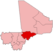
Bankass Cercle Bankass (Bankass) · Baye (Baye) · Diallassagou (Diallassagou) · Tori (Tori) · Kanibonzon (Kanibonzon) · Ouenkoro (Ouenkoro) · Segue (Segue) · Sokoura (Sokoura) · Koulogon Habe (Koulogon Habe) · Lessagou Habe (Lessagou Habe) · Soumbala (Soumbala) · Dimbal Habe (Dimbal Habe)Djenné Cercle Djenné (Djenné) · Dandougou Fakala (Dandougou Fakala) · Derary (Gagna) · Fakala (Fakala) · Femaye (Taga) · Kewa (Kouakourou) · Nema Badenyakafo (Mougna) · Ouro Ali (Senossa) · Pondori (Gomitogo) · Togue Mourari (Mourrah) · Madiama (Madiama) · Niansanarie (Keke)Douentza Cercle Douentza (Douentza) · Dallah (Dallah) · Dangol-Bore (Boré) · Debere (Debere) · Dianweli (Dianweli Maoude) · Djaptodji (N'Gouma) · Gandamia (Kikara) · Haire (Boni) · Korarou (Boni) · Koubewel Koundia (Koubewel) · Mondoro (Mondoro) · Tedie (Tongo-Tongo) · Hombori (Hombori) · Petaka (Petaka) · Kerena (Kerena)Koro Cercle Koro (Koro) · Bamba (Deguere) · Barapireli (Barapireli) · Bondo (Bondo) · Diankabou (Diankabou) · Dinangourou (Dinangourou) · Dioungani (Dioungani) · Dougoutene I (Toroli) · Dougoutene II (Andiagana-Na) · Kassa (Berdosso) · Koporokendie Na (Koporokendie Na) · Koporo Pen (Koporo Pen) · Madougou (Madougou) · Pel Maoude (Pel Maoude) · Yoro (Yoro) · Youdiou (Youdiou)Mopti Cercle Mopti (Mopti) · Socoura (Socoura) · Dialloube (Dialloube) · Fatoma (Fatoma) · Konna (Konna) · Korombana (Korientze) · Kounari (Manaco) · Ouro Modi (Ouro Modi) · Ouroube Doudde (Sendegue) · Sio (Soufouroulaye) · Soye (Soye) · Borondougou (Diambacourou) · Sasalbe (Nogourema Toboro) · Koubaye (Koubaye) · Bassirou (Bassirou)Tenenkou Cercle Youwarou Cercle Categories:- Djenné
- Populated places in the Mopti Region
- Communes of Mali
- World Heritage Sites in Mali
- Niger Inland Delta
- Bani River
- Massina Empire


Wikimedia Foundation. 2010.