- Chambly, Quebec
-
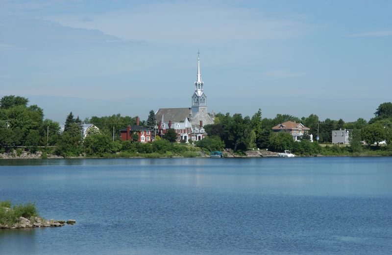
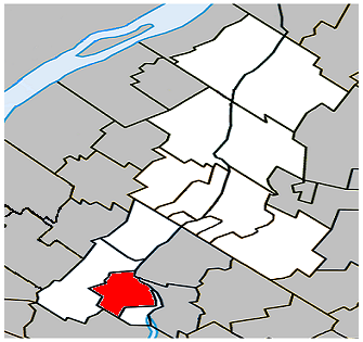
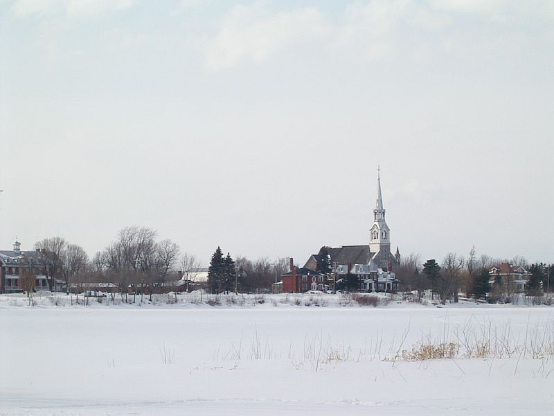
Chambly, Quebec — City — Ville de Chambly Chambly's Church St-Joseph, viewed from the Basin.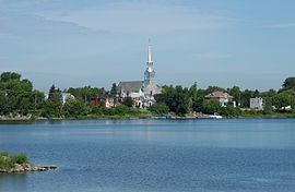 Location within La Vallée-du-Richelieu Regional County Municipality.
Coordinates (56, rue Martel [1]): 45°27′00″N 73°17′27″W / 45.45°N 73.29083°W Country  Canada
Province  Quebec
Region Montérégie (16) RCM La-Vallée-du-Richelieu Established October 26, 1848 Incorporated September 18, 1965 Electoral Districts
Federal
Chambly—BorduasProvincial Chambly Government[1][2][3] - Mayor Denis Lavoie - Federal MP(s) Matthew Dubé (NDP) - Quebec MNA(s) Bertrand St-Arnaud (PQ) Area[4] - Land 25.11 km2 (9.7 sq mi) Population (2006)[4] - Total 22,608 - Density 900.2/km2 (2,331.5/sq mi) - Change (2001-06)  11.1%
11.1%- Dwellings 8,740 Time zone Eastern (UTC-5) - Summer (DST) EDT (UTC-4) Postal code(s) J3L Area code(s) 450 Access Routes [5]
 A-10
A-10
 Route 112
Website www.ville.chambly.qc.ca Chambly is a city in southwestern Quebec, Canada, about 25 km (16 mi) to the south east of Montreal.
Contents
Geography
It sits on the Richelieu River in the Regional County Municipality of La-Vallée-du-Richelieu, at 45°27′00″N 73°17′27″W / 45.45°N 73.29083°W.
History
People have lived in Chambly since the 17th century, but Chambly was not incorporated as a city until 1965.
Samuel de Champlain passed through the area that came to be the site of the town of Chambly, QC, in 1609., when he wrote the following in his journal:
“ The approach to the rapids is a sort of lake into which the water flows down, and it is about three leagues in circumference. Near by are meadows were no Indians live, by reason of the wars. At the rapids there is very little water, but it flows with great swiftness, and there are many rocks and boulders, so that the Indians cannot go up by water; but on the way back they run them very nicely. All this region is very level and full of forests, vines and butternut trees. No Christian has ever visited this land and we had all the misery of the world trying to paddle the river upstream. ” The College of Chambly was chartered on March 21, 1835 in Lower Canada.[6]
Fort Chambly
Main article: Fort Chambly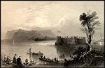
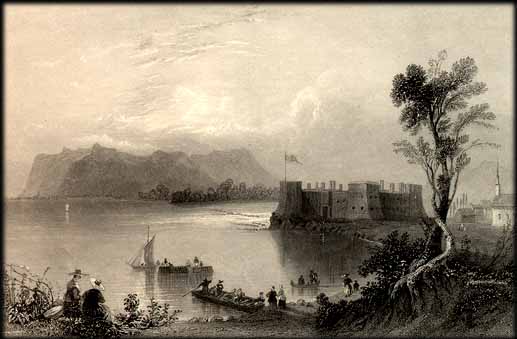
Chambly is home to the massive Fort Chambly, built with local stone between 1709 and 1711 in the style of Vauban's classic French fortifications. It was built at the mouth of a large basin, on the site of successive wooden forts dating back to 1665. Fort Chambly was the largest in a series of fortifications on the shores of what was known as the Iroquois River (later known as the Chambly River, finally becoming the Richelieu River in the nineteenth century). Originally called Fort Saint-Louis, it soon came to be known by the name of its first commanding officer, Jacques de Chambly, to whom the surrounding seigniory was granted in 1672. It was intended to protect New France in general (and Montreal in specific) from attack from hostile natives and the English. Today, the fort is run by Parks Canada as a National Historic Site, and houses a museum and interpretive center, and hosts historical re-enactments of military drills (as well as a number of contemporary cultural events).
A small local population clustered around the fort, and the entire area eventually became known as Chambly as well.
Chambly Canal
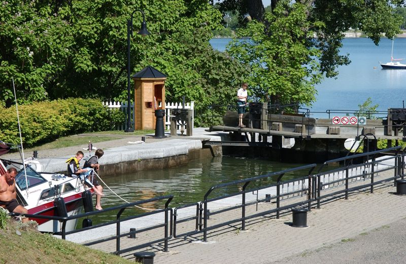
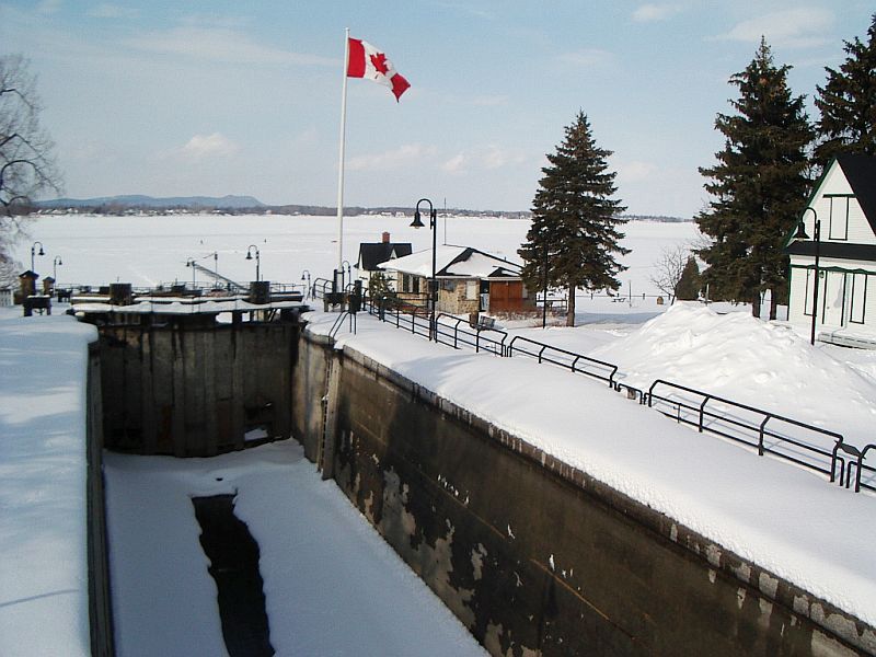
Main article: Chambly Canal Chambly Canal lock
Chambly is also known for the Chambly Canal, a National Historic Site run by Parks Canada. It was built in 1843 to bypass several kilometers of successive Richelieu River rapids between the towns of Chambly, QC, and Saint-Jean-sur-Richelieu. Part of a series of waterways connecting the Saint Lawrence River and New York City, Chambly Canal was built to facilitate commercial traffic between Canada and the United States.
Trade dwindled after World War I, and as of the 1970s, traffic has been replaced by recreational vessels. Today the canal is enjoyed by tourists and more than 7,000 pleasure boats in the summer, and ice skaters in the winter.
The St-Joseph of Chambly church is located at 164 Martel street. It was built between 1880 and 1881. The parish was founded in 1665.
Demographics
Population
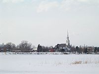 Chambly's Church St-Joseph, viewed in winter from the Basin
The population as of the Canada 2006 Census was 22,608. Although mostly populated today by French Canadians, Chambly has long had a vibrant English citizenry.
Population trend[7]
Census Population Change (%) 2006 22,608 11.1%2001 20,342 3.2%1996 19,716 24.1%1991 15,893 N/A 1986 12,869 N/A Language
Mother tongue language (2006)[4]
Language Population Pct (%) French only 20,605 91.82% English only 1,165 5.19% Both English and French 125 0.56% Other languages 545 2.43% Economy
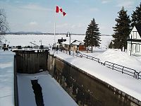 Chambly Canal locks, viewed in winter
Business
In 2004, Chambly's largest local employers were:
- Les Aliments Cargill
- Kraft Canada inc.
- Parks Canada
- Marché Lambert et Frères inc. (IGA)
- Métro Collin inc.
- Centre Jeunesse de la Montérégie
- Les Fibres J.C. inc.
- Bennett Fleet (Chambly) inc.
- Sapporo Unibroue inc.
(Source: Town of Chambly website)
- Le Centre Athlétique de Chambly (le CAC)
Transportation
The CIT Chambly-Richelieu-Carignan provides commuter and local bus services.
Media
Chambly is currently served by a local weekly newspaper called the "Journal de Chambly", first published in 1966.
A small daily news sheet called Chambly Matin also maintains a journalistic presence on the internet reporting on local issues.
Notable people
See also
References
- ^ a b Ministère des Affaires Municipales et Régions: Chambly
- ^ Parliament of Canada Federal Riding History: CHAMBLY--BORDUAS (Quebec)
- ^ Chief Electoral Officer of Québec - 40th General Election Riding Results: CHAMBLY
- ^ a b c 2006 Statistics Canada Community Profile: Chambly, Quebec
- ^ Official Transport Quebec Road Map
- ^ Pound, Richard W. (2005). 'Fitzhenry and Whiteside Book of Canadian Facts and Dates'. Fitzhenry and Whiteside.
- ^ Statistics Canada: 1996, 2001, 2006 census
External links
- Town of Chambly website
- Fort Chambly page at Parks Canada website
- Chambly Canal page at Parks Canada website

Saint-Mathias-sur-Richelieu Carignan 
Richelieu
Carignan Chambly

Saint-Jean-sur-Richelieu Administrative divisions of Montérégie (Region 16)Regional county municipalities
and equivalent territoriesBrome-Missisquoi · La Haute-Yamaska · Acton · Pierre-De Saurel · Les Maskoutains · Rouville · Le Haut-Richelieu · La Vallée-du-Richelieu · Longueuil · Lajemmerais · Roussillon · Les Jardins-de-Napierville · Le Haut-Saint-Laurent · Beauharnois-Salaberry · Vaudreuil-Soulanges
Municipalities Cowansville · Granby · Sorel-Tracy · Saint-Hyacinthe · Saint-Jean-sur-Richelieu · Chambly · Saint-Basile-le-Grand · Mont-Saint-Hilaire · Belœil · Brossard · Saint-Lambert · Boucherville · Saint-Bruno-de-Montarville · Longueuil · Sainte-Julie · Varennes · La Prairie · Candiac · Sainte-Catherine · Saint-Constant · Mercier · Châteauguay · Beauharnois · Salaberry-de-Valleyfield · Pincourt · Vaudreuil-Dorion · Saint-Lazare
Administrative divisions of Quebec Categories:
Wikimedia Foundation. 2010.