- Vallejo, California
-
City of Vallejo — City — Vallejo City Hall and County Building
Nickname(s): Valley-Joe, V-Town, The "V" Motto: City of Opportunity Location in Solano County and the state of California
Coordinates: 38°6′47″N 122°14′9″W / 38.11306°N 122.23583°WCoordinates: 38°6′47″N 122°14′9″W / 38.11306°N 122.23583°W Country  United States
State  California
County Solano Founded 1851 Incorporated 1867 Government – Type Council-Manager – Mayor Osby Davis – City Manager Bob Adams (Interim) – Senate Noreen Evans (D) – Assembly Michael Allen (D) – U. S. Congress George Miller (D) Area[1] – Total 49.540 sq mi (128.310 km2) – Land 30.671 sq mi (79.439 km2) – Water 18.869 sq mi (48.871 km2) 38.09% Elevation 60 ft (21 m) Population (2010) – Total 115,942 – Rank 1st in Solano County
49th in California
223rd in the United States– Density 2,340.4/sq mi (903.6/km2) Time zone PST (UTC-8) – Summer (DST) PDT (UTC-7) ZIP Code 94589, 94590, 94591, 94592 Area code(s) 707 FIPS code 06-81666 GNIS feature ID 1661612 Website www.ci.vallejo.ca.us Vallejo (
 /vəˈleɪ.oʊ/ or /vəˈleɪhoʊ/; Spanish: [baˈʎexo]) is the largest city in Solano County, California, United States. The population was 115,942 at the 2010 census. It is located in the San Francisco Bay Area on the northeastern shore of San Pablo Bay. Vallejo is named for General Mariano Guadalupe Vallejo.
Vallejo is home to the Six Flags Discovery Kingdom theme park (formerly Marine World and Marine World Africa USA) ; the now-defunct Mare Island Naval Shipyard; the regional office for Region 5 of the United States Forest Service; the California Maritime Academy (part of the California State University system); the Vallejo Center campus of Solano Community College; and Touro University, an osteopathic medical college. Ferry service runs from a terminal on Mare Island Strait to San Francisco, through Vallejo Transit's BayLink division.
Vallejo has twice served as the capital of the state of California: once in 1852 and again in 1853, both periods being brief.[2] Some of the first Europeans drawn to the Vallejo area were attracted by the sulfur springs; in the year 1902 the area was named Blue Rock Springs. In 2008, Vallejo became the largest California city ever to file for bankruptcy.
Contents
Geography and environment
According to United States Census Bureau, the city has a total area of 49.5 square miles (128 km2). Land area is 30.7 square miles (80 km2), and 18.9 square miles (49 km2) of it (38.09%) is water. The Napa River flows until it changes into the Mare Island Strait in Vallejo which then flows into the San Pablo Bay.
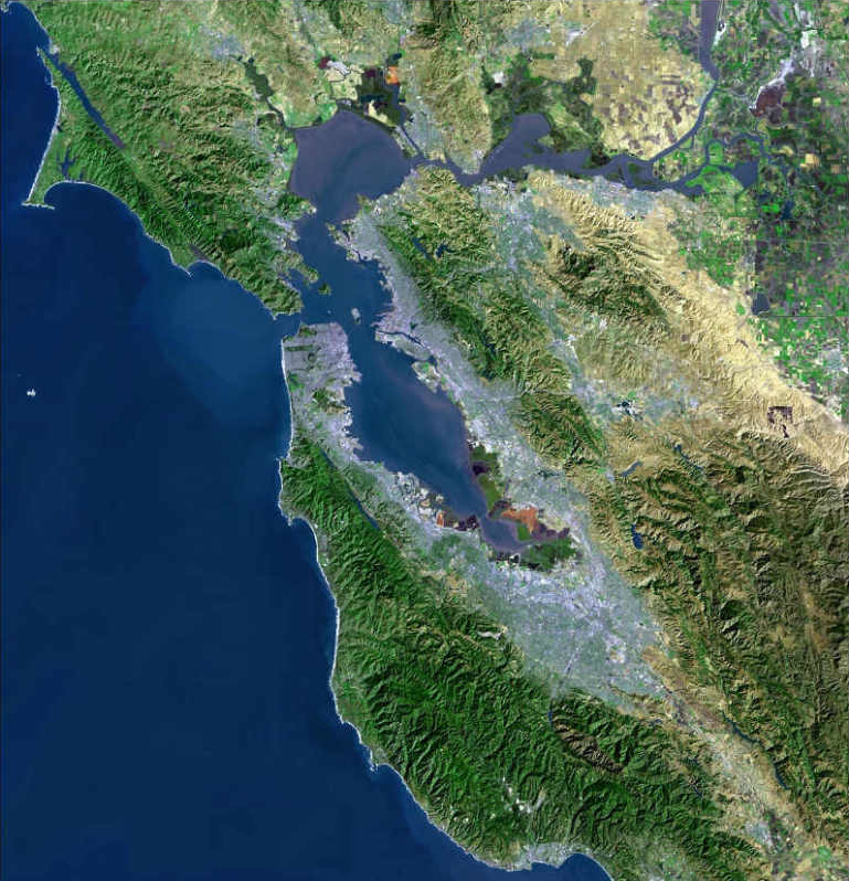
Vallejo is located in the northern part of the East Bay region of the Bay Area in Central California. Vallejo is accessible by Interstate 80 between San Francisco and Sacramento, and is the location for the northern half of the Carquinez Bridge. It is also accessible by Interstate 780 from neighboring Benicia to the east, and by Route 37 from Sonoma to the west. Route 29 (former U.S. Route 40) begins in the city near the Carquinez Bridge and travels north through the heart of the city and beyond into Napa County, entering neighboring American Canyon and eventually Napa.
Several faults have been mapped in the vicinity of Vallejo. The San Andreas Fault and Hayward Faults are the most active faults, even though the San Andreas is at some distance. Locally, the Sulphur Springs Valley Thrust Fault and Southhampton Fault are found. No quaternary seismic activity along these minor faults has been observed with the possible exception of a slight offset revealed by trenching. The Sulphur Mountain and Green Valley faults have been associated with the Concord Fault to the south. The Concord Fault is considered active. Historically there have been local cinnabar mines in the Vallejo area.[3] The Hastings Mine and St. John's Mine contribute ongoing water contamination for mercury; furthermore, mine shaft development has depleted much of this area's spring water. Both Rindler Creek and Blue Rock Springs Creek have been affected.
There are a variety of flora and fauna in the Vallejo area. The Suisun Shrew (Sorex ornatus sinuosus), a mammal found only in salt marshes, has local habitat. Also according to city's 1989 Environmental Assessment, the Tiburon Indian paintbrush, (Castilleja neglecta) is found in the Vallejo area.
Demographics
Historical populations Census Pop. %± 1880 5,987 — 1890 6,343 5.9% 1900 7,965 25.6% 1910 11,340 42.4% 1920 21,107 86.1% 1930 16,072 −23.9% 1940 20,072 24.9% 1950 26,038 29.7% 1960 60,877 133.8% 1970 71,710 17.8% 1980 80,303 12.0% 1990 109,199 36.0% 2000 116,760 6.9% 2010 115,942 −0.7% 2010
The 2010 United States Census[4] reported that Vallejo had a population of 115,942. The population density was 2,340.3 people per square mile (903.6/km²). The racial makeup of Vallejo was 38,064 (32.8%) White, 25,572 (22.1%) African American, 757 (0.7%) Native American, 28,895 (24.9%) Asian (21.1% Filipino, 1.0% Indian, 0.9% Chinese, 0.5% Vietnamese, 0.2% Japanese, 0.2% Korean, 0.1% Laotian) , 1,239 (1.1%) Pacific Islander, 12,759 (11.0%) from other races, and 8,656 (7.5%) from two or more races. Hispanic or Latino of any race were 26,165 persons (22.6%); 16.1% of Vallejo is Mexican, 1.8% Salvadoran, 0.8% Puerto Rican, 0.7% Guatemalan, 0.5% Nicaraguan, and 0.2% Peruvian.
The Census reported that 114,279 people (98.6% of the population) lived in households, 1,130 (1.0%) lived in non-institutionalized group quarters, and 533 (0.5%) were institutionalized.
There were 40,559 households, out of which 14,398 (35.5%) had children under the age of 18 living in them, 17,819 (43.9%) were opposite-sex married couples living together, 7,214 (17.8%) had a female householder with no husband present, 2,755 (6.8%) had a male householder with no wife present. There were 2,804 (6.9%) unmarried opposite-sex partnerships, and 497 (1.2%) same-sex married couples or partnerships. 9,870 households (24.3%) were made up of individuals and 3,255 (8.0%) had someone living alone who was 65 years of age or older. The average household size was 2.82. There were 27,788 families (68.5% of all households); the average family size was 3.36.
The population was spread out with 26,911 people (23.2%) under the age of 18, 11,667 people (10.1%) aged 18 to 24, 30,053 people (25.9%) aged 25 to 44, 33,312 people (28.7%) aged 45 to 64, and 13,999 people (12.1%) who were 65 years of age or older. The median age was 37.9 years. For every 100 females there were 94.3 males. For every 100 females age 18 and over, there were 91.4 males.
There were 44,433 housing units at an average density of 896.9 per square mile (346.3/km²), of which 24,188 (59.6%) were owner-occupied, and 16,371 (40.4%) were occupied by renters. The homeowner vacancy rate was 3.0%; the rental vacancy rate was 9.4%. 68,236 people (58.9% of the population) lived in owner-occupied housing units and 46,043 people (39.7%) lived in rental housing units.
2000
As of the census[5] of 2000, there were 116,760 people, 39,601 households, and 28,235 families residing in the city. The population density was 1,493.3/km² (3,867.9/mi²). There were 41,219 housing units at an average density of 527.2/km² (1,365.4/mi²). The racial makeup of the city was 35.97% White, 23.69% African American, 0.66% Native American, 24.16% Asian, 1.09% Pacific Islander, 7.88% from other races, and 6.56% from two or more races. Hispanic or Latino of any race were 15.92% of the population.
As of 2000, residents with Filipino ancestry made up 20.74% of Vallejo's population.[6] As of 2009, Vallejo is the 9th largest city in the San Francisco Bay Area, 48th in the state of California, and 215th in the U.S. by population.
There were 39,601 households out of which 36.5% had children under the age of 18 living with them, 49.1% were married couples living together, 16.5% had a female householder with no husband present, and 28.7% were non-families. 22.7% of all households were made up of individuals and 8.0% had someone living alone who was 65 years of age or older. The average household size was 2.90 and the average family size was 3.43.
In the city the population was spread out with 27.6% under the age of 18, 9.0% from 18 to 24, 29.6% from 25 to 44, 22.6% from 45 to 64, and 11.2% who were 65 years of age or older. The median age was 35 years. For every 100 females there were 93.9 males. For every 100 females age 18 and over, there were 89.7 males.
The median income for a household in the city was $47,030, and the median income for a family was $53,805. Males had a median income of $40,132 versus $32,129 for females. The per capita income for the city was $20,415. About 7.7% of families and 10.1% of the population were below the poverty line, including 12.2% of those under age 18 and 8.9% of those age 64 or over.
History
Vallejo was once home of the Coastal Miwok as well as Suisunes and other Patwin Native American tribes. The Columbus Parkway EIR documents three confirmed Native American sites located in the rock outcrops in the hills above Blue Rock Springs Park. The California Archaeological Inventory has indicated that the three Indian sites are located on Sulphur Springs Mountain.
 Mariano Vallejo, ca. 1880-85, founder and city namesake
The city of Vallejo was once part of the 84,000-acre (340 km2) Rancho Suscol Mexican land grant of 1843 by Governor Manuel Micheltorena to General Mariano Guadalupe Vallejo. The city was named for this original Mexican military officer and title holder, he helped to settle and oversee the north bay region. General Vallejo was responsible for military peace in the region until 1846, when independence-minded Californians rose up against the Mexican government of California in 1846 in the Bear Flag Revolt, followed subsequently by the annexation of the California Republic to the United States. General Vallejo, though a Mexican and Mexican army officer, generally acquiesced in the annexation of California to the United States, recognizing the greater resources of the United States and benefits that would bring to California. He was a proponent of reconciliation and statehood after the Bear Flag Revolt, and has a U.S. Navy submarine, the USS Mariano G. Vallejo (SSBN-658), named after him.
In 1850, Vallejo proposed plans for a new city, to be called Eureka, with the capitol, university, botanical garden and other features. After a state wide referendum, his proposal was accepted, although a new name was decided upon: Vallejo. In 1851, a commission appointed by the Senate found a site on a hill that overlooked the bay and could see San Francisco on a clear day, and it was approved for its symbolic strategic value. In 1851, Vallejo was the official state capitol, with the government prepared to meet for the first time the following year. In 1852, the legislature convened for the first time. Unfortunately, Vallejo didn't follow through with building a capitol for them to meet in. After being forced to meet in a leaky building, sitting on barrels, they motioned to move sessions to Sacramento, and served there for the remainder of the session after only 11 days. In 1853, it was again the meeting place for the legislature, solely for the purpose of moving the capitol officially to Benicia, which occurred on February 4, 1853, after only a month. Benicia is named after Vallejo's wife, Francisca Benicia Carrillo. After legislature left, the government established a naval shipyard on Mare Island, which helped the town overcome the loss. The yard functioned for over a hundred years, finally closing in 1996.[7]
Although the town is named after General Vallejo, the man regarded as the true founder of Vallejo is John B. Frisbie. After his daughter Epifania married Frisbie, General Vallejo granted him power of attorney for the land grant. It was Frisbie who hired E.H. Rowe, the man who designed the city layout and who named the east-west streets after states and the north-south streets after California counties.[8]
In the early 1900s, Vallejo was home to a Class D minor-league baseball team, referred to in local newspapers sometimes as the "Giants" and other times simply as "The Vallejos." Pacific Coast League star and future Chicago White Sox center fielder Ping Bodie played for Vallejo during the 1908 season, in which the team reached the California state title game. The team was disbanded in the early 1920s.
Downtown Vallejo retains many of its historic Victorian and Craftsman homes.
Recent events
Zodiac Killer
Main article: Zodiac KillerThe Zodiac Killer was a serial killer who was active in Northern California during the 1960s. He claimed to have killed 37, but only 7 victims were confirmed, two of which survived. Both the Vallejo Police Department and San Francisco Police Department investigated the murders but were never able to solve the case. The case was marked inactive in April 2004 but was reopened before March 2007. The Vallejo Police Department website has a menu tab for providing Zodiac Crime Tips. The case also remains open in additional jurisdictions.
Gay and Lesbian Community
As early as the 1940s and before, Vallejo is known to have had a well-formed gay community, which was a short drive or boat ride away from San Francisco.[9] At one time Vallejo boasted eight gay bars. After a migration of gays and lesbians from San Francisco in the decade 2000-2009[10], openly gay members of the community encountered what they described as a backlash against them. The school district was threatened by the ACLU to be sued for harassment of a 17-year-old lesbian by school administrators[11]. Some candidates for public office were alarmed by the formation of a "faith community" coalition organized by a group of local churches, formed under the name "Vallejo Faith Organization." The coalition sought to represent the values and interest of people of faith in local politics and to help facilitate the church's involvement in bettering the community of Vallejo.[12] A few of these churches have partnered with a group known as the "New Apostolic Reformation," or NAR, to declare Vallejo as a "City of God."
In 2009, Osby Davis answered a question in an interview with New York Times columnist (Scott James, who writes fiction under the pen name Kemble Scott) by saying that according to Davis's personal belief and understanding of the Bible the gay lifestyle was sin and any sin of any kind keeps one out of heaven unless one turns to Christ, who died to pay for everyone's sins. [13]
A small group of political activists used his comments out of context to create a firestorm of controversy. Many within the community saw his comments as divisive and bigoted and demanded that he step down. Many other residents of Vallejo agreed with his comments and offered their full support. In the next election in November 2011, Osby Davis was re-elected mayor of Vallejo.
Two openly gay men have been elected to Vallejo's city council.
November 2007 mayoral election
The incumbent mayor was former city council member Anthony Intintoli; as of December 2007, the current mayor is Osby Davis. The mayoral race had Davis and Gary Cloutier tied on election day before the last few votes counted put Cloutier slightly ahead. But the results of a recount declared Davis the winner instead, two days after Cloutier had already been sworn in. The two candidates would have been firsts for Vallejo: Davis is the first black mayor elected in Vallejo; Cloutier would have been the first openly gay mayor.
Bankruptcy
On May 6, 2008, the City Council voted 7-0 to file for Chapter 9 bankruptcy, becoming the largest city to do so ever in California.[14] Stephanie Gomes, Vallejo City Councilwoman, largely blames exorbitant salaries and benefits for Vallejo firefighters and police officers. Reportedly, salaries and benefits for public safety workers account for at least 80 percent of Vallejo's general fund budget.
Economy
According to the City's 2009 Comprehensive Annual Financial Report,[15] the top employers in the city are:
# Employer # of Employees 1 Kaiser Permanente Medical Center 3,906 2 Six Flags Discovery Kingdom 1,600 3 Vallejo City Unified School District 1,600 4 Kaiser Permanente Call Center 950 5 Sutter Health Medical Center 690 6 City of Vallejo 574 7 Sutter Health 400 8 Touro University California 385 9 United States Forest Service 300 10 Petrochem 225 Schools
Public High schools
- Vallejo High School
- Jesse Bethel High School
- Peoples High School
Public Middle Schools
- Solano Middle School
- Benjamin Franklin Middle School
- Hogan Middle School
- Vallejo Charter School
Private and parochial schools
- North Hills Christian School Preschool, Elementary, Middle, and High School[16]
- Middle and High School
- St. Basil the Great's Preschool, Elementary and Middle School
- St. Catherine of Siena School (Vallejo, California) Preschool, Elementary and Middle School[17]
- St. Vincent Ferrer's School Preschool, Elementary and Middle School
- St. Patrick-St. Vincent High School
- [1] Starting Gate School Preschool, Elementary, Middle, and High School
- Shining Star Children's House
Alternative schools
- Mare Island Technology (MIT) Academy
- Community Day School
- Vallejo Adult School
- HOPE School
- Aspire 2 Achieve School
Post-secondary education
- California Maritime Academy (part of the CSU system)
- Solano Community College Bill Thurston Vallejo Center, campus of
- Touro University
Other places of interest
Golf courses
- Blue Rock Springs Golf Course (36 holes, public)
- Hiddenbrooke Golf Course (18 holes, private)
- Mare Island Golf Course (18 holes, public)
- Joe Mortara Municipal Golf Course (9 holes, public)
Museums and attractions
- McCune Rare Book and Art Collection
- Solano County Fairgrounds (near I-80 and Hwy 37)
- Six Flags Discovery Kingdom (previously Six Flags Marine World)
- Mare Island Naval Shipyard and Mare Island Historic Park
- Vallejo Naval and Historical Museum
- Historical Empress Theater
- Dance Unlimited
Sailing and boating
- Vallejo Yacht Club, founded in the year 1900, is a not for profit volunteer organization, solely organized to promote and encourage yachting, sailing, rowing, power boating and related activities.[18]
- Vallejo Municipal Marina
- Glen Cove Marina
Local events
- Farmers Market, downtown, Saturdays from 9-1
- The Vallejo Symphony performs four subscription concerts per year from September to May.[19]
- The Northern CA Pirate Festival, Father's Day weekend
Neighborhoods
West Vallejo is the oldest and most historic section of the city, and stretches from Interstate 80 and Sonoma Blvd. to Mare Island and the Vallejo waterfront. The majority of streets in West Vallejo are either named after U.S States or California counties and cities.
The downtown and waterfront areas, located in West Vallejo near Mare Island are currently undergoing extensive transformation and development as many people from San Francisco move to the Victorian homes downtown.
The city's three historic neighborhoods are in West Vallejo:
- Saint Vincent's Hill Historic District bounded by Mare Island Way almost to Sonoma Blvd. and from Quincy Alley to Kissel Alley, Vallejo in West Vallejo[20]
- Vallejo Old City Historic District, also in West Vallejo. This registered historic district is near Vallejo's downtown.[20]
- Also in West Vallejo is the Bay Terrace subdivision, located within the boundaries of the Vallejo Heights Neighborhood.[21]
This subdivision, originally named the "Georgetown" was renamed the "Bay Terrace" in 1920. It is a district composed of 126 individual buildings, designed by architect George W. Kelham (a student of Frederick Law Olmsted, architect of Golden Gate Park, Central Park and the "Emerald Necklace" in Boston) and constructed by the United States Housing Corporation in 1918 as the permanent component of Project 581, to provide housing for Mare Island Naval Shipyard workers during World War I.
This project was one of only two on the Pacific Coast. The district has a remarkably high degree of integrity. Most of the original residential buildings remain; almost 2/3 of them have survived in their original condition. The residential buildings are detached single-family houses, semi-detached two-family houses and semi-detached two-flat houses, distributed fairly evenly along the street. A sense of individuality among the houses was achieved by using fifteen variations on six basic plans, while visually harmonious streetscapes were created through the use of the Colonial Revival style. This distinctive architectural style of the housing visually distinguished the boundaries of the Bay Terrace district from the surrounding neighborhood. Although the subdivision is not currently on the National Register of Historic Places, it does meet the "significant" requirements under criteria A and C for evaluation.[22]
The newest neighborhoods of Vallejo are located in the northeast section of the city, east of Interstate 80 and include the Northgate neighborhood near Blue Rock Springs Park and Hiddenbrooke with its own golf course in the mountains between Vallejo and Fairfield.
East Vallejo is the largest and most populated, containing newer neighborhoods of the city, which has undergone considerable growth since the late 1940s. East Vallejo begins on the east side of Interstate 80 and includes the "manor neighorhoods" such as Tennessee and Steffan Manor, Silverview, Skyview Terrace, Granada Hills, Greenmont, Somerset Highlands (the most easternly part of Georgia Street; Columbus Parkway is the southern border of East Vallejo. The Woods are all the streets in East Vallejo with the "wood" in them: redwood, rollingwood, oakwood, located on the south east side of the city between I-80 and the eastern-most city limits.
North Vallejo includes Country Club Crest (or "The Crest"), a neighborhood located north of Highway 37. The Crest is famously known for the neighborhoods of national rap artists Mac Dre and Mac Mall, as it is mentioned frequently in both of their lyrics. "Rancho" is a neighborhood located on the northwest side of the city near American Canyon. North Vallejo's boundaries include Interstate 80 on the east and Highway 37 on the South.
South Vallejo is located south of York and Marin Streets and is sometimes known as "Hillside", the "Su side", or "Beverly Hills". South Vallejo is famous for being the birthplace of the famous Vallejo rap group The Click, as well as E-40's record label Sick Wid It Records. The southeast area of Vallejo includes Glen Cove, a neighborhood located where Interstates 80 and 780 meet, near Benicia. It boasts views of the Carquinez Strait, including the newly built westbound Carquinez Bridge. Most of the home construction in this area was completed in the 1980s but includes some of the most expensive housing in the city. South Vallejo also has another historic area "Sandy Beach", the first area in Vallejo to be settled. Although this area is located in South Vallejo, Sandy Beach is actually unincorporated Solano County. The houses here, located on the shore at the mouth of the Napa River, were formerly fishing shacks originally built in the 1800s. It is rumored that Jack London used to play poker at the age of 16 in the shack on the pier directly across the water. Of course, any such house would have been torn down and replaced by a house by now.
South Vallejo has other historic buildings, including a rare 1869 historic mansion, the only one of its kind left in Vallejo. The Starr Mansion,[23] named after its builder, Abraham Dubois Starr, sits on top of a hill and offers panoramic views of the city of Vallejo, the waterways of the Napa River, Mare Island and the picturesque hills to the east. The beautiful, unique architecture is Second Empire Italianate and thought of as Vallejo's diamond. Now a bed and breakfast that lodges and caters to tourists and business visitors, the mansion is filled with furniture and accessories of the period. The two adjoining parlors have matching Italian marble fireplaces and breath-taking unique gold leaf light fixtures original to the structure.
Mare Island, former home to the oldest Naval Base west of the Mississippi and decommissioned in 1996, has the newest homes in the city as well as some of the oldest.[24] Touro University, located on the south side of the island, has plans to build a state-of-the-art cancer research center. This project, combined with the new neighborhoods, is poised to revitalize Mare Island and have a positive impact on the entire city, especially West Vallejo. As one of the nation’s oldest decommissioned shipyard and naval bases, Mare Island has a rich history and contains many National Historic Landmark buildings, including a 19th century industrial brick warehouse, the Coal Shed Artists Studios, Officers Mansions, designated historic landscapes Alden Park and Chapel Park, the oldest golf course west of the Mississippi, and Saint Peters Chapel, a nondenominational church built in 1901 that boasts the largest collection of actual Louis Comfort Tiffany stain-glass windows on the west coast.
Notable people
See also: Category:People from Vallejo, CaliforniaCelebrities
- Raymond Burr, actor
- Rockmond Dunbar, actor
- Wesley Mann, actor
- Ed Rollins, political advisor
- Jim Vitti, author, lived in Vallejo as a child, when his father was Athletic Director at the California Maritime Academy
- Monique Alexander, actress
Musicians
- 4 Corners
- Indecent the Slapmaster
- Moe Green
- K.O.B.
- B-Legit
- Baby Bash
- Celly Cel
- Con Funk Shun
- The Click
- Da' Unda' Dogg
- Dtheyeer (producer)
- DJ D-Wrek
- Droop-E
- E-40
- Emcee Lynx
- Joe da Driva
- K.J da Star
- Paul Foster
- Khayree
- Mac Dre
- Mac Mall
- One Vo1ce
- Johnny Otis
- Roy Rogers
- Sly Stone
- Turf Talk
- Young Lay
Athletes
- Brandon Armstrong, National Basketball Association player
- Dick Bass, National Football League player
- Jahvid Best, National Football League player
- Ping Bodie, Major League Baseball player
- Bobby Brooks, Major League Baseball player
- Bill Buckner, Major League Baseball player
- Joey Chestnut, competitive eater
- Natalie Coughlin, Olympic swimmer
- Ward Cuff, National Football League player
- Mike Felder, Major League Baseball player
- Augie Garrido, University of Texas baseball coach
- Jeff Gordon, NASCAR driver
- Damon Hollins, Major League Baseball player
- Kerry Jackson, North Hill Football
- Fulton Kuykendall, National Football League player
- Tug McGraw, Major League Baseball player
- Mike Merriweather, National Football League player
- Mark Munoz, Ultimate Fighting Championship Fighter
- DeMarcus Nelson, National Basketball Association player
- CC Sabathia, Major League Baseball player
- Sammie Stroughter, National Football League player
- Barton Williams, Olympian track and field
Media
- The Vallejo Times-Herald is the local paper
- The Vallejo Independent Bulletin is a popular digital outlet in the community.[25][26]
- Vallejo Community Access Television[27] is a Public, educational, and government access (PEG) cable television station that offers open-mic/do-it-yourself/free-speech television to all those who live, work, or attend school in Vallejo.
- The backyard wrestling public access television show CWF Devastation was filmed in Vallejo at a private residence on La Cienega Ave. from 1997 until 2000.[28]
Sister cities
Vallejo has six sister cities, as designated by Sister Cities International:
 Akashi, Japan
 Bagamoyo, Tanzania
 Santo Domingo, Dominican Republic
 Baguio, Philippines
 La Spezia, Italy
 Trondheim, Norway (since 1956)[29]
 Jincheon, South Korea
References
- ^ U.S. Census
- ^ Vallejo Profile
- ^ C.Michael Hogan, Marc Papineau et al., Environmental Assessment of the Columbus Parkway Widening between Ascot Parkway and the Northgate Development, Vallejo, Earth Metrics Inc. Report 7853, California State Clearinghouse, Sept, 1989
- ^ All data are derived from the United States Census Bureau reports from the 2010 United States Census, and are accessible on-line here. The data on unmarried partnerships and same-sex married couples are from the Census report DEC_10_SF1_PCT15. All other housing and population data are from Census report DEC_10_DP_DPDP1. Both reports are viewable online or downloadable in a zip file containing a comma-delimited data file. The area data, from which densities are calculated, are available on-line here. Percentage totals may not add to 100% due to rounding. The Census Bureau defines families as a household containing one or more people related to the householder by birth, opposite-sex marriage, or adoption. People living in group quarters are tabulated by the Census Bureau as neither owners nor renters. For further details, see the text files accompanying the data files containing the Census reports mentioned above.
- ^ "American FactFinder". United States Census Bureau. http://factfinder.census.gov. Retrieved 2008-01-31.
- ^ Vallejo Population and Demographics (Vallejo, CA)
- ^ Vallejo History from the Vallejo Museum
- ^ Vallejo, CA About Vallejo: City of Vallejo, California
- ^ http://www.youtube.com/watch?v=cXSpLUxgKO4
- ^ Bajko, Matthew (June 26, 2008). "A ferry ride away, Vallejo continues to attract SF gays.". The Bay Area Reporter. http://www.ebar.com/pride/article.php?sec=pride&article=74. Retrieved September 14, 2011.
- ^ Gill, Elizabeth (June 30,2009). "Rochelle H. v. Vallejo City Unified School District". ACLU of Northern California. http://www.aclunc.org/cases/closed_cases/rochelle_h._v._vallejo_city_unified_school_district.shtml. Retrieved September 14, 2011.
- ^ James, Scott (November 20, 2009). "Faith and Tolerance Collide in Vallejo". The New York Times. http://www.nytimes.com/2009/11/20/us/20sfmetro.html. Retrieved May 27, 2010.
- ^ Quinn, Michelle (December 1, 2009). "The Context of the Comments Made by Vallejo’s Mayor". The New York Times. http://bayarea.blogs.nytimes.com/2009/12/01/the-context-of-the-comments-made-by-vallejos-mayor/. Retrieved November 20, 2011.
- ^ Jones, Carolyn (May 7, 2008). "Vallejo votes to declare Chapter 9 bankruptcy". The San Francisco Chronicle. http://www.sfgate.com/cgi-bin/article.cgi?f=/c/a/2008/05/07/BACH10HUK6.DTL.
- ^ City of Simi Valley CAFR
- ^ North Hills Christian School
- ^ St. Catherine of Siena School
- ^ Vallejo Yacht Club
- ^ Vallejo Symphony
- ^ a b CALIFORNIA - Solano County - Historic Districts
- ^ Vallejo Heights Neighborhood
- ^ City of Vallejo
- ^ Starr Mansion
- ^ Mare Island History
- ^ http://www.ibvallejo.com/
- ^ James, Scott (November 20, 2009). "The Burning Voice of Vallejo". The Bay Area (The New York Times). http://bayarea.blogs.nytimes.com/2009/11/20/the-burning-voice-of-vallejo/.
- ^ Vallejo Community Access Television
- ^ "Spotlight Artist: CWF Devastation". Full Effect Magazine. 2000-04-20. http://www.fulleffectmagazine.com/?q=node/169. Retrieved 2007-04-05.
- ^ Trondheims offisielle nettsted - Vennskapsbyer
External links
- Official city website
- Historical photographs of Vallejo, ca. 1865-ca. 1910, The Bancroft Library

Sonoma American Canyon Fairfield 
Novato  Vallejo
Benicia 
Hercules Crockett Martinez Municipalities and communities of Solano County, California Cities 
CDPs Allendale | Elmira | Green Valley | Hartley
Unincorporated
communitiesBahia | Batavia | Birds Landing | Bucktown | Collinsville | Montezuma | Rockville | Yolano
 State of California
Topics - Climate
- Delegations
- Deserts
- Districts
- Ecology
- Elections
- Environment
- Geography
- Government
- History
- Protected areas
- Sports
- Symbols
- Transportation
- Visitor attractions
- Index of California-related articles
Society Regions - Antelope Valley
- Big Sur
- Cascade Range
- Central California
- Central Coast
- Central Valley
- Channel Islands
- Coachella Valley
- Conejo Valley
- Cucamonga Valley
- Death Valley
- East Bay (SF)
- East County (SD)
- Eastern California
- Emerald Triangle
- Gold Country
- Great Basin
- Greater Los Angeles
- Greater Sacramento
- Inland Empire
- Lake Tahoe
- Los Angeles Basin
- Lost Coast
- Metropolitan Fresno
- Mojave
- Mountain Empire
- North Bay (SF)
- North Coast
- North County (SD)
- Northern California
- Owens Valley
- Oxnard Plain
- San Francisco Peninsula
- Pomona Valley
- Sacramento Valley
- San Bernardino Valley
- San Diego–Tijuana
- San Fernando Valley
- San Francisco Bay Area
- San Gabriel Valley
- San Joaquin Valley
- Santa Clara Valley
- Santa Clara River Valley
- Santa Clarita Valley
- Shasta Cascade
- Sierra Nevada
- Silicon Valley
- South Bay (LA)
- South Bay (SF)
- South Bay (SD)
- South Coast
- Southern California
- Southern Border Region
- Tri-Valley
- Upstate California
- Victor Valley
- Wine Country
- Yosemite
Metro areas - Bakersfield
- Chico
- El Centro
- Fresno
- Hanford–Corcoran
- Los Angeles–Long Beach–Glendale
- Madera
- Modesto
- Merced
- Napa
- Oakland–Fremont–Hayward
- Oxnard–Thousand Oaks–Ventura
- Redding
- Riverside–San Bernardino–Ontario
- Sacramento–Arden Arcade–Roseville
- Salinas
- San Diego–Carlsbad–San Marcos
- San Francisco–San Mateo–Redwood City
- San Jose–Sunnyvale–Santa Clara
- San Luis Obispo–Paso Robles
- Santa Ana–Anaheim–Irvine
- Santa Barbara–Santa Maria–Goleta
- Santa Cruz–Watsonville
- Santa Rosa–Petaluma
- Stockton
- Vallejo–Fairfield
- Visalia–Porterville
- Yuba City
Micro areas Counties - Alameda
- Alpine
- Amador
- Butte
- Calaveras
- Colusa
- Contra Costa
- Del Norte
- El Dorado
- Fresno
- Glenn
- Humboldt
- Imperial
- Inyo
- Kern
- Kings
- Lake
- Lassen
- Los Angeles
- Madera
- Marin
- Mariposa
- Mendocino
- Merced
- Modoc
- Mono
- Monterey
- Napa
- Nevada
- Orange
- Placer
- Plumas
- Riverside
- Sacramento
- San Benito
- San Bernardino
- San Diego
- San Francisco
- San Joaquin
- San Luis Obispo
- San Mateo
- Santa Barbara
- Santa Clara
- Santa Cruz
- Shasta
- Sierra
- Siskiyou
- Solano
- Sonoma
- Stanislaus
- Sutter
- Tehama
- Trinity
- Tulare
- Tuolumne
- Ventura
- Yolo
- Yuba
Mayors of cities with populations exceeding 100,000 in California - Antonio Villaraigosa
(Los Angeles) - Jerry Sanders
(San Diego) - Chuck Reed
(San Jose) - Edwin M. Lee
(San Francisco) - Ashley Swearengin
(Fresno) - Kevin Johnson
(Sacramento) - Bob Foster
(Long Beach) - Jean Quan
(Oakland) - Harvey Hall
(Bakersfield) - Tom Tait
(Anaheim) - Miguel A. Pulido
(Santa Ana)
- Ronald O. Loveridge
(Riverside) - Ann Johnston
(Stockton) - Cheryl Cox
(Chula Vista) - Bob Wasserman
(Fremont) - Sukhee Kang
(Irvine) - Pat Morris
(San Bernardino) - Jim Ridenour
(Modesto) - Thomas E. Holden
(Oxnard) - Acquanetta Warren
(Fontana) - William H. Batey II
(Moreno Valley)^ - John Drayman
(Glendale)
- Joe Carchio
(Huntington Beach)^ - Bob Kellar
(Santa Clarita)^ - William Dalton
(Garden Grove) - Susan Gorin
(Santa Rosa)^ - Jim Wood
(Oceanside) - Donald Kurth
(Rancho Cucamonga) - Paul S. Leon
(Ontario) - R. Rex Parris
(Lancaster) - Pat Hume
(Elk Grove) - James C. Ledford Jr.
(Palmdale) - Stan Skipworth
(Corona)^
- Dennis Donohue
(Salinas) - Elliot Rothman
(Pomona) - Frank Scotto
(Torrance) - Michael Sweeney
(Hayward) - Sam Abed
(Escondido) - Tony Spitaleri
(Sunnyvale) - Bill Bogaard
(Pasadena) - Carolyn Cavecche
(Orange) - F. Richard Jones
(Fullerton)^ - Jacqui Irwin
(Thousand Oaks)^ - Jesus Gamboa
(Visalia)
- Paul Miller
(Simi Valley) - William D. Shinn
(Concord)^ - Gina Garbolino
(Roseville) - Jamie L. Matthews
(Santa Clara) - Osby Davis
(Vallejo) - Rudy Cabriales
(Victorville) - Ernest Gutierrez
(El Monte) - Tom Bates
(Berkeley) - Rick Trejo
(Downey)^ - Eric R. Bever
(Costa Mesa)^ - James T. Butts, Jr.
(Inglewood)
 ^Mayor selected from city council
Other states: AL • AK • AZ • AR • CA • CO • CT • DE • FL • GA • HI • ID • IL • IN • IA • KS • KY • LA • ME • MD • MA • MI • MN • MS • MO • MT • NE • NV • NH • NJ • NM • NY • NC • ND • OH • OK • OR • PA • RI • SC • SD • TN • TX • UT • VT • VA • WA • WV • WI • WYCategories:- Vallejo, California
- Cities in Solano County, California
- Cities in the San Francisco Bay Area
- Former United States state capitals
- Government units that have filed for Chapter 9 bankruptcy
- Incorporated cities and towns in California


Wikimedia Foundation. 2010.