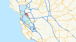
- California State Route 13
-
"CA 13" redirects here. For the congressional district, see California's 13th congressional district.For the original Sign Route 13, see California State Route 13 (1934).
State Route 13
Route information Defined by S&HC § 313 Maintained by Caltrans Length: 9.73 mi[2] (15.659 km) Existed: 1964 renumbering[1] – present Major junctions South end:  I-580 in Oakland
 SR 24 in Oakland
 SR 123 in Berkeley
North end:  I-80 / I-580 in Berkeley
Highway system State highways in California(list • pre-1964)
History • Unconstructed • Deleted • Freeway • Scenic←  SR 12
SR 12SR 14  →
→State Route 13 (SR 13) is a state highway in California. It is a short loop in Alameda County currently built from Interstate 580 in Oakland to Interstate 80/Interstate 580 in Berkeley.
It consists of three contiguous segments: the Warren Freeway from I-580 to State Route 24 in Oakland; Tunnel Road, a narrow two-lane road to Claremont Avenue in Berkeley; and Ashby Avenue, a main east–west street through south Berkeley to I-80/I-580.
Contents
Route description
SR 13 is part of the California Freeway and Expressway System.[3] SR 13 is known as the Warren Freeway from Route 24 to Route 580, as named by Assembly Concurrent Resolution 96, Chapter 166 in 1957.[4]
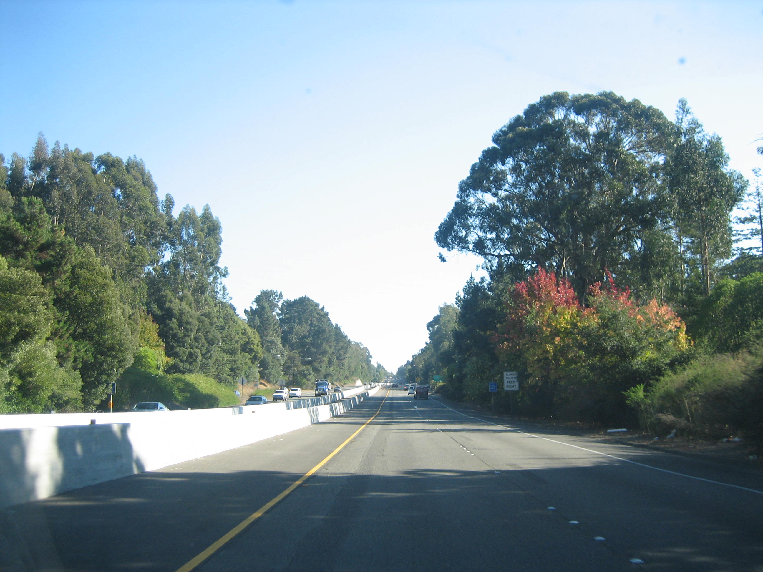
The route currently begins at Interstate 580 near Mills College in East Oakland and continues north as the Warren Freeway, named after former California Governor and U.S. Supreme Court Chief Justice Earl Warren. The four-lane freeway takes a largely straight path as it runs through a scenic valley, part of which spans between Piedmont and Oakland's Montclair Village. This valley is a rift valley created by the Hayward Fault Zone, and the entire freeway lies within the earthquake fault zone of the Hayward Fault. In the event of a major earthquake on the fault, this section of SR 13 may sustain heavy damage. Numerous overpasses have recently undergone extensive seismic retrofitting.
The city of Piedmont perches on the west-facing hills, which give an imposing shadow over the highway at sunset. The tall trees on the highway's side make the highway appear narrower, and until late 2004, a dense group of trees also lined most of the highway's median. For most of the day, the freeway experiences only modest traffic, which makes it a speedy bypass around downtown Oakland. Much of the traffic on this highway comes from SR 24's commute hour congestion backing up onto SR 13 northbound via the exchange between the highways. On a clear day, the Oakland segment of the freeway offers some spectacular views of the San Francisco Bay Area.
 The Warren Freeway portion of State Route 13 between Joaquin Miller Road and Redwood Road.
After going through an interchange with State Route 24 (completed August 1999) near the entrance to the Caldecott Tunnel, however, SR 13 takes drastic changes in its quality and capacity. The freeway ends at an uphill junction and the route is defaulted onto Tunnel Road, a much more narrow two-lane road that bends to the west and winds downhill. Upon reaching the foot of the hill, Tunnel Road becomes Ashby Avenue, a markedly urban (and very busy) two-lane street with an east–west routing. Entering Berkeley, UC Berkeley is north on Telegraph Avenue, while a BART station is located at Adeline Street. Past San Pablo Avenue (SR 123), Route 13 (as Ashby Avenue) runs through a more modest neighborhood before reaching its current end at Interstate 80/Interstate 580.
History
SR 13 was created to accommodate the construction of the Grove-Shafter Freeway, now designated State Route 24. Before the construction of the Grove-Shafter, Ashby Avenue was State Route 24, while the balance of the route of today's Warren Freeway was not a designated state highway. The main thoroughfare through the Montclair District in those days was Mountain Blvd.
State Route 13 was formed out of the 1964 state highway renumbering. Before its designation, it was known as several different legislative route numbers, including 258 from Interstate 580 to present-day SR 61, and 227 from Warren Boulevard to U.S. Route 50. This latter segment was not finished in 1963 and only existed from SR 24 to Joaquin Miller Road. However, the finished portion along Warren Boulevard was commissioned as part of the state highway system in 1947.
The portion of SR 13 between SR 24 and I-80 was known as Sign Route 24; however, it was legislatively designated as Route 206 since 1935. The portion between I-80 and SR 61 was also part of Legislative Route 206 and was commissioned into the state highway system in 1959.[1]
Route 13 was to have been a freeway bypass of Oakland and Berkeley and would have extended south from its present end to the Nimitz Freeway (Route 880). (State law describes an even longer Route 13, which would start further south at Route 61 and end at an unconstructed part of Route 61 west of Emeryville. The latter end would require an interchange over water. However, local resistance to further freeway construction in Oakland prevented the extension. Similar resistance in Berkeley has kept Route 13 from being built as a freeway north of Route 24, hence its role as a surface street.
In August 2004, Caltrans began replacing the median's original metal guardrails with a new wall along the 3.5-mile (5.6 km) stretch of SR 13 between SR 24 and I-580. This allowed road crews to drive street-sweeping vehicles along the shoulders throughout the week, rather than sending people to pick up trash by hand. However, residents frequenting SR 13 have said that the median appears to be filled with fewer trees and bushes than prior to Caltrans construction. These trees once densely lining the median have long supplemented the lush vegetation on both sides of the highway to beautify this scenic route. [5]
Major intersections
- Note: Except where prefixed with a letter, postmiles were measured in 1964, based on the alignment as it existed at that time, and do not necessarily reflect current mileage.
The entire route is in Alameda County.
Location Postmile
[2][6][7]Exit
[8]Destinations Notes Oakland 4.26 1A I-580 east (MacArthur Freeway) – Hayward, StocktonSouthbound exit and northbound entrance 26 Seminary Avenue Southbound exit and northbound entrance 1B To I-580 west (MacArthur Freeway) – Downtown Oakland, San FranciscoSouthbound exit and northbound entrance 5.01-
5.391C Carson Street, Redwood Road Signed as exit 1 northbound 6.47 2 Joaquin Miller Road, Lincoln Avenue 7.40 3 Park Boulevard 8.30 4 Moraga Avenue, Thornhill Drive 9.07 5A Broadway Terrace Signed as exit 5 southbound R9.62 5B SR 24 east (Grove-Shafter Freeway) – Walnut Creek, ConcordNo southbound exit R9.62 5C SR 24 west (Grove-Shafter Freeway) – OaklandNorthbound left exit and southbound entrance North end of freeway Berkeley 11.61 Telegraph Avenue 12.24 Adeline Street 13.18 SR 123 (San Pablo Avenue) – Albany, Oakland13.93 I-80 / I-580 (Eastshore Freeway) – Richmond, Sacramento, San FranciscoInterchange; northbound exit and southbound entrance 1.000 mi = 1.609 km; 1.000 km = 0.621 mi
Concurrency terminus • Closed/Former • Incomplete access • UnopenedReferences
- ^ a b California Highways: State Route 13
- ^ a b California Department of Transportation, State Truck Route List (XLS file), accessed January 2008
- ^ CA Codes (shc:250-257)
- ^ 2007 Named Freeways, Highways, Structures and Other Appurtenances in California. Caltrans. pp. 78. http://www.dot.ca.gov/hq/tsip/hseb/products/Named_Freeways.pdf. Retrieved 2007-03-28.
- ^ Web Comments
- ^ California Department of Transportation, Log of Bridges on State Highways, July 2007
- ^ California Department of Transportation, All Traffic Volumes on CSHS, 2006
- ^ California Department of Transportation, California Numbered Exit Uniform System, State Route 13 Freeway Interchanges, I-580 Eastbound Retrieved on 2009-02-05 (Note: The exit number for Seminary Avenue is used from I-580 mileage, but the number is signed on SR 13).
External links
- California @ WestCoastRoads.com - State Route 13
- Caltrans: Route 13 highway conditions
- California Highways: Route 13
San Francisco Bay Area Freeways Italics denote former routes.Interstates and U.S. Routes I-80 (James Lick / Eastshore / San Francisco Skyway) · US 101 (South Valley / Bayshore / Redwood Highway / Central) · I-238 · I-280 (Junipero Serra / Southern / Sinclair) · I-380 (Kopp) · CA 480 (Embarcadero) · I-580 (MacArthur) · I-680 (Sinclair) · I-780 · I-880 (Nimitz Freeway) · I-980 (Grove-Shafter)
California State Routes CA 1 (Cabrillo Highway) · CA 4 (John Muir Parkway) · CA 12 (Burbank Freeway) · CA 13 (Warren Freeway) · CA 17 (Santa Cruz Highway) · CA 24 (Grove-Shafter Freeway) · CA 29 (Vallejo-Napa Freeway) · CA 37 (Sears Point Freeway/Marine World Parkway) · CA 84 (Dumbarton Bridge) · CA 85 (West Valley Freeway) · CA 87 (Guadalupe Freeway) · CA 92 (San Mateo-Hayward Bridge/Younger Freeway) · CA 160 (Antioch Bridge) · CA 237 (South Bay Freeway) · CA 242 (Concord Freeway)Named interchanges Bridges Golden Gate Bridge · San Francisco – Oakland Bay Bridge · San Mateo – Hayward Bridge · Dumbarton Bridge · Richmond – San Rafael Bridge · Carquinez Bridge · Benicia–Martinez Bridge · Antioch BridgeSee also Categories:- State highways in California
- San Francisco Bay Area freeways
- Roads in Alameda County, California
- Transportation in Oakland, California
- Berkeley, California


Wikimedia Foundation. 2010.