- Mullaghanish
-
Mullaghanish Mullach an Ois 
Transmitter towers at MullaghanishElevation 694 m (2,277 ft) Listing Marilyn, Hewitt Translation summit of the deer (Irish) Location Location Cork,  Ireland
Range Derrynasaggart Mountains Topo map OSi Discovery 79 OSI/OSNI grid W214827 Mullaghanish (Irish: Mullach an Ois) is a mountain located just northeast of Ballyvourney in County Cork, Ireland. It is home to one of RTÉ's main transmitters, as well as some other mobile phone and independent radio stations.
Television and Radio services are all broadcast from this site to serve the southwest of Ireland, namely counties Cork, Kerry and Limerick. It is operated by RTÉ NL a wholly owned subsidiary of RTÉ.
The mast of the facility is 152.4 metres ( 500 ft) tall. A second mast was built ( see discusion)
Television
Both of RTÉ's television services as well as those from TV 3 and TG 4 are broadcast from Mullaghanish at a max ERP of 220kW for the VHF signals and at 500kW for the UHF signals.
The frequencies (and aerial polarisation) for Mullaghanish analogue TV are as follows:
- VHF D / 175.25 MHz (Vertical) - RTÉ ONE
- VHF G / 199.29 MHz (Vertical) - RTÉ TWO
- UHF 27 / 519.25 MHz (Horizontal) - TV 3
- UHF 31 / 551.25 MHz (Horizontal) - TG4
Saorview (Irish Digital Terrestrial TV) is broadcast in the MPEG-4 standard. From Mullaghanish it is on UHF 21 (474 MHz). The 4 main TV channels along with 3e and addtional RTE TV services and all RTÉ radio services are currently being broadcast on Saorview. UHF channel 24 (498MHz) is planned for MUX2 and channels 25 and 28 were also planned for future use. A 'Group A' (Red colour code) or wideband UHF aerial, (horizontally polarised) will cover all planned DTT and the two analogue UHF channels transmitted from Mullaghanish.
Radio
All of RTÉ's radio services are broadcast from Mullaghanish at a max ERP of 160kW.
The frequencies of all FM radio services transmitted from Mullaghanish is as follows;
- 90.0 FM - RTÉ Radio 1
- 92.2 FM - RTÉ 2fm
- 94.4 FM - RTÉ Raidió na Gaeltachta
- 97.0 FM - Radio Kerry
- 99.6 FM - RTÉ lyric fm
- 101.8 FM - Today FM
- 107.4 FM - Newstalk
(all are vertically polarised)
-

Mullaghanish as taken from the N22 road on the Cork/Kerry county bounds.
-

Old and new masts
-

Cable tie down for stabilizing the mast
-

Base of Mast with Antennas and Comms Tower.
Mountains and hills of Munster List of mountains in Ireland Ballyhoura Mountains Carron Mountain • Seefin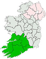
Boggeragh Mountains Caha Mountains Hungry Hill • SugarloafComeragh Mountains Derrynasaggart Mountains MullaghanishDingle Peninsula Benoskee • BrandonGaltee Mountains Galteemore • LyracappulIveragh Peninsula BenteeKnockmealdown Mountains Macgillycuddy's Reeks Mangerton Mountains Shehy Mountains Silvermine Mountains Slieve Mish Mountains Bartregaum • CaherconreeSlieve Miskish Mountains Others An Triúr Deirfiúr • Devil's Bit • Geokaun Mountain • Mount Gabriel • Mullaghareirk Mountains • Paps of Anu • Purple Mountain • Slieve Aughty • Slievecallan • Slievenamon
Coordinates: 51°59′29″N 9°08′42″W / 51.99131°N 9.14495°WSee also

This article about a mast or transmitter tower in Europe is a stub. You can help Wikipedia by expanding it.


