- Copetown, Ontario
-
Coordinates: 43°14′39.09″N 80°3′22.94″W / 43.2441917°N 80.0563722°W
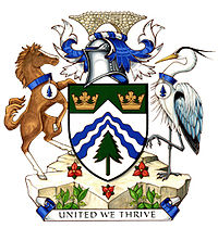 The Flamborough Community Coat of Arms
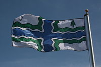 The Flag of Flamborough (Copetown is one of the most southern communities found in Flamborough
Copetown is a community that is east of Brantford[1] in the southern region of Ontario, Canada. Dundas Hill is located nearby, signifying its closeness to Dundas. There are a various number of golf courses within the local area.[2]
Contents
Summary
General summary
Residential areas are nearby; approximately 67% of the residents in Copetown have ownership of their home.[3] However, all family units that apply for mortgage applications in Copetown consists of married couples with the average age of a Copetown mortgage holder being 36 years of age.[3] Agriculture and services are two major industries in Copetown. There are several commercial enterprises in Copetown (including the general store located off Highway 52[4] and the feed mill off Railway Street). For the local senior citizens, there is a retirement community that is located in the village on the outskirts of Hamilton.[5]
The community is located within the 905 area code for telephones and the postal forward sortation area in this region is L0R.[6] Copetown also has a Lions Community Centre which is considered to be a service club for adults.[7] Meetings take place first and third Monday during the months of September through June at 7 o'clock in the evening.[7] Membership is required and the official language of the organization is English.[7] The Copetowns are located in Ward 11 of the regional Lions Association and elections take place annually in April.[7]
From the CN/VIA Railway, one can see the Feed Mill after the bridge. This location is actually where the old Copetown station used to be prior to closing due to lack of service. There is no high speed Internet for those who live in Copetown, other than the Internet supplied to the school. All Internet has to come via telephone (dial-up Internet), from satellite or wireless Internet. In addition to this, Copetown is a short drive to Flamboro Downs, which is to the east. Copetown is located roughly ten kilometres from downtown Dundas. The centre of Copetown is the four-way stop at the intersection between Highway 52 and Governors Road. The TH&B railway used to run through Copetown by way of Old Highway 99, Slote Road and Highway 52 until it was closed in the late 1970s.
Copetown also had its own railway station, which too was closed in 1970s and turned into the local wholesale feed mill now known as Quick Feeds Ltd., which is owned by Mr. David Quick and currently employs three people.[8] Queen's Rangers Elementary School was built in 1958, named after the rangers who had worked in the area.
Distance to nearby cities
- Burlington - 15 miles
- Oakville - 25 miles
- Brantford - 25 miles
- Milton - 30 miles
- Mississauga - 35 miles
- Toronto - 40 miles
See also
References
- ^ "Railfan Copetown". Railfan. http://railfan.ca/Copetown.html. Retrieved 2008-09-08.
- ^ "Local golf course information". Ontario Golf. http://www.ontgolf.ca/querydetail.php?id=719. Retrieved 2008-09-08.
- ^ a b "Copetown Mortgages". Canada Equity. http://www.canequity.com/ontario/copetown-mortgages.htm. Retrieved 2008-09-08.
- ^ "Copetown General Store information". Canpages. http://www.profilecanada.com/companydetail.cfm?company=http://www.canpages.ca/page/ON/dundas/copetown-general-store/4464975.html. Retrieved 2008-10-10.
- ^ "Woodland Estates". Woodland Estates Inc.. http://www.woodlandsestates.ca/. Retrieved 2008-10-10.
- ^ "Postal/Area Code Information". Postal Code Download. http://www.postalcodedownload.com/L0R/1J0/index.html. Retrieved 2008-10-07.
- ^ a b c d "Copetown Lions Club Information". Inform Hamilton. http://www.inform.hamilton.ca/details.asp?RSN=67249. Retrieved 2008-10-10.
- ^ "Canadian Business Directory of Companies". Profile Canada. http://www.profilecanada.com/companydetail.cfm?company=2377036_Quick_Feeds_Copetown_Feed_Mill_Copetown_ON. Retrieved 2008-10-10.
External links

Aldershot, Oakville, Toronto Brantford, Woodstock, Ingersoll, London, Glencoe, Chatham–Kent, Windsor 
Dundas, Hamilton  Copetown

Lake Erie Categories:- Neighbourhoods in Hamilton, Ontario


Wikimedia Foundation. 2010.