- North Santiam River
-
North Santiam River  North Santiam River at Niagara County Park
Name origin: Kalapuya tribe that lived near the river until removal to the Grande Ronde Reservation[1] Country United States State Oregon County Linn and Marion Source Santiam Lake - location Cascade Range, Mount Jefferson Wilderness, Linn County, Oregon - elevation 5,133 ft (1,565 m) [2] - coordinates 44°28′39″N 121°53′04″W / 44.4775°N 121.88444°W [3] Mouth Santiam River - location Willamette Valley, Marion County, Oregon - elevation 217 ft (66 m) [3] - coordinates 44°41′12″N 123°00′24″W / 44.68667°N 123.00667°W [3] Length 92 mi (148 km) [4] Basin 766 sq mi (1,984 km2) [4] Discharge for Mehama, 38.7 miles (62.3 km) from the mouth - average 3,371 cu ft/s (95 m3/s) - max 76,600 cu ft/s (2,169 m3/s) - min 420 cu ft/s (12 m3/s) 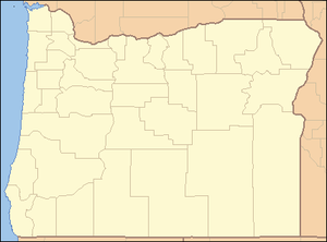
 Location of the mouth of the North Santiam River in Oregon
 North Santiam River near Detroit
 Big Cliff Dam on the North Santiam River
The North Santiam River is a 92-mile (148 km) tributary of the Santiam River in western Oregon in the United States.[4] It drains 766 square miles (1,980 km2) of the Cascade Range on the eastern side of the Willamette Valley east of Salem.[4]
It rises in the high Cascades in eastern Linn county, northwest of Three Fingered Jack in the Willamette National Forest. It flows north through the mountains past Marion Forks, receiving the drainage from the western slope of Mt. Jefferson. Near Mt. Jefferson it turns sharply west, descending through a canyon past Idanha and Detroit to Niagara County Park where the valley begins to widen and some agriculture use begins. Continuing west, the river flows past Gates, Mill City and Mehama. It emerges through the foothills into the Willamette Valley near Stayton, then flows 15 miles (24 km) southwest through the valley where it joins the South Santiam River to form the Santiam River. The confluence is approximately 10 miles (16 km) east of the confluence of the Santiam and the Willamette River.
It is impounded by Detroit Dam in the mountains west of Detroit to form Detroit Lake for flood control. Detroit Lake State Park is located along the northern shore of the lake.
In the 19th century, the canyon of the North Santiam River provided a formidable obstacle to settlers. The construction of a railroad in 1887 opened up the canyon to settlement and logging of the surrounding mountains.
Contents
Natural history
The headwaters of Marion Creek, a tributary of the North Santiam River, originate at Marion Lake, which is a location of many wildlife species. This headwaters area is a breeding location for a number of amphibians including the rough-skinned newt.[5] The North Santiam river is a location chosen by a number of anglers because of its fishing quality.[6]
Watershed
Ten cities draw their drinking water from the North Santiam watershed: Detroit, Gates, Indanha, Jefferson, Lyons, Mehama, Mill City, Salem, Stayton, and Turner.[7]
References
- ^ McArthur, Lewis A.; McArthur, Lewis L. (2003). Oregon Geographic Names (Seventh ed.). Portland, Oregon: Oregon Historical Society Press. p. 848. ISBN 0-87595-277-1.
- ^ Google Earth elevation for GNIS coordinates
- ^ a b c "North Santiam River". Geographic Names Information System (GNIS). United States Geological Survey. November 28, 1980. http://geonames.usgs.gov/pls/gnispublic/f?p=gnispq:3:::NO::P3_FID:1147060. Retrieved July 25, 2009.
- ^ a b c d "The Watershed". North Santiam Watershed Council. http://www.nsantiamwatershed.org/the-watershed/. Retrieved February 27, 2011.
- ^ Hogan, C. Michael (2008). "Rough-skinned Newt (Taricha granulosa)". Globaltwitcher. http://www.globaltwitcher.com/artspec_information.asp?thingid=43182.
- ^ Shewey, John (2007). Complete Angler's Guide to Oregon: A Wilderness Adventures Press Angler's Guidebook. Wilderness Adventures Press. ISBN 9781932098310.
- ^ "Current Water Source". City of Salem. http://www.cityofsalem.net/DEPARTMENTS/PUBLICWORKS/ADMINISTRATION/UTILITYPLANNING/SALEMWATERPLANS/Pages/CurrentWaterSource.aspx. Retrieved 2011-02-28.
External links
Categories:- Rivers of Oregon
- Landforms of Marion County, Oregon
- Landforms of Linn County, Oregon
- Willamette National Forest


Wikimedia Foundation. 2010.