- Monocacy National Battlefield
-
Monocacy National Battlefield IUCN Category V (Protected Landscape/Seascape)Map of the United States

Location Frederick County, Maryland, USA Nearest city Frederick, Maryland Coordinates 39°22′16″N 77°23′31″W / 39.37115°N 77.39208°WCoordinates: 39°22′16″N 77°23′31″W / 39.37115°N 77.39208°W Area 1,647 acres (6.67 km2) Established October 21, 1976 Visitors 17,985 (in 2005) Governing body National Park Service  View of battlefield
Monocacy National Battlefield is a unit of the National Park Service, the site of the Battle of Monocacy Junction in the American Civil War fought on July 9, 1864. The battlefield straddles the Monocacy River southwest of the city of Frederick, Maryland. The battle, labeled "The Battle That Saved Washington," was one of the last the Confederates would carry out in Union territory. The two opposing leaders were General Jubal Early, fighting for the South, and General Lew Wallace, fighting for the North.
 Best Farm, at Monocacy National Battlefield
Monacacy National Battlefield is located in the center of a region with a number of other Civil War battlefields and sites. It is located on Maryland State Highway 355 (Urbana Road) a few miles southeast of the city of Frederick. Nearby Interstate 70 leads westward to Antietam National Battlefield and U.S. Route 15 leads northward to the Gettysburg Battlefield. To the south on U.S. 15 is the battlefield of Balls Bluff. Monacacy National Battlefield is 50 miles (80 km) west of Baltimore and 44 miles (71 km) northwest of Washington D.C..
Much of the Monocacy battlefield remained in private hands for over 100 years after the Civil War. In 1928, Glenn Worthington, the owner of a large portion of the northern segment of the battlefield, petitioned Congress to create a National Military Park at Monocacy. Though the bill passed in 1934, the battlefield languished for nearly 50 years before Congress appropriated funds for land acquisition. Once funds were secured, 1,587 acres (6 km2) of the battlefield were acquired in the late 1970s and turned over to the National Park Service for maintenance and interpretation. The historic Thomas Farm, scene of some of the most intense fighting, was acquired by the National Park Service in 2001, and is currently subject to a life estate. Preservationists lost fights in the 1960s and 1980s when Interstate 270 was constructed and later widened, bisecting a portion of the battlefield.
In the decades following the battle, a few veterans organizations placed commemorative markers to specific units on the battlefield, including the 14th New Jersey (dedicated in 1907), 87th Pennsylvania Infantry, and Vermont markers. In the years that have followed, other monuments have been added, including the Confederate Monument and Maryland Centennial Monument near the Best farm (the site where Union soldiers discovered Robert E. Lee's lost Special Order 191 during the 1862 Maryland Campaign). The National Park Service has since added wayside interpretive markers throughout the park.
The visitor center has been relocated from the historic Gambrill Mill to a new facility on the west side of the Monocacy River. It offers an electric map orientation program, an interactive computer program, interpretive displays, and artifacts of the battle. The visitor center is the starting point for a self-guided four-mile (6 km) auto tour and 1/2 mile (800 m) loop walking trail. National Park Service rangers and volunteers host battle walks, special programs, an auto tour and special events throughout the summer season. The interpretive Worthington Farm Trail, a pair of loops (one nearly two miles (3 km) long, the other 1.6 miles (2 km)) on the northern portion of the battlefield, allows the visitor to walk parts of the battlefield and explore the native flora of the region.
The National Park Service has recently established a General Management Plan to further interpret the area and acquire additional land if funding can be secured.
See also
- L'Hermitage Slave Village Archeological Site at the Best Farm, a pre-Civil War plantation founded by immigrants from Haiti
External links
Protected Areas of Maryland Federal Blackwater • Eastern Neck • Martin • Patuxent Research Refuge • Susquehanna RiverState Assateague • Big Run • Bill Burton Fishing Pier State Park • Calvert Cliffs • Casselman River Bridge • Chapel Point • Cunningham Falls • Dans Mountain • Deep Creek Lake • Elk Neck • Fort Frederick • Fort Tonoloway • Gambrill • Gathland • Greenbrier • Greenwell • Gunpowder Falls • Hart-Miller Island • Herrington Manor • Janes Island • Jonas Green • Martinak • Matapeake • New Germany • North Point • Palmer • Patapsco Valley • Patuxent River • Pocomoke River • Point Lookout • Purse • Rocks • Rocky Gap • Rosaryville • Sandy Point • Seneca Creek • Smallwood • South Mountain • St. Clement's Island • St. Mary's River • Susquehanna • Swallow Falls • Tuckahoe • Washington Monument • Wye Oak
Cedarville • Chesapeake • Doncaster • Elk Neck • Garrett • Green Ridge • Pocomoke • Potomac-Garrett • Savage River • Seth • Stoney • Wicomico
Avondale • Belle Grove • Billmeyer • Bowen • Cedar Island • Cedar Point • Cheltenham • Chicamuxen • Dan's Mountain • Deal Island • Diersson • E.A. Vaughn • Earlville • Ellis Bay • Fairmount • Fishing Bay • Frederick City Watershed • Grove Farm • Gwynnbrook • Heater's Island • Hugg-Thomas • Idylwild • Indian Springs • Islands of the Potomac • Isle of Wight • Johnson • Le Compte • Linkwood • McKee-Beshers • Maryland Marine Properties • Millington • Mt. Nebo • Myrtle Grove • Nanticoke River • Old Bohemia • Pocomoke River • Prather’s Neck • Pocomoke Sound • Sideling Hill • Sinepuxent Bay • South Marsh • Strider • Taylors Island • Warrior Mountain • Wellington
Belt Woods • Dundee • Governor Parris N. Glendening • Mattawoman • Morgan Run • Severn Run • Soldiers Delight • Zekiah Swamp
County and
MunicipalParks & SanctuariesAcorn Park • Clifton Park • Constitution Park • Fort Smallwood Park • Jug Bay Wetlands Sanctuary • Lake Centennial • Lake Elkhorn • Lakelands Park • Oregon Ridge Park • Patterson Park • Robert E. Lee Memorial ParkNon-governmental Parks & SanctuariesBattle Creek Cypress Swamp Sanctuary • Merkle Wildlife Sanctuary • Sherwood Gardens • Somers Cove Marina • Sugarloaf Mountain • Western Maryland Rail Trail • Youghiogheny Scenic & Wild River
Maryland Department of Natural Resources (web): Maryland Park Service (web) and Maryland Forest ServiceU.S. National Register of Historic Places Topics Lists by states Alabama • Alaska • Arizona • Arkansas • California • Colorado • Connecticut • Delaware • Florida • Georgia • Hawaii • Idaho • Illinois • Indiana • Iowa • Kansas • Kentucky • Louisiana • Maine • Maryland • Massachusetts • Michigan • Minnesota • Mississippi • Missouri • Montana • Nebraska • Nevada • New Hampshire • New Jersey • New Mexico • New York • North Carolina • North Dakota • Ohio • Oklahoma • Oregon • Pennsylvania • Rhode Island • South Carolina • South Dakota • Tennessee • Texas • Utah • Vermont • Virginia • Washington • West Virginia • Wisconsin • WyomingLists by territories Lists by associated states Other Maryland in the American Civil War Battles 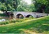 Burnside's Bridge at Antietam
Events Miscellaneous Museums People Maryland Civil War regiments · Soldiers and civiliansPlaces Antietam Battlefield · Burnside's Bridge · Fort McHenry · Heart of the Civil War Heritage Area · Loudon Park Cemetery · Monocacy Battlefield · Point Lookout State ParkCategories:- IUCN Category V
- National Battlefields and Military Parks of the United States
- National Historic Landmarks in Maryland
- American Civil War battlefields
- Maryland in the American Civil War
- American Civil War museums in Maryland
- Museums in Frederick County, Maryland
- United States National Park Service areas in Maryland
- Parks in Frederick County, Maryland


Wikimedia Foundation. 2010.