- Coloma, California
-
Coloma — census-designated place — Position in California.
 Coloma
Coordinates: 38°48′09″N 120°53′41″W / 38.8025°N 120.89472°WCoordinates: 38°48′09″N 120°53′41″W / 38.8025°N 120.89472°W Country  United States
State  California
County El Dorado Area[1] – Total 3.355 sq mi (8.690 km2) – Land 3.355 sq mi (8.690 km2) – Water 0 sq mi (0 km2) 0% Elevation[2] 764 ft (233 m) Population (2010) – Total 529 – Density 157.7/sq mi (60.9/km2) Time zone Pacific (PST) (UTC-8) – Summer (DST) PDT (UTC-7) ZIP Code GNIS feature ID 1655915; 2582981 U.S. Geological Survey Geographic Names Information System: Coloma, California; U.S. Geological Survey Geographic Names Information System: Coloma, California Coloma Sutters Mill 1850
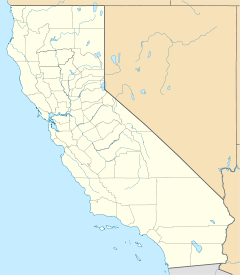

Nearest city: Placerville, California[3] Coordinates: 38°48′09″N 120°53′41″W / 38.8025°N 120.89472°WCoordinates: 38°48′09″N 120°53′41″W / 38.8025°N 120.89472°W Area: approx. 200 acres (0.81 km2)[4] Built: 1848 Governing body: State NRHP Reference#: 66000207 Significant dates Added to NRHP: October 15, 1966[5] Designated NHLD: July 4, 1961[6] Coloma (formerly, Colluma and Culloma)[7] is a census-designated place[8] in El Dorado County, California, USA. It is approximately 36 miles (58 km) northeast of Sacramento, California. Coloma is most noted for being the site where James W. Marshall first discovered gold in California, at Sutter's Mill on January 24, 1848,[3] leading to the California Gold Rush. Coloma's population is 529.
Today it a tourist attraction known for its ghost town and the centerpiece of the Marshall Gold Discovery State Historic Park. Coloma was designated a National Historic Landmark District on July 4, 1961[4][6]
It lies at an elevation of 764 feet (233 m).[9]
Contents
History
Coloma grew around Sutter's Mill following the discovery of gold.[7] A post office was established in 1849 under the name Culloma, changing it to Coloma in 1851.[7]
Ghost Town
While some people still live in this unincorporated area, Coloma is considered something of a ghost town, as civic buildings such as the jail have been abandoned and left to decay, and other buildings from its boom era (1847-1852) have been converted into museums and other historical displays. The foundation of Sutters Mill remains, along with a nearby reconstruction.[10]
Currently the town counts approximately 300 inhabitants, mainly consisting of some hopeful modern-day miners who pan the American River and others who run the museums and tours in the area. In fact, Coloma's economy is based on the money generated from its museums and students who take field trips with their schools to learn about the California Gold Rush. The local economy is also supported by various businesses and organizations tied to rafting and kayaking the South Fork American River. While the water sports are a seasonal industry, the class II-III rapids attract tourists from all over the world.
The name comes from the original natives' (Nisenan Native Americans) name for the valley Coloma is in: Cullumah, meaning "beautiful." Coloma is on the South Fork American River that runs through the valley, and was built on an original Native American village of Koloma.[11]
Demographics
The 2010 United States Census[12] reported that Coloma had a population of 529. The population density was 157.7 people per square mile (60.9/km²). The racial makeup of Coloma was 462 (87.3%) White, 4 (0.8%) African American, 3 (0.6%) Native American, 8 (1.5%) Asian, 0 (0.0%) Pacific Islander, 15 (2.8%) from other races, and 37 (7.0%) from two or more races. Hispanic or Latino of any race were 63 persons (11.9%).
The Census reported that 495 people (93.6% of the population) lived in households, 34 (6.4%) lived in non-institutionalized group quarters, and 0 (0%) were institutionalized.
There were 216 households, out of which 44 (20.4%) had children under the age of 18 living in them, 116 (53.7%) were opposite-sex married couples living together, 14 (6.5%) had a female householder with no husband present, 10 (4.6%) had a male householder with no wife present. There were 22 (10.2%) unmarried opposite-sex partnerships, and 2 (0.9%) same-sex married couples or partnerships. 51 households (23.6%) were made up of individuals and 20 (9.3%) had someone living alone who was 65 years of age or older. The average household size was 2.29. There were 140 families (64.8% of all households); the average family size was 2.64.
The population was spread out with 69 people (13.0%) under the age of 18, 31 people (5.9%) aged 18 to 24, 127 people (24.0%) aged 25 to 44, 200 people (37.8%) aged 45 to 64, and 102 people (19.3%) who were 65 years of age or older. The median age was 49.0 years. For every 100 females there were 115.9 males. For every 100 females age 18 and over, there were 120.1 males.
There were 251 housing units at an average density of 74.8 per square mile (28.9/km²), of which 153 (70.8%) were owner-occupied, and 63 (29.2%) were occupied by renters. The homeowner vacancy rate was 1.3%; the rental vacancy rate was 12.5%. 355 people (67.1% of the population) lived in owner-occupied housing units and 140 people (26.5%) lived in rental housing units.
Politics
In the state legislature Coloma is located in the 1st Senate District, represented by Republican Dave Cox, and in the 4th Assembly District, represented by Republican Ted Gaines. Federally, Coloma is located in California's 4th congressional district, which has a Cook PVI of R +11[13] and is represented by Republican Tom McClintock.
Images
-

Coloma street scene
-

Coloma street scene
References
- ^ U.S. Census
- ^ U.S. Geological Survey Geographic Names Information System: Coloma, California
- ^ a b NHL Writeup[dead link]
- ^ a b Allen W. Welts (February, 1970) (PDF). National Register of Historic Places Inventory-Nomination: Marshall Gold Discovery State Historic Park / Coloma. National Park Service. http://pdfhost.focus.nps.gov/docs/NHLS/Text/66000207.pdf. Retrieved 2009-06-22 and Accompanying one image, from 1850sPDF (213 KB)
- ^ "National Register Information System". National Register of Historic Places. National Park Service. 2007-01-23. http://nrhp.focus.nps.gov/natreg/docs/All_Data.html.
- ^ a b "Coloma". National Historic Landmark summary listing. National Park Service. http://tps.cr.nps.gov/nhl/detail.cfm?ResourceId=113&ResourceType=District. Retrieved 2008-06-29.
- ^ a b c Durham, David L. (1998). California's Geographic Names: A Gazetteer of Historic and Modern Names of the State. Quill Driver Books. p. 468. ISBN 9781884995149.
- ^ U.S. Geological Survey Geographic Names Information System: Coloma, California
- ^ U.S. Geological Survey Geographic Names Information System: Coloma, California
- ^ NPS Red Book[dead link]
- ^ U.S. Geological Survey Geographic Names Information System: Koloma
- ^ All data are derived from the United States Census Bureau reports from the 2010 United States Census, and are accessible on-line here. The data on unmarried partnerships and same-sex married couples are from the Census report DEC_10_SF1_PCT15. All other housing and population data are from Census report DEC_10_DP_DPDP1. Both reports are viewable online or downloadable in a zip file containing a comma-delimited data file. The area data, from which densities are calculated, are available on-line here. Percentage totals may not add to 100% due to rounding. The Census Bureau defines families as a household containing one or more people related to the householder by birth, opposite-sex marriage, or adoption. People living in group quarters are tabulated by the Census Bureau as neither owners nor renters. For further details, see the text files accompanying the data files containing the Census reports mentioned above.
- ^ "Will Gerrymandered Districts Stem the Wave of Voter Unrest?". Campaign Legal Center Blog. http://www.clcblog.org/blog_item-85.html. Retrieved 2007-10-20.
External links
- Nine photosets of Coloma sites available by searching on "Coloma CA" here, at Historic American Buildings Survey
- Local visitor's guide
- Coloma Campground
U.S. National Register of Historic Places Topics Lists by states Alabama • Alaska • Arizona • Arkansas • California • Colorado • Connecticut • Delaware • Florida • Georgia • Hawaii • Idaho • Illinois • Indiana • Iowa • Kansas • Kentucky • Louisiana • Maine • Maryland • Massachusetts • Michigan • Minnesota • Mississippi • Missouri • Montana • Nebraska • Nevada • New Hampshire • New Jersey • New Mexico • New York • North Carolina • North Dakota • Ohio • Oklahoma • Oregon • Pennsylvania • Rhode Island • South Carolina • South Dakota • Tennessee • Texas • Utah • Vermont • Virginia • Washington • West Virginia • Wisconsin • WyomingLists by territories Lists by associated states Other Municipalities and communities of El Dorado County, California Cities 
CDPs Auburn Lake Trails | Cameron Park | Camino | Cold Springs | Coloma | Diamond Springs | El Dorado Hills | Georgetown | Grizzly Flats | Pollock Pines | Shingle Springs | Tahoma‡
Unincorporated
communitiesApex | Arroyo Vista | Aukum | Avinsino Corner | Balderson Station | Bonetti | Brandon Corner | Brela | Briarwood Canyon | Bryants | Buckeye | Buffalo Hill | Bullard | Caldor | Cambridge Oaks | Cameron Airpark Estates | Camino Heights | Camp Richardson | Campana | Cedar Grove | Clarksville | Claussenius | Cool | Coyoteville | Crescent Ridge Village | Croft | Crown Village | Darlington | Deer Park | Deer View | Ditch Camp Five | Dugan | Echo Lake | El Dorado | Emerald Bay | Equestrian Village | Fair Play | Fairbanks | Fallen Leaf | Five Mile Terrace | Flonellis | Fornis | Fountain Place | Franciscan Village | Frenchtown | Fresh Pond | Garden Valley | Gilberts | Glenridge Park | Gold Hill | Gold Ridge | Gold Trail Park | Governors Village | Green Springs Ranch | Green Springs Valley | Green Valley Acres | Greenwood | Griminger | Grizzly Peak | Happy Valley | Hickok Ranch | Hidden Valley | Highland Village | Jayhawk | Jones Place | Kelsey | Kingsville | Kiva Beach | Kyburz | La Cresta Village | Lake Hills Estates | Lake Valley | Lakeridge Oaks | Lakewood Sierra | Latrobe | Leonardi | Little Norway | Lotus | Lower Forni | Manzanita Acres | Marble Mountain | Mariemont | Marina Village | McConnel Place | McManus | Meadow Brook | Meeks Bay | Meiss | Melsons Corner | Meyers | Morrison | Motor City | Nashville | Nebelhorn | Newtown | North Placerville | Oak Creek Hills | Oak Ridge Village | Oak Tree Village | Old Fort Jim | Old Pino | Omo Ranch | Outingdale | Pacific | Pacific House | Park Village | Perks Corner | Phillips | Pilliken | Pilot Hill | Pino Grande | Pleasant Valley | Pomins | Quintette | Raffetto | Rancho del Sol | Rescue | Ridgeview Village | Riverton | Saint Andrews Village | Sciots Camp | Short Place | Shrub | Sierra Springs | Skinners | Sly Park | Smithflat | Soapweed | Somerset | Spanish Flat | Sprekelsville | Spring Creek | Spring Valley | Springfield Meadows | Stonegate Village | Strawberry | Summit Village | Sweeneys Crossing | Tallac Village | Tiger Lily | Twin Bridges | Tylers Corner | Upper Forni | Van Vleck | Virner | Volcanoville | Voss | Waterford Village | White Hall | Winterhaven Village | Zee Estates
Former
settlementsAurum City | Bamom | Bennett | Buckeye Flat | Canton | Canyon | Cedar Creek Camp | Chicken Flat | Chili Bar | Cincinnati | Cummings | Dogtown | Dufftown | Euchre Diggings | Flora's | Fornis | Frosts | Golden | Green Springs | Green Valley | Greenwood Camp | Higgins Point | Hitchcock Ranch | Indak | Jacobsen | Jurgens | Koloma | Lava | Lawrenceberg | Live Oak Bar | Middletown | Missouri House | Mormon Tavern | Onchomo | Opok | Peru | Pleasant Flat | Powningville | River Hill | Rodwell | Rubicon | Rubicon Lodge | Rubicon Springs | Sailors Flat | Saint Lawrence | Salmon Falls | Siwim Pakan | Slatington | Snyders Bar | Sportsmans Hall | Stag Flat | Stony Bar | Swift | Texas Bar | Tchikimisi | Union Flat | Uniontown | Uno | Urban | Wentworth Springs | Yalisumni | Youngs | Zodoc
Footnotes ‡This CDP also has portions in an adjacent county or counties
Greater Sacramento Counties Douglas (NV) · El Dorado · Nevada · Placer · Sacramento · Sutter · Yolo · Yuba
Major City Cities
and
towns100k–200k25k–100kArden Arcade · Auburn · Carmichael · Citrus Heights · Davis · Folsom · Florin · Laguna · Lincoln · North Highlands · Orangevale · Parkway-South Sacramento · Rancho Cordova · Rocklin · West Sacramento · Woodland · Yuba City
10k–25kCameron Park · El Dorado Hills · Fair Oaks · Foothill Farms · Galt · Gardnerville Ranchos (NV) · Granite Bay · Grass Valley · La Riviera · Linda · Marysville · North Auburn · Olivehurst · Placerville · Rosemont · Rio Linda · South Lake Tahoe · South Yuba City · Truckee · Vineyard
Sub-regions Gold Country · Lake Tahoe · Sacramento Valley · Sierra Nevada · Yuba-Sutter Area
Categories:- NRHP articles with dead external links
- Historic districts in California
- National Historic Landmarks in California
- Ghost towns in California
- Census-designated places in El Dorado County, California
- California Gold Rush
- Sacramento metropolitan area
- Former county seats in California
- Unincorporated communities in California
- Populated places established in 1849
-


Wikimedia Foundation. 2010.