- Cotswolds
-
"Cotswold" redirects here. For other uses, see Cotswold (disambiguation)."Cotswold Hills" redirects here. For the suburb of Toowoomba, Queensland, see Cotswold Hills, Queensland.
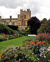
Cotswolds Area of Outstanding Natural Beauty  St James, a "wool" church, and the East Banqueting House, Chipping Campden
Country England Counties Gloucestershire, Oxfordshire, Somerset, Warwickshire, Wiltshire, Worcestershire. Highest point - location Cleeve Hill - elevation 330 m (1,083 ft) Plant Hawkweed, Pasque flower, Woolly Thistle, Yellow Archangel. Animal Badger, Goldfinch, Grey Wagtail, Treecreeper The Cotswolds are a range of hills in west-central England, sometimes called the "Heart of England", an area 25 miles (40 km) across and 90 miles (145 km) long. The area has been designated as the Cotswold Area of Outstanding Natural Beauty. The highest point in the Cotswolds range is Cleeve Hill at 1,083 ft (330 m),[1] 2.5 miles (4 km) to the north of Cheltenham.
The Cotswolds lie mainly within the ceremonial counties of Gloucestershire and Oxfordshire, but extend into parts of Wiltshire, Somerset, Worcestershire and Warwickshire. The hills give their name to the Cotswold local government district in Gloucestershire, which administers a large part of the area.
Contents
Toponymy
The name Cotswold is sometimes attributed the meaning "sheep enclosure in rolling hillsides",[2][3] incorporating the term "wold" meaning hills. The English Place-Name Society has for many years accepted that the term Cotswold is derived from Codesuualt of the twelfth century or other variations on this form, the etymology of which was given 'Cod's-wold', which is 'Cod's high open land'.[4] Cod was interpreted as an Old English personal name, which can be recognised in further names: Cutsdean, Codeswellan, and Codesbyrig, some of which date back to the eighth century AD.[5] It has subsequently been noticed that "Cod" could philologically derive from a Brittonic female cogname "Cuda", which is the name of a mother goddess recognised in the Cotswold region.[6][7]
Description


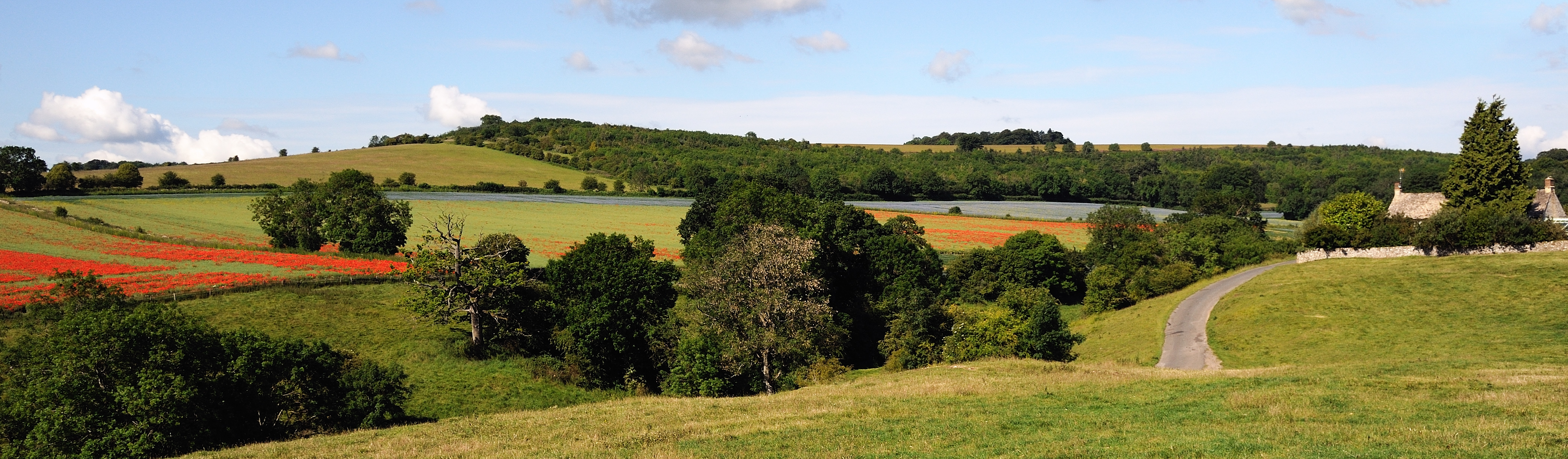
Rolling hills and farm fields that typify the Cotswolds landscape. The spine of the Cotswolds runs south west to north east through six counties, particularly Gloucestershire, west Oxfordshire, and south western Warwickshire. The northern and western edges of the Cotswolds are marked by steep escarpments down to the Severn valley and the Warwickshire Avon. This escarpment or scarp feature, sometimes called the Cotswold Edge, is a result of the uplifting (tilting) of the limestone layer, exposing its broken edge.[8] This is a cuesta, in geological terms. The dip slope is to the south east. On the eastern boundary lies the city of Oxford and on the west is Stroud. To the south-east the upper reaches of the Thames Valley and towns such as Lechlade, Tetbury and Fairford are often considered to mark the limit of this region. To the south the Cotswolds, with the characteristic uplift of the Cotswold Edge, reach beyond Bath, and towns such as Chipping Sodbury and Marshfield share elements of Cotswold character.
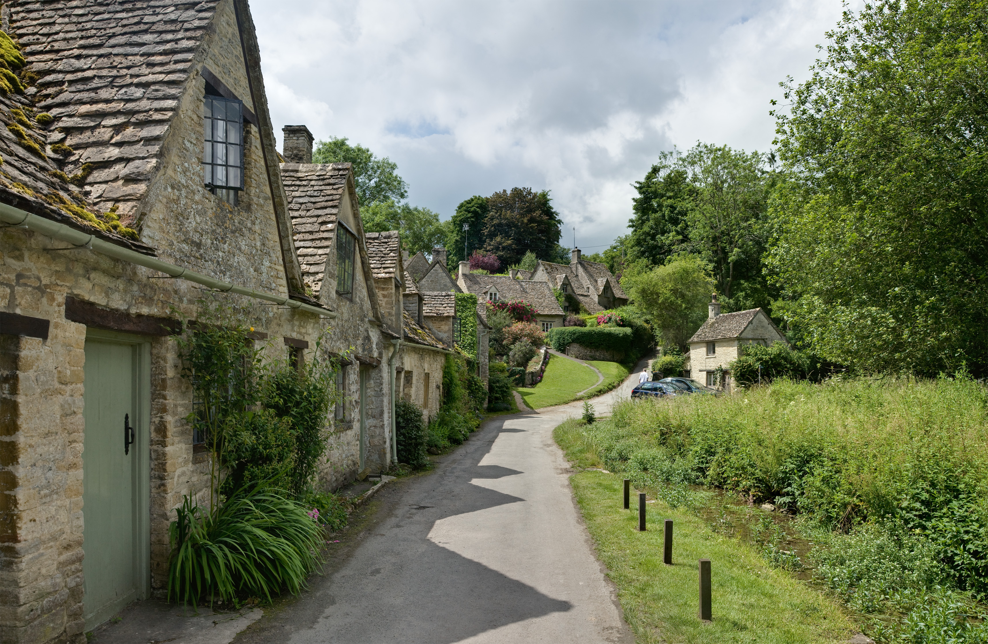
The area is characterised by attractive small towns and villages built of the underlying Cotswold stone (a yellow oolitic limestone).[8] This limestone is rich in fossils, in particular fossilised sea urchins. In the Middle Ages the wool trade made the Cotswolds prosperous. Some of this money was put into the building of churches so the area has a number of large handsome Cotswold stone "wool churches". The area remains affluent and has attracted wealthy people who own second homes in the area or have chosen to retire there.
Cotswold towns include Bourton-on-the-Water, Broadway, Burford, Chipping Norton, Cirencester, Moreton-in-Marsh, Northleach, Stow-on-the-Wold, Stroud and Winchcombe. The town of Chipping Campden is notable for being the home of the Arts and Crafts movement, founded by William Morris at the end of the 19th and beginning of the 20th centuries.[9] William Morris lived occasionally in Broadway Tower, a folly, now part of a country park.[10] Chipping Campden is also known for the annual Cotswold Olimpick Games, a celebration of sports and games dating back to the early 17th century.[11]
Area of Outstanding Natural Beauty
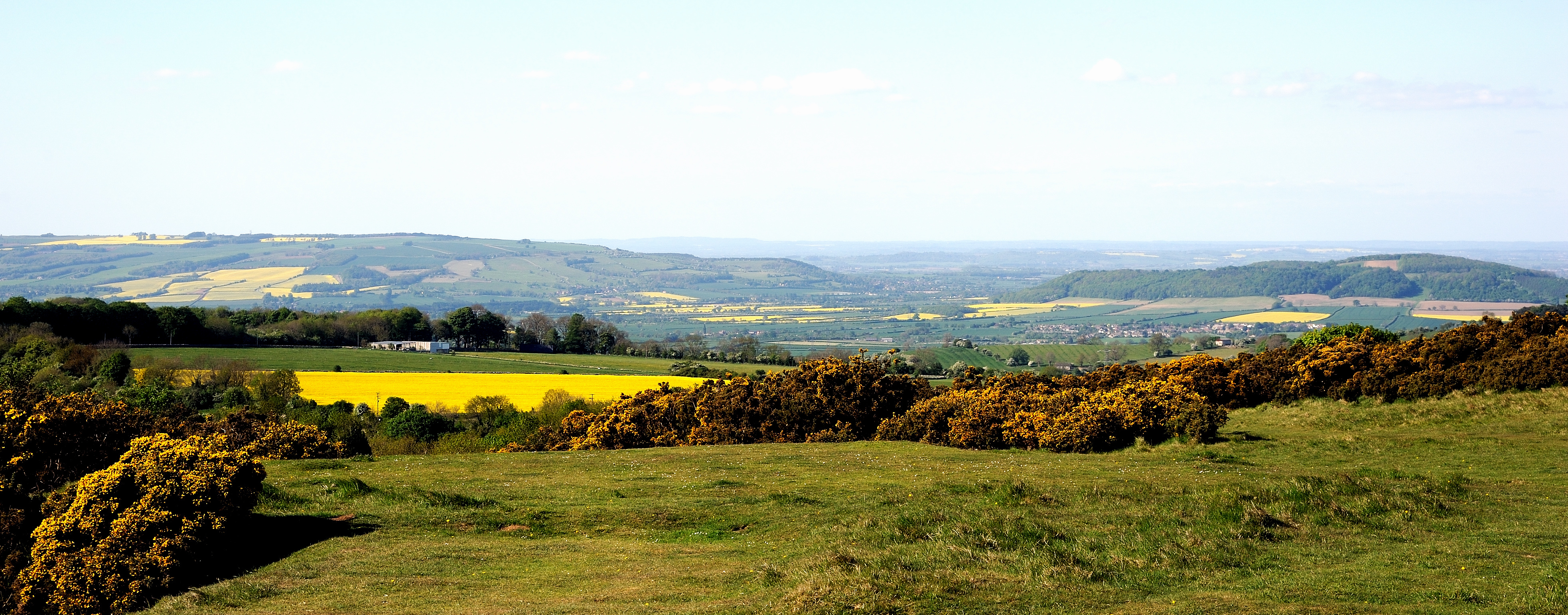
 From Cleeve Common, near the highest point in the Cotswolds
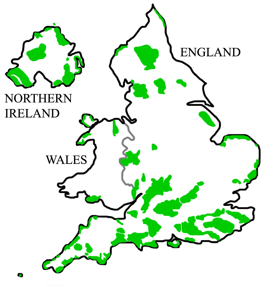
The Cotswolds were designated an Area of Outstanding Natural Beauty (AONB) in 1966, with an expansion on 21 December 1990 to 1,990 square kilometres (768 sq mi). In 1991, all AONBs were measured again using modern methods. The official area of the Cotswolds AONB increased to 2,038 square kilometres (787 sq mi). In 2000, the government confirmed that AONBs had the same landscape quality and status as National Parks.[12] The Cotswolds AONB, which is the largest in England and Wales, stretches from the border regions of South Warwickshire and Worcestershire, through West Oxfordshire and Gloucestershire and takes in parts of Wiltshire, and Bath and North East Somerset in the South. Gloucestershire County Council is responsible for 63 per cent of the AONB.[13]
The Cotswolds Conservation Board is the organisation that exists to conserve and enhance the AONB. Established in 2004, the board carries out a range of work from securing funding for 'on the ground' conservation projects to providing a strategic overview of the area for key decision makers, such as planning officials. The board is an independent organisation funded by Natural England and the 17 local authorities that sit within the AONB.[14]
While the beauty of the Cotswold AONB is intertwined with the villages that seem to almost grow out of the landscape, the Cotswolds were primarily designated an Area of Outstanding Natural Beauty for the rare limestone grassland habitats as well as the old growth beech woodlands that typify the area. These habitat areas are also the last refuge for many other flora and fauna with some so endangered they are protected under the Wildlife and Countryside Act 1981. Cleeve Hill, and its associated commons, is a fine example of a limestone grassland and it is one of the few locations where the Duke of Burgundy butterfly can still be found in abundance.[15] The uniqueness and value of the Cotswolds is engendered in the fact that five European Special Areas of Conservation, three National Nature Reserves and over 80 Sites of Special Scientific Interest are contained within the Cotswold AONB.[16]
The Cotswold Voluntary Wardens Service, now part of the Cotswolds Conservation Board, was established in 1968 to help conserve and enhance the area and now has over 300 wardens.
The Cotswold Way is a long-distance footpath, approximately 103 miles (166 km) long, running the length of the AONB mainly on the edge of the Cotswold escarpment with views over the Severn Valley and the Vale of Evesham.[17]
Principal settlements
 Bibury: a typical Cotswold Village
 Burford
- Bourton-on-the-Water
- Broadway, Worcestershire
- Burford
- Chipping Campden
- Chipping Norton
- Cirencester
- Malmesbury
- Moreton-in-Marsh
- Nailsworth
- Northleach
- Shipston-on-Stour
- Stow-on-the-Wold
- Tetbury
- Winchcombe
- Wotton-under-Edge
Bath, Cheltenham, Dursley, Gloucester and Stroud are larger urban centres that border on, or virtually surrounded by, the Cotswold AONB.
Noteworthy historical structures
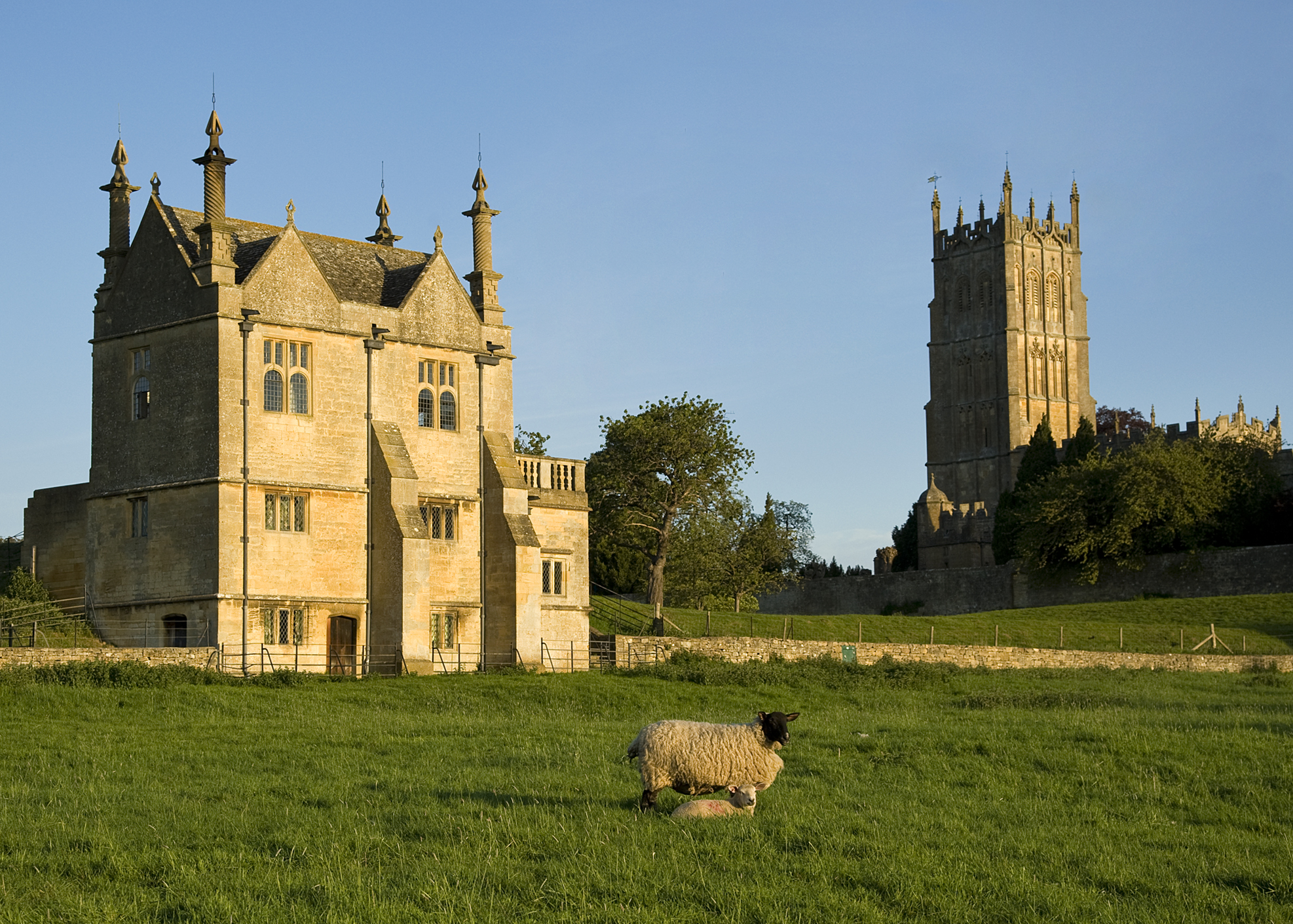
 The Secret Garden at Sudeley Castle
- Beverston Castle
- Calcot Manor
- Chavenage House
- Chedworth Roman Villa
- Cirencester Abbey
- Malmesbury Abbey
- Owlpen Manor
- Sudeley Castle
- Tetbury Market House
- Broadway Tower
- Corsham Court
Transport
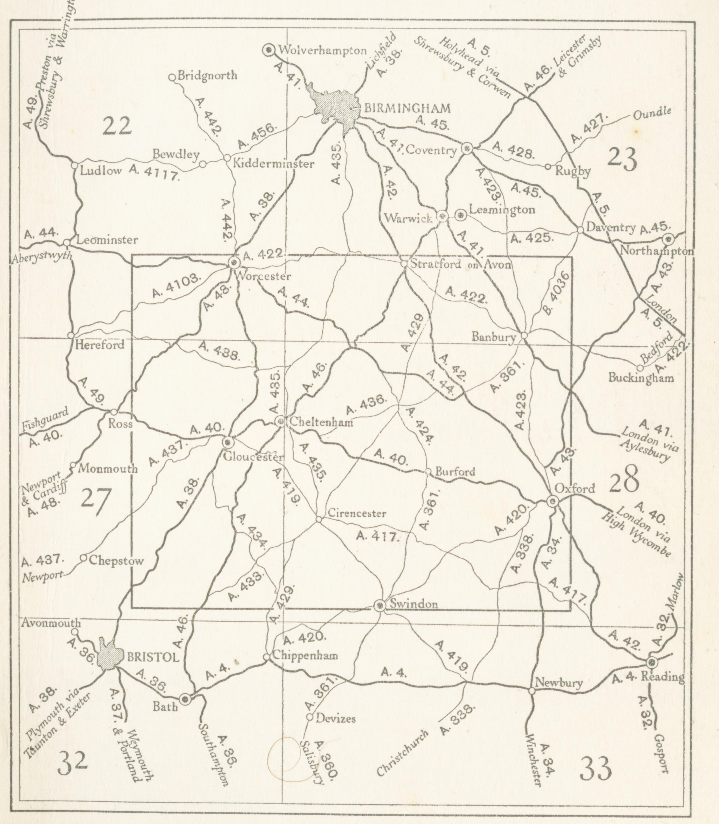
 Map of Cotswolds roads from 1933
The Cotswolds lies between the M5, M40 and M4 motorways. The main non-motorway roads through the area are the A46: Bath – Stroud – Cheltenham; the A419: Swindon – Cirencester – Stroud; the A429: Cirencester – Stow-on-the-Wold – Moreton-in-Marsh; and the A40: Oxford – Burford – Cheltenham. These all roughly follow the routes of ancient roads, some laid down by the Romans, such as Ermin Street and the Fosse Way.
The area is bounded by two major rail routes: in the south by the main Bristol–Bath–London High Speed line and in the west by the Bristol–Birmingham main line. In addition, the Cotswold Line runs through the Cotswolds from Oxford to Worcester, and the Golden Valley Line runs from Swindon to Gloucester, carrying high speed and local services.
Main-line, high-speed rail services to the big cities run from stations such as Bath, Swindon, Oxford, Cheltenham and Worcester. High-speed services to London are also available from Kemble station near Cirencester, Kingham station near Stow-on-the-Wold, Charlbury station and Moreton-in-Marsh station.
Cheltenham, which is located just West of the Cotswolds, is a hub for National Express coach services. There are local bus services across the area, but some are infrequent.
The Cotswolds in cultural life and media
The Cotswold region has inspired some of England's finest composers. In the early 1900s, Herbert Howells and Ivor Gurney used to go for long walks together over the hills and Gurney urged Howells to make the landscape, including the nearby Malvern Hills, the inspiration for his future work. True to his word, in 1916, Howells wrote his first major piece, the Piano Quartet in A minor, inspired by the magnificent view of the Malverns - it was dedicated to "the hill at Chosen (Churchdown) and Ivor Gurney who knows it".[18] Another contemporary of theirs, Gerald Finzi, lived in nearby Painswick. The film Better Things, directed by Duane Hopkins, is set in a small Cotswold village. The fictional Agatha Raisin lives in the fictional village of Carsely in the Cotswolds.
See also
- Areas of Outstanding Natural Beauty in England
- Geology of the United Kingdom
References
- ^ "Landscape". Cleeve Common. http://www.cleevecommon.org.uk/200702/about-land.html. Retrieved 12 December 2009.
- ^ Let's Go Britain
- ^ Charnock, Richard Stephen (1859). Local etymology: a derivative dictionary of geographical names. Houlston and Wright. pp. 76. http://books.google.com/books?id=apcmAAAAMAAJ.
- ^ Smith, A. H. 1964 The Place-Names of Gloucestershire, part 1: The Rivers and Road-names, the East Cotswolds, Cambridge, p.2
- ^ Smith A. H. 1964 The Place-Names of Gloucestershire part 2: The North and West Cotswolds, Cambridge pp.7-8
- ^ Yeates, S. J. 2008 The Tribe of Witches: The Religion of the Dobunni and the Hwicce pp.11-18
- ^ Yeates, S. J. 2006 River-Names, Celtic and Old English: their dual medieval and post-medieval personalities, Journal of the English Place-Name Society 38, pp.63-81
- ^ a b "Cotswold Stone". Cotswold Gateway. http://thecotswoldgateway.co.uk/cotswoldstone.htm. Retrieved 12 December 2009.
- ^ "History". Court Barn Museum. http://www.courtbarn.org.uk/history. Retrieved 6 April 2010.
- ^ "Broadway Tower". Cotswold website. http://www.cotswoldswebsite.com/broadway-tower.htm. Retrieved 12 December 2009.
- ^ "Origins of Robert Dover's Games". Olympick Games. http://www.olimpickgames.co.uk/contentok.php?id=862. Retrieved 12 December 2009.
- ^ "AONB". Cotswolds AONB. http://www.cotswoldsaonb.org.uk/?page=AONB. Retrieved 12 December 2009.
- ^ Cotswolds Natural England
- ^ "Cotswolds Conservation Board". Cotswolds AONB. http://www.cotswoldsaonb.org.uk/?page=ccb. Retrieved 12 December 2009.
- ^ "Natural Areas - 55 Cotswolds". Natural England. http://www.naturalareas.naturalengland.org.uk/science/natural/NA_Details.asp?NA_Id=55. Retrieved 6 May 2011.
- ^ "Understanding the Cotswold AONB". Cotswolds Area of Outstanding Natural Beauty. http://www.cotswoldsaonb.org.uk/?page=aonb. Retrieved 6 May 2011.
- ^ "Cotswold Way - About this trail". National Trail. http://www.nationaltrail.co.uk/Cotswold/text.asp?PageId=2. Retrieved 2007-06-30.
- ^ Long Remembered Hills How the English composers Ivor Gurney and Herbert Howells were influenced by the Gloucestershire countryside.
External links
- Cotswolds Tourist Board
- Cotswolds Area of Outstanding Natural Beauty website (Countryside Agency)
- Genealogy researcher pages of the Cotswolds includes 274 researcher pages, 715 census pages and 8000 images of 765 parish churches.
- Cotswolds travel guide from Wikitravel
East of England 
East Midlands North East North West South East South West Blackdown Hills | Cranborne Chase and West Wiltshire Downs | Cornwall | Cotswolds | Dorset | East Devon | Isles of Scilly | Mendip Hills | North Devon Coast | North Wessex Downs | Quantock Hills | South Devon | Tamar ValleyWest Midlands Yorkshire and Humber Categories:- Areas of Outstanding Natural Beauty in England
- Hills of Gloucestershire
- Hills of Oxfordshire
- Hills of Somerset
- Hills of Warwickshire
- Hills of Wiltshire
- Hills of Worcestershire
- Cotswolds
- Protected areas of Gloucestershire
- Protected areas of Oxfordshire
- Protected areas of Somerset
- Protected areas of Warwickshire
- Protected areas of Wiltshire
- Protected areas of Worcestershire


Wikimedia Foundation. 2010.