- Maghera
-
For the Romanian village, see Vârfu Câmpului.
Coordinates: 54°50′38″N 6°40′23″W / 54.844°N 6.673°W
Maghera Irish: Machaire Rátha 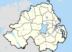
 Maghera
Maghera shown within Northern IrelandPopulation 3,711 (2001 Census) District Magherafelt County County Londonderry Country Northern Ireland Sovereign state United Kingdom Post town MAGHERA Postcode district BT46 Dialling code 028 Police Northern Ireland Fire Northern Ireland Ambulance Northern Ireland EU Parliament Northern Ireland UK Parliament Mid Ulster List of places: UK • Northern Ireland • County Londonderry Maghera (pronounced ma-hə-rah, from Irish: Machaire Rátha, meaning "plain of the ringfort") is a village in County Londonderry, Northern Ireland. Its population was 2,876 in 1991 and had risen to 3,711 in the 2001 Census. It provides the local commercial centre for the surrounding villages of Swatragh, Tobermore, Upperlands, Gulladuff and Knockcloghrim. It is also the educational centre for the surrounding area and St. Patrick's is one of the largest schools in Mid-Ulster.[citation needed]
The Slaughtneil/Carntogher area around the village is unique for being the only rural community in Ireland outside of the Gaeltacht where most primary school children are taught through the Irish language. Maghera also has parishes of Fallalea, Ranaghan and Glen. In the Roman Catholic parish church of St Patrick's there is a headstone remembering the large number of people who died during the Famine.
 Maghera town centre.
Contents
History
On 12 July 1830, Orange Institution parades led to confrontations between Orangemen and Ribbonmen in Maghera and Castledawson. Several Catholic homes were then burnt by Protestants following these clashes.[1]
The Troubles
Maghera suffered significant violence during the Northern Irish Troubles. In total, 14 people were killed, half of them members of the security forces and a further two as a result of family membership of the Ulster Defence Regiment. The Provisional Irish Republican Army were responsible for ten of the 14 deaths.
See also: The Troubles in Maghera Ulster Bank, Maghera.
Demographics
Maghera is classified as an intermediate settlement by the NI Statistics and Research Agency (NISRA) (i.e. with population between 2,250 and 4,500 people). On Census day (29 April 2001) there were 3,711 people living in Maghera. Of these:
- 28.6% were aged under 16 years and 13.3% were aged 60 and over
- 49.3% of the population were male and 50.7% were female
- 72.4% were from a Catholic background and 27.1% were from a Protestant background
- 3.9% of people aged 16–74 were unemployed.
For more details see: NI Neighbourhood Information Service
Places of interest
Notable buildings in Maghera include St. Lurach's Church, which was founded in the year 500AD, originally as a monastery. The town of Maghera grew up around this church. The importance of the monastery was such that Maghera was a Bishop’s seat in the 12th century and 13th century.[citation needed] However, the Church was allowed to fall into disrepair and is now a roofless ruin, and is maintained by the Environmental Heritage Service. Within the ruins, as an insert to the west wall is a sculpture of the crucifixion, which is thought to date from the 10th century - making it one of earliest representations of a cross in Ireland. St Lurach is also the saint of the town.[citation needed]
Transport
- Maghera railway station opened on 18 December 1880, closed for passenger traffic on 28 August 1950 and finally closed altogether on 1 October 1959.[2]
People
- Maghera is the birthplace of Charles Thomson, who emigrated to the United States where he became secretary of the Continental Congress. Thomson designed the Great Seal of the United States.
- Watty Graham was a local United Irishman who took part in the Irish Rebellion of 1798
- Children's author Eve Bunting was born in Maghera and later emigrated to the United States.
- Robert Hawthorne who won a Victoria Cross during the Indian Mutiny was from the town.
- Dr Henry Cooke, a noted theologian, was born at Maghera. A statue of Cooke called the "Black Man" (due to its former colour, when covered in soot) stands outside Royal Belfast Academical Institution in Belfast.
- James Lenox-Conyngham Chichester-Clark and his grandfather James Johnston Clark, both MPs for County Londonderry, were born here at Largantogher House.
- William Shiels (3 December 1848 — 17 December 1904), Australian colonial politician and 16th Premier of Victoria, was born at Maghera.
Education
There are 3 primary and 1 secondary school located in Maghera.
Primary schools
- St. Mary's Primary School, Glenview
- Maghera Controlled Primary School
- St. Patrick's Primary School, Glen
Secondary School
- St. Patrick's Co-Ed Comprehensive College is the largest school in the NEELB and one of the largest in Ulster.[citation needed]
- Maghera High School, which had served an intake mainly from the local Protestant population, was closed in 2009, after a protracted campaign by many in the local population to save it from closure. The majority of remaining pupils were transferred to nearby Magherafelt High School.
Sport
- The local Gaelic football club is Watty Graham's Gaelic Athletic Club.
- The local soccer team is Maghera Strollers F.C.
- The local golf Driving Range is located in Tobermore
- The local leisure centre is Maghera Leisure Centre located on the Coleraine road.
See also
- List of villages in Northern Ireland
- List of towns in Northern Ireland
- Market Houses in Northern Ireland
References
- ^ "Parades and Marches - Chronology 2: Historical Dates and Events". Conflict Archive on the Internet (CAIN). http://cain.ulst.ac.uk/issues/parade/chpa2.htm. Retrieved 28 January 2010.
- ^ "Maghera station". Railscot - Irish Railways. http://www.railbrit.co.uk/Ireland/Irish_railways.pdf. Retrieved 28 September 2011.
External links
Categories:- Towns in County Londonderry


Wikimedia Foundation. 2010.