- Olompali State Historic Park
-
Further information: Rancho Olompali
Olompali State Historic Park 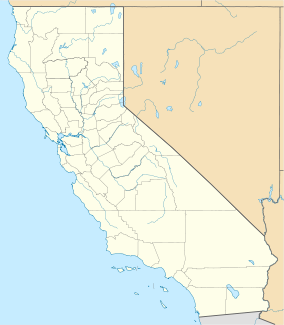

Location Marin County, California, USA Nearest city Novato, California Coordinates 38°9′9″N 122°34′11″W / 38.1525°N 122.56972°WCoordinates: 38°9′9″N 122°34′11″W / 38.1525°N 122.56972°W Area 700 acres (2.8 km2) Governing body State of California Reference #: 210 Olompali State Historic Park is a 700-acre (2.8 km2) park on the Marin Peninsula, 3.5 miles (5.6 km) north of Novato, California, USA, which overlooks the Petaluma River and San Pablo Bay. In 1977, the State of California purchased Rancho Olompali and made it into a state historical park. The foundations of two prehistoric adobe brick houses are preserved in the park. The Burdell two-story frame house, built in the 1870s serves as the ranger station. Associated ranch buildings include barns, a blacksmith shop, a saltbox house and a ranch superintendent's house.
Contents
Significance
The park is the site of the oldest house built north of the San Francisco Bay (California Historical Landmark #210), built in 1776 of adobe bricks by the Chief of the Olompolli tribe.[1] Camillo Ynitia was also the only Native American on the northern frontier to confirm and keep a large land grant for his tribe.[1]
History
Prehistoric and Native American era
The name "Olompali" comes from the Coast Miwok language and likely means "southern village" or "southern people".[2] The Coast Miwok village site of Olompali (historically spelled "Olompolli") dates back to about 500 AD.[3] Olompali had been a main center in 1200 AD, and might have been the largest native village in Marin County[2] For more, see Olompali.
An Elizabethan silver sixpence minted in 1567 was discovered in the park by archeologists, indicating that villagers may have had contact with Sir Francis Drake or with people who had traded with the early English explorer.[3] Many Miwok cultural artifacts have been identified during archaeological studies within the area of the present-day park, indicating this may have once been an important trade and cultural crossroads.
The oldest house built north of the San Francisco Bay was built here in 1776 by the Coast Miwok, out of adobe bricks, and owned by the chief of the Olompoli tribe Aurelio, who was the father of Camillo Ynitia. Camillo was known as the last Hoipu (Headman) of the Miwok community living at Olompali.[1]
Mexican-American era
In 1843, with the helpful petition of General Vallejo,[1] the Governor Manuel Micheltorena of Alta California granted this land to Camillo Ynitia, the acting Hoipu (Headman) of the village:
"Olompali #48, Marin Co., Grant of 2 sq. leagues made in 1843 by Gov. Micheltorena to Camilo Unitia [sic]. Patent for 8,877.48 acres (35.9259 km2) issued in 1862 to Camilo Unitia [sic] in T 3-4N, R 6-7W, MDM."
— California Ranchos: Patented Private Land Grants Listed by County, Shumway 1988:39
The newly secured grant of Rancho Olompali included Ynitia's father's historical house, the first abobe house built north of the San Francisco Bay, as well as his own adobe house.
Ynitia's adobe house was the site of the Battle of Olompali in June 1846 during the Bear Flag Revolt.[3]
Ynitia held onto the Olompali land title for 9 years, but in 1852 he sold most of the land to James Black of Marin for $5,200.[2][3] Black was to become one of the largest landowners of Marin county.[2] Ynitia retained 1,480 acres (6.0 km2) of Olompali called Apalacocha.
The Blacks and Burdells
In 1863, the land and adobe house passed from James Black to his daughter Mary (Black) Burdell and her husband Galen Burdell, a wealthy dentist.[1][3] Mary's son James transformed Olompali into a country estate, he built a 26-room mansion with a formal Victorian-style mansion that incorporated the foundations and rooms of Ynitio's adobe house.[2][4]
Jesuit retreat, commune and state park
The land and estate was eventually sold by the Burdell family to Court Harrington. Harrington in turn sold it to the University of San Francisco, to be used as a Jesuit retreat.[2][3]
"During the 1960s, the University of San Francisco sold Olompali several times. Each time, the buyers defaulted and the property reverted back to the university. The most famous tenant was the rock band Grateful Dead. During the Dead's brief stay it became a gathering place for San Francisco's rock musicians, including Janis Joplin and Grace Slick."[2]
In 1967, Don McCoy leased Olompali, and started a hippie commune there called The Chosen Family. A fire caused by faulty wiring eventually destroyed the mansion. Finally in 1977, the State of California purchased the land and turned it into the state park.[2][3]
Location
Olompali State Historic Park is located at 8901 Redwood Hwy., State Hwy 101 (P.M. 24.8), 3.5 miles (5.6 km) N of Novato. It is also listed on the National Register of Historic Places as Rancho Olompali.[5]
Notes
- ^ a b c d e University of California Irvine Camillo Ynitia, Coast Miwok (1803-1856) - Catholic, Rancho Grant Owner
- ^ a b c d e f g h Reutinger 1997.
- ^ a b c d e f g Olompali State Historic Park, Website 2008.
- ^ Mason, Jack. Early Marin. Petaluma, CA: House of Printing, 1971.
- ^ Search on NR.NPS.GOV website for Rancho Olompali[dead link]
Sources
- State of California, Office of Historical Preservation - Marin County landmarks
- California State Parks: Olompali State Historic Park, Website by California Department of Parks and Recreation, 2008.
- Olompali State Historic Park (pamphlet and map), by California Department of Parks and Recreation.
- Reutinger, Joan. Olompali Park Filled With History, The Coastal Post, Sept. 1997.
- Shumway, Burgess M., California Ranchos: Patented Private Land Grants Listed by County. San Bernardino, CA: The Borgo Press, 1988. ISBN 0-89370-935-2
Protected areas of California National Park System National Parks National Preserves National Monuments Cabrillo · Devils Postpile · Lava Beds · Muir Woods · Pinnacles · World War II Valor in the Pacific National MonumentNational Seashores National Historical Parks National Historic Sites National Memorials Port Chicago Naval MagazineNational Recreation Areas National Forests National Forests Angeles · Cleveland · Eldorado · Inyo · Klamath · Lassen · Los Padres · Mendocino · Modoc · Plumas · San Bernardino · Sequoia · Shasta-Trinity · Sierra · Six Rivers · Stanislaus · TahoeNational Wilderness
Preservation SystemAgua Tibia · Ansel Adams · Bucks Lake · Caribou · Carson-Iceberg · Castle Crags · Cucamonga · Desolation · Dick Smith · Dinkey Lakes · Emigrant · Golden Trout · Hoover · Inyo Mountains · Ishi · Jennie Lakes · John Muir · Kaiser · Marble Mountain · Mokelumne · Mount Shasta Wilderness · North Fork · San Gabriel · Sanhedrin · San Jacinto · San Rafael · Sespe · Siskiyou · Snow Mountain · South Fork Eel River · South Sierra · South Warner · Thousand Lakes · Trinity Alps · Ventana · Yolla Bolly-Middle Eel · YukiOther State Forests Boggs Mountain Demonstration · Ellen Pickett · Jackson Demonstration · Las Posadas · LaTour Demonstration · Mount Zion · Mountain Home Demonstration · Soquel Demonstration
National Wildlife Refuges Antioch Dunes · Bitter Creek · Blue Ridge · Butte Sink · Castle Rock · Clear Lake · Coachella Valley · Colusa · Delevan · Don Edwards San Francisco Bay · Ellicott Slough · Farallon · Guadalupe-Nipomo Dunes · Hopper Mountain · Humboldt Bay · Kern · Lower Klamath · Marin Islands · Merced · Modoc · Pixley · Sacramento · Sacramento River · Salinas River · San Diego Bay · San Diego · San Joaquin River · San Luis · San Pablo Bay · Seal Beach · Sonny Bono Salton Sea · Stone Lakes · Sutter · Tijuana Slough · Tule LakeState Wildlife Areas Wildlife Areas Antelope Valley · Ash Creek · Bass Hill · Battle Creek · Big Lagoon · Big Sandy · Biscar · Butte Valley · Buttermilk Country · Cache Creek · Camp Cady · Cantara/Ney Springs · Cedar Roughs · Cinder Flats · Collins Eddy · Colusa Bypass · Coon Hollow · Cottonwood Creek · Crescent City Marsh · Crocker Meadows · Daugherty Hill · Decker Island · Doyle · Dutch Flat · Eastlker River · Eel River · Elk Creek Wetlands · Elk River · Fay Slough · Feather River · Fitzhugh Creek · Fremont Weir · Grass Lake · Gray Lodge · Green Creek · Grizzly Island · Hallelujah Junction · Heenan Lake · Hill Slough · Hollenbeck Canyon · Honey Lake · Hope Valley · Horseshoe Ranch · Imperial · Indian Valley · Kelso Peak and Old Dad Mountains · Kinsman Flat · Knoxville · Laguna · Lake Berryessa · Lake Earl · Lake Sonoma · Little Panoche Reservoir · Los Banos · Lower Sherman Island · Mad River Slough · Marble Mountains · Mendota · Merrill's Landing · Miner Slough · Monache Meadows · Morro Bay · Moss Landing · Mouth of Cottonwood Creek · Napa-Sonoma Marshes · North Grasslands · O'Neill Forebay · Oroville · Petaluma Marsh · Pickel Meadow · Pine Creek · Point Edith · Putah Creek · Rector Reservoir · Red Lake · Rhode Island · Sacramento River · San Felipe Valley · San Jacinto · San Luis Obispo · San Luis Reservoir · San Pablo Bay · Santa Rosa · Shasta Valley · Silver Creek · Slinkard/Little Antelope · Smithneck Creek · South Fork · Spenceville · Surprise Valley · Sutter Bypass · Tehama · Truckee River · Upper Butte Basin · Volta · Warner Valley · Waukell Creek · West Hilmar · Westlker River · White Slough · Willow Creek · Yolo BypassEcological Reserves Albany Mudflats · Alkali Sink · Allensworth · Atascadero Creek Marsh · Bair Island · Baldwin Lake · Batiquitos Lagoon · Blue Sky · Boden Canyon · Boggs Lake · Bolsa Chica · Bonny Doon · Buena Vista Lagoon · Butler Slough · Butte Creek Canyon · Butte Creek House · Buttonwillow · By Day Creek · Calhoun Cut · Canebrake · Carlsbad Highlands · Carmel Bay · Carrizo Canyon · Carrizo Plains · China Point · Clover Creek · Coachella Valley · Coal Canyon · Corte Madera Marsh · Crestridge · Dairy Mart Ponds · Dales Lake · Del Mar Landing · Eden Landing · Elkhorn Slough · Estelle Mountain · Fall River Mills · Fish Slough · Fremont Valley · Goleta Slough · Indian Joe Spring · Kaweah · Kerman · King Clone · Laguna Laurel · Loch Lomond Vernal Pool · Lokern · Magnesia Spring · Marin Islands · Mattole River · McGinty Mountain · Morro Dunes · Morro Rock · Napa River · North Table Mountain · Oasis Spring · Panoche Hills · Peytonia Slough · Pine Hill · Piute Creek · Pleasant Valley · Point Lobos · Rancho Jamul · Redwood Shores · River Springs Lakes · Saline Valley · San Dieguito Lagoon · San Elijo Lagoon · San Felipe Creek · San Joaquin River · Santa Rosa Plateau · Springville · Stone Corral · Sycamore Canyon · Sycuan Peak · Thomes Creek · Tomales Bay · Upper Newport Bay · Watsonville Slough · West Mojave Desert · Woodbridge · YaudanchiMarine Protected Areas Abalone Cove · Agua Hedionda Lagoon · Albany Mudflats · Anacapa · Anacapa · Año Nuevo · Asilomar · Atascadero Beach · Bair Island · Batiquitos Lagoon · Big Creek · Big Creek · Big Sycamore Canyon · Bodega · Bolsa Chica · Buena Vista Lagoon · Cambria · Cardiff and San Elijo · Carmel Bay · Carmel Pinnacles · Carrington Point · Catalina Marine Science Center · Corte Madera Marsh · Crystal Cove · Dana Point · Del Mar Landing · Doheny · Doheny · Duxbury Reef · Edward F. Ricketts · Elkhorn Slough · Elkhorn Slough · Encinitas · Estero de Limantour · Fagan Marsh · Farallon Islands · Farnsworth Bank · Fort Ross · Gerstle Cove · Goleta Slough · Greyhound Rock · Gull Island · Harris Point · Heisler Park · Hopkins · Irvine Coast · James V. Fitzgerald · Judith Rock · Julia Pfeiffer Burns · La Jolla · Laguna Beach · Lovers Cove (Catalina Island) · Lovers Point · MacKerricher · Manchester and Arena Rock · Marin Islands · Mia J. Tegner · Moro Cojo Slough · Morro Bay · Morro Bay · Morro Beach · Natural Bridges · Niguel · Pacific Grove Marine Gardens · Painted Cave · Peytonia Slough · Piedras Blancas · Piedras Blancas · Pismo · Pismo-Oceano Beach · Point Buchon · Point Buchon · Point Cabrillo · Point Fermin · Point Lobos · Point Reyes Headlands · Point Sur · Point Sur · Portuguese Ledge · Punta Gorda · Redwood Shores · Refugio · Richardson Rock · Robert E. Badham · Robert W. Crown · Russian Gulch · Russian River · Salt Point · San Diego-Scripps · San Dieguito Lagoon · San Elijo Lagoon · Santa Barbara Island · Scorpion · Skunk Point · Sonoma Coast · Soquel Canyon · South Laguna Beach · South Point · Tomales Bay · Upper Newport Bay · Van Damme · Vandenberg · White Rock (Cambria)National Landscape Conservation System National Monuments National Conservation Areas California Desert · King RangeWilderness Areas Argus Range · Big Maria Mountains · Bigelow Cholla Garden · Bighorn Mountain · Black Mountain · Bright Star · Bristol Mountains · Cadiz Dunes · Carrizo Gorge · Chemehuevi Mountains · Chimney Peak · Chuckwalla Mountains · Chumash · Cleghorn Lakes · Clipper Mountain · Coso Range · Coyote Mountains · Darwin Falls · Dead Mountains · Dick Smith · El Paso Mountains · Fish Creek Mountains · Funeral Mountains · Golden Valley · Grass Valley · Headwaters Forest Reserve · Hollow Hills · Ibex · Indian Pass · Inyo Mountains · Jacumba · Kelso Dunes · Kiavah · Kingston Range · Little Chuckwalla Mountains · Little Picacho · Machesna Mountain · Matilija · Malpais Mesa · Manly Peak · Mecca Hills · Mesquite · Newberry Mountains · Nopah Range · North Algodones Dunes · North Mesquite Mountains · Old Woman Mountains · Orocopia Mountains · Otay Mountain · Owens Peak · Pahrump Valley · Palen/McCoy · Palo Verde Mountains · Picacho Peak · Piper Mountain · Piute Mountains · Red Buttes · Resting Spring Range · Rice Valley · Riverside Mountains · Rodman Mountains · Sacatar Trail · Saddle Peak Hills · San Gorgonio · Santa Lucia · Santa Rosa · Sawtooth Mountains · Sespe · Sheephole Valley · South Nopah Range · Stateline · Stepladder Mountains · Surprise Canyon · Sylvania Mountains · Trilobite · Turtle Mountains · Whipple Mountains ·National Marine Sanctuaries National Estuarine Research Reserves Elkhorn Slough · San Francisco Bay · Tijuana River Estuary
University of California Natural Reserve System Año Nuevo Island · Bodega Marine · Box Springs · Boyd Deep Canyon Desert Research Center · Burns Piñon Ridge · Carpinteria Salt Marsh · Chickering American River · Coal Oil Point · Dawson Los Monos Canyon · Eagle Lake Field Station · Elliott Chaparral · Emerson Oaks · Fort Ord · Hastings · James San Jacinto Mountains · Jenny Pygmy Forest · Jepson Prairie · Kendall-Frost Mission Bay Marsh · Kenneth S. Norris Rancho Marino · Landels-Hill Big Creek · McLaughlin · Motte Rimrock · Quail Ridge · Sagehen Creek Field Station · San Joaquin Freshwater Marsh · Santa Cruz Island · Scripps Coastal · Sedgwick · Stebbins Cold Canyon · Steele Burnand Anza-Borrego · Stunt Ranch Santa Monica Mountains · Sweeney Granite Mountains Desert Research Center · Valentine Eastern Sierra · Younger LagoonHeritage registers: World Heritage Sites · World Network of Biosphere Reserves · National Register of Historic Places · National Historic Landmarks · National Natural Landmarks · California Historical Landmarks · California Points of Historical Interest · California Register of Historical Resources
Historic districts China Camp | Fort Baker | Fort Barry | Fort Cronkhite | Hamilton Army Air Field Discontiguous Historic District | Larkspur Downtown Historic District | Point Bonita Light Station | Point Reyes Light Station
Belvedere Valentine Rey HouseInverness Brock Schreiber Boathouse and Beach | Pierce Ranch | Point Reyes Lifeboat Rescue Station, 1927Larkspur Alexander-Acacia Bridge | Dolliver House | Green Brae Brick YardTiburon Muir Beach Archeological Site | Steamship Tennessee remainsMarshall Station KPH Operating Station | Station KPH, Marconi Wireless Telegraph Company of AmericaMill Valley Novato Fashion Shop and Stephen Porcella House | Rancho Olompali | Robert Dollar Estate | Robert Dollar HouseOlema San Rafael Boyd House | Bradford House | Dixie Schoolhouse | Erskine B. McNear House | Marin County Civic Center | San Rafael Improvement ClubSausalito Griswold House | Sausalito Woman's Club | William G. Barrett HouseTiburon Tomales Tomales Presbyterian Church and Cemetery
See also: National Register of Historic Places listings in Marin County, California U.S. National Register of Historic Places Topics Lists by states Alabama • Alaska • Arizona • Arkansas • California • Colorado • Connecticut • Delaware • Florida • Georgia • Hawaii • Idaho • Illinois • Indiana • Iowa • Kansas • Kentucky • Louisiana • Maine • Maryland • Massachusetts • Michigan • Minnesota • Mississippi • Missouri • Montana • Nebraska • Nevada • New Hampshire • New Jersey • New Mexico • New York • North Carolina • North Dakota • Ohio • Oklahoma • Oregon • Pennsylvania • Rhode Island • South Carolina • South Dakota • Tennessee • Texas • Utah • Vermont • Virginia • Washington • West Virginia • Wisconsin • WyomingLists by territories Lists by associated states Other  Category:National Register of Historic Places •
  Portal:National Register of Historic PlacesCategories:
- NRHP articles with dead external links
- Ranches on the National Register of Historic Places in California
- History of Marin County, California
- California State Historic Parks
- California Historical Landmarks
- Parks in Marin County, California
- National Register of Historic Places in the San Francisco Bay Area
- University of San Francisco
- Protected areas established in 1977

Wikimedia Foundation. 2010.