- Karlova Ves
Geobox | settlement
name = Karlova Ves
native_name =
other_name =
category = Borough
etymology =
official_name =
motto =
nickname =
image_caption =
symbol = Karlova Ves CoA.png
country_
state =
region = Bratislava
district = Bratislava IV
municipality =
part =
river =Danube
location =
elevation = 150
lat_d = 48
lat_m = 09
lat_s = 20
lat_NS = N
long_d = 17
long_m = 03
long_s = 09
long_EW = E
coordinates_type = region:SK_type:city
highest =
highest_lat_d =
highest_long_d =
lowest =
lowest_lat_d =
lowest_long_d =
area = 10.948
area_round = 3
population = 33559
population_date = 2005
population_density = auto
established =1786
established_type = First mentioned
date =
mayor =
timezone =
timezone_DST =
postal_code = 84104
area_code = 421-02
code = BA
code_type = Car plate
free =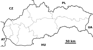
map_background = Slovakia - background map.png
map_locator = Slovakia
website = [http://www.karlovaves.sk/ www.karlovaves.sk]
commons = Devín
footnotes =Source [ [http://www.statistics.sk/mosmis/eng/run.html Mestská a obecná štatistika SR ] ]Karlova Ves ( _de. Karlsdorf, _hu. Károlyfalu) is a borough in western
Bratislava and part of theBratislava IV district, located near the southern end of theLittle Carpathians .In the past, it was a quiet vineyard village in the proximity of Bratislava, and was incorporated into the city in 1943. It includes large, recent high-rise apartment blocks in the
Dlhé diely area. In theMlynská dolina quarter is the headquarters ofSlovak Television , and there isSlávičie údolie cemetery nearby.Parts or quarters:
Dlhé diely ,Mlynská dolina , Kútiky, Rovnice.References
External links
* [http://www.karlovaves.sk Karlova Ves website]


Wikimedia Foundation. 2010.