Kilbirnie railway station
- Kilbirnie railway station
Infobox UK disused station
name = Kilbirnie
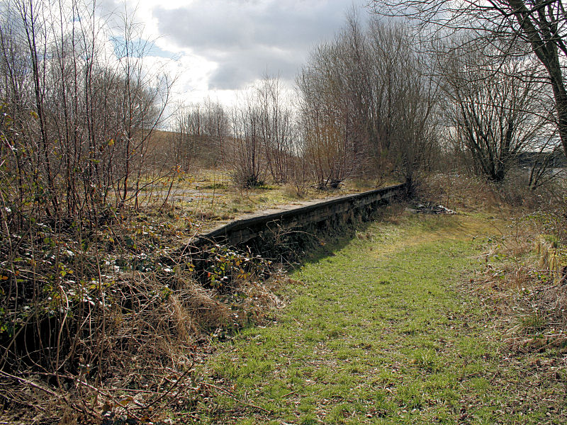
caption = The remains of Kilbirnie in 2008
manager = Glasgow and South Western Railway
locale = Kilbirnie
borough = Ayrshire
latitude = 55.7553
longitude = -4.6782
gridref = NS320545
years = 1 June 1905
events = Opened
years1 = 27 June 1966
events1 = Closed
platforms = 2|
__NOTOC__Kilbirnie railway station was a railway station serving the town of Kilbirnie, North Ayrshire, Scotland. The station was part of the Dalry and North Johnstone Line on the Glasgow and South Western Railway.
History
The station opened on 1 June 1905,[Butt, p. 131] and closed to passengers on 27 June 1966.] References
Notes
Sources
*
rail line
previous = Dalry
"Line closed; station open
next = Lochwinnoch
"Line and station closed
route = Glasgow and South Western Railway
"'Dalry and North Johnstone Line
col = G&SW colour
###@@@KEYEND@@@###
Wikimedia Foundation.
2010.
Look at other dictionaries:
Glengarnock railway station — Infobox UK station name = Glengarnock code = GLG caption = manager = First ScotRail pte = SPT locale = Glengarnock borough = North Ayrshire latitude = 55.7386 longitude = 4.6749 gridref = NS321527 usage0203 = 0.209 usage0405 = 0.231 usage0506 = 0 … Wikipedia
Kilbirnie South railway station — Infobox UK disused station name = Kilbirnie South caption = line = Lanarkshire and Ayrshire Railway manager = Caledonian Railway locale = Kilbirnie borough = Ayrshire latitude = 55.7559 longitude = 4.6815 gridref = NS317546 years = 2 December… … Wikipedia
Giffen railway station — Infobox UK disused station name = Giffen caption = The remains of Giffen station in 2006 line = Lanarkshire and Ayrshire Railway manager = Caledonian Railway platforms = 3 locale = Near Barrmill borough = Ayrshire latitude = 55.7202 longitude = 4 … Wikipedia
Brackenhills railway station — Infobox UK disused station name = Brackenhills other name= caption = line = Lanarkshire and Ayrshire Railway manager = Caledonian Railway locale = Near Beith borough = Ayrshire latitude = 55.7325 longitude = 4.6502 gridref = NS336519 years = 1… … Wikipedia
Dalry railway station — Dalry Location Place Dalr … Wikipedia
Wellington Railway Station — Infobox Station name=Wellington type=Metlink regional rail image size= image caption=Wellington Railway Station Frontage at night address=Bunny Street, Wellington coordinates= coord|41|16|43|S|174|46|51|E|region:NZ WGN type:railwaystation… … Wikipedia
Glengarnock High railway station — Infobox UK disused station name = Glengarnock High caption = line = Lanarkshire and Ayrshire Railway manager = Caledonian Railway locale = Glengarnock borough = Ayrshire latitude = 55.7449 longitude = 4.6793 gridref = NS318534 years = 2 December… … Wikipedia
Lochwinnoch (loop) railway station — Infobox UK disused station name = Lochwinnoch caption = The approach to Lochwinnoch looking west in 2008 manager = Glasgow and South Western Railway locale = Lochwinnoch borough = Renfrewshire latitude = 55.7949 longitude = 4.6248 gridref =… … Wikipedia
Kilbirnie — KILBIRNIE, a parish, in the district of Cunninghame, county of Ayr, 3 miles (W. by N.) from Beith; containing 2631 inhabitants. This place derives its name from the term Kil, signifying a church, chapel, or monastic cell, and Birnie, or… … A Topographical dictionary of Scotland
Kilbirnie — Infobox UK place official name= Kilbirnie gaelic name= scots name= local name= country= Scotland map type= Scotland population= 7,280 population density= os grid reference= NS315545 edinburgh distance= london distance= latitude= 55.755 longitude … Wikipedia