- Jhelum District
-
For other uses, see Jhelum (disambiguation).
Jhelum — District — 
Nickname(s): Land of Martyrs and Warriors Country Pakistan Province Punjab Capital Jhelum city Established Area – Total 3,587 km2 (1,384.9 sq mi) Population (2006) – Total 1,103,000 – Density 261/km2 (676/sq mi) Time zone PST (UTC+5) Number of Tehsils 4 Jhelum District (Urdu: ضلع جہلم) is in the Punjab province of Pakistan. According the 1998 census the district had a population of 936,957, of which 31.48% were urban.[1] Jhelum is known for providing a large number of soldiers to the British and later to the Pakistan armed forces due to which it is also known as city of soldiers or land of martyrs and warriors.[2] The district of Jhelum stretches from the river Jhelum almost to the Indus. Salt is quarried at the Mayo mine in the Salt Range. There are two coal-mines, the only ones worked in the province, from which the North-Western railway obtains part of its supply of coal. The chief centre of the salt trade is Pind Dadan Khan. The district is crossed by the main line of the North-Western railway, and also traversed along the south by a branch line. It is located in the north of the Punjab province, Jhelum district is bordered by Sargodha to its south, Gujrat and the Jhelum River to its south and east, Chakwal to its west, Mirpur to its east, and Rawalpindi to its north.
Contents
Administration
 Location of jhelum
The district of Jhelum, which covers an area of 3,587 km2,[3] is administratively divided into four tehsils: Jhelum, Sohawa, Pind Dadan Khan and Dina,[4] - which are divided into 53 Union Councils.[5] It also contains the cities of Jhelum,
Demographics
The population of Jhelum District according to the 1998 census of Pakistan was 936,957 with a population density of 261 people per square kilometre.[6] According the Punjab Education Department's annual literacy statistics for 2006, Jhelum had a literacy rate of 79% which is among the highest in Pakistan.[7][8][9] Human Development Index of Jhelum is 0.770, which highest in Pakistan after Karachi.
Before the Partition of 1947 took place Jhelum District had a Very Large Hindu Population Shops, lands, Markets in Jhelum District were owned by the native Hindus until 1947 Chaos took Place.
Language
 Tilla Jogian, the highest peak in Jhelum District
Inhabitants of Jhelum District speak Punjabi although the written language is Urdu.
History
Main article: History of JhelumEarly history
The history of the district dates back to the Hindu mythological period of the Mahabharata. The epic represents the Salt Range as the refuge of the five Pandava brethren during the period of their exile, and every salient point in its scenery is connected with some legend of the national heroes. Modern research has fixed the site of the conflict between Alexander and Porus as within Jhelum district, though the exact spot at which the Macedonian king effected the passage of the Jhelum (or Hydespes) has been hotly disputed. After this event, we have little information with regard to the condition of the district until the Muslim conquest brought back literature and history to Upper India. The Janjuas and Jats, who now hold the Salt Range and its northern plateau respectively, appear to have been the earliest inhabitants[10]
The Gakhars, who appear to represent an early wave of conquest from the west, and who still inhabit a large tract in the east of the District; while the Awans, who now cluster in the western plain, are apparently later invaders, the Gakhars were the dominant race during the early Muslim era and they long continued to retain their independence, both in Jhelum itself and in the neighbouring District of Rawalpindi.[10]
Mughal era
During the flourishing period of the Mughal dynasty, the Gakhar chieftains were among the most prosperous and loyal vassals of the house of Babar. But after the collapse of the Delhi empire, Jhelum fell, like its neighbours, under the sway of the Sikhs.[10]
Sikh era
In 1765 Gujar Singh defeated the last independent Gakhars Chief, Muqarrrab Khan, and reduced the wild mountaineers of the Salt Range and the Murree Hills to subjection. His son succeeded to his dominions until 1810, when it fell to Ranjit Singh. Under the Lahore government the dominant classes of Jhelum suffered much from fiscal actions; and the Janjua, Gakhars, and Awan families gradually lost their landed estates, which passed into the hands of their Jat dependants.[10]
British era
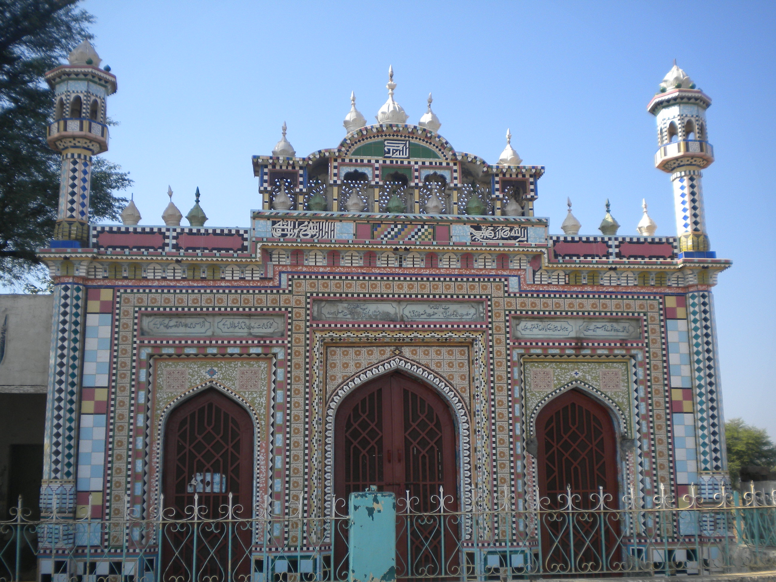
 a mosque on Jhelum Pind Dadan Khan Road
In 1849. Jhelum passed with the rest of the Sikh territories into the power of the British. Ranjit Singh, however, had so thoroughly subjected the wild mountain tribes who inhabited the District that little difficulty was experienced in reducing it to working order. In 1857 the 14th Native Infantry stationed at Jhelum town mutinied, and made a vigorous defence against a force sent from Rawalpindi to disarm them, but decamped on the night following the action, the main body. being subsequently arrested by the Kashmir authorities, into whose territory they had escaped.
During British rule Jhelum was a district of Rawalpindi Division, and was larger than the current district of Jhelum. On April 1, 1914, the tehsil of Talagang was detached from the District and incorporated with the new District of Attock.
The old Jhelum district (minus Talagang) covered an area of 2,813 square miles (7285 km2) and included Chakwal tehsil – it was bounded by Shahpur and Attock to the west, and by Rawalpindi to the north – the Jhelum River separated it from Kashmir to the north-east and from Gujrat and Shahpur to the south-east and south.[10]
Topography
 Location of Jhelum District within Punjab Province.
Jhelum City
Main article: JhelumThe district capital, Jhelum City, is situated on the right bank of the Jhelum River, crossed by a bridge. The 16th-century Grand Trunk Road passes through the city. Jhelum city is near the site of the famous Battle of the Hydaspes between the armies of Alexander the Great and Raja Porus This battle took place a few miles downstream from the city centre, along the river banks. Population of the Jhelum city (proper) is about 172,073[11] (2009) and it is the 35th largest city of Pakistan with respect to population. A cantonment was built during the British rule, which has grown up into a strong Garrison, with an Infantry Division commanded by a Major General.
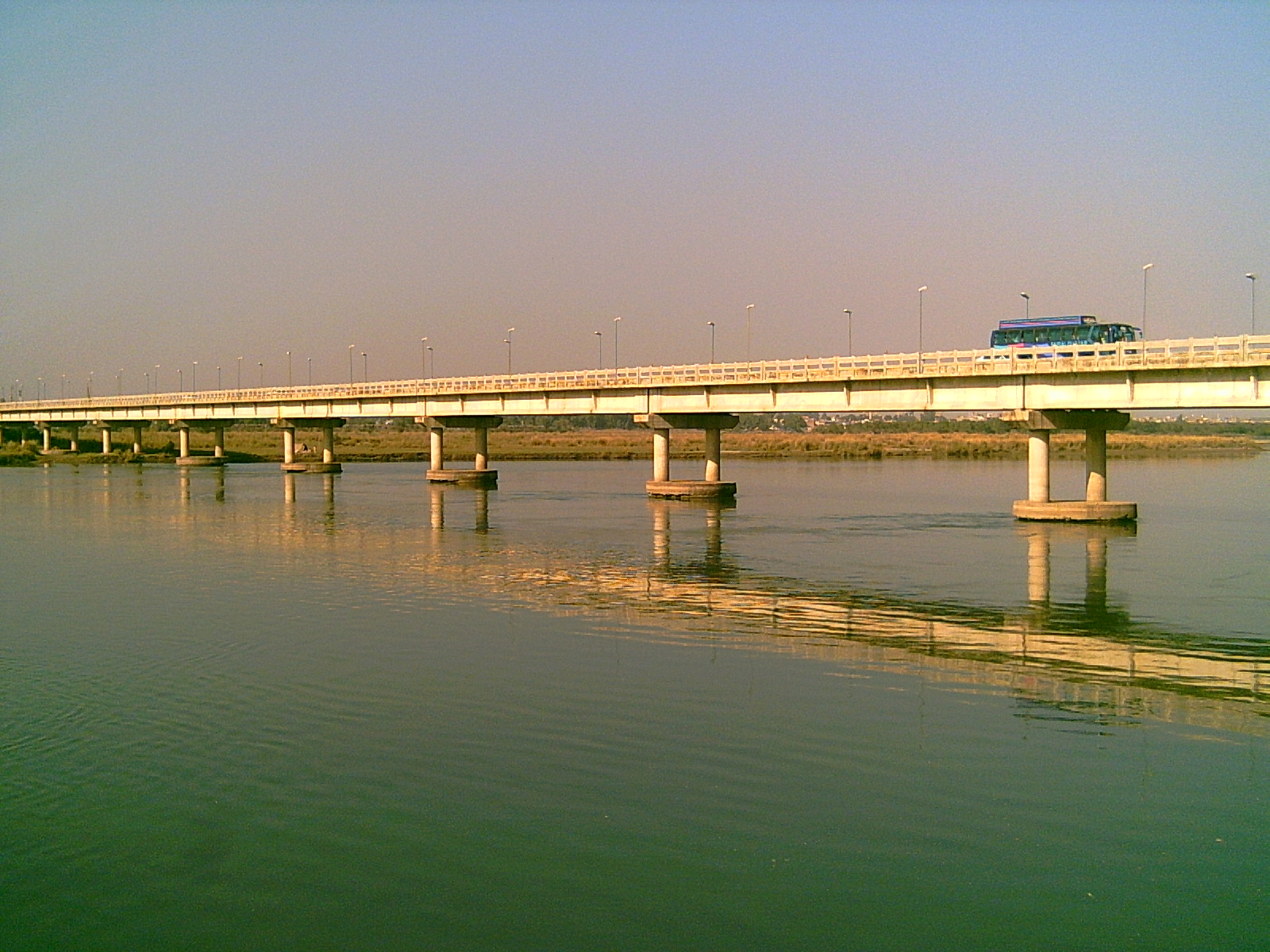
River Jhelum
Main article: River Jhelum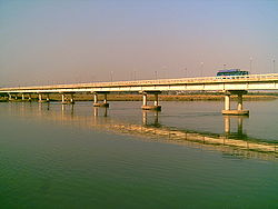 The River Jhelum below the bridge beside Jhelum City
The river Jhelum is navigable throughout the district, which forms the south-eastern portion of a rugged Himalayan spur, extending between the Indus and Jhelum to the borders of the Sind Sagar Doab. Its scenery is very picturesque, although not of so wild a character as the mountain region of Rawalpindi to the north, and is lighted up in places by smiling patches of cultivated valley. The backbone of the district is formed by the Salt Range, a treble line of parallel hills running in three long forks from east to west throughout its whole breadth.
The range rises in bold precipices, broken by gorges, clothed with brushwood and traversed by streams which are at first pure, but soon become impregnated with the saline matter over which they pass. Between the line of hills lies a picturesque table-land, in which the beautiful little lake of Kallar Kahar nestles amongst the minor ridges. North of the Salt Range, the country extends upwards in an elevated plateau, diversified by countless ravines and fissures, until it loses itself in tangled masses of Rawalpindi mountains. In this rugged tract cultivation is rare and difficult, the soil being choked with saline matter. At the foot of the Salt Range, however, a small strip of level soil lies along the banks of the Jhelum, and is thickly dotted with prosperous villages.
The drainage of the district is determined by a low central watershed running north and south at right angles to the Salt Range. The waters of the western portion find their way into the Sohan, and finally into the Indus; those of the opposite slope collect themselves into small torrents, and empty themselves into the Jhelum.
Agriculture
Jhelum District has a total area of 858,767 acres (3,475.31 km2), out of which 316,815 acres (1,282.10 km2) are cultivated. It has four tehsils viz; Jhelum, Pind Dadan Khan, Dina and Sohawa. The area is located on the eastern part of Potohar upland along with River Jhelum.
Agriculture in the District Jhelum depends mainly on rainfall. The average rainfall of the area varies from 20 to 40 inches (1,000 mm). About three fourth of this precipitation is received in monsoon season and the remaining one fourth is received during the rest of the year. The irrigated area at present is limited but the emphasis on construction of small Dams and Mini Dams is gradually increasing. Wheat remains the main crop.
In Tehsil P.D.Khan Salt is the predominant feature which is spoiling the rich agricultural land day by day. There is a long strip of very rich and virgin soil along the river which could be made a paradise of citrus plantation by drip irrigation if the local people are motivated and the Government of Punjab expressed some interest in it.
Sport
The main sports of the area are centred around agricultural pursuits and excellence and include Patthar (stone) lifting by young men. A localised version of Kabbadi, Bull racings centred around a Persian water wheel at the villages of Kantrili, and Jada near the suburban town of Kala Gujran. These happen to be important and most popular with many thousands of people in attendance. Tent pegging using the local horses and riders. This indicates the regions prowess during war and battle and hence the city being attributed the name of land of martyrs and warriors. There is a small cricket stadium at Suleiman Park. Many of these rural sports retain the regions excellence in raising and retaining some of the finest young citizens of the country.
 The fine horse and riders of the Jhelum tract
Flora and fauna
Vegetation of the forests of Jhelum Forest Division is dry deciduous scrub type, Phulai, Kau and sanatha are the main species. The stocking on the whole is poorand the forests are open. Vegetation is poor on sandstone and redmarl. The southern slopes are often devoid of vegetation while north western slopes carry good forests. The forests of Jhelum Forests Divisions are burdened with right of grazing browsing and firewood. Under settlement out of total area 93,566 acres (378.65 km2) only 5,468 acres (22.13 km2) about (45%) are right free. Remaining 55% are open to grazing.
The fauna of the District is mostly indigenous restricted, like the vegetation, but similarly varied and interesting. The rugged and rough terrain, low rainfall, the scantly cover of vegetation and the burning passions of the increasing number of hunters, all have their share in limiting the animal kingdom in the District. The riverine offers a better environment than elsewhere though the hills support a more interesting wildlife. Urial and Chinckara are spot aids while wild bores are found in the Salt Range. Wolves, Foxes and Wild Cats are also found. Hare is fairly common. Chikor grey and black Partridge are also found in the parts of the district. Migratory ducks like Teal Pintail and Mallard and some geese visit during winter.[12]
Climate
The climate of the tract is extreme. In winter it is very cold and summer is very hot. The average rainfall varies from 48 to 69 m.m per annum which is much below the required quantity but in the rainy season the water torrents flow from North to the river Jhelum with a very fast speed and cause damages to the crops, bridges, roads and are responsible for the soil erosion in the District. The detailed data is as under:
Climate data for Jhelum, Pakistan Month Jan Feb Mar Apr May Jun Jul Aug Sep Oct Nov Dec Year Average high °C (°F) 20
(68)22
(72)27
(81)33
(91)38
(100)40
(104)36
(97)34
(93)35
(95)33
(91)28
(82)21
(70)31
(87)Average low °C (°F) 5
(41)8
(46)12
(54)18
(64)22
(72)26
(79)26
(79)25
(77)23
(73)17
(63)10
(50)6
(43)16
(62)Precipitation mm (inches) 34
(1.3)50
(2)60
(2.4)36
(1.4)32
(1.3)52
(2)237
(9.3)221
(8.7)78
(3.1)12
(0.5)10
(0.4)30
(1.2)85.2
(32.2)Source: Weatherbase[13] Development organizations
Rehmat Karim Welfare Foundation http://www.rehmatfoundation.com/about/ is a charity project working for poor & needy people of fifty mile area including Jhelum which cannot afford the expenses of their daily life and very expensive general medical and kidney dialysis treatment. http://www.youtube.com/results?search_query=rehmatkarimkidney&aq=f
Civil Society Human and Institutional Development Program[14](CHIP)is working in Sohawa Tehsil since 2004, with its field office in the area CHIP has successfully mobilized community people to get organize into Community Based Organizations, Community Citizen Boards and Women Organizations. Further, CHIP has duly built the capacity of these local entities to take new initiatives. These community level organizations, in collaborative partnerships with CHIP, are working on several development projects. The main focus of these projects is to eliminate illiteracy from villages of Sohawa especially those where government education structure does not exist, make clean drinking water available, provide technical support to the local farmers, raise skill development opportunities for women and sensitize communities to include women in decision making. The local community level organizations developed by CHIP are making successful efforts in implementing development projects by deriving funds from local government bodies.
CHIP has announced Sohawa as its main development area and the organization is assessing further development interventions in villages of Sohawa, presently the main focus of organization is to introduce an 'Inclusive Development Model' which suggest active involvement of people with disabilities in the development process.
Education Welfare Society (EWS)a registered NGO, founded in 1995 by Syed Waqar Azeem; a well known social personality awarded by "FAKHR-E-JHELUM" (Proud of Jhelum) in 1998 demonstrated pivotal role in educational development in the city and represented the jhelum on international level and its educational welfare and developments' needs on major platforms and devoted himself for the welfare of the masses. TOOR WELFARE TRUST kundal (founded 2008).
Colleges and schools
 Govt. College GT Road Jhelum
- Army Public School and College Jhelum Cantt.
- FG Intermediat College Jhelum Cantt.
- Fauji Foundation Model School & College,Jhelum Cantt.
Cantonment Board CMB Model Jhelum
- Govt. Degree College, Jhelum.
- Govt. College. G.T. Road, Jhelum.
- Govt. College for Women, Jhelum.
- Govt. College of Commerce, Bilal Town, Jhelum.
- Research Girls College Kala Gujran Jhelum
- Jinnah Law College Near Kutcheri, Jhelum.
- M.A. Jinnah College of Commerce & Computer Science, Jhelum.
- PICS, Bilal town Jhelum.
- Presentation convent high school for girls, Jhelum Cantt
- Jhelum Homeopathic Medical College,GT Road Jada, Jhelum
- SLS College, Jhelum.
- Govt.college of technology Chak daulat,Jhelum
Notable people
- Muhammad Akram, Nishan-e-Haider, R/o Nakka Kalan
- Tariq Kamal Khan, former Chief of Naval Staff, Pakistan Navy, R/o Domely
- Asif Nawaz, former Chief of Army Staff, Pakistan
- Ghazanfar Ali Khan, Leader In Pakistan Movement
- Ghulam Hussain, former Secretary General Pakistan People's Party, former Federal Minister
- Chaudhry Farrukh Altaf, former District Nazim Jhelum
- Ghafer Shahzad, Deputy Director Architecture, Punjab Auqaf Department, writer and Poet
- Ehsan Mehmood Khan, politico-security analyst and writer hailing from Wagh, Pind Dadan Khan Tehsil
See also
References
- ^ Punjab Population (1988 Census) – Urban Resource Centre
- ^ BBC NEWS – City of Soldiers
- ^ Jhelum District Overview - Punjab Police
- ^ Administrative Units of Pakistan
- ^ Tehsils & Unions in the District of Jhelum -Government of Pakistan
- ^ 1998 Census of Pakistan
- ^ http://www.statpak.gov.pk/depts/fbs/statistics/pslm_prov2006-07/2.14a.pdf
- ^ Punjab Education Department's annual literacy statistics for 2006 Daily Times
- ^ Literacy rate figures still not updated - Daily Times
- ^ a b c d e Jhelum District Imperial Gazetteer of India, v. 14, p. 152
- ^ Population of Jhelum City
- ^ http://merajhelum.freeservers.com/NJHELUM.HTM
- ^ "Weatherbase: Historical Weather for Jhelum, Pakistan". Weatherbase. 2008. http://www.weatherbase.com/weather/weather.php3?s=415980&refer=&units=metric.
- ^ Civil Society Human and Institutional Development Program
External links
Administrative divisions of Jhelum District Headquarter 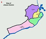
Jhelum City Jhelum-I, Jhelum-II, Jhelum-III, Jhelum-IV, Jhelum-V, Jhelum-VI, Jhelum-VII.Tehsil Jhelum Tehsil Dina Tehsil
Pind Dadan KhanAhmedabad, Chak Shadi, Daulatpur, Dharyala Jalap, Gharibwal, Golepur, Gujjar, Haranpur, Jalalpur Sharif, Kandwal, Khewra-I, Khewra-II, Lilla, Pind Dadan Khan, Pindi Saidpur, Sauwal, Toba.Tehsil Sohawa * Indicates the district headquatersDivisions of Pakistan Balochistan KP Punjab Bahawalpur · Dera Ghazi Khan · Faisalabad · Gujranwala · Lahore · Multan · Rawalpindi · Sahiwal · SargodhaSindh
Categories:- Jhelum
- Jhelum District
- Pre-Islamic heritage of Pakistan


Wikimedia Foundation. 2010.