- Silver Falls State Park
Infobox_nrhp | name =Silver Falls State Park Concession Building Area
nrhp_type =
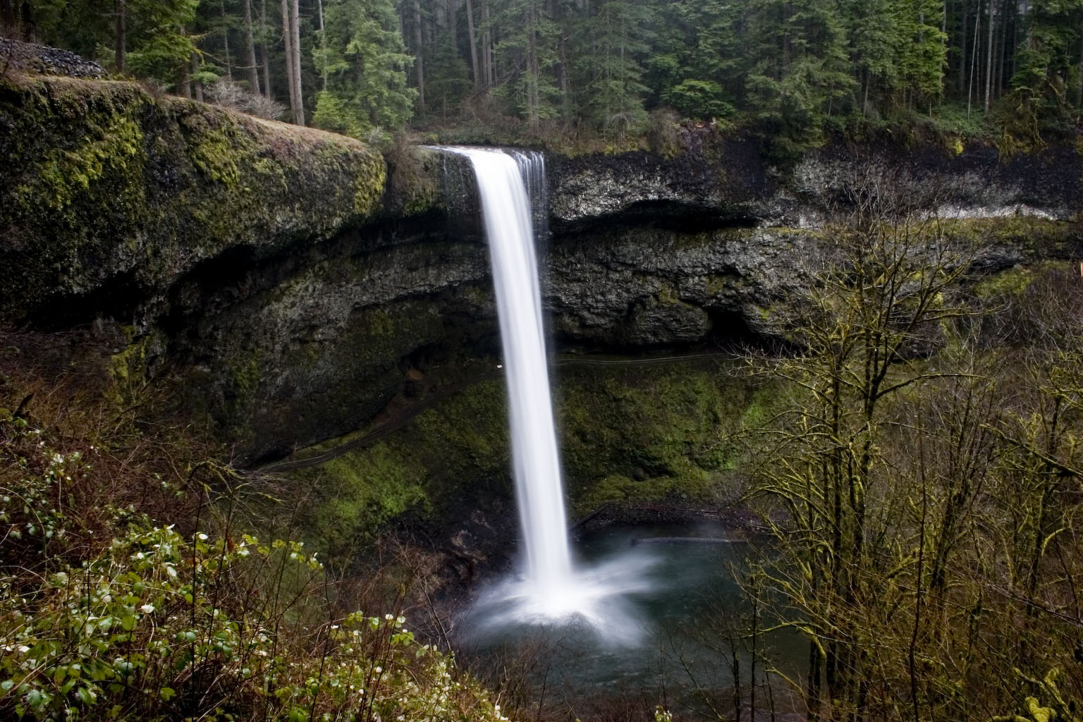
caption =South Falls
nearest_city=Sublimity, Oregon
area =
built =1934
architect= Isted, J. Elwood
added =June 30 ,1983
governing_body = State
refnum=83002164 cite web|url=http://www.nr.nps.gov/|title=National Register Information System|date=2006-03-15|work=National Register of Historic Places|publisher=National Park Service]Silver Falls State Park is a
state park located nearSilverton, Oregon . It is the largest state park in Oregon with more than convert|9000|acre|km2 containing more than convert|24|mi|km of walking trails, convert|14|mi|km of horse trails, and a convert|4|mi|km|adj=on bike path. Its convert|8.7|mi|km|adj=on Canyon Trail/Trail of Ten Falls runs along the banks of Silver Creek and by tenwaterfall s, from which the park received its name. Four of the ten falls have an amphitheater-like surrounding that allows the trail to pass behind the flow of the falls. [cite web|url=http://www.oregonstateparks.org/park_211.php|title=Silver Falls State Park|publisher=Oregon Parks and Recreation|accessdate=2007-09-01]The park's most visited waterfall is South Falls, a convert|177|ft|m|adj=on cascade. [cite web|url=http://www.travelsalem.com/media/storyline03.html|title=Recreation in Salem Oregon|publisher=Salem, Oregon Convention & Visitors Association|accessdate=2007-01-28] Remote Double Falls, however, is the highest waterfall in the park, plunging convert|178|ft|m| in a small tributary side canyon deep within the Silver Creek Canyon.
History
Silver Falls City formed in 1888 and was primarily a
logging community with a fewhomesteader s, and the area was extensively logged. By 1900 a Silverton photographerJune Drake began to campaign for park status, using his photographs of the falls to gain support. In 1926, however, an inspector for theNational Park Service rejected the area for park status because of a proliferation of unattractive stumps.In 1935 President
Franklin D. Roosevelt announced that the Silver Falls area would be turned into aRecreational Demonstration Area . Private land that had been logged was purchased, and workers in theCivilian Conservation Corps were employed to develop park facilities, including the historic South Falls Lodge, completed in the late 1930s. It was used as a restaurant from 1946 until the late 1950s and was listed on theNational Register of Historic Places in 1983 [cite web|url=http://www.oregon.com/hiking/silver_falls.cfm|title=Oregon Hikes - Silver Falls|accessdate=2007-09-01] . The Silver Creek Youth Camp was also added to the National Register at this time.Recently one representative in the
Oregon Legislative Assembly was seeking federal designation of the area as anational park , but the effort has been dropped. Previous attempts also failed. [cite web|url=http://www.leg.state.or.us/08ss1/measures/hjm100.dir/hjm0101.intro.html|title=Urges designation of Silver Falls State Park as national park.|accessdate=2008-05-13] [cite web|url=http://www.leg.state.or.us/08ss1/pubs/hsemh.html|title=House Bills|accessdate=2008-05-13]Geology
The formation of the canyon stretches back about 26 million years ago to the
Oligocene period, when most ofOregon was covered by ocean. After the waters of the ocean receded about 15 million years ago, theflood basalt flows of theColumbia River Basalt Group covered thesandstone that had been the ocean floor. The softer layers ofsandstone beneath the basalt sheet eroded over time, creating pathways behind some of the waterfalls whichCivilian Conservation Corps workers widened to make safe for public use. Another geologic feature are many tree "chimneys" or casts, formed when hot lava engulfed living trees and disintegrated them.cite web|url=http://www.oregonstateparks.org/images/pdf/silverfalls_trailmap.pdf|title =Silver Falls Trailmap|publisher=Oregon Parks and Recreation|accessdate=2007-09-01]Waterfalls
The 10 waterfalls in Silver Falls State Park are listed below from north to south.
*Upper North Falls, convert|65|ft|m
*North Falls, convert|136|ft|m
*Double Falls, convert|178|ft|m
*Lower North Falls, convert|30|ft|m
*Drake Falls, convert|27|ft|m
*Middle North Falls, convert|106|ft|m
*Twin Falls, convert|31|ft|m
*Winter Falls, convert|134|ft|m
*Lower South Falls, convert|93|ft|m
*South Falls, convert|177|ft|mcite web|url=http://www.oregonstateparks.org/images/pdf/silverfalls_trailmap.pdf|title =Silver Falls Trailmap|publisher=Oregon Parks and Recreation|accessdate=2007-09-01]References
External links
* [http://www.oregonstateparks.org/park_211.php Silver Falls State Park] official website from
Oregon State Parks and Recreation Department
* [http://www.traveloregon.com/Explore-Oregon/Willamette-Valley/Outdoor-Recreation/State-Parks/State-Parks/Silver-Falls-State-Park.aspx Silver Falls State Park] from theOregon Tourism Commission
* [http://www.silverfallspark.info/ Friends of Silver Falls State Park]
*Geolinks-US-cityscale|44.876667|-122.64805
Wikimedia Foundation. 2010.