- Denton Hill State Park
-
Denton Hill State Park Pennsylvania State Park Natural Monument (IUCN III)  The ski slopes at Denton Hill State Park
Country United States State Pennsylvania County Potter Township Ulysses Location [1] - coordinates 41°46′03″N 77°49′48″W / 41.7675°N 77.83°WCoordinates: 41°46′03″N 77°49′48″W / 41.7675°N 77.83°W - elevation 1,962 ft (598 m) [1] Area 700 acres (283 ha) Founded 1951 Managed by Pennsylvania Department of Conservation and Natural Resources 
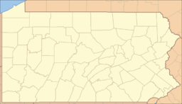 Location of Denton Hill State Park in Pennsylvania
Website : Denton Hill State Park Denton Hill State Park is a 700-acre (283 ha) Pennsylvania state park in Ulysses Township, Potter County, Pennsylvania, in the United States. The park is a downhill skiing resort. Denton Hill State Park is on U.S. Route 6 between Coudersport and Galeton. In 2000 the park became part of the Hills Creek State Park complex, an administrative grouping of eight state parks in Potter and Tioga counties.[2]
Contents
Recreation
Denton Hill State Park was the first ski operation run by the Pennsylvania Department of Forests and Waters (a predecessor to the Pennsylvania Department of Conservation and Natural Resources). The park was established in 1951, opened in 1959, and the lodge and ski are were built between 1958 and 1967. The ski area was operated by the state until 1979, when it became a concession run by a private contractor ("Ski Denton" as of 2011).[3]
The skiing ranges from easy, beginner slopes to some of the most dangerous, expert, black diamond slopes on the east coast of the United States. There are four ski lifts at the park, each of which stops at a different elevation on the slopes. Lift-accessed Snow tubing is also available at Denton Hill State Park, or Ski Denton.[4]
There are five chalets on the grounds of Ski Denton. Each cabin has wall to wall carpeting and two bedrooms that sleep up to six individuals. There is a large living room with a cathedral ceiling in each cabin. The cabins also have a full kitchen, dining room, and bathroom. A hostel style bunkhouse sits atop the main lodge.[4]
Ski Denton opens its slopes and trails for lift-serviced mountain bikers in the off season. There are over 50 miles (80 km) of maintained downhill and cross-country single track and trails available for riding. A mountain bike trail begins at Denton Hill State Park and is 15 miles (24 km) long, passing through Patterson State Park on its way to Cherry Springs State Park. Part of the Susquehannock Trail System, an 85-mile (137 km) loop hiking trail, forms the southern border of the park.[5]
Nearby state parks
The following state parks are within 30 miles (48 km) of Denton Hill State Park:[6][7][8]
- Bucktail State Park Natural Area (Cameron and Clinton Counties)
- Cherry Springs State Park (Potter County)
- Colton Point State Park (Tioga County)
- Hyner Run State Park (Clinton County)
- Hyner View State Park (Clinton County)
- Kettle Creek State Park (Clinton County)
- Leonard Harrison State Park (Tioga County)
- Lyman Run State Park (Potter County)
- Patterson State Park (Potter County)
- Prouty Place State Park (Potter County)
- Sinnemahoning State Park (Cameron and Potter Counties)
- Sizerville State Park (Cameron and Potter Counties)
References
 The beginners slope at Denton Hill State Park
- ^ a b "Denton Hill State Park". Geographic Names Information System. United States Geological Survey. August 2, 1979. http://geonames.usgs.gov/pls/gnispublic/f?p=gnispq:3:::NO::P3_FID:1173166. Retrieved 2008-02-12.
- ^ "Manager named at Hills Creek Lake". Wellsboro Gazette: p. 6. 2000-02-02. http://greenfreelibrary.newspaperarchive.com/PdfViewer.aspx?img=12106011&firstvisit=true&src=search¤tResult=4¤tPage=0. Retrieved 2009-04-09. Note: the eight parks in the Hills Creek State Park Complex are Cherry Springs, Colton Point, Denton Hill, Hills Creek, Leonard Harrison, Lyman Run, Patterson, and Prouty Place.
- ^ "Denton Hill State Park". Pennsylvania Department of Conservation and Natural Resources. http://www.dcnr.state.pa.us/stateparks/findapark/dentonhill/index.htm. Retrieved 2011-11-05.
- ^ a b "Ski Denton". Pennsylvania Department of Conservation and Natural Resources. http://www.skidenton.com. Retrieved 2006-11-01.
- ^ Pennsylvania Department of Conservation and Natural Resources (PDF). Susquehannock State Forest Map (Map). 1 inch = 2 miles. http://www.dcnr.state.pa.us/forestry/stateforests/maps/fd15_map.pdf. Retrieved 2009-03-03.
- ^ Pennsylvania Department of Transportation, Bureau of Planning and Research, Geographic Information Division. 2007 General Highway Map Potter County Pennsylvania (Map). 1:65,000. ftp://ftp.dot.state.pa.us/public/pdf/BPR_pdf_files/Maps/GHS/Roadnames/potter_GHSN.pdf. Retrieved 2007-07-27. Note: shows Denton Hill State Park
- ^ Michels, Chris (1997). "Latitude/Longitude Distance Calculation". Northern Arizona University. http://www2.nau.edu/~cvm/latlongdist.html. Retrieved 2008-04-20.
- ^ "Find a Park by Region (interactive map)". Pennsylvania Department of Conservation and Natural Resources. http://www.dcnr.state.pa.us/stateparks/findapark/where/index.htm. Retrieved November 18, 2011.
External links
Categories:- Pennsylvania state parks
- Protected areas established in 1951
- Mountain biking venues in the United States
- Parks in Potter County, Pennsylvania


Wikimedia Foundation. 2010.