- São José dos Campos
Infobox City
official_name = São José dos Campos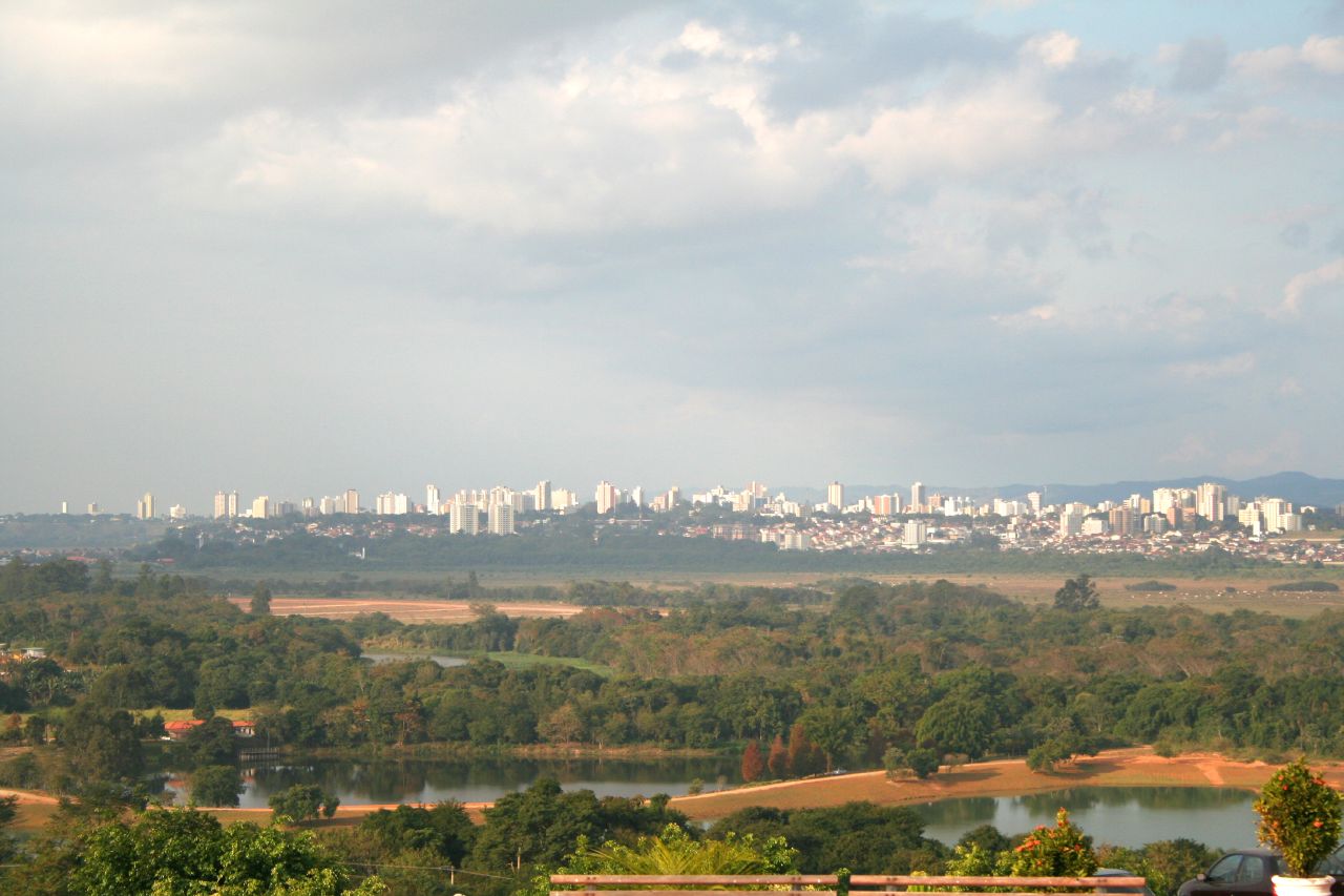
imagesize = 250px
image_caption = Nightview
motto = "Aura terraque generosa "spaces|2(Latin) "Generous are my airs and land"
nickname = Capital of the Valley
and The Airplane Capital
image_

mapsize = 250px
map_caption = Location in the state of São Paulo and Brazil
subdivision_type = Country
subdivision_type1 = Region
subdivision_type2 = State
subdivision_name =Brazil
subdivision_name1 = Southeast
subdivision_name2 = São Paulo
leader_title =Mayor
leader_name =Eduardo Cury (PSDB)
area_magnitude = 1 E9
area_total_km2 = 1099.60
area_urban_km2 = 298.99
population_as_of = 2006
population_note =
population_total = 610965
population_density_km2 = 555.62
timezone =UTC-3
utc_offset = -3
timezone_DST =UTC-2
utc_offset_DST = -2
latd=23 |latm= 11 |lats=11 |latNS=S
longd=45 |longm= 52 |longs=43 |longEW=W
elevation_m = 660
elevation_ft = 2165
website = [http://www.sjc.sp.gov.br São José dos Campos]
footnotes =São José dos Campos is a municipality and a major city in the state of São Paulo,
Brazil and one of the most important industrial and research centers inLatin America .It is located in the Vale do Paraíba ("Paraiba Valley"), between the two most active production and consumption regions in the country, São Paulo (80 km from the city) and Rio de Janeiro (320 km).
According to a 1999 UN study, São José dos Campos was rated one of the top 25 Brazilian cities for quality of life. With its high per capita income, long life expectancy and high level of infrastructure, São José dos Campos is a safe and secure city that offers a wide variety of stores and services. A native of São José dos Campos is called "joséense" (IPA2|ʒo.ze.'ẽnsi̯).
Geographic information
Area
* total area: 1099.60 km² (about 425 miles²)
**urban area: 298.99 km² (27.19%)
**metropolitan area (east): 45.04 km² (4.09%)
**metropolitan area (north): 81.18 km² (7.38%)
**rural: 673.39 km² (61.23%)Borders
*Northern Border:
Camanducaia ,Sapucaí Mirim inMinas Gerais
*Southern Border:Jacareí ,Jambeiro in São Paulo State
*Eastern Border: Monteiro Lobato,Caçapava in São Paulo State
*Western border:Igaratá ,Joanópolis ,Piracaia in São Paulo StateCityscape
The municipality is comprised by three districts: São José dos Campos - the city itself, (also the seat),
Eugênio de Melo andSão Francisco Xavier . The last one is known for its natural sites andecotourism .The district of São José dos Campos is also subdivided into 2 subdistricts (São José dos Campos and Santana do Paraíba).
However, for administrative purposes, the city is composed of 7 urban regions: Center, North, South, West, East, Southeast and São Francisco Xavier.
Climate
The climate is humid and
subtropical , with the dry season in winter. The greatest precipitation occurs from November to March, contributing to 72% of the annual volume.The annual average
relative humidity is 76%. Tropical air masses predominate during 50% of the year and colder air masses predominate for the rest of the yearIn the summer, the average maximum temperature is 29 °C and in the winter, the average minimum temperature is 10°C. The average annual temperature is 20 °C.
Köppen climate classification : CfaTopography
Highlands predominate in the north region of the municipality, whose altitudes range from 660 the 975 meters. They are called Serra da Mantiqueira ("Mantiqueira Range"). There are also peaks and mountains that can reach up to 2082 meters.
In the
urban area , there are rollingplateaus andhills .In the south, the ridges of
Serra do Mar form the boundary between the coastal plain and the inland plateau ("planalto"), which has an altitude of 400 to 500 meters.* Municipality: Elevations 550 m to 2,082 m
* City: Elevations 550 m to 690 m, average of 660 metersHydrology
The municipality is located in the Hydrological Basin of the
Paraíba do Sul River that crosses the city longitudinally and names the region asVale do Paraíba (Paraiba Valley). The river has larger tributaries on the left bank than the right. However, on the right banks, theJaguari River ,Buquira River ,and other tributaries are an important part of the city's drainage system. Some of these other creeks are theComprido River , thePararangaba River and theLambari River .For the
water supply of the population and livestock, theRio do Peixe , tributary of the Jaguari River, stands out. It drains the north portion of the municipality and its waters contribute significantly to the JaguariDam , which forms an important reservoir used by CESP forelectricity generation .Along with the
mountainous topography , there are a great number of fluvial elements, such as waterfalls.The quality of the water is excellent, and the
artesian wells of the region possess average outflow of 30m³/hour.History
The beginning
The origins of São José dos Campos lie at the end of the 16th Century when Jesuits founded a cattle farm, "Aldeia do Rio Comprido". The farm was created through a concession of settlements around 1590 to the
Society of Jesus . The farm was located on the banks of the Rio Comprido, natural division between São José and the city ofJacareí today.*FM Radio
Bisceted by the Federal Highway BR-116 Dutra, which links it to the main economical centers of the country, São José dos Campos is a city that continuously tries to develop its infrastructure and technology, improving the quality of life of its citizens and opening new opportunities for business. The presence of educational and research centers in the city was a major key for its fast economical development. It occupies the 9th position among the 100 best Brazilian cities for business, according to a study of the magazine
Exame published in 2002. In another study, made by Cushman & Wakefield, an American company in the area of real estate business, São José dos Campos was appointed worldwide as one of the seven best cities with opportunities of investment inreal estate .High and positive economy indicators show that this municipality has a great share in the state and in the country's economy.
In 2004, the municipality had the eleventh Gross Domestic Product on national terms and the third GDP within the State. It was the second exporter only to the city of São Paulo (revenues of USD 4.7 billion) in 2004.
Its estimated per capita income value, in nominal terms, was US$ 10,715 (far higher than the national average or even São Paulo's).
Discussions about how to diversify the activities in the city have been held. Around 66.6% of the local economy still comes from the manufacturing sector. Many economists, such as Roberto Koga, consider the city still heavily dependent from few sectors, especially the aerospace and defense industry.
Despite these arguments, the city was appoínted as the 3rd best employer among Brazilian non-capital cities by magazine Você S/A, published in July 2005
Agriculture
The municipality cultivates different crops: rice, tomato, potatoes, orange and many vegetables; cattle are raised for beef and milk supply. There are also farms for production of eggs and chicken.
Industry
In contrast to the rural town in 1950s, today São José is an important manufacturing center and holds a large array of industries. Over 1251 industries are in the municipality and nearby 47,000 inhabitants work for industries. The three main industries are
automotive , oil/petrochemical andaerospace . There are significantpharmaceutical ,consumer durables ,chemical , andtelecommunication companies in the city.It is also known as the "Brazilian aeronautics capital" because it is home to one of the biggest regional aviation aircraft manufacturers in the world,
Embraer . It owes much of its economic success to Embraer's presence.Service industry
Since the 1990s, the local economy has been evolving in a different direction. The manufacturing economy has been downsized or replaced by tertiary and quartenary sectors of industries.
For instance, the "Entrepreneurial District of Chacaras Reunidas "concentrates companies of micro, small and medium size, which are mainly the result of downsizing from old large local industries. Yet even though most of these are industries, these companies provide service as well.
Two technological parks and five (one in project)
business incubators have been created within universities or industrial facilities.There are incubators with technological start-up companies installed at Univap and at Henrique Lage
Refinery ofPetrobrás . The CTA houses other incubator, Incubaero, specialized in the aeronautical field.Univap features a technological park with capacity for around 40 small to medium sized innovating companies in the areas of
materials ,electronics andtelecommunications ,information technology ,aerospace ,energy , environment control,biotechnology ,bioinformatics ,chemical engineering , andsoftware among others. A new technological park, managed by the municipality and the state government of São Paulo, will house two newthink tanks : the Institute for Technological Research (IPT) and the ItecBio (Instituto de Tecnologias Biomédicas).As a result of its geographical location, the city became an important distribution center, having several
logistics providers. Activities like purchasing, transport, planning and warehousing have employed many people recently.Commerce and real estate ventures have developed in the last years, reflecting the changes in the economy. For instance, the largest shopping mall in the region was an old manufacturing facility. Serving the region's population of approximately one million, the city is the regional hub for shopping and services for the
Vale do Paraíba , the northern coast of São Paulo and southernMinas Gerais .The city has 34 hotels (1784 hotel rooms) and several auditoriums for meetings and conventions. There are 77 bank branches and 8 internet providers.
Advertising agencies have been established alongside television stations.
External links
* [http://www.sjc.sp.gov.br Official website]
* [http://www.explorevale.com.br/cidades/saojosedoscampos/index.htm Page About São José dos Campos City]
* [http://www.empresasvale.com.br Companies in Vale do Paraíba]
* [http://www.saojosedoscampos.com.br Portal São José dos Campos]
* [http://www.fccr.org.br Cassiano Ricardo Cultural Foundation]
* [http://www.fundhas.org.br Hélio Augusto de Souza Foundation (FUNDHAS)]
* [http://www.cta.br Brazilian Aerospace Technical Center (CTA)]
* [http://www.comtursjc.com.br Tourism Municipal Council (COMTUR)]Sources
* The City Hall of São José dos Campos."
* Instituto Brasileiro de Geografia e Estatistica -IBGE
* FundaçãoSeade
* JornalValeParaibano
*The State Government of São Paulo."


Wikimedia Foundation. 2010.