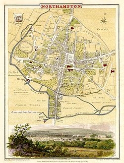
- Northampton
-
This article is about Northampton in England. For other places of the same name, see Northampton (disambiguation).
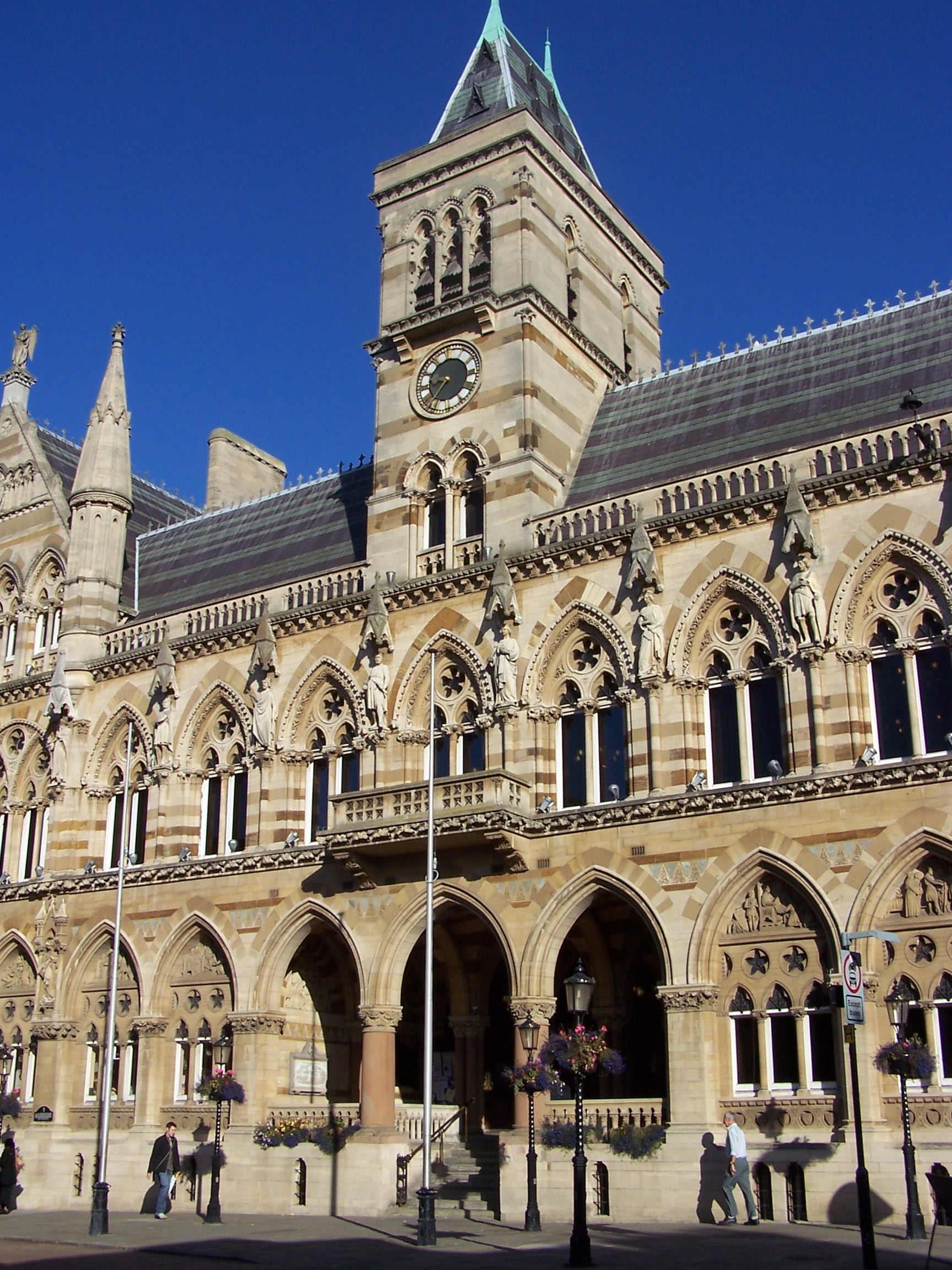
Borough of Northampton — Town & Borough — Northampton Guildhall, built 1861-4, by E.W. Godwin Northampton
Coordinates: 52°11′55″N 0°52′26″W / 52.198697°N 0.873928°W Sovereign state United Kingdom Constituent country England Region East Midlands Ceremonial county Northamptonshire Founded Admin. HQ Northampton Government – Type Northampton Borough Council
Mayor of the Borough and Chair 2011–2012
Cllr Jamie Lane[1]– Leadership: Leader & Cabinet
Cllr David Palethorpe[1]– Executive: Conservative – MPs: Brian Binley,
Michael EllisArea – Total 31.2 sq mi (80.76 km2) Area rank 237th Population (2010 est.) – Total 212,100 – Rank Ranked 74th – Density 6,802.1/sq mi (2,626.3/km2) Demonym Northamptonian Time zone Greenwich Mean Time (UTC+0) – Summer (DST) British Summer Time (UTC+1) Postcode NN1-NN6 ISO 3166-2 ONS code 34UF OS grid reference NUTS 3 Ethnicity 86.1% White
6.4% S.Asian
3.9% Black British
2.1% Mixed Race
2.3% Chinese or other[2]Website northampton.gov.uk Northampton (pronounced /nɔrˈθæmptən/ (
 listen)) is a large market town and local government district in the East Midlands region of England. Situated about 67 miles (108 km) north-west of London and around 50 miles (80 km) south-east of Birmingham, Northampton lies on the River Nene and is the county town of Northamptonshire. The demonym of Northampton is Northamptonian.
Original settlements in Northampton date back to the 6th century. Its modern development is largely due to its rapid population increase since the 1960s after a planned expansion occurred under the New Towns Commission in the early 1970s. In 2001, its urban area population was 197,199[3] while its town population was 189,474,[3] making Northampton the 27th largest settlement in England, and the UK's 3rd largest town without official city status after Reading and Dudley. Northampton is the most populous district in England that is not a unitary authority, a status it failed to obtain in the 1990s local government reform.[4]
Northampton has a history of the manufacture of boots and shoes yet engineering has taken over as a modern key industry; other industries include food processing, brewing, and the manufacture of shoe machinery, cosmetics, leather goods, and car accessories. At present, the major employers are public administration, financial services, and the distribution trade.
Contents
History
Early history
Remains found here date from the Bronze Age.[citation needed] Farming settlement probably began around the 7th century AD. In the 8th century it was an administrative and/or religious[citation needed] centre for the kingdom of Mercia. The pre-Norman town was known as Hamtun and was only ca.0.60 acres (2,400 m2).
A large hall was discovered just west of St. Peter's church that is estimated to be 8–9th century[5]
Medieval
The town became significant in the 11th century, when the Normans built town walls and a large castle under the stewardship of the Norman earl, Simon de Senlis.[6] The original defence line of the walls is preserved in today's street pattern (Bridge St, The Drapery, Bearward St and Scarletwell Street). The town grew rapidly after the Normans arrived, and beyond the early defences. By the time of the Domesday Book, the town had a population of about 1500 residents, living in 300 houses.
The town and its castle were important in the early 12th century and the King often held Court in the town. During his famous fallout with Henry II, Thomas Becket at one time escaped from Northampton Castle through the unguarded Northern gate to flee the country.
Northampton had a large Jewish population in the 13th century, centred around Gold Street. In 1277 300 Jews were executed,[citation needed] allegedly for clipping the King's coin, and the Jews of Northampton were driven out of the town. Archaeological sites include a medieval Jewish cemetery and the Northampton Medieval Synagogue.[7]
The town was originally controlled by officials acting for the King who collected taxes and upheld the law. In 1189 King Richard I gave the town its first charter. In 1215 King John authorised the appointment of William Tilly as the town's first Mayor and ordered that: 'twelve of the better and more discreet residents of the town join him as a council to assist him' . In 1176 the Assize of Northampton laid down new powers for dealing with law breakers.
A university was established in 1261 by scholars from the University of Cambridge. It briefly flourished, but was dissolved by Henry III in 1265 apparently as it posed a threat to the University of Oxford.
The first Battle of Northampton took place at the site of Northampton Castle in 1264 – when the forces of Henry III overran the supporters of Simon de Montfort. In 1460, a second Battle of Northampton took place in the grounds of Delapré Abbey – and was a decisive battle of the Wars of the Roses, and King Henry VI was captured in the town by the Yorkists.
In May 1328 the Treaty of Northampton was signed – being a peace treaty between the English and the Scots in which Edward III recognised the authority of Robert the Bruce as King of Scotland and betrothed Bruce's still infant son to the king's sister Joanna.
A large network of medieval tunnels[citation needed] remains under the centre around All Saints church.
Civil War to 1900
 An 1810 engraving of Northampton by George Cole and engraved by J Roper
Northampton supported the Parliamentarians during the English Civil War. For this reason the town walls and castle were later torn down on the orders of King Charles II as punishment. The railway station in Northampton stands on the site of the former castle, and used to be called "Northampton Castle Station".
The town was destroyed by fire in both 1516 and 1675 (for the latter see Great Fire of Northampton), and was rebuilt as a spacious and well-planned town. In the 18th century Northampton became a major centre of footwear and leather manufacture. The prosperity of the town was greatly aided by demand for footwear caused by the Napoleonic Wars of the late 18th and early 19th centuries. In his 18th century "Tour through the Whole Island of Great Britain", Daniel Defoe described Northampton as, "...the handsomest town in all this part of England."
Northampton's growth was accelerated in the 19th century, first by the Grand Union Canal, which reached the town in 1815 and later the coming of the railways. The first railway to be built into Northampton was a branch from the main London-Birmingham line at Blisworth to Peterborough through Northampton which opened in 1845. This was followed by lines to Market Harborough (1859) and Bedford (1872). The Northampton loop of the West Coast Main Line was built in the late 1870s. After 1850 the town grew beyond the old town walls. In 1800 the population was round 7,000 and was 87,000 a century later. In the 19th century Northampton acquired a reputation for political radicalism when radical non-conformist Charles Bradlaugh was elected as the town's Member of Parliament.
20th century

Growth after 1900 slowed until the 1960s. The shoe industry declined and other employment was slow to arrive. In the 1920s and 30s, council houses were built in the east of the town at Headlands; north at St. David's; and south in Far Cotton. The Borough boundary, first extended in 1900, expanded again in 1932. From the 1920s until 1975 the town had its own power station supplying electricity to areas as far away as Wolverton.
In the 1960s The Deco was an ABC cinema. The Beatles appeared there twice on stage in 1963, on Wednesday, 27 March as part of the Tommy Roe/Chris Montez Tour.[8] Montez commented "Who are these guys The Beatles? I try to keep up with the British scene, but I don't know their work".[8] The Beatles were back on Wednesday, 6 November, in their own right and on their own tour.
Northampton was designated a New Town in 1968, and the Northampton Development Corporation (NDC) was set up to almost double the size of the town, with a population target of 230,000 by 1981, rising to 260,000 in later years. In 1959 the M1 motorway was opened nearby. Growth was slower than planned. The 1960s and 70s saw the town centre change with development of a new bus station, the Grosvenor Shopping Centre, flats and hotels.
The population grew to 100,000 by 1961, and 130,000 by 1971. When NDC wound up after 20 years, another 40,000 residents and 20,000 houses had been added. The borough boundaries changed in 1974 with the abolition of Northampton county borough and its reconstitution as a non-metropolitan district also covering areas outside the former borough boundaries but inside the designated New Town.
The rail link and busy M1 motorway to London helped the growth as a commuter town for London. Northampton's housing expansion was east with the 1970s eastern district estates built mainly for the London overflow population and more recently, in the west at Upton and south near M1 junction 15 at Grange Park, initially of 1,500 houses actually in South Northants Council area.
21st century
Current projections (February 2008) are that the district's population will grow to 226,400 by 2016 and to 261,300 by 2026.[9] Northampton asked, unsuccessfully, for city status as a part of the 'millennium cities' scheme.[10][11] The University of Northampton was established in 2005 after several years as a University College and before that being Nene College.
In 2006 Northampton became a government expansion zone with new growth by West Northamptonshire Development Corporation (WNDC)[12] an unelected quango. Expansion began in 2007 at Upton and St Crispins spreading west towards junction 16 of the M1. The other major projected area was south-east of the town enveloping villages such as Little and Great Houghton, Quinton, Hackleton and Cogenhoe though as at 2011 nothing had happened.[citation needed] Some expansion will be on brownfield sites such as Ransome Road, Far Cotton, an inner suburb, and in existing borough boundaries.
Government and politics
Northampton is administered by both Northampton Borough Council, run from May 2007 for the first time by the Liberal Democrats and from 2011 by the Conservatives, and also Northamptonshire County Council. From 2005 the latter has been controlled by the Conservative Party. The Borough Council runs services such as housing, waste collection and smaller planning items in the Borough. The County Council looks after social services, education and libraries in the whole county. Since April 2006 major planning decisions such as large housing schemes and new roads have been the responsibility of the WNDC.
Northampton is represented in Parliament by three MPs:
- Brian Binley, Conservative, (Northampton South)
- Michael Ellis, Conservative, (Northampton North)
- Andrea Leadsom, Conservative, (South Northamptonshire)
Northampton's constituency boundaries changed significantly for the 2010 General Election with the creation of a new constituency, South Northamptonshire, which includes large residential areas in the south of Northampton borough, including East and West Hunsbury and Upton.
Geography
Compass
Northampton's nearest towns are Wellingborough, Daventry and Towcester
Destinations from Northampton 
Rugby, Coventry, Birmingham Market Harborough, Leicester, Loughborough, Nottingham Kettering, Corby Daventry, Long Buckby, Stratford-upon-Avon, Worcester 
Earls Barton, Wellingborough, Rushden  Northampton

Towcester, Brackley, Banbury Milton Keynes, Aylesbury Bedford, Dunstable, Luton, London Climate
As with the rest of the British Isles, Northampton experiences a maritime climate with cool summers and mild winters. The official Metoffice Weather Station for Northampton is the Moulton Park Weather Station at the University of Northampton. Situated at an elevation of around 130m above sea level compared to Northampton town centre at 50-60metres, it is one of the highest points in the Borough, and so may not be a perfect representation of other parts of the town. Its hilltop location means less pooling of cold air on calm clear nights, and lower maximums during summer. The absolute maximum recorded is 34.7c (94.5f)[13] on 3 August 1990. A high of 34.4c (93.9f)[14] was recorded on 19 July 2006. The absolute minimum is −16.8c (1.8f),[13] recorded during February 1986. It is likely the absolute maximum in the town centre is a degree or so higher owing to the lower elevation, and absolute minimum on the eastern and western edges of the Borough around the Nene valley a couple of degrees colder due to katabatic drainage of cold air allowing a frost hollow effect. Most recently, the temperature fell to −9.6c(14.7f)[15] on 20 December 2010.
Rainfall, at around 650mm per year is not high, though is often unpredictable, giving rise to flooding events such as 1998, but also short term droughts. Desborough Weather Station also supplies the public with a local weather service.
Climate data for Northampton Moulton Park, elevation 127m, 1971–2000. Rainfall data Althorp, elevation 122m, 1841–1987 Month Jan Feb Mar Apr May Jun Jul Aug Sep Oct Nov Dec Year Average high °C (°F) 6.4
(43.5)6.8
(44.2)9.5
(49.1)11.9
(53.4)15.6
(60.1)18.5
(65.3)21.2
(70.2)21.1
(70.0)17.9
(64.2)13.7
(56.7)9.3
(48.7)7.2
(45.0)13.3 Average low °C (°F) 0.8
(33.4)0.6
(33.1)2.3
(36.1)3.5
(38.3)6.3
(43.3)9.2
(48.6)11.5
(52.7)11.5
(52.7)9.5
(49.1)6.6
(43.9)3.3
(37.9)1.7
(35.1)5.6 Precipitation mm (inches) 54.7
(2.154)42.6
(1.677)44.9
(1.768)45.5
(1.791)53.5
(2.106)55.4
(2.181)64.1
(2.524)64.3
(2.531)58.3
(2.295)66.1
(2.602)61.3
(2.413)56.7
(2.232)668.5
(26.319)Source no. 1: YR.NO[16] Source no. 2: WorldClimate[17] Economy
Northampton was a major centre of shoemaking and other leather industries, although only specialist shoemaking companies such as Church's[18] and Trickers,[19] formerly located in nearby Earls Barton, survive. A large number of old shoe factories remain, mostly now converted to offices or accommodation, some of which are surrounded by terraced houses built for factory workers. Northampton's main private-sector employers are now in distribution and finance rather than manufacturing, and include Avon Products,[20][21] Barclaycard, Blacks Leisure Group, Nationwide Building Society, Panasonic, Travis Perkins, Coca Cola, Schweppes, National Grid, Texas Instruments and Carlsberg.[22] The University of Northampton is also a major employer, as is St Andrew's Healthcare, a national mental health charity whose St Andrew's Hospital campus in Northampton is by far the UK's largest psychiatric hosptial.
Anglia Building Society was formed by amalgamation of Northampton Town and County Building Society with Leicestershire Building Society in 1966 and subsequently merged with Nationwide Building Society in 1987.[23]
Transport
 This bridge carries Banbury Lane over Swan Valley Way in the Pineham Park industrial estate, close to Junction 15A of the M1. The bridge is unusual in that it carries one unclassified road over another, the purpose being to keep residential and industrial traffic away from each other.
Northampton is near junctions 15, 15a and 16 of the M1 London to North Yorkshire motorway. The A45 and A43 can be accessed by a partially completed ring road. The A14 is close by to the north.
Northampton railway station is on the Northampton Loop of the West Coast Main Line, and has regular services to London and Birmingham provided by London Midland. Virgin Trains provide one commuter service to London and a departure from Birmingham New Street late at night. These two Virgin Train services are scheduled to be Pendolinos.
Sywell Aerodrome is the nearest airfield which has recently been upgraded with a 1000 metre concrete runway.[24] For international links, East Midlands Airport and Luton Airport are quickly accessible by the M1; Birmingham International Airport via the M1/M6 and also by train.
In the town, buses are operated by Stagecoach Northants and First Northampton from the Greyfriars bus station. Stagecoach provide travel to outlying villages and towns during the day. National Express cover routes between major towns. There are good local links to Daventry, Wellingborough, Oxford, Milton Keynes, Rushden, Kettering, Corby and Market Harborough.
Northampton is the terminus of an arm of the Grand Union Canal. The arm connects to the River Nene and from that to the River Great Ouse and the North Sea. No longer used for freight, the waterway is now popular with anglers and narrowboaters. Principal outlying villages on the canal include Gayton, Blisworth, Braunston and Stoke Bruerne.
Northampton had a horse-drawn tramway which opened in 1881. The system was extended in stages and taken over by the council in 1897 and named Northampton Corporation Tramways. It was electrified in 1904, but closed in 1934 mainly as a result of competition from motor buses which were introduced in 1929. Two of the original tram shelters are preserved: one at the Racecourse park and another in Kingsthorpe opposite the Cock Hotel.[25]
Leisure
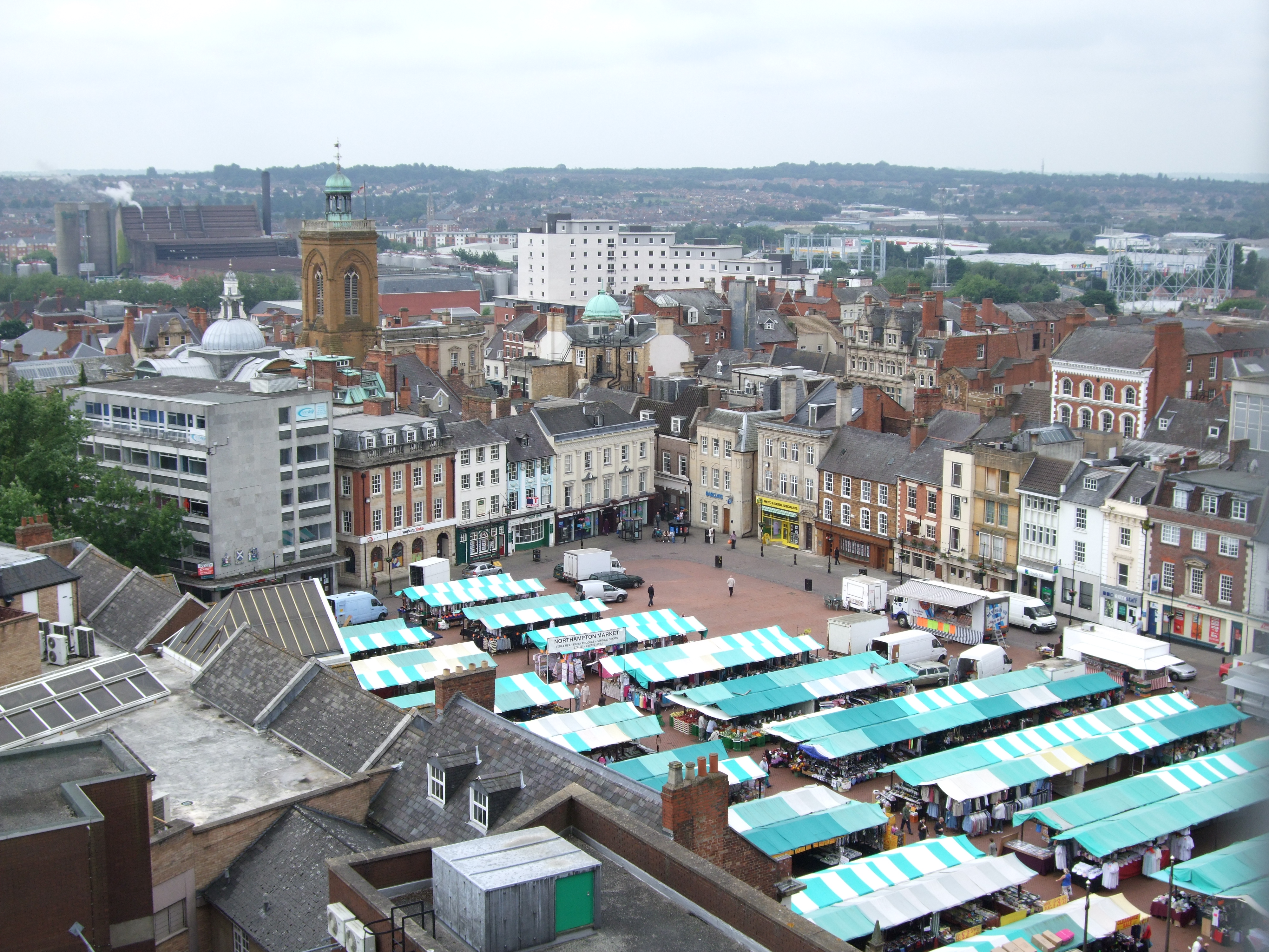
 Market Square from top of the Grosvenor Centre in 2008
Formal parks[26] include: Abington Park; The Racecourse, which used to be home in summer to the Balloon Festival and originally used for horse-racing until 1904 and also used as a cricket ground between 1844–1885; Delapré Park; Bradlaugh Fields; Becket's Park, named after Thomas Becket as are nearby Becket's Well and Thomas á Becket pub. There is a park around an Iron Age fort in West Hunsbury.
Billing Aquadrome leisure park is on the eastern outskirts with a caravan site, marina, funfair, bar, riverside restaurant and converted water mill with original workings. Other smaller ones are Thorntons Park and Victoria Park.
The main shopping centre is the Grosvenor Centre built in the 1970s. The town has one of Britain's largest market squares, dating from 1235. Outside the centre the Weston Favell Centre built in the 1970s is in the eastern district together with various out of town retail and leisure parks.
Contemporary culture
The Derngate and Royal theatres are in Guildhall Road, opposite Northampton Museum and Art Gallery. They were renovated and reopened in 2006, at a cost of £15 million. The Deco is a 900-seat theatre/conference centre based on the Grade-II listed former Cannon Cinema, in Abington Square used mainly by the voluntary and charitable sector. It was restored by the Jesus Army as part of their Jesus Centre project.
 The Deco and the Northampton Jesus Centre share a Grade II listed Art Deco building, formerly the Cannon cinema
 Northampton Market
Northampton Museum and Art Gallery has a world-class collection of historical footwear, and also Italian art, glass and ceramics, plus visiting exhibitions and local history. There is also a smaller historical museum in a former mansion within Abington Park.
The old Fishmarket[27] opposite the market square, was renovated by the Northampton Arts Collective. It has three art gallery spaces, retail units, a café, and an arts studio and is host to exhibitions by leading artists and live music, community events and workshops.
An independent contemporary arts gallery and studios, The Sanctuary,[28] self-funded and supported by the Arts Council has 16 studios. The Avenue Gallery[29] is at the Avenue campus of Northampton University. Northamptonshire runs an annual county-wide Open Studios[30] event in which artists' studios are open to the public.
The university spent £3m on its Portfolio Innovation Centre,[31] and in early 2011 it now houses around 60 creative freelancers, digital media developers, and designers.
Two commercial cinemas are also in the town: Vue (formerly UCI) at Sol Central, Cineworld (formerly UGC, Virgin Cinema and MGM) at Sixfields. There is also the subsidised Forum Cinema at Lings Forum, whose film programme is widely varied and includes art-house and non-mainstream films.
Many local music venues provide events. One venue is The Roadmender, which used to be run and funded by the council and later bought by The Purplehaus group. It is host to mainstream touring bands and one off gigs. Alan Moore's underground magazine Dodgem Logic included a CD "Nation of Saints, 50 Years of Northampton Music" in the first issue, December 2009.[32]
Sport
The town is home to Premiership Rugby union club Northampton Saints, who play at Franklin's Gardens in the St James area. "The Saints" had their greatest moment when they won the Heineken Cup in 2000 at Twickenham, beating Munster 9–8. There are also a number of "Junior" rugby clubs in the area, the most successful of these at producing young players is Northampton Old Scouts RFC[33] who have produced Ben Cohen and Steve Thompson amongst others.[33]
League Two football club Northampton Town, known as "The Cobblers" from the town's shoemaking background, are based at Sixfields Stadium. Established in 1897, in their centenary season of 1997 they reached Wembley through the play-offs and beat Swansea City 1–0 with an injury time winning free kick from John Frain. In 2010, they were drawn against premiership team Liverpool in the 2010-11 Football League Cup 3rd round/last 32. They were drawing 1–1 after full-time but won 2–4 on penalties. But they lost out against Ipswich Town 3-1 in the 4th round/last 16. It was the first club to set up a trust for supporters to work with the club as many have done. There is an athletics track adjacent to the ground. There are also three non-league clubs in the United Counties Football League: Northampton Spencer; Northampton Sileby Rangers; and Northampton Old Northamptonian Chenecks.
Northamptonshire County Cricket Club, known in limited overs cricket as "The Steelbacks", play at the County Ground, in the Abington area.
Nene Whitewater Centre provides an artificial whitewater course for canoes, kayaks and rafts.
Northampton Swimming Club trained the young Olympic swimmer Caitlin McClatchey.
Collingtree Golf Club hosted the British Masters in 1995.
Northampton International Raceway near Brafield is a leading venue for stock-car racing and hosts the European Championships every July. Speedway racing has been staged at Brafield in the 1950s and again in the 1960s. In the 1950s the team was known as The Flying Foxes and in the 1960s they were known as The Badgers.
Speedway was also staged at the greyhound stadium in Northampton in the pioneer days of the late 1920s.
Education
Until 2004 the county operated a three-tier system involving lower, middle and upper schools. In 2001 the move to a two-tier system began, aiming at improving educational standards.[34] A complete list of primary and secondary schools in the town and surrounding area is available on the County Council website.[35]
University
Primary and secondary schools
Northampton School for Boys became the top performing comprehensive school in the country in 2007.[36]
For a complete list see the NCC site.[35]
Northampton School for Girls was the first school in England to gain Specialist Music College status.[37]
Independent schools
Independent government reports on all schools can be obtained from the Ofsted website.[38]
- Great Houghton (co-educational, 1–13)
- Maidwell Hall for boys aged 8–13
- Northampton High School, girls 2–18
- Northamptonshire Grammar School (co-educational, 3–18)
- Overstone Park School (co-educational, 2–18)
- Quinton House School (co-educational, 2–18)
- St Peter's Independent School(co-educational, 5–18)
- Spratton Hall School, co-educational, 4–13
Media
Newspapers The Northampton Chronicle & Echo is the town's only paid-for newspaper. There are other free newspapers, but with a town circulation only: The Mercury (Thursday) and Northants on Sunday, both from the publishers of the Chronicle & Echo, and the Herald and Post (Thursday). These free papers are mostly advertising with limited news. The Mercury is one of the oldest newspapers still in circulation first published in 1720. It is the fifth-oldest such newspaper in the UK and the tenth-oldest such in the world.[39]
Radio Three stations are based in the town, two of which broadcast county-wide. BBC Radio Northampton[40] broadcasts news, topical items and some music, switching to a regional network after 7 pm. A commercial station, Heart 96.6 (formerly Northants 96), broadcasts mostly popular music. A community radio station, Inspiration FM was awarded a 5 year licence on 24 July 2008 and officially launched on Saturday 24 July 2010.[41]
Regional TV news is broadcast on the BBC East (terrestrial and satellite) with a main programme, BBC Look East, and on ITV's Anglia News. From 1999–2004, Northants TV (NTV) on cable and later terrestrial showed local ads, sport, and limited local activities.
Film and TV Northampton was the town location in the BBC's Keeping Up Appearances from 1990–1995. Parts of the 2005 film Kinky Boots were made in Northampton and featured shots of the statue outside the Grosvenor Centre in the Town Centre and inside RE Tricker's[19] shoe factory in St. Michaels Road representing the original factory, in Earls Barton. The third series of BBC Three's Bizarre ER was filmed at Northampton General Hospital.
Notable buildings
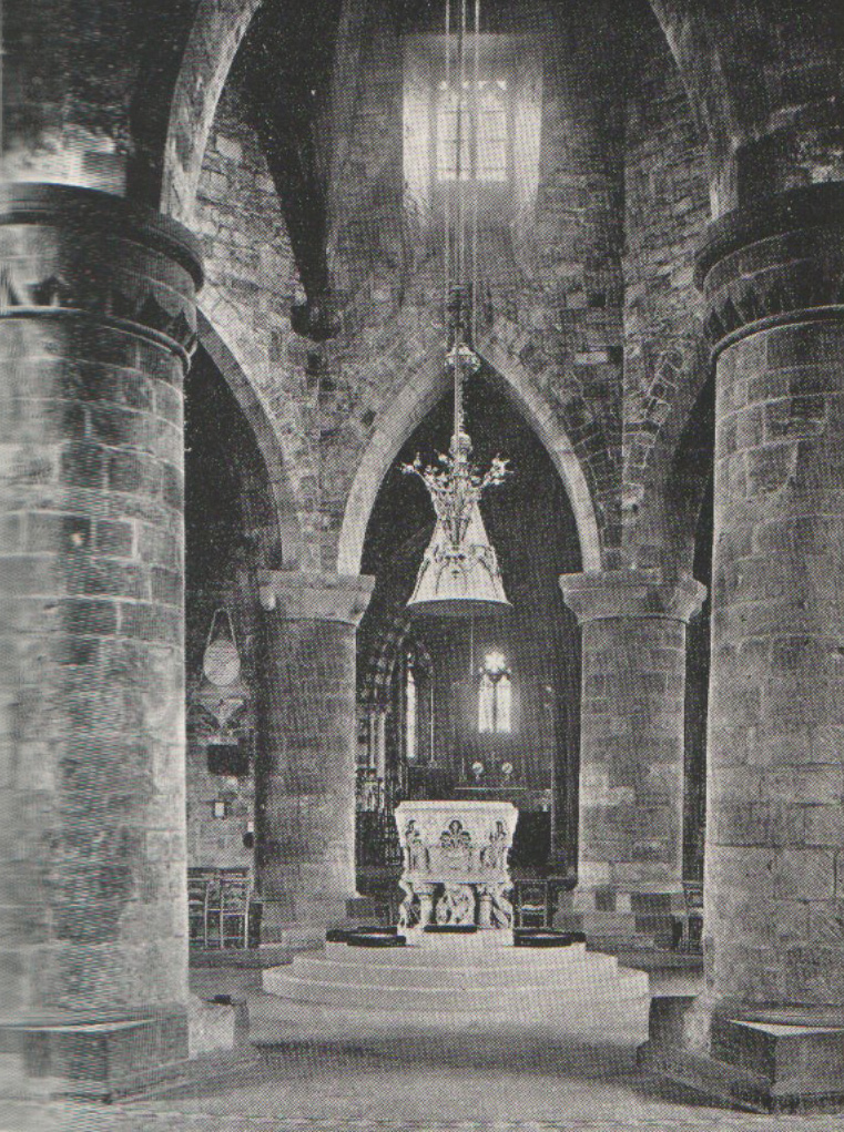
 Interior of the Church of the Holy Sepulchre
- Northampton's oldest standing building, the Church of The Holy Sepulchre, is one of the largest and best-preserved round churches in England. It was built in 1100 on the orders of the first Earl of Northampton, Simon de Senlis, who had just returned from the first Crusade. It is based on a plan of the original Church of the Holy Sepulchre in Jerusalem.
- The current All Saints' Church was built on the site of a great Norman church, All Hallows, which was almost completely destroyed by the Fire of Northampton in 1675. All that remained was the medieval tower and the fine vaulted crypt, but by 1680 All Saints had been rebuilt, with the help of donations from all over England, including 1,000 tons of timber from King Charles II, whose statue can be seen above the portico. Famously, the poet John Clare liked to sit beneath the portico of the church.
 All Saints' Church in central Northampton
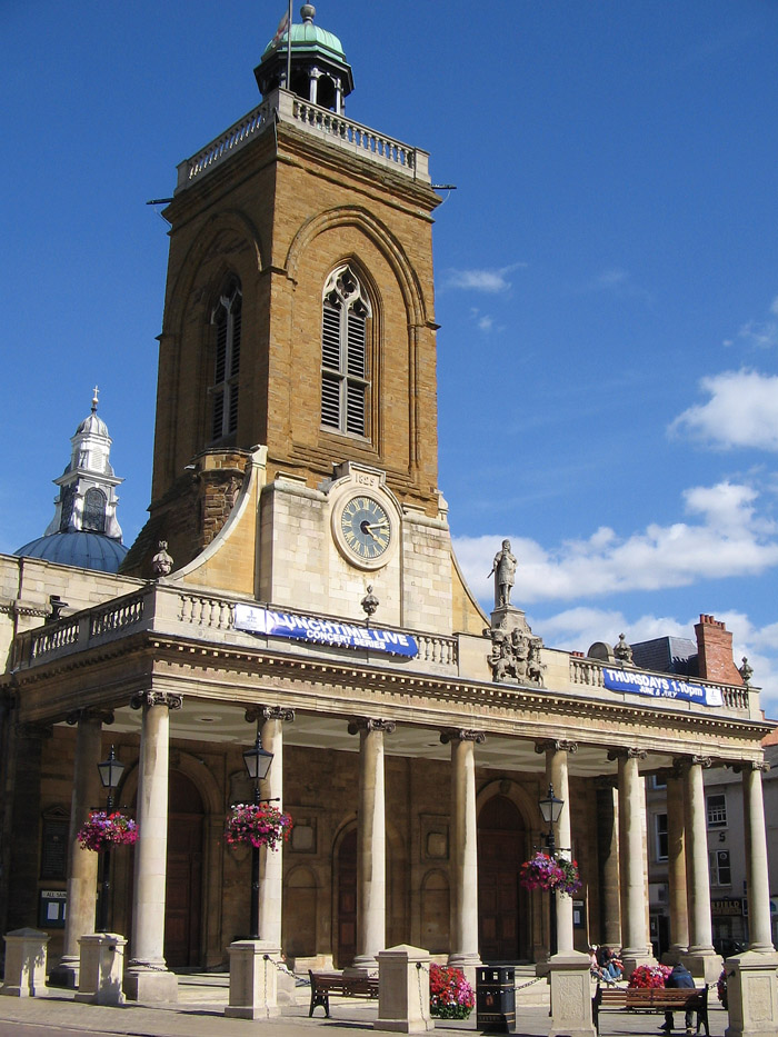
- The Guildhall in Northampton (see picture at top) was constructed mostly in the 1860s in Victorian Gothic architecture, and extended in the 1990s. It is built on the site of the old town hall.
- 78 Derngate is a Grade II* listed Georgian Town House remodelled by Charles Rennie Mackintosh for Wenman Joseph Bassett-Lowke in 1916–17. It contains notable Mackintosh interiors (which have been restored) and is his only major domestic commission outside Scotland. It is open to the public.
- The 127.45 m (418 ft 2 in) tall Express Lift Tower is a dominant feature and visible from most of the town. A Terry Wogan radio phone-in during the 1980s to came up with the name "Northampton Lighthouse" as Northampton is one of the furthest places from the sea. It is also known as the "Cobblers' Needle". It was built for testing new lifts at the Express Lifts factory, now closed. Though now redundant, it is a listed building.
 Express Lift Tower
- Northampton Castle (now only remaining as a rebuilt postern gate in a wall outside the railway station and the hill on which it stood) was for many years one of the country's most important castles. The country's parliament sat here many times and Thomas Becket was imprisoned here until he escaped.
- The Carlsberg UK brewery.
- Delapre Abbey – former Cluniac nunnery, founded by Simon de Senlis – later the County Records Office and site of the second Battle of Northampton.
- Queen Eleanor's body rested here on its way to London – and the nearby Eleanor cross in Hardingstone, now part of the Delapre area of the town, commemorates this. Out of the twelve originally erected, this cross is one of only three left including others at Geddington and Waltham. The original top of the monument widely thought to have been an ornate cross has apparently been destroyed and replaced several times from as early as 1460.[42] The last cross is reported to have been knocked off by a low flying aircraft from a nearby airfiled during WWII. However The Friends of Delapré Abbey charity is raising funds for the restoration of the cross in their tea room inside the abbey. The Cross is also referred to in Daniel Defoe's a "Tour through the whole island of Great Britain" where he describes the Great Fire of Northampton, "...a townsman being at Queen's Croos upon a hill on the south side of the town, about two miles off, saw the fire at one end of the town then newly begun, and that before he could get to the town it was burning at the remotest end, opposite where he first saw it."
- The 1970s Greyfriars Bus Station was built which replaced one in Derngate. In the 2000s it was featured on Channel 4's Demolition programme as the ugliest transport station in the UK and worthy of demolition.
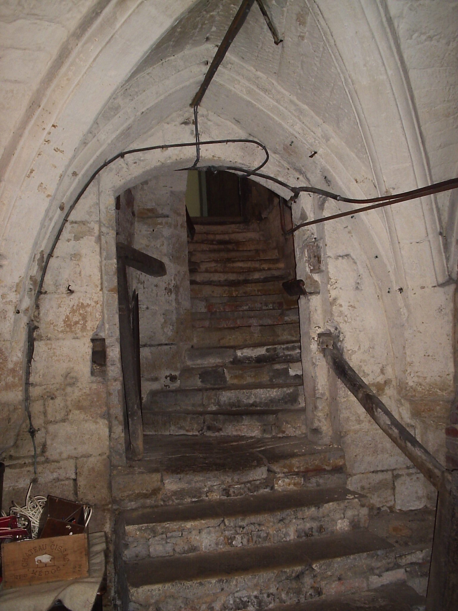
 Medieval cellars at Northampton & County Club see Northampton's tunnels
 - St Andrew's Hospital, opened 1838, and its new building William Wake House, the largest neo-classical structure in England since the Ministry of Defence.
- Northampton & County Club, established 1873, was the old county hospital before becoming a private members' club; the cellars are medieval.
Other notable church buildings include: St Edmunds, closed 1978 and demolished 2007 with the bells now in St Paul's Cathedral, Wellington, New Zealand; St Giles; St Matthew's in Phippsville, built 1891-4 has a Henry Moore sculpture of the Madonna ; Cathedral of Our Lady Immaculate & St Thomas of Canterbury, the mother church of the Roman Catholic Diocese of Northampton and seat of the Bishop of Northampton.
Notable residents
Modern
- Will Alsop[43] architect, was born, raised, and studied for his Foundation degree in the town. Designed the Sharp Centre for Design in Toronto and North Greenwich tube station on the London Underground Jubilee Line
- Dallas Campbell, TV presenter, studied Drama and English at the University of Northampton between 1989~1992[44]
- Judy Carne, actress, born Joyce Botterill 27 April 1939 in the town. Her catch phrase wasphrase "Sock it to me!" on Laugh-In
- Alan Carr, comedian, attended what is now Weston Favell School, but was not born locally. His father Graham Carr managed Northampton Town FC[45]
- Andrew Collins journalist and broadcaster, grew up in the town and wrote about it in his memoir Where Did It All Go Right?
- Delia Derbyshire (deceased), who produced the original Doctor Who theme tune, spent her final years in the town
- Marcia Matilda Falkender, Baroness Falkender, formerly Marcia Williams, private secretary to Prime Minister Harold Wilson was educated at Northampton High School for Girls
- Anne Fine – Author of Madame Doubtfire attended Northampton High School for Girls[46]
- Joan Hickson, who played Miss Marple, comes from Kingsthorpe
- Ruaridh Jackson, who plays rugby union for Glasgow Warriors and Scotland, was born in the town
- Lesley Joseph Birds of a Feather actress grew up in the town
- Robert Llewellyn, actor, (Kryten from Red Dwarf) was born here and lived at 47 Booth Rise until the age of 13[47]
- Tim Minchin comedian, actor and musician was born here
- Alan Moore, writer of V for Vendetta, Watchmen, The League of Extraordinary Gentlemen, Voice of the Fire, a fictionalised history of the town, is a lifelong resident
- James Morrison singer/songwriter lived in the town for 18 months and went to Kingsthorpe Middle School
- Nanette Newman, actress and author, wife of Bryan Forbes was born here
- Anna Murby, former BBC radio presenter attended Campion School, Bugbrooke
- Des O'Connor, television presenter and singer, evacuated to the town in 1932 during WWII and briefly played for Northampton Town FC
- Myrea Pettit, fantasy artist of fairies, flowers and butterflies learned her craft in the county
- Former Blue Peter presenter Peter Purves lived for a number of years at the old rectory in Cogenhoe[48]
- Derek Redmond, Olympic runner, was born and raised here and attended Roade Comprehensive School, now Roade Sports College, where the sports hall is named after him
- Ian Sampson, former Northampton Town, Sunderland United and Tottenham Hotspur football player and Northampton FC Manager
- Norman Smiley, professional wrestler, was born here
- Matt Smith, actor, who plays the eleventh Doctor in Doctor Who and is the youngest actor in the role, went to Northampton School for Boys[49][50][51][52][53]
- Diana, Princess of Wales (Diana Spencer) is buried at Althorp, the country estate of Earl Spencer where Charles Spencer, the current and 9th Earl Spencer (b.1964) is her brother. In 1989, the Prince and Princess of Wales, Charles & Diana, made an official visit to Northampton and Diana was made an Honorary Freeman of the Borough.[54] The Royal Pioneer Corps from the former Simpson Barracks, which were located at Wootton in the south of the town, stood guard of honour on the day.[55] There is a bronze plaque in her memory on the outside of the Guildhall 1992 extension
- Graeme Swann, cricketer was born in Northampton and played for Northamptonshire County Cricket Club from 1998–2004 before moving to Nottinghamshire County Cricket Club. He currently plays in both the England Test and One Day International teams
- Michael Underwood, TV presenter, lives in the town and attended what is now Weston Favell School
- Marc Warren, played Danny Blue in the BBC's Hustle series, was born in Kingsthorpe
- Jo Whiley, a former BBC Radio 1 presenter, now presenting on BBC Radio 2, attended Campion School, Bugbrooke
- Stuart Pearson Wright, award winning artist, was born here in 1975
- Lee Hasdell, a former professional kickboxer and mixed martial artist. Also pioneer of British mixed martial arts.
Historical
- Robert Adams Sculptor and designer born in the Far Cotton area of the town
- William Alwyn, composer born in the town
- Sir Malcolm Arnold composer
- George Baker (topographer)
- Margaret Bondfield Labour MP for Northampton in 1923, first woman Cabinet minister in the United Kingdom and one of the first three female Labour MPs
- John de Bothby, former Lord Chancellor of Ireland, spent his last years as vicar of the church of The Holy Sepulchre, Northampton c.1380.
- Elizabeth Bowen, 20th century Anglo-Irish writer, lived here after her marriage
- Charles Bradlaugh radical MP and member for the town
- Anne Bradstreet (1612–1672) a puritan poet later based in Massachusetts
- Alban Butler (1710–1773) the author of Lives of the Saints
- John Clare, the poet, was detained in Northampton County Lunatic Asylum, now St Andrew's Hospital, and remained until his death in 1864
- Francis Crick, scientist, born in the town in 1916. With James D. Watson discovered the structure of DNA and Nobel Prize winner. In December 2005, a public sculpture called Discovery by Lucy Glendinning was erected in Abington Street as a memorial to him[56]
- Philip Doddridge (1702–1751) was an English Nonconformist leader, educator, and hymnwriter.
- Errol Flynn acted in the Northampton Repertory Theatre 1933–34
- Violet Gibson, would-be assassin of Benito Mussolini, is buried in Kingsthorpe
- James Harrington (1611–1677), philosopher and author of "Oceana", was born at nearby Upton Hall
- Jerome K. Jerome, author of Three Men in a Boat and other works, died here in 1927
- Spencer Perceval was a local MP and Prime Minister. Shot in the House of Commons by assassin John Bellingham in 1812
- Pickering Phipps Brewer and local MP
- Edmund Rubbra composer born in the town
- Charles ("C.T.") Studd Victorian cricketer and pioneer missionary who played in the first Ashes test, was born at Spratton
- Walter Tull, Northampton Town FC player who became Britain's first black army officer in the First World War.
Musical
- Bauhaus
- VV Brown, artist-songwriter-producer
- New Cassettes, indie rock band formed in 2005
- The Departure, rock band who have gone on to gain mainstream success
- Pat Fish, leader of the Jazz Butcher
- Rebecca Hunter singer from pop group allSTARS*
- James Chapman, Northampton-based Mercury-nominated musician
- Moom, progressive rock band formed in 1992
- Medium 21, alternative rock band formed in 1999
- Slipstream, alternative band formed in 1994
- Faye Tozer, singer from pop group Steps
Related towns
Northampton is twinned with:
Northampton is also a sister town of:
 Northampton, Maryland, United States
- Northampton, Massachusetts, United States
- Northampton, New York, United States
- Northampton, North Carolina, United States
- Northampton, Pennsylvania, United States
- Northampton, Virginia, United States
See also
- Districts of Northampton
- St Peter's Church, Northampton
- HMS Laforey
- Flooding in Weedon Road, St James and Far Cotton around Easter 1998
References
- ^ a b NBC Councillors 2007–2011 Accessed 16 August 2011
- ^ "Office for National Statistics (Northampton Area)". http://www.neighbourhood.statistics.gov.uk/dissemination/LeadTableView.do?a=3&b=277057&c=northampton&d=13&e=13&g=473257&i=1001x1003x1004&m=0&r=1&s=1207126453659&enc=1&dsFamilyId=1812.
- ^ a b KS01 Usual resident population: Census 2001, Key Statistics for urban areas line 1129 – Office of National Statistics
- ^ "City winners named". BBC News. 18 December 2000. http://news.bbc.co.uk/1/hi/uk/1074434.stm. Retrieved 2 April 2008.
- ^ "Northants Review Part V: The Middle and Late Saxon periods". http://finds.org.uk/blogs/northamptonshire/.
- ^ "Northampton Castle", The Gatehouse
- ^ Northampton synagogue discovered under kebab shop Jewish Chronicle – Marcus Dysch – 15 April 2010 TheJC.com
- ^ a b Harry, Bill (2000). The Beatles Encyclopaedia (2000 paperback edition; first published 1992). London: Virgin Publishing, London W6 9HA. pp. 9 and 776. ISBN 0 7535 0481 2.
- ^ Microsoft Word – Northamptonshire 2006-based Population Projections – Draft.... (PDF) . Retrieved on 25 August 2011.
- ^ "Millennium city leak angers bookies". BBC. 7 March 2000. http://news.bbc.co.uk/1/hi/uk/669580.stm. Retrieved 15 October 2008.
- ^ "City winners named". BBC. 18 December 2000. http://news.bbc.co.uk/1/hi/uk/1074434.stm. Retrieved 15 October 2008.
- ^ West Northamptonshire Development Corporation website. Wndc.co.uk. Retrieved on 25 August 2011.
- ^ a b "Moulton Park Weather". http://www.northampton.ac.uk/appliedsciences/appliedscience/geoenvsci/climatological-station/temperature. Retrieved 23 February 2011.
- ^ "19th July 2006". http://www.metoffice.gov.uk/climate/uk/interesting/july2006/MaxTemp1907Points_jpeg.JPG. Retrieved 23 February 2011.
- ^ Rogers, Simon (21 December 2010). "20 December 2010". The Guardian (London). http://www.guardian.co.uk/news/datablog/2010/dec/20/winter-weather-coldest-places-britain. Retrieved 23 February 2011.
- ^ "Climate Normals 1971–2000". YR.NO. August 2011. http://www.yr.no/place/United_Kingdom/England/Moulton~2642124/statistics.html. Retrieved 23 February 2011.
- ^ "Long term Rainfall". WorldClimate. http://www.worldclimate.com/cgi-bin/data.pl?ref=N52W000+2100+0355801G1. Retrieved 23 February 2011.
- ^ Church's English Shoes. Church-footwear.com. Retrieved on 25 August 2011.
- ^ a b "RE Trickers Limited". http://www.trickers.com/. Retrieved 21 May 2008.
- ^ '' 'Avon New European HQ to Open Autumn 2009' '' Northampton Chronicle & Echo report. Northamptonchron.co.uk. Retrieved on 25 August 2011.
- ^ Avon cease manufacturing in Northampton – BBC report 2003. BBC News (17 April 2003). Retrieved on 25 August 2011.
- ^ English Partnerships. English Partnerships. Retrieved on 25 August 2011.
- ^ Extract from Building Societies Yearbook 2009/10 (p.127) Building Societies Association (retrieved 17 November 2009)
- ^ Sywell Aerodrome – new concrete runway to open. Northamptonchron.co.uk. Accessed 25 August 2011.
- ^ "Trams". Far Cotton History Group. http://cottonites.co.uk/transport.htm. Retrieved 7 October 2009.
- ^ "Northampton parks and gardens: County Council website". http://www.northampton.gov.uk/site/scripts/documents.php?categoryID=1132. Retrieved 24 May 2008.[dead link]
- ^ The Fishmarket Gallery. The Fishmarket Gallery. Retrieved on 25 August 2011.
- ^ The Sanctuary Contemporary Art Gallery. The-artist-sanctuary.org.uk. Retrieved on 25 August 2011.
- ^ Avenue Gallery[dead link]
- ^ Open Studios. Open Studios. Retrieved on 25 August 2011.
- ^ The Portfolio Innovation Centre. Portfoliocentre.co.uk. Retrieved on 25 August 2011.
- ^ Logic, Dodgem. "Dodgem Logic Steal Page". Dodgem Logic. http://www.dodgemlogic.com/steal.
- ^ a b Northampton Old Scouts RFC. Nosrfc.com. Retrieved on 25 August 2011.
- ^ – Education – Parents' concern over school closures. BBC News (28 June 2001). Retrieved on 25 August 2011.
- ^ a b "Northamptonshire Schools Directory". http://www.northamptonshire.gov.uk/ncc/Templates/content_applications.aspx?NRMODE=Published&NRORIGINALURL=%2fLearning%2fInstitutions%2fschoolsdir%2ehtm%3fSchoolDetail%3d9282196%257CPrimary&NRNODEGUID=%7b7BF3FCE4-28B4-49B8-8F4E-CEA308D6E556%7d&NRCACHEHINT=NoModifyGuest. Retrieved 31 March 2008.[dead link]
- ^ "Five-star performance by NSB's A-level students". Newspaper (Chronicle & Echo). 14 August 2008. Archived from the original on 19 May 2010. http://www.webcitation.org/5ppXebos3. Retrieved 12 October 2008.
- ^ Woodthorpe, David (10 February 2006). "East: Education, education ...". BBC. http://news.bbc.co.uk/1/hi/programmes/politics_show/4696116.stm. Retrieved 22 August 2008.
- ^ "Ofsted Inspection Reports". http://www.ofsted.gov.uk/reports/. Retrieved 31 March 2008.
- ^ "World Association of Newspapers". http://www.wan-press.org/article2823.html. Retrieved 30 August 2009.
- ^ BBC Radio Northampton "BBC Radio Northampton". http://www.bbc.co.uk/england/radionorthampton BBC Radio Northampton. Retrieved 2 April 2008.
- ^ Ofcom press release 24 July 2008 "Ofcom website". http://www.ofcom.org.uk/media/news/2008/07/nr_20080724a Ofcom press release 24 July 2008.
- ^ Hardingstone Eleanor Cross:: OS grid SP7558 :: Geograph Britain and Ireland – photograph every grid square!. Geograph.org.uk. Retrieved on 25 August 2011.
- ^ Parker, Helen (13 September 2007). "Tutti Frutti has room for all sorts – Daily Telegraph 13 September 2007". The Daily Telegraph (London). http://www.telegraph.co.uk/property/main.jhtml?xml=/property/2007/09/13/ptutti113.xml. Retrieved 5 October 2008.
- ^ "The Donor" (Quarterly magazine from the National Blood Service) Winter 2010.
- ^ "Alan Carr book Launch – Chronicle & Echo report 1 October 2008". http://www.northamptonchron.co.uk/news/Alan-Carr-tells-of-Northampton.4544085.jp/. Retrieved 5 October 2008.
- ^ "Anne Fine biography". Bibliography. The Wee Web. Archived from the original on 25 December 2010. http://www.webcitation.org/5vF9p2RaO. Retrieved 25 December 2010.
- ^ Anglian TV's Celebrity Going Home: Robert Llewellyn (2004)
- ^ Northampton Chronicle & Echo 16 January 2009. Northamptonchron.co.uk. Retrieved on 25 August 2011.
- ^ "BBC – Doctor Who – The Official Site". BBC. http://www.bbc.co.uk/doctorwho/. Retrieved 4 January 2009.
- ^ "BBC – Doctor Who – News Story". BBC. 3 January 2009. http://www.bbc.co.uk/doctorwho/s4/news/latest/090103_news_01. Retrieved 14 January 2009.
- ^ "Ex-NSB head boy Matt Smith is new Doctor Who". Chronicle & Echo. 3 January 2009. http://www.northamptonchron.co.uk/news/He39s-done-it-Former-Northampton.4841560.jp. Retrieved 14 January 2009.
- ^ "Ex-NSB student Matt Smith is new Dr Who!". Northampton School for Boys. http://www.nsb.northants.sch.uk/?_id=1399. Retrieved 14 January 2009.
- ^ "Who on earth is Matt Smith?". BBC. 3 January 2009. http://news.bbc.co.uk/1/hi/entertainment/7807996.stm. Retrieved 14 January 2009.
- ^ "Diana, Princess of Wales – Northamptonshire's most famous daughter – BBC News". http://www.bbc.co.uk/northamptonshire/asop/people/diana/diana.shtml. Retrieved 28 October 2008.
- ^ "Royal Pioneer Corps, guard of honour for visit of Prince & Princess of Wales, 1989, when Diana received Freedom of the Borough". http://www.royalpioneercorps.co.uk/rpc/pastevents5.htm. Retrieved 7 October 2008.
- ^ Sculpture celebrates DNA pioneers BBC News, 13 December 2005
External links
Coordinates: 52°14′14″N 0°53′46″W / 52.237211°N 0.896028°W
Ceremonial county of Northamptonshire Boroughs or districts Major settlements Rivers Canals Topics Northampton Borough Council Suburbs and Villages Abington · Billing · Collingtree · Collingtree Park · Dallington · Duston · East Hunsbury · Far Cotton · Hardingstone · Kingsthorpe · Northampton · Queen's Park · Round Spinney ·
Sixfields · Spring Boroughs · Upton · West Hunsbury · Weston Favell · Wootton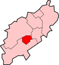
Attractions Constituencies Higher Education Sport County Cricket Ground · Nene Whitewater Centre · Northampton ON Chenecks F.C. · Northampton Saints · Northamptonshire County Cricket Club · Northampton Sileby Rangers F.C. · Northampton Spencer F.C. · Northampton Town F.C. · Northampton Swimming Club · Sixfields Stadium · Franklin GardensTransport A43 road · A45 road · Grand Union Canal · Greyfriars bus station · London Midland · First Northampton · M1 Motorway · Arriva · Northampton railway station · Stagecoach in Northants · Virgin TrainsEast Midlands · England Portal · Northamptonshire · WikiProject Northamptonshire · United Kingdom PortalSettlements on the River Nene, Source– Wash Yelvertoft · Badby · Newnham · Dodford · Everdon · Weedon · Flore · Nether Heyford · Northampton · Wellingborough · Little Irchester · Thrapston · Aldwincle · Peterborough · Whittlesey · Benwick · Wisbech · Sutton BridgeDerbyshire Amber Valley • Bolsover • Chesterfield • Derby • Derbyshire Dales • Erewash • High Peak • North East Derbyshire • South Derbyshire
Leicestershire Lincolnshire Nottinghamshire Ashfield • Bassetlaw • Broxtowe • Gedling • Mansfield • Newark and Sherwood • Nottingham • Rushcliffe
Northamptonshire Corby • Daventry • East Northamptonshire • Kettering • Northampton • South Northamptonshire • Wellingborough
Rutland  25 largest settlements in the UK by urban core population*
- London: 7,172,091
- Birmingham: 970,892
- Glasgow: 629,501
- Liverpool: 469,017
- Leeds: 443,247
- Sheffield: 439,866
- Edinburgh: 430,082
- Bristol: 420,556
- Manchester: 394,269
- Leicester: 330,574
- Coventry: 303,475
- Kingston-upon-Hull: 301,416
- Bradford: 293,717
- Cardiff: 292,150
- Belfast: 276,459
- Stoke-on-Trent: 259,252
- Wolverhampton: 251,462
- Nottingham: 249,584
- Plymouth: 243,795
- Southampton: 234,224
- Reading: 232,662
- Derby: 229,407
- Dudley: 194,619
- Newcastle upon Tyne: 189,863
- Northampton: 189,474
*Based on 2001 Census data.Categories:- Northampton
- County towns in England
- Local government in Northamptonshire
- New towns in England
- Market towns in Northamptonshire
- Towns with cathedrals in the United Kingdom
- Towns in Northamptonshire
- Non-metropolitan districts of Northamptonshire
- Local government districts of the East Midlands


Wikimedia Foundation. 2010.