- City of Albury
-
City of Albury
New South Wales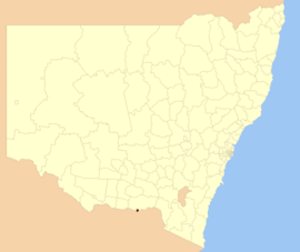
Location in New South WalesPopulation: 50,522(2009)[1] Area: 313 km² (120.8 sq mi) Mayor: Alice Glachan Council Seat: Albury (553 Kiewa Street}[2] Region: Riverina State District: Albury Federal Division: Farrer LGAs around City of Albury: Greater Hume Greater Hume Greater Hume Greater Hume City of Albury Greater Hume Wodonga (Vic) Wodonga (Vic) Wodonga (Vic) The City of Albury is a Local Government Area (LGA) in the Riverina region of New South Wales, Australia. The LGA covers the entirety of the Albury urban area including the suburbs of Forrest Hill, Lavington, Thurgoona, Splitters Creek, Ettamogah, Bowna, Table Top and Wirlinga.
The LGA is administered by the Albury City Council, consisting of a mayor and eight councillors with day-to-day operations controlled by a General Manager.
Contents
History
Albury was declared a municipality in 1859 and proclaimed a city in 1946.[3]
Council
Albury City Council is composed of nine councillors elected proportionally. The mayor is not directly elected.[4] The current makeup of the council is as follows:[4]
Party Councillors Independents and Unaffiliated 8 Albury Citizens and Ratepayers Movement 1 Total 9 The current council, elected in 2008, is:[4]
Councillor Party Notes Patricia Gould Unaffiliated Mayor Alice Glachan Independent Deputy Mayor Paul Wareham Independent Robert Angus Unaffiliated Elected on Patricia Gould's ticket Daryl Betteridge Independent Philomena Sawyer Citizens and Ratepayers Hank van de Ven Independent Neville Hull Independent Amanda Duncan-Strelec Independent Sister city
Albury is a sister city with Nanping. The agreement was formalised in September 2003.[5]
References
- ^ Australian Bureau of Statistics (30 March 2010). "Regional Population Growth, Australia, 2008–09". http://www.abs.gov.au/ausstats/abs@.nsf/Latestproducts/3218.0Main%20Features42008-09?opendocument&tabname=Summary&prodno=3218.0&issue=2008-09&num=&view=. Retrieved 3 June 2010.
- ^ "Albury City Council". Department of Local Government. http://www.dlg.nsw.gov.au/dlg/dlghome/dlg_CouncilContactDetails.asp?slacode=60. Retrieved 2006-11-30.
- ^ "Albury and District Historical Society". Research and references. Albury City Council. http://www.alburycity.nsw.gov.au/librarymuseum/research/200792051679.htm. Retrieved 2008-07-08.
- ^ a b c "Albury City Council". 2008 Election results. Electoral Commission NSW. http://www.lg.elections.nsw.gov.au/LGE2008/result.Albury.html. Retrieved 2009-06-15.[dead link]
- ^ "Sister City - Nanping". Albury City Council. http://www.alburycity.nsw.gov.au/city/history/nanping.htm. Retrieved 2008-07-08.
External links
- Albury City Council - official website
- Local Government & Municipal Knowledge Base - Albury City Council Page
See also
References
- ^ Australian Bureau of Statistics (30 March 2010). "Regional Population Growth, Australia, 2008–09". http://www.abs.gov.au/ausstats/abs@.nsf/Latestproducts/3218.0Main%20Features42008-09?opendocument&tabname=Summary&prodno=3218.0&issue=2008-09&num=&view=. Retrieved 3 June 2010.
- ^ "Albury City Council". Department of Local Government. http://www.dlg.nsw.gov.au/dlg/dlghome/dlg_CouncilContactDetails.asp?slacode=60. Retrieved 2006-11-30.
- ^ "Albury and District Historical Society". Research and references. Albury City Council. http://www.alburycity.nsw.gov.au/librarymuseum/research/200792051679.htm. Retrieved 2008-07-08.
- ^ a b c "Albury City Council". 2008 Election results. Electoral Commission NSW. http://www.lg.elections.nsw.gov.au/LGE2008/result.Albury.html. Retrieved 2009-06-15.[dead link]
- ^ "Sister City - Nanping". Albury City Council. http://www.alburycity.nsw.gov.au/city/history/nanping.htm. Retrieved 2008-07-08.
Coordinates: 36°03′S 146°57′E / 36.05°S 146.95°E
Suburbs of the City of Albury Local Government Area Albury · East Albury · Ettamogah · Glenroy · Hamilton Valley · Lavington · North Albury · South Albury · Splitters Creek · Springdale Heights · Table Top · Thurgoona · West Albury
Main Article: Local Government Areas of New South WalesLocal Government Areas of New South Wales Metropolitan Sydney Inner SydneyAshfield · Botany Bay · Burwood · Canada Bay · Canterbury · Hurstville · Kogarah · Lane Cove · Leichhardt · Manly · Marrickville · Mosman · North Sydney · Randwick · Rockdale · Strathfield · Sydney · Waverley · Willoughby · WoollahraOuter SydneyAuburn · Bankstown · Blacktown · Camden · Campbelltown · Fairfield · The Hills · Holroyd · Hornsby · Hunter's Hill · Ku-ring-gai · Liverpool · Parramatta · Penrith · Pittwater · Ryde · Sutherland · WarringahSydney SurroundsMid North Coast Bellingen · Clarence Valley · Coffs Harbour · Greater Taree · Kempsey · Nambucca · Port Macquarie-Hastings · Lord Howe IslandMurray Albury · Balranald · Berrigan · Conargo · Corowa · Deniliquin · Greater Hume · Jerilderie · Murray · Tumbarumba · Urana · Wakool · WentworthMurrumbidgee Carrathool · Coolamon · Cootamundra · Griffith · Gundagai · Hay · Junee · Leeton · Lockhart · Murrumbidgee · Narrandera · Temora · Wagga WaggaHunter Cessnock · Dungog · Gloucester · Great Lakes · Lake Macquarie · Maitland · Muswellbrook · Newcastle · Port Stephens · Singleton · Upper HunterIllawarra Richmond Tweed Southeastern Bega · Bombala · Boorowa · Cooma-Monaro · Eurobodalla · Goulburn Mulwaree · Harden · Palerang · Queanbeyan · Snowy River · Tumut · Upper Lachlan · Yass Valley · YoungNorthern Armadale Dumaresq · Glen Innes-Severn · Gunnedah · Guyra · Gwydir · Inverell · Liverpool Plains · Moree Plains · Narrabri · Tamworth · Tenterfield · Uralla · WalchaCentral West North Western Far West Local Government Areas of the Riverina Cities: Albury · Griffith · Wagga Wagga
Towns: Deniliquin
Shires: Balranald · Berrigan · Carrathool · Conargo · Coolamon · Cootamundra · Corowa · Greater Hume · Gundagai · Hay · Jerilderie · Junee · Leeton · Lockhart · Murray · Murrumbidgee · Narrandera · Temora · Tumbarumba · Tumut · Urana · Wakool
Categories:- Local Government Areas of the Riverina, New South Wales
- Albury, New South Wales
- Riverina geography stubs

Wikimedia Foundation. 2010.