- Maryland Route 216
-
Maryland Route 216
Seventh Street, Scaggsville Road 
Route information Maintained by MDSHA Length: 8.70 mi[1][2] (14.00 km) Major junctions South end:  MD 198 in Laurel
 I-95
I-95 US 29 in Scaggsville
North end:  MD 108 in Highland
Highway system Maryland highway system
Interstate • US • State • Minor • Former • Turnpikes←  MD 214
MD 218  →
→Maryland Route 216 is a Maryland between Laurel and Highland, primarily within Howard County. The name for Route 216 is Scaggsville Road.
Contents
Route description
7th Street, Laurel
MD 216 begins at the intersection between 7th St and Gorman Avenue (eastbound MD 198) in downtown Laurel. After crossing Talbot Ave (westbound MD 198) the route continues northward as an inner-city street, eventually crossing Montgomery St and Main St. At the Main St intersection, maintenance responsibility for MD 216 switches from the city of Laurel to MDOT SHA.
Scaggsville Road
Beyond Main St., MD 216 assumes the name of Scaggsville Rd. (though most signage in Prince George's County uses the "MD 216" notation) and continues north, crossing the Patuxent River via a high-level bridge about a mile downstream from Rocky Gorge Reservoir. Continuing to the northwest, the route intersects All Saints Rd. at a traditional traffic light and Stephens Rd. via ramp before upgrading to a limited-access expressway. In this format, the route interchanges with Interstate 95 at a full cloverleaf. Northwest of the interchange, MD 216 crosses Leishear Road near a major BG&E electrical substation, continuing northwest before meeting US 29 at a folded-diamond interchange in Scaggsville controlled by two traffic circles. After crossing US 29, MD 216 downgrades to a two-lane country road and continues to the north-northwest, passing through Fulton before reaching its northern terminus at MD 108 in Highland.
History
Howard County
The realignment of MD 216 between I-95 and US 29 was completed to address expected growth and increased traffic demands. Prior to this realignment, MD 216 was a broken route; the limited-access expressway ended at Leishear Rd., and traffic was forced to turn left and access MD 216's original alignment via the county-maintained street. With the completion of the limited-access parkway between Leishear Rd. and US 29, MD 216 is now a continuous route between MD 108 in Highland and MD 198 in Laurel; Old Scaggsville Rd. (MD 216E and MD 983) survives under state maintenance.
Funding for the construction of the missing segment of MD 216 was provided by the developer of property in the northeast and northwest quadrants of the I-95/MD216 interchange.
Prince George's County
Prior to the 1950s, MD 216 extended eastward from Laurel into Anne Arundel County with an eastern terminus at Fort Meade, near the current eastern terminus of MD 198. Instead of entering Laurel at 7th Street, MD 216 crossed the Patuxent River over a now-defunct bridge at 9th Street.
MD 216 turned east onto Main Street and followed it past the one-lane railroad bridge to Main Street's current eastern end. At that point, MD 216 turned northeast and crossed another now-defunct bridge over the Patuxent River onto the grounds of Laurel Park in Anne Arundel County.
For some time after this path changed in the 1950s, MD 216 continued south on 9th Street to a terminus at MD 198.
Anne Arundel County
Prior to the 1950s, MD 216 extended across the Laurel Park grounds toward the current intersection of MD 198 and Brock Bridge Road. The portion of MD 216 between Laurel and Fort Meade was known as Old Camp Meade Road. When the route was disjointed by the construction of the Baltimore-Washington Parkway in the early 1950s, the "MD 216" designation was removed within Anne Arundel County. Three state-maintained segments of this road remain:
- A 0.2-mile (0.32 km) section known as Old Camp Meade Road exists between the Maryland City fire station and Whiskey Bottom Road (where it is blocked with barriers), and continuing across that road behind some businesses. State highway maintenance records list this section as MD 216A.[3] Though very overgrown by nature, remnants of the road continue eastward between homes and business properties until reaching Russett Green East.
- A 0.5-mile (0.80 km) section known as Old Portland Road exists from MD Route 198 west toward Maya Angelou Academy. State highway maintenance records list this section as MD 216B.[3]
- A 0.04-mile (0.064 km) section now known as Welchs Court exists as a spur from MD 198 about 0.1-mile (0.16 km) east of MD 216B. State highway maintenance records list this section as MD 216C.[3] The former MD 216 passed through this area, parallel with the current Route 198.
The rest of this former eastward section of MD 216 was subsumed by MD 198 (Laurel Fort Meade Rd), business and residential development, and nature.
Junction list
County Location Mile Destinations Notes Prince George's Laurel 0.00  MD 198 east (Gorman Avenue) to US 1 – Maryland City
Southern terminus
One-way eastbound0.11 MD 198 west (Talbot Avenue) to I-95 – Sandy SpringOne-way westbound 0.35 Montgomery Street 0.52 Main Street eastbound Main Street leads to Laurel MARC station; westbound leads to old MD 216 river crossing MD 216 changes jurisdiction from Laurel municipal maintenance to MDOT SHA maintenance and crosses the Patuxent River Howard Laurel 0.71 Baltimore Avenue / Pilgrim Avenue – to Old Scaggsville Road Pilgrim Avenue westbound leads to other side of old old MD 216 river crossing 1.26 All Saints Road 1.49 Stephens Road east – to Whiskey Bottom Road Interchange
No eastbound entrance from Stephens Road west2.18 I-95 – Baltimore, Washington D.C.Interchange 3.3  To MD 983 (Leishear Road)
4.01  To MD 216E / MD 983 / Old Scaggsville Road (Crest Road)
Scaggsville 4.55 Ice Crystal Drive Roundabout
Unsigned MD 216G4.68 US 29 (Columbia Pike) – Sandy Spring, ColumbiaInterchange 4.9 MD 216JRoundabout
Includes link to old segment of MD 2165.07 Maple Lawn Boulevard north – Maple Lawn Roundabout 5.21 Old Columbia Road south (MD 216H) Former US 29 Fulton 5.89 Murphy Road 5.92 Lime Kiln Road 6.46  To MD 32 (Pindell School Road)
7.55 Brown Bridge Road 8.14 To MD 108 (Hall Shop Road)Highland 8.70 MD 108 (Clarksville Pike) – Olney, ClarksvilleNorthern terminus
Continues as Highland RoadThe segment of Old Scaggsville Road bypassed by the new construction between US 29 and Leishear Road in Howard County was redesignated Maryland Route 216E.
Location Mile Destinations Notes 0.00 MD 983 (Old Scaggsville Road) / Leishear RoadEastern terminus 0.04 Harding Road – Rocky Gorge Reservoir Scaggsville 0.78 To MD 216 (Crest Road)1.10 Sweet Cherry Lane 1.21 Cul-de-sac Western terminus References
- ^ Maryland State Highway Administration (2008). "Highway Location Reference: Prince George's County" (PDF). http://apps.roads.maryland.gov/keepingcurrent/performTrafficStudies/dataAndStats/hwyLocationRef/2008_hlr_all/co16.pdf. Retrieved 2010-04-19.
- ^ Maryland State Highway Administration (2008). "Highway Location Reference: Howard County" (PDF). http://apps.roads.maryland.gov/KeepingCurrent/performTrafficStudies/dataAndStats/hwyLocationRef/2008_hlr_all/co13.pdf. Retrieved 2010-04-21.
- ^ a b c "Anne Arundel County Highway Location Reference". sha.state.md.us. Maryland State Highway Administration. December 31, 2002. http://apps.roads.maryland.gov/KeepingCurrent/performTrafficStudies/dataAndStats/hwyLocationRef/2002_hlr_all/co02.pdf. Retrieved 28 August 2009.
External links
Roads in Prince George's County, Maryland Maryland State Highways 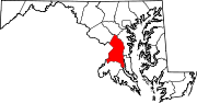
U.S. Routes Interstate Highways Roads by name Categories:- State highways in Maryland
- Roads in Prince George's County, Maryland
- Roads in Howard County, Maryland


Wikimedia Foundation. 2010.