- Shu, Kazakhstan
-
Shu
ШуShu Hospital Location in Kazakhstan
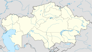
 Shu
ShuCoordinates: 43°35′54″N 73°45′41″E / 43.59833°N 73.76139°E Country  Kazakhstan
Province Jambyl Province Population - Total 35,000 Time zone UTC+6 (UTC+6)  Melons being sold on the platform of the railway station of the city of Shu
Shu (Kazakh: Шу / Şw), formerly known as Chu (Russian: Чу, until 1992), is a city in Jambyl Province of Kazakhstan, the administrative center of Shu District.
The city is located on the river of the same name, and is populated by approximately 35,000 people.
Contents
Transportation
Shu is an important transportation hub for the southern Kazakhstan / northern Kyrgyzstan region. This is where the east-west Turkestan-Siberia railway is joined with the railway running north to Kazakhstan's new capital, Astana and Petropavl, a city on the Transsiberian railway. There is no direct railroad from Shu to Bishkek serviced by Kazakhstani trains. This means that every day a large number of passengers travelling from Astana to Bishkek for example arrive in Shu by train and transfer to minivans and taxis to continue into Kyrgyzstan. Though it is possible to travel through Shu and on to Bishkek on Kyrgyz trains, it is much longer than transferring to a marshrutka for the 1.5 hour ride from Shu to Bishkek rather than the 5 to 6 hour train option. While functioning as a large transportation hub form passengers, Shu's central location makes it a natural large hub for rail freight as well. All rail freight coming through Shu is resorted and new freight trains are assembled.
Other places in Kazakhstan with the name "Shu"
 Railway station of the city of Shu
There is also a town of Shu in Kazakhstan's Akmola Oblast with the population of only a little more than 100 people. In addition to the town in Akmola Oblast, there is another village named Shu in Sozak District in South Kazakhstan Province. Due to the frequency of the name Shu, the Shu of Zhambyl Province is frequently referred to as Stantsia Shu in Russian, or "The Station Shu."
Sources
External links
Coordinates: 43°35′54″N 73°45′41″E / 43.59833°N 73.76139°E
Capital: Taraz Districts 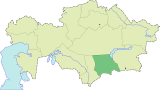
Major cities Categories:- Populated places in Kazakhstan
- Zhambyl Province
- Kazakhstan geography stubs


Wikimedia Foundation. 2010.