- Chelsea Heights, Victoria
-
Chelsea Heights
Melbourne, Victoria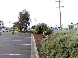
Wells Road - Springvale Road intersection view from the Chelsea Heights fast food outlets car park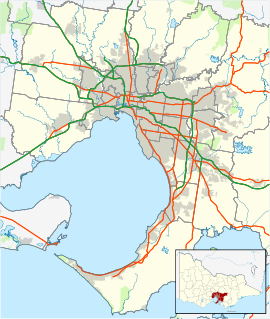
 Chelsea Heights
Population: 5125 (2006)[1] Postcode: 3196 Area: 3.2 km² (1.2 sq mi) Location: 32 km (20 mi) from Melbourne LGA: City of Kingston State District: Carrum Federal Division: Isaacs Suburbs around Chelsea Heights: Edithvale Aspendale Gardens Braeside Chelsea Chelsea Heights Bangholme Bonbeach Patterson Lakes Bangholme Chelsea Heights is a suburb in Melbourne, Victoria, Australia, 30 km south-east from Melbourne's central business district. Its Local Government Area is the City of Kingston. At the 2006 Census, Chelsea Heights had a population of 5,125.
The suburb is home to Chelsea Heights Primary School, The Chelsea Heights Cricket & Football Club, Bonbeach Blue Jays Baseball Club.
On the border of Chelsea Heights and Chelsea is the Bayside Trail bicycle track, which begins in Seaford and continues north for approximately 43 km to Port Melbourne.
Contents
Popular reference
The aerial photography at the beginning of the Network 7 show Kath & Kim shows the central portion of Chelsea Heights.[2]
See also
- City of Springvale - the former local government area of which Chelsea Heights was a part.
- Famous resident - Shah Diron
References
- ^ Australian Bureau of Statistics (25 October 2007). "Chelsea Heights (State Suburb)". 2006 Census QuickStats. http://www.censusdata.abs.gov.au/ABSNavigation/prenav/LocationSearch?collection=Census&period=2006&areacode=SSC21165&producttype=QuickStats&breadcrumb=PL&action=401. Retrieved 2008-03-28.
- ^ Google Maps
External links
Coordinates: 38°02′49″S 145°08′13″E / 38.047°S 145.137°E
Suburbs of the City of Kingston | Melbourne | Victoria Aspendale · Aspendale Gardens · Braeside · Bonbeach · Carrum · Chelsea · Chelsea Heights · Cheltenham · Clarinda · Clayton South · Dingley Village · Edithvale · Heatherton · Highett · Mentone · Moorabbin · Moorabbin Airport · Mordialloc · Oakleigh South · Parkdale · Patterson Lakes · Waterways
Categories:- Suburbs of Melbourne
- Melbourne geography stubs


Wikimedia Foundation. 2010.