- Clayton South, Victoria
-
Clayton South
Melbourne, Victoria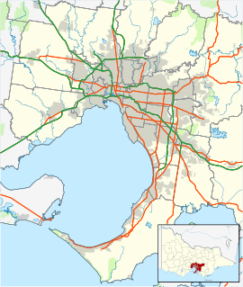
 Clayton South
Population: 10,644 (2006)[1] Postcode: 3169 Area: 8.3 km² (3.2 sq mi) Location: 20 km (12 mi) from Melbourne LGA: City of Kingston State District: Clayton Federal Division: Chisholm, Hotham Suburbs around Clayton South: Oakleigh South Clayton Mulgrave Clarinda Clayton South Springvale Heatherton Dingley Village Springvale South Clayton South is a suburb in Melbourne, Victoria, Australia, 20 km south-east from Melbourne's central business district. Its Local Government Area is the City of Kingston. At the 2006 Census, Clayton South had a population of 10,644.
Contents
History
Clayton South Post Office opened on 15 July 1929 and closed in 1976. Westall Post Office opened in 1960 near the station and closed in 1971.[2]
Transport
Westall Road runs North and South through Westall. There is a large bridge over the railway line. Several bus routes pass through the suburb and drop passengers off at the shops near the Westall railway station.
Schools
- Westall Secondary College
- Clayton South Primary School
- St Andrew's Primary School
Retail
There are a small number of shops located on Rosebank Avenue. Many of which include Australian Post Office, a local milkbar, a computer store, a pizza restaurant, a fish and chip store, a local cellar, and a newsagency.
Development of new homes
Recently[when?] a new residential estate has been opened for business. It is called The Village, and is on previously vacant land between Rosebank Avenue, Moore Avenue and very close to Westall railway station.
Sport
Golfers play at the course of the Spring Valley Golf Club on Heatherton Road.[3]
References
- ^ Australian Bureau of Statistics (25 October 2007). "Clayton South (State Suburb)". 2006 Census QuickStats. http://www.censusdata.abs.gov.au/ABSNavigation/prenav/LocationSearch?collection=Census&period=2006&areacode=SSC21175&producttype=QuickStats&breadcrumb=PL&action=401. Retrieved 2007-09-29.
- ^ Premier Postal History, Post Office List, https://www.premierpostal.com/cgi-bin/wsProd.sh/Viewpocdwrapper.p?SortBy=VIC&country=, retrieved 2008-04-11
- ^ Golf Select, Spring Valley, http://www.golfselect.com.au/armchair/courseView.aspx?course_id=364, retrieved 2009-05-11
External links
Coordinates: 37°56′49″S 145°07′23″E / 37.947°S 145.123°E
Suburbs of the City of Kingston | Melbourne | Victoria Aspendale · Aspendale Gardens · Braeside · Bonbeach · Carrum · Chelsea · Chelsea Heights · Cheltenham · Clarinda · Clayton South · Dingley Village · Edithvale · Heatherton · Highett · Mentone · Moorabbin · Moorabbin Airport · Mordialloc · Oakleigh South · Parkdale · Patterson Lakes · Waterways
Categories:- Suburbs of Melbourne

Wikimedia Foundation. 2010.