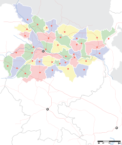
- Chakia, Bihar
-
Chakia — town — Coordinates 26°25′N 85°03′E / 26.42°N 85.05°ECoordinates: 26°25′N 85°03′E / 26.42°N 85.05°E Country India State Bihar District(s) East Champaran district Parliamentary constituency Purvi Champaran Assembly constituency Pipra Population 16,618 (2001[update]) Time zone IST (UTC+05:30) Area
• 52 metres (171 ft)
Website eastchamparan.bih.nic.in/ Chakia is one of the important and commercial towns and a Nagar Panchayat in Purvi Champaran district in the state of Bihar, India. The associate post office is called Barachakia, Pin Code 845412. It is served by a broad gauge train. The Sugar cane mill is now defunct. The railway station is called Chakia. It is also the closest railway station to Kesaria Stupa, a Buddhist pilgrimage site.
Contents
River
This town has a river Budhi Gandak flowing by it.Budhi Gandak is branch of Gandak. chakia is sub divisional headquarter town and also block headquarter. During the British rule the champaran sugar mill was founded in 1905, right now the sugar factory is closed since 1995.File:ARMY PUBLIC SCHOOL This is the famous school of chakia.
Demographics
As of 2001[update] India census[1], Chakia had a population of 16,618. Males constitute 53% of the population and females 47%. Chakia has an average literacy rate of 51%, lower than the national average of 59.5%; with male literacy of 60% and female literacy of 40%. 20% of the population is under 6 years of age.
Buddhist tourism
Kesaria Stupa This Buddhist stupa is the largest in the world, with a height of 104 ft. Kesaria is located at a distance of 110 km from Patna, in the Champaran (east) district of Bihar. You can reach here by flying to Patna, & driving for another 3–4 hours from there. Alternatively, you can take a direct train "SaptKranti Express" to Chakia, from Delhi\New Delhi, & drive a 30 minutes further. edit] References
- ^ "Census of India 2001: Data from the 2001 Census, including cities, villages and towns (Provisional)". Census Commission of India. Archived from the original on 2004-06-16. http://web.archive.org/web/20040616075334/http://www.censusindia.net/results/town.php?stad=A&state5=999. Retrieved 2008-11-01.
External links
Cities and towns in Tirhut Division East Champaran district Muzaffarpur district Sheohar district Sitamarhi district Vaishali district West Champaran district See also Tirhut Division topicsCities and towns
in other DivisionsCategories:- Cities and towns in East Champaran district
- Bihar geography stubs
Wikimedia Foundation. 2010.


