- Galanta
Geobox | settlement
name = Galanta
category = Town
etymology =
official_name =
motto =
nickname =
image_caption =
symbol =
country = Slovakia
country_
state =
region = Trnava
district = Galanta
municipality =
parent = Dolné Považie
parent_type = Tourism region
river =
location =
elevation = 118
lat_d = 48
lat_m = 11
lat_s = 20
lat_NS = N
long_d = 17
long_m = 43
long_s = 35
long_EW = E
coordinates_type = region:SK_type:city
highest =
highest_lat_d =
highest_long_d =
lowest =
lowest_lat_d =
lowest_long_d =
area = 31.85
area_round = 2
population = 15873
population_date = 2005
population_density = auto
established = 1237
established_type = First mentioned
date =
mayor = Alexander Mézéš
timezone =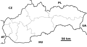
map_background = Slovakia - background map.png
map_locator = Slovakia
map1 = Trnava Region - outline map.svg
map1_background = Trnava Region - background map.png
map1_locator = Trnava Region
map1_size = 160
commons = Galanta
statistics = [http://www.statistics.sk/mosmis/eng/prvav2.jsp?txtUroven420202&lstObec503665&Okruhzaklad MOŠ/MIS]
website = http://www.galanta.sk/
footnotes =Galanta ( _hu. Galánta, _de. Gallandau) is a small town (about 16,000 inhabitants) in
Slovakia . It is situated 50 km due East from the Slovak capitalBratislava .Geography
Galanta lies in the
Danubian Lowland ("Podunajská nížina"), the warm southern part of Slovakia. There are many agricultural fields around Galanta, where wheat, corn, and other vegetables and fruits are grown.History
The land around Galanta has almost continuously been inhabited since the
neolithic . The first written record of Galanta was made in 1237 in a Royal Decree byBéla IV of Hungary . Through the years, the settlement was under the lordship of various noble families. Beginning in 1421, the Esterhazy family ruled the town and the surrounding area for over six centuries. In 1613 or 1614, Galanta was promoted to a free market town.Features
Galanta is an old town where most historical buildings have unfortunately been damaged or destroyed in
World War II . During theCommunist era ofCzechoslovakia (1948-1989) the architecture of the town has further deteriorated as historic buildings were razed and replaced by prefabricated concrete apartment complexes and buildings. There are two important historical buildings left. The first one is the Esterházys' Castle and the second one aRenaissance castle. The Esterházys' Castle is in a state of disrepair and has been closed to the public since the late 1980s. The Renaissance castle was renovated in the 1990s and is being used as a museum, exhibition space and cultural center.Demographics
According to the 2001
census , the town had 16,365 inhabitants. 60.35% of inhabitants wereSlovaks , 36.80% Hungarians, 1.07% Roma and 0.70% Czechs.cite web | title = Municipal Statistics | publisher = Statistical Office of the Slovak republic | url = http://www.statistics.sk/mosmis/eng/run.html | accessdate = 2008-01-13] The religious makeup was 67.05%Roman Catholics , 20.07% people with no religious affiliation and 6.34%Lutherans .Notable citizens
The Hungarian composer
Zoltán Kodály spent most of his childhood in this town and composed the "Dances of Galanta" (1933, for orchestra) based on the folk music of this region.ister Cities
*
Mikulov ,Czech Republic (2003)
*Paks ,Hungary (1998)
*Tótkomlós , Hungary (1999)
*Kecskemét , Hungary (1998)
*Liptovský Mikuláš , Slovakia (2006)
*Bečej ,Serbia (2001)References
External links
* [http://www.galanta.sk/index.php?id=4&action=1&language=2 Official website]


Wikimedia Foundation. 2010.