- Patagonia
-
For other uses, see Patagonia (disambiguation).
 Official map of cartographer of the King of Spain, Juan de la Cruz Cano y Olmedilla, 1775.
Patagonia is a region located in Argentina and Chile, integrating the southernmost section of the Andes mountains to the southwest towards the Pacific ocean and from the east of the cordillera to the valleys it follows south through Colorado River towards Carmen de Patagones in the Atlantic Ocean. To the west, it includes the territory of Valdivia through Tierra del Fuego archipelago.[1]
The name Patagonia comes from the word patagón[2] used by Magellan in 1520 to describe the native people that his expedition thought to be giants. It is now believed the Patagons were actually Tehuelches with an average height of 180 cm (~5′11″) compared to the 155 cm (~5′1″) average for Spaniards of the time.[3]
The Argentine portion of Patagonia includes the provinces of Neuquén, Río Negro, Chubut and Santa Cruz, as well as the eastern portion of Tierra del Fuego archipelago and the southernmost department of Buenos Aires province: Patagones. The Argentine politico-economic Patagonic Region includes the Province of La Pampa.[4]
Patagonia has a Welsh colony.
The Chilean part of Patagonia embraces the southern provinces and regions of Aisén and Magallanes, including the west side of Tierra del Fuego and Cape Horn.[5]
Population and land area
Country Area Population Density Argentina 2,780,400 km2 40,091,359 14.4 per km2 Chile 743,812 km2 16,601,707 22.3 per km2 Patagonia 1,043,076 km2 1,999,540 1.9 per km2 Physical geography
Patagonia 
Regions Eastern Patagonia Western Patagonia Tierra del Fuego Ecoregions Valdivian forests Magellanic forests Patagonian steppe National Parks Laguna San Rafael · Los Glaciares · Nahuel Huapi · Torres del Paine · Alberto de Agostini · Tierra del Fuego Political divisions Chile: Palena Province · Aisén Region · Magallanes Region Argentina: Neuquén Province · Río Negro Province · Chubut Province · Santa Cruz Province · Tierra del Fuego Province - See also: Geography of Argentina and Geography of Chile
Argentine Patagonia is for the most part a region of steppelike plains, rising in a succession of 13 abrupt terraces about 100 metres (330 ft) at a time, and covered with an enormous bed of shingle almost bare of vegetation.[1] In the hollows of the plains are ponds or lakes of fresh and brackish water. Towards the Andes the shingle gives place to porphyry, granite, and basalt lavas, animal life becomes more abundant and vegetation more luxuriant, acquiring the characteristics of the flora of the western coast, and consisting principally of southern beech and conifers. The high rainfall against the western Andes (Wet Andes) and the low sea surface temperatures offshore give rise to cold and humid air masses, contributing to the ice-fields and glaciers, the largest ice-fields in the Southern hemisphere outside of Antarctica.[1]
Among the depressions by which the plateau is intersected transversely, the principal are the Gualichu, south of the Río Negro, the Maquinchao and Valcheta (through which previously flowed the waters of Nahuel Huapi Lake, which now feed the river Limay); the Senguerr (spelled Senguer on most Argentine maps and within the corresponding region), the Deseado River. Besides these transverse depressions (some of them marking lines of ancient inter-oceanic communication), there are others which were occupied by more or less extensive lakes, such as the Yagagtoo, Musters and Colhue Huapi, and others situated to the south of Puerto Deseado, in the centre of the country. In the central region volcanic eruptions, which have taken part in the formation of the plateau from the Tertiary period down to the present era, cover a large part with basaltic lava-caps; and in the western third more recent glacial deposits appear above the lava. There, in contact with folded Cretaceous rocks, uplifted by the Tertiary granite, erosion, caused principally by the sudden melting and retreat of the ice, aided by tectonic changes, has scooped out a deep longitudinal depression, which generally separates the plateau from the first lofty hills, the ridges generally called the pre-Cordillera, while on the west of these there is a similar longitudinal depression all along the foot of the snowy Andean Cordillera. This latter depression contains the richest and most fertile land of Patagonia. Lake basins along the Cordillera were also excavated by ice-streams, including Lake Argentino and Lake Fagnano, as well as coastal bays such as Bahía Inútil.[1]
Geology
The geological constitution is in accordance with the orographic physiognomy. The Tertiary plateau, flat on the east, gradually rising on the west, shows Upper Cretaceous caps at its base. First come Lower Cretaceous hills raised by granite and dioritic rocks, undoubtedly of Tertiary origin, as in some cases these rocks have broken across the Tertiary beds, so rich in mammal remains; then follow, on the west, metamorphic schists of uncertain age; then quartzites appear, resting directly on the primitive granite and gneiss which form the axis of the Cordillera. Porphyritic rocks occur between the schists and the quartzites. The Tertiary deposits are greatly varied in character, and there is considerable difference of opinion concerning the succession and correlation of the beds. They are divided by Wilckensi into the following series (in ascending order):
- Pyrotherium-Notostylops beds. Of terrestrial origin, containing remains of mammalia. Eocene and Oligocene.
- Patagonian Molasse. Partly marine, partly terrestrial. Lower Miocene.
- Santa Cruz series. Containing remains of mammals. Middle and Upper Miocene.
- Paranfl series. Sandstones and conglomerates with marine fossils. Pliocene. Confined to the eastern part of the region.
The Upper Cretaceous and Tertiary deposits have revealed a most interesting vertebrate fauna. This, together with the discovery of the perfect cranium of a chelonian of the genus Myolania, which may be said to be almost identical with Myolania oweni of the Pleistocene age in Queensland, forms an evident proof of the connection between the Australian and South American continents. The Patagonian Myolania belongs to the Upper Chalk, having been found associated with remains of Dinosauria. One such dinosaur to be found in Patagonia is Argentinosaurus, which may be the largest of all dinosaurs. Other specimens of the interesting fauna of Patagonia, belonging to the Middle Tertiary, are the gigantic wingless birds, exceeding in size any hitherto known, and the singular mammal Pyrotherium, also of very large dimensions. In the Tertiary marine formation a considerable number of cetaceans has been discovered. In deposits of much later date, formed when the physiognomy of the country did not differ materially from that of the present time, there have been discovered remains of pampean mammals, such as Glyptodon and Macrauchenia, and in a cave near Última Esperanza Sound, a gigantic ground sloth (Grypoiherium listai), an animal which lived contemporaneously with humans, and whose skin, well preserved, showed that its extermination was undoubtedly very recent. With the remains of Grypotherium have been found those of the horse (Onoshippidium), which are known only from the lower pampas mud, and of the Arciotherium, which is found, although not in abundance, in even the most modern Pleistocene deposits in the pampas of Buenos Aires. It would not be surprising if this latter animal were still in existence, for footprints, which may be attributed to it, have been observed on the borders of the rivers Tamangoand Pista, affluents of the Las Hefas, which run through the eastern foot-hills of the Cordillera in 47°S.

Glaciers occupy the valleys of the main chain and some of the lateral ridges of the Andean Cordillera. In general these glaciers flow into lakes towards the East and into Pacific Ocean fjords towards the West. Some of the larger lakes located to the east of the glaciated Cordillera include; General Carrera Lake, Cochrane/Pueyrredón Lake, O'Higgins/San Martín Lake, Lake Viedma, Argentino Lake and many other smaller lakes. In turn, some of these lakes, as is the case with the first three mentioned, drain into the Pacific Ocean through short mountainous rivers, while others, the later two lakes, flow to the Atlantic Ocean through longer and slower moving rivers. These glacial lakes are often strewn with many icebergs. In Patagonia an immense ice-sheet extended to the east of the present Atlantic coast at the close of the Tertiary epoch, while, during more recent glaciation, the terminal moraines have generally stopped, 50 kilometers (30 mi) in the north and 80 kilometers (50 mi) in the south, east of the summit of the Cordillera. These ice-sheets, which scooped out the greater part of the longitudinal depressions, and appear to have rapidly retreated to the point where the glaciers now exist, did not, however, in their retreat fill up with their detritus the fjords of the Cordillera, for these are now occupied by deep lakes on the east, and on the west by the Pacific channels, some of which are as much as 460 m (1500 ft) in depth, and soundings taken in them show that the fjords are as usual deeper in the vicinity of the mountains than to the west of the islands. Several of the high peaks are still active volcanoes.
Insofar as its main characteristics are concerned, Patagonia seems to be a portion of the Antarctic continent, the permanence of which dates from very recent times, as is evidenced by the apparent recent emergence of the islets around Chiloé, and by the general character of the pampean formation. Some of the promontories of Chiloé are still called huapi, the Araucanian equivalent for "islands"; and this may perhaps be accepted as perpetuating the recollection of the time when they actually were islands. They are composed of caps of shingle, with great, more or less rounded boulders, sand and volcanic ashes, precisely of the same form as occurs on the Patagonian plateau. From an examination of the pampean formation it is evident that in recent times the land of the province of Buenos Aires extended farther to the east, and that the advance of the sea, and the salt water deposits left by it when it retired, forming some of the lowlands which occur on the littoral and in the interior of the pampas, are much more recent phenomena; and certain caps of shingle, derived from rocks of a different class from those of the neighboring hills, which are observed on the Atlantic coasts of the same province, and increase in quantity and size towards the south, seem to indicate that the caps of shingle which now cover such a great part of the Patagonian territory recently extended farther to the east, over land which has now disappeared beneath the sea, while other marine deposits along the same coasts became converted into bays during the subsequent advance of the sea. There are besides, in the neighbourhood of the present coast, deposits of volcanic ashes, and the ocean throws up on its shores blocks of basaltic lava, which in all probability proceed from eruptions of submerged volcanoes now extinct. One fact, however, which apparently demonstrates with greater certainty the existence in recent times of land that is now lost, is the presence of remains of pampean mammals in Pleistocene deposits in the bay of Puerto San Julian and in Santa Cruz. The animals undoubtedly reached these localities from the east; it is not at all probable that they advanced from the north southwards across the plateau intersected at that time by great rivers and covered by the ice-sheet. With the exception of the discoveries at the inlet of Ultima Esperanza, which is in close communication with the Atlantic valley of Río Gallegos, none of these remains have been discovered in the Andean regions.
Political divisions
Regions of Argentine Northwest Gran Chaco Mesopotamia Cuyo Pampas Patagonia Antártida Argentina Argentine Patagonia
Neuquén
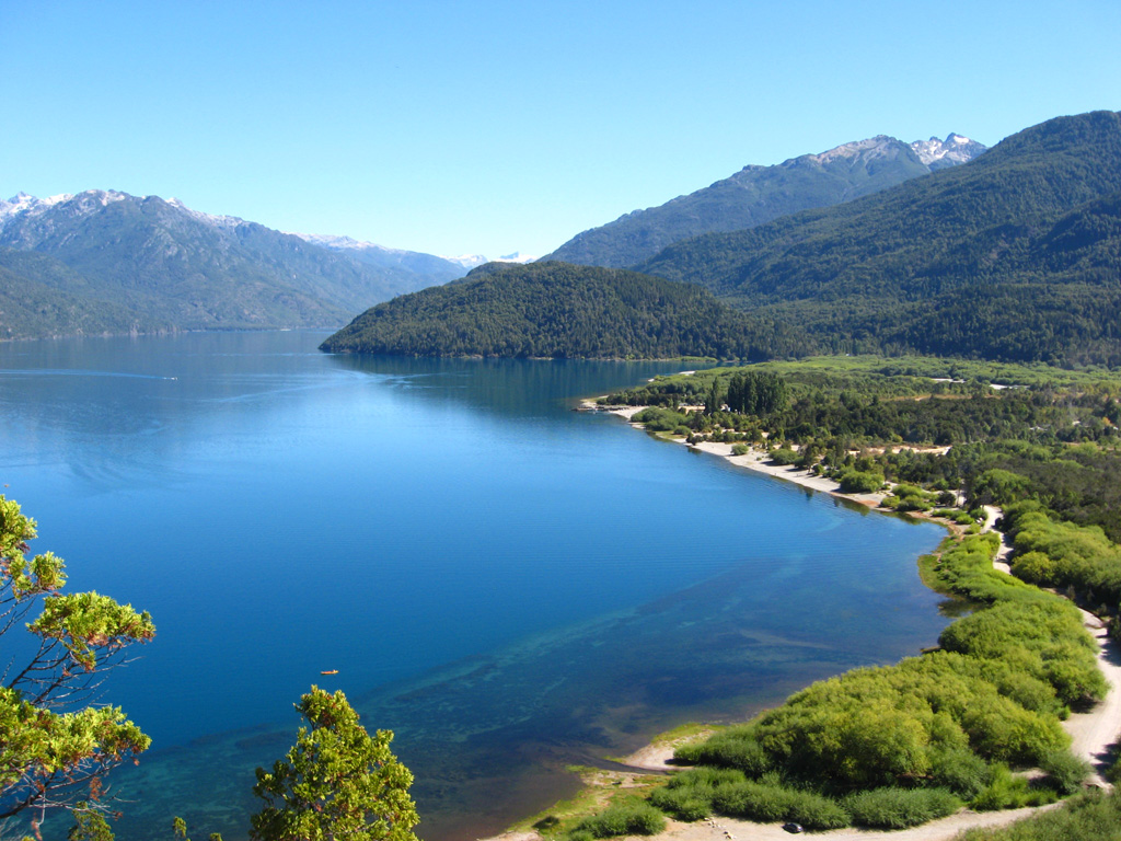
Main article: Neuquén Province Lake Lacar
Neuquén covers 94,078 km2 (36,324 sq. miles), including the triangle between the Limay River and Neuquén River, which extends southward to the northern shore of Lake Nahuel-Huapi (41°S) and northward to the Río Colorado.
On the upper plains of Neuquén territory thousands of cattle can be fed, and the forests around Lakes Traful and Nahuel-Huapi yield large quantities of valuable timber. The Neuquén river is not navigable, but as its waters are capable of being easily dammed in places, large stretches of land in its valley are used; but the lands on each side of its lower part are of little commercial value.
As the Cordillera is approached, the soil becomes more fertile, and suitable districts for the rearing of cattle and other agricultural purposes exist between the regions which surround the Tromen volcano and the first ridges of the Andes. Chos Malal, the capital of the territory, is situated in one of these valleys. More to the west is the mining region, in great part unexplored, but containing deposits of gold, silver, copper and lignite. In the centre of the territory, also in the neighborhood of the mining districts, are the valleys of Norquín and Las Lajas, the general camp of the Argentine army in Patagonia, with excellent timber in the forest on the Andean slope. The wide valleys occur near Río Malleo, Lake Huechulafquén, the river Chimehuin, and Vega de Chapelco, near Lake Lacar, where are situated villages of some importance, such as Junín de los Andes and San Martín de los Andes. Close to these are the famous apple orchards supposed to have been planted by the Jesuits in the 17th and 18th centuries. These regions are drained by the river Collon Cura, the principal affluent of the river Limay. Lake Lacar is now a contributory of the Pacific, its outlet having been changed to the west, owing to a passage having been opened through the Cordillera.
 Mount Otto, near Bariloche, Rio Negro Province
Río Negro
Main article: Río Negro ProvinceRío Negro covers 203,013 km2 (78,383 sq. miles), extending from the Atlantic to the Cordillera of the Andes, to the north of 42°S.
The Río Negro (river) runs along a wide transverse depression, the middle part of which is followed by the railway which runs to the settlement of Neuquén at the confluence of the rivers Limay and Neuquen. In this depression are several settlements, among them Viedma, the capital of the Río Negro territory, Cipolletti, General Conesa, Choele Choel and General Roca. To the south of the Río Negro, the Patagonian plateau is intersected by the depressions of the Gualicho and Maquinchao, which in former times directed the waters of two great rivers (now disappeared) to the gulf of San Matias, the first-named depression draining the network of the Collon Cura and the second the Nahuel Huapi lake system. In 42°S there is a third broad transverse depression, apparently the bed of another great river, now perished, which carried to the Atlantic the waters of a portion of the eastern slope of the Andes, between 41° and 42°30"S.

Chubut
Main article: Chubut Province Puelo Lake, Chubut.
Chubut, covers 224,686 km2 (86,751 sq. miles), embracing the region between 42° and 46°S;
Chubut territory presents the same characteristics as the Río Negro territory. Rawson, the capital, is situated at the mouth of the river Chubut on the Atlantic (42°30'S). The town was founded in 1865 by a group of colonists from Wales, assisted by the Argentine government; and its prosperity has led to the foundation of other important centres in the valley, such as Trelew and Gaiman, which is connected by railway with Puerto Madryn on Bahía Nueva. Here is the seat of the governor of the territory, and by 1895 the inhabitants of this part of the territory, composed principally of Argentines, Welsh and Italians, numbered 552,585. The valley has been irrigated and cultivated, and produces the best wheat of the Argentine Republic. Between the Chubut and the Senguerr there are vast stretches of fertile land, spreading over the Andean region to the foot of the Cordillera and the lateral ridges of the Pre-Cordillera, and filling the basins of some desiccated lakes, which have been occupied since 1885, and farms and colonies founded upon them. The chief of these colonies is that of 16 de Octubre, formed in 1886, mainly by the inhabitants of Chubut colony, in the longitudinal valley which extends to the eastern foot of the Cordillera.
Other rivers in this territory flow into the Pacific through breaches in the Cordillera, e.g. the upper affluents of the Futaleufú River, Palena and Río Cisnes. The principal affluent of the Palena, the Carrenleufu, carries off the waters of Lake General Paz, situated on the eastern slope of the Cordillera. Río Pico, an affluent of the same river, receives nearly the whole of the waters of the extensive undulating plain which lies between the Río Tecka and the Río Senguerr to the east of the Cordillera, while the remainder are carried away by the affluents of Río Jehua: the Cherque, Omkel, and Appeleg. This region contains auriferous drifts, but these, like the auriferous deposits, veins of galena and lignite in the mountains farther west which flank the Cordillera, have not been properly investigated. At Lake Fontana there are auriferous drifts and lignite deposits which abound in fossil plants of the Cretaceous age. The streams which form the rivers Mayo and Chalia join the tributaries of the Río Aisén, which flows into the Pacific, watering in its course extensive and valuable districts where colonization has been initiated by Argentine settlers. Colonies have also been formed in the basin of Lakes Musters and Colhué Huapi; and on the coasts near the Atlantic, along Bahía Camarones and the Gulf of San Jorge, there are extensive farms.
In addition it is one of the highest critically acclaimed group of rivers in the world for fly fishing. Every year thousands of fly fishermen flock there for the hope of catching "the big one".
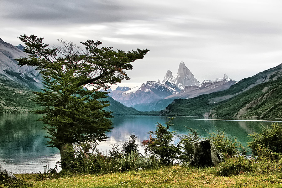
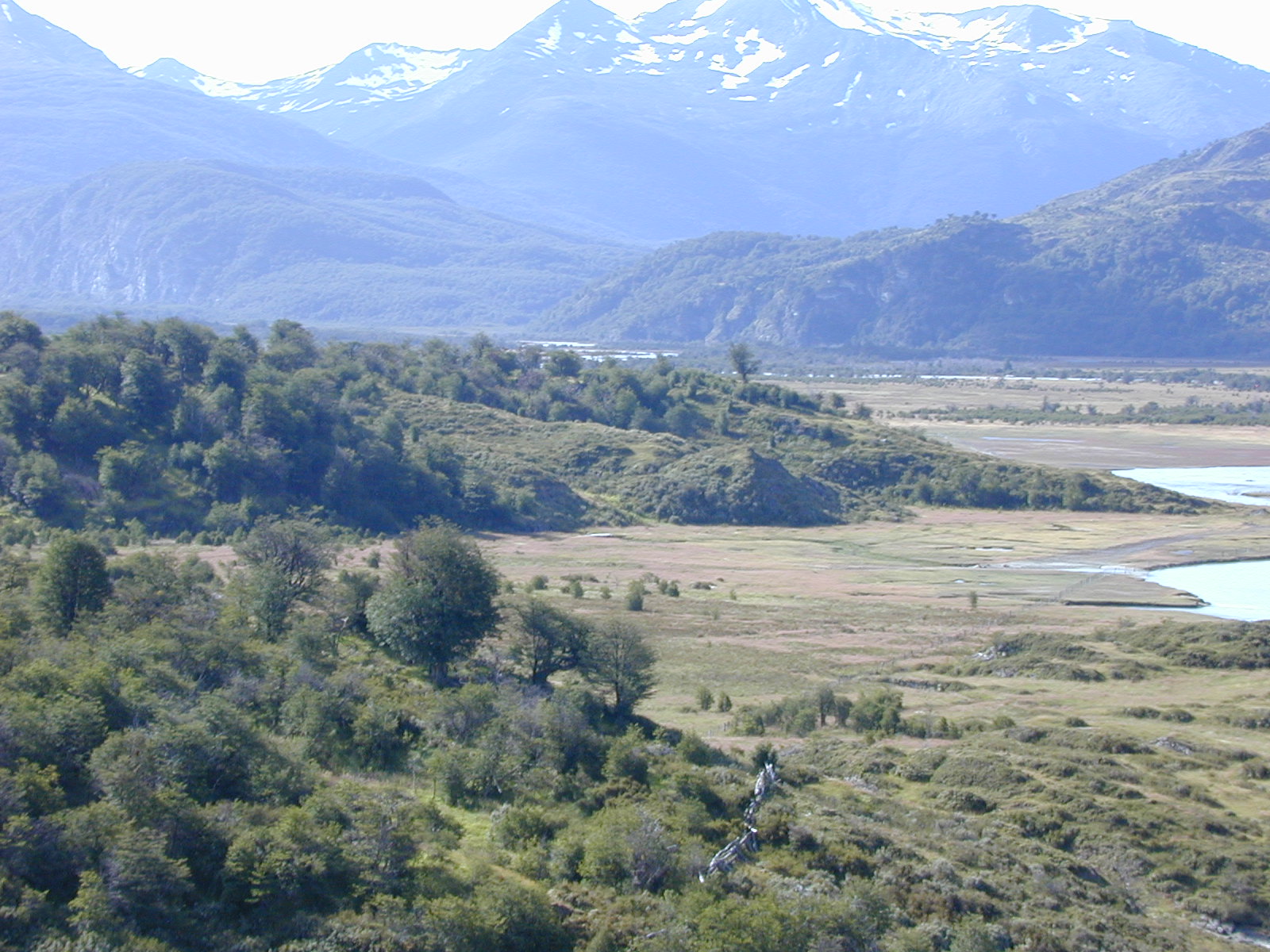
 Desert Lake and, in the background, the emblematic Mt. Fitz Roy, Santa Cruz Province.
Santa Cruz
Main article: Santa Cruz Province, ArgentinaSanta Cruz is the largest province in the Argentinean Patagonia and the largest political subdivision in the region as a whole, covering 293,993 km2.
The province, mostly a cold, windswept steppe, is well known for its extensive pebble beaches as well as for the deep-water lakes and vast glaciers in the Andes foothills along its western border with Chile. Santa Cruz's Atlantic coast is also known for the Laguna del Carbón; lying 105 metres (330 ft) below sea level, it is the lowest geographic point in the Western Hemisphere.
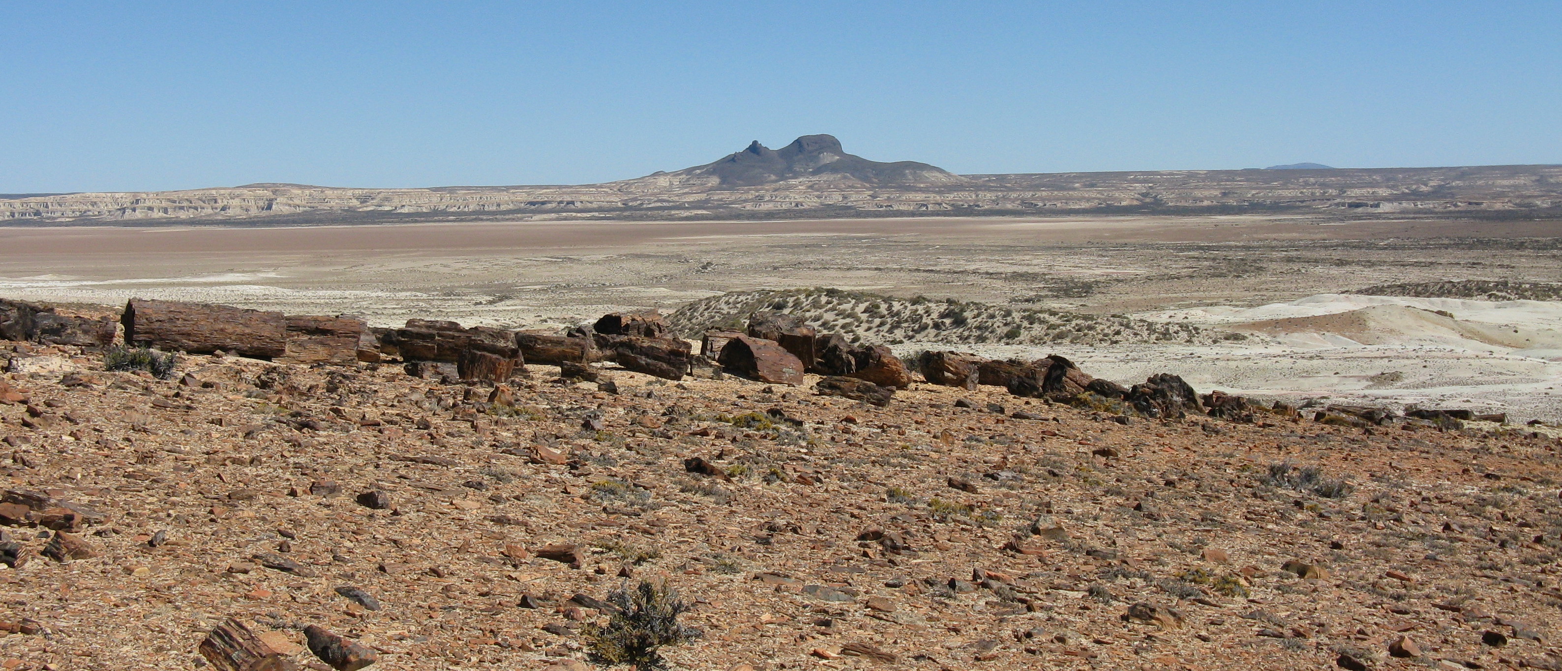
 Mother and Daughter Peaks, Jaramillo Petrified Forest.
One of Santa Cruz's best-known geological curiosities is its Jaramillo Petrified Forests National Monument. Incorporated into the national park system in 1954, the 13,700 hectare (35,000 acre) area includes one of the world's most significant remains of Jurassic-era forests. The National Parks Administration also acquired 60,000 hectares (150,000 acres) of neighboring land, creating the largest natural steppe preserve in South America.
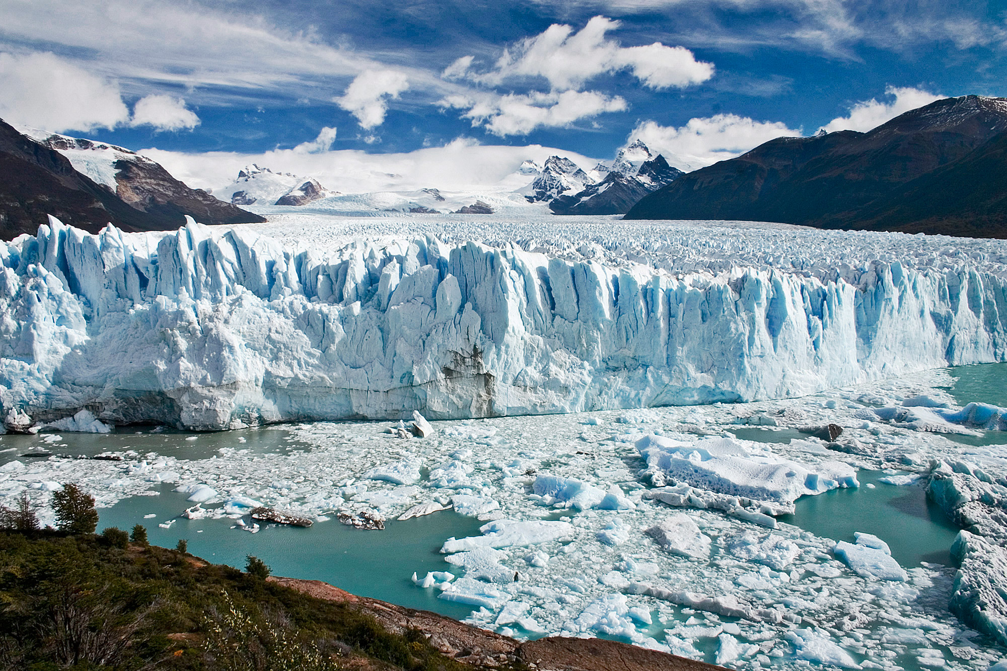
Santa Cruz's most notable and most visited geographic feature, however, is probably Perito Moreno Glacier (see section above), a national park as well.
Chilean Patagonia
 Calbuco Volcano, Chilean PatagoniaSee also: Zona Austral
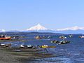
Chilean Patagonia begins at the Pacific ocean in Valdivia through río Calle Calle towards the cordillera of the Andes up to its highest peaks. There, where the waters flow to the Pacific Ocean, is the Chilean territory and where the water flows to the east towards the Atlantic ocean is a territory of Argentina.[8] Chilean territory stretches from Valdivia to Cape horn, including the western side of Tierra del fuego island (62% of which is Chilean) in addition to all of Cape Horn and the Strait of magellan, to the north through the fjords to Chiloe island and Puerto Montt, and including in particular the Archeological site of Monte Verde, Puerto Varas, lake Llanquihue, Frutillar, Osorno and Valdivia.
The Tehuelches were mainly a nomad tribe that moved from east to west during the change of the seasons, following their hunting habits. Thus, before the winter, they would migrate down from the cordillera to the sea, either to the Atlantic or Pacific ocean. Chilean Patagonia was probably the closest to the sea from the cordillera, so they would travel following the rivers and creeks in order to camp and have fresh water at all times during their journey. One of the principal camps found by archeologists recently is the site of Monte Verde near Puerto Montt, which dates 14.500 BP. This camp was based at a water creek close to the Pacific ocean, near today´s city of Puerto Montt. The Tehuelches would feed their families with fish and seafood during autumn and winter, avoiding the cold ice, snow storms and the strong polar winds of the cordillera. They would camp all winter until spring in the valleys near the rivers, lakes and fiords of the Chilean Patagonia. Then, during spring, they would travel up the rivers and creeks coming from the defrosting snow of the cordillera and live all summer until autumn in the highest valleys with fresh waters, streams and ponds containing good quantities of trout. The Tehuelches skillfully hunted deer, pumas and new guanacos during the season, in this way they would sustain their feeding habits all year. They would have their children during this period, in protected areas of the forest and Cordilleras of the Chilean Patagonia and away from the heat of the eastern and western territory. In this way they would integrate their lives into the wild forest, under a temperate temperature and climate condition.
It can be said that Chilean Patagonia is divided into two types of territories: the "Patagonia Insular" which includes all the fjords and channels along the Pacific Ocean down to Tierra del Fuego, and the "Cordillera Patagonica" which includes valleys and glaciers towards the steep mountains of the cordillera where Argentinean Patagonia begins, where the valleys are more arid and the terrain persists in the cold desert known as "Pampa Patagonica", towards the long route to the Atlantic Ocean (800 km).[5][9]
Palena
Main article: Palena ProvincePalena Province is one of the provinces of the Los Lagos Region, Chile. The capital of the Province is the town of Chaitén.
Within Palena Province there are several parks and natural reserves such as the Palena Lake National Reserve,[10] 494 square kilometres (122,070 acres) of native lenga forest, ice caps and high peaks, which can be visited only in summer because of weather conditions, it can be accessed only by horse or trekking routes.The private Pumalín Park is also located in the province, has 3,000 square kilometres (741,316 acres),it is protected by the state of Chile but owned by Douglas Tompkins, although it is private can be accessed by the Caleta Gonzalo, where lodging and camping is allowed.[11]In the first quarter of 2008, Chaitén Volcano increased its activity, causing damage in the town of Chaitén and spreading volcanic ashes in several tourist spots, specifically in Futaleufú.[12]
Aisén
Main article: Aisén Region
Aisén (also spelled Aysén) is Chile's eleventh administrative region. It is the least populated region in Chile, and it remains a region with severe communication problems because of topographical features that make it extremely difficult to quickly improve its infrastructure. The region is known for its unique ecological characteristics, including unspoiled habitat for numerous indigenous species. Its terrain and form are very similar to those of the Alaska Panhandle, the northern Norwegian coast, and New Zealand's Milford Sound region. Laguna San Rafael National Park, accessible only by boat or plane, is one of its most popular tourist destinations. Until the construction of Route 7, the Southern Highway, in the 1980s, the only overland routes from north to south through the region were extremely primitive tracks.
The Spanish electric company Endesa has recently proposed building a series of hydroelectric dams in Aisén in a project named HidroAysén. HidroAysén project is based on water rights the company acquired before privatization during the military rule of Augusto Pinochet. The dams would first be built on the Baker and Pascua rivers, but additional dams have been proposed on a number of other previously intact rivers in the area, including the Futaleufú. The power would be transported 1,200 miles (1,900 km) north, via a high-tension transmission line through a number of national parks and protected areas to supply power to the Santiago area, where much of the power is used for heavy industry and mining. The project involves the installation of over 5000 high voltage towers, each covering a width of 70 metres and a height of 50 metres, and the deforestation of the native forest within the trail. The company chosen for the installation is Transelec, which was responsible of a project of similar characteristics in Canada.[13]
A number of local, national and international environmental organizations oppose the dams, claiming they would destroy the natural heritage of the area and would lead to greatly increased electrical costs for Chilean consumers. The umbrella organization for the movement is called Patagonia Sin Represas (translation: Patagonia Without Dams), a group that now includes over 50 international organizations.[14]
Magallanes
 Main article: Magallanes y Antártica Chilena Region
Magallanes and Chilean Antártica Region is the southernmost, largest and second least populated region of Chile.
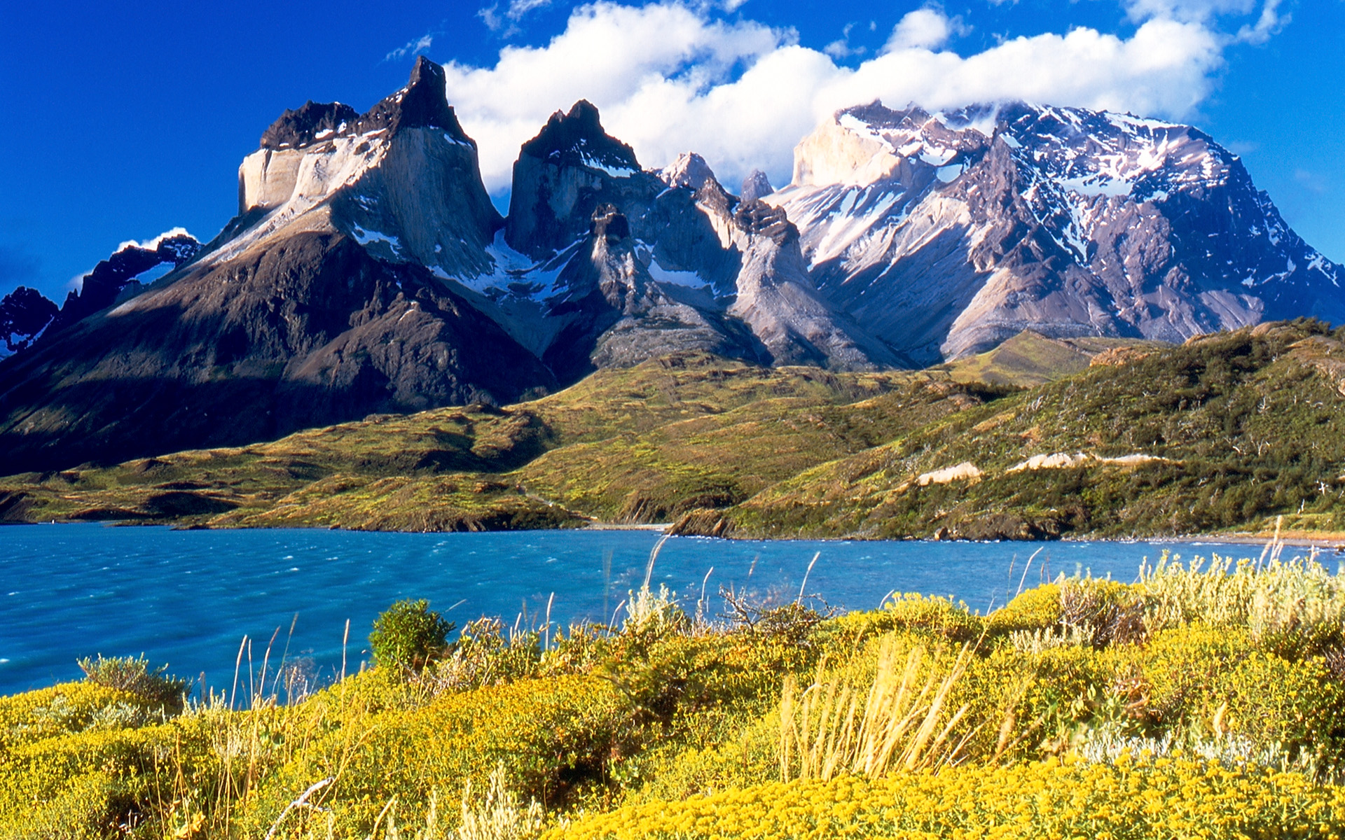
This region has many globally known places and geographical accidents like Torres del Paine, Cape Horn, Tierra del Fuego Island, and the Strait of Magellan. It also includes the Antarctic territory claimed by Chile.
The low population and vastness makes this region a good place for many native animal and plant species. It is relatively easy to find penguins, ñandúes, guanacos, condors, and other animals in their natural environment.
The main economic activities are sheep farming, oil extraction and tourism. This region is also home to one of the world's spectacular adventure races, the Patagonia Expedition Race.
 Yendegaia Valley (Chile), Tierra del Fuego Island.
Tierra del Fuego
Main article: Tierra del FuegoTierra del Fuego is an archipelago at the southernmost tip of Patagonia, divided between Argentina and Chile. It consists of the 47,992 km2 of the Isla Grande de Tierra del Fuego, and several minor islands.
 NASA satellite image of Patagonia during winter.
Climate
See also: Climate of ChileOverall climate is cool and dry. The east coast is warmer than the west, especially in summer, as a branch of the southern equatorial current reaches its shores, whereas the west coast is washed by a cold current. However, winters are much colder on the eastern inland plateaus in Argentina, and the lowest extreme temperatures can be colder on the east coast than on the west coast. At Puerto Montt, on the inlet behind Chiloé Island. The mean annual temperature is 11 °C (52 °F) and the average extremes 25.5 °C (78 °F) and −1.5 °C (29.5 °F), whereas at Bahía Blanca near the Atlantic coast and just outside the northern confines of Patagonia the annual temperature is 15 °C (59 °F) and the range much greater, as temperatures above 35°C and below -5°C are recorded every year. At Punta Arenas, in the extreme south, the mean temperature is 6 °C (43 °F) and the average extremes 24.5 °C (76 °F) and −2 °C (28 °F). The prevailing winds are westerly, and the westward slope has a much heavier precipitation than the eastern in a rainshadow effect;[1] the western islands close to Torres del Paine receive an annual precipitation of 4,000 to 7,000 mm, whilst the eastern hills are less than 800 mm and the plains may be as low as 200 mm annual precipitation.[1]
Precipitation is highly seasonal in northwestern Patagonia (for example, Villa La Angostura, in Argentina and right next to Chile, receives up to 434 mm of rain and snow in May, 297 mm in June, 273 in July, compared to 80 in February and 72 in March. The total for the city is 2074 mm, making it one of the rainiest in Argentina. Further west, some areas receive up to 4,000 mm and more, especially on the Chilean side. In the northeast, the seasons for rain are reversed: most rain falls from occasional summer thunderstorms, but totals barely reach 500 m in the northeast corner, and rapidly decrease to less than 300 mm.
The Patagonian west coast, which belongs exclusively to Chile, has a cool oceanic climate, with summer temperatures ranging from 14°C in the south to 19°C in the north (and nights between 5°C and 11°C) and very high precipitation, from 2,000 to more than 7,000 mm in local micro-climates. Snow is uncommon at the coast in the north, but happens more often in the south, and frost is usually not very intense. Immediately east from the coast are the Andes, cut by deep fjords in the south and by deep lakes in the north, and with varying temperatures according to the altitude. The tree line ranges from close to 2,000 m on the northern side (except for the Andes in northern Neuquen in Argentina, where sunnier and dryer conditions allow trees to grow up to close to 3,000 m), and diminishes southward to only 600–800 m in Tierra del Fuego. Precipitation changes dramatically from one spot to the other, and diminishes very quickly eastward. An example of this is Laguna Frías, in Argentina, receives 4,400 mm yearly. The city of Bariloche, about 40 km further east, receives about 1,000 mm, and the airport, another 15 km east, receives less than 600 mm. The easterly slopes of the Andes are home to several Argentine cities: San Martín de los Andes, Bariloche, El Bolsón, Esquel, El Calafate. Temperatures there are milder in the summer (in the north, between 20°C and 24°C, with cold nights between 4°C and 9°C; in the south, summers are between 16°C and 20°C, at night temperatures are similar to the north) and much colder in the winter, with frequent snowfall (although snow cover rarely lasts very long). Daytime highs range from 3°C to 9°C in the north, and from 0°C to 7°C in the south, whereas nights range from -5°C to 2°C everywhere. Cold waves can bring much colder values: -21°C have been recorded in Bariloche, and most places can often see temperatures between -12°C and -15°C and highs staying around 0°C for a few days. Directly east of these areas, the weather becomes much harsher: precipitation drops to between 150 and 300 mm, the mountains no longer protect the cities from the wind, and temperatures become more extreme. Maquinchao is a couple hundred kilometers east of Bariloche, at the same altitude on a plateau, and summer daytime temperatures are usually about 5°C warmer, rising up to 35°C sometimes, but winter temperatures are much more extreme: the record is -35°C, and it is not uncommon to see some nights 10°C colder than Bariloche. The plateaus in Santa Cruz province and parts of Chubut usually have snow cover through the winter, and often experience very cold temperatures. In Chile, the city of Balmaceda is known for being situated in this region (which is otherwise almost exclusively in Argentina), and for being the coldest place in Chile, with temperatures below -20°C every once in a while. The northern Atlantic coast has warm summers (28°C to 32°C, but with relatively cool nights at 15°C) and mild winters, with highs of about 12°C and lows about 2-3°C. Occasionally, temperatures reach -10°C or 40°C, and rainfall is very scarce. It only gets a bit colder further south in Chubut, and the city of Comodoro Rivadavia has summer temperatures of 24°C to 28°C, nights of 12°C to 16°C, and winters with days around 10°C and nights around 3°C, and less than 250 mm of rain. However, there is a drastic drop as we move south to Santa Cruz: Rio Gallegos, in the south of the province, has summer temps of 17°C to 21°C, (nights between 6°C and 10°C) and winter temperatures of 2°C to 6°C, with nights between -5°C and 0°C despite being right on the coast. Snowfall is common despite the dryness, and temperatures are known to fall to under -18°C and to remain below freezing for several days in a row. Rio Gallegos is also among the windiest places on Earth, with winds reaching 100 km h occasionally. Tierra del Fuego is extremely wet in the west, relatively damp in the south, and dry in the north and east. Summers are cold (13°C to 18°C in the north, 12°C to 16°C in the south, with nights generally between 3°C and 8°C), cloudy in the south, and very windy. Winters are dark and cold, but without extreme temperatures in the south and west (Ushuaia rarely reaches -10°C, but hovers around 0°C for several months, and snow can be heavy). In the east and north, winters are much more severe, with cold snaps bringing temperatures down to -20°C all the way to Rio Grande on the Atlantic coast. Snow can fall even in the summer in most areas as well.
The depletion of the ozone layer over the South Pole has been reported as being responsible for blindness and skin cancer in sheep in Tierra del Fuego, and concerns for human health and ecosystems.[15]
Fauna
 Guanacos near Torres del Paine, Chile
The guanaco, the cougar, the Patagonian Fox (Lycalopex griseus), the Patagonian Hog-nosed Skunk (Conepatus humboldtii), and the Magellanic Tuco-tuco (Ctenomys magellanicus; a subterranean rodent) are the most characteristic mammals of the Patagonian plains. The guanaco roam in herds over the country and form with the Darwin's Rhea (Rhea pennata) formerly the chief means of subsistence for the natives, who hunted them on horseback with dogs and bolas. Vizcachas (Lagidum spp.) and the Patagonian Mara (Dolichotis patagonum) are also characteristic of the steppe and the Pampas to the north.

Bird-life is often abundant. The Southern Caracara (Caracara plancus) is one of the characteristic objects of a Patagonian landscape; the presence of Austral Parakeets (Enicognathus ferrugineus) as far south as the shores of the strait attracted the attention of the earlier navigators; and Green-backed Firecrowns (Sephanoides sephaniodes), a species of hummingbird, may be seen flying amidst the falling snow. Of the many kinds of waterfowl it is enough to mention the Chilean Flamingo (Phoenicopterus chilensis), the Upland Goose (Chloephaga picta), and in the strait the remarkable steamer ducks.
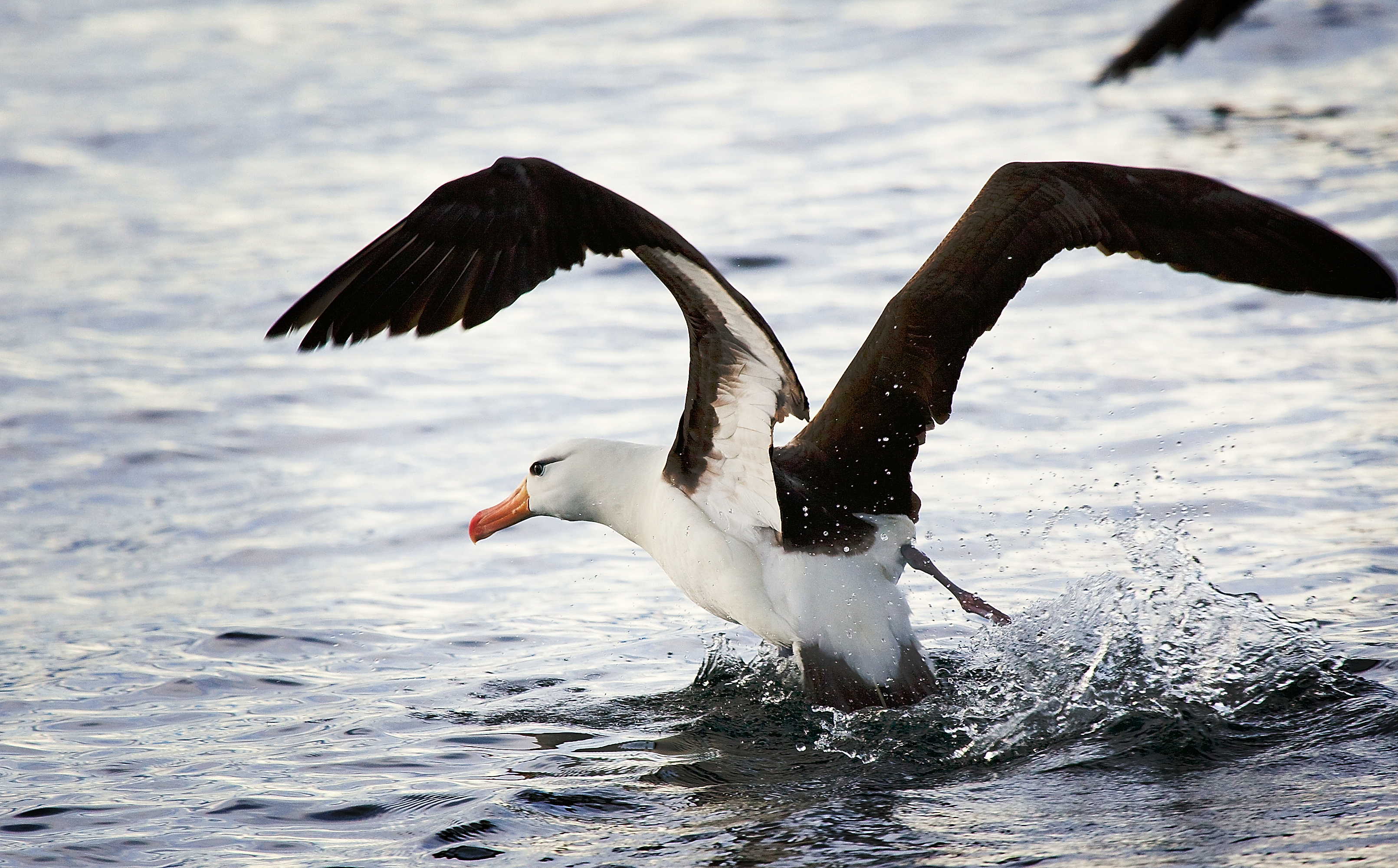
Signature marine fauna include the Southern right whale, the Magellanic Penguin (Spheniscus magellanicus), the Orca and elephant seals. The Valdés Peninsula is a UNESCO World Heritage Site for its importance as a nature reserve.
History
- See also: History of Argentina, History of Chile and Argentina-Chile relations
Pre-Columbian Patagonia (10,000 BC-1520 AD)
Human habitation of the region dates back thousands of years, with some early archaeological findings in the area dated to at least the 13th millennium BC, although later dates of around the 10th millennium BC are more securely recognized. There is evidence of human activity at Monte Verde in Llanquihue Province, Chile dated to around 12,500 BC.[1] The glacial period ice-fields and subsequent large meltwater streams would have made settlement difficult at that time.
The region seems to have been inhabited continuously since 10,000 BC, by various cultures and alternating waves of migration, the details of which are as yet poorly understood. Several sites have been excavated, notably caves such as Cueva del Milodon[16] in Última Esperanza in southern Patagonia, and Tres Arroyos on Tierra del Fuego, that support this date.[1] Hearths, stone scrapers, animal remains dated to 9400-9200 BC have been found east of the Andes.[1]
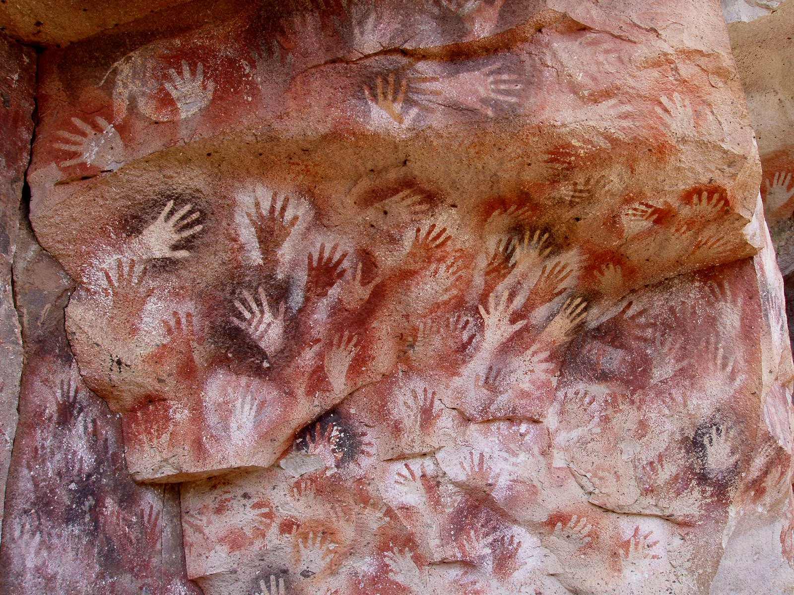
 Cueva de las Manos site in Santa Cruz, Argentina.
The Cueva de las Manos is a famous site in Santa Cruz, Argentina. A cave at the foot of a cliff, it has wall paintings, particularly the negative images of hundreds of hands, believed to date from around 8000 BC.[1]
Among tribes living on the eastern plains hunting of guanaco was the most important activity, and rhea (ñandu) to a lesser extent, it appears from artifacts.[1] It is unclear whether the megafauna of Patagonia, including the ground sloth and horse, were extinct in the area before the arrival of humans, although this is now the more widely accepted account. It is also not clear if domestic dogs were part of early human activity. Bolas are commonly found and were used to catch guanaco and rhea.[1] A maritime tradition existed along the Pacific coast; whose latest exponents were the Yámana to the south of Tierra del Fuego, the Kaweshqar between Taitao Peninsula and Tierra del Fuego and the Chonos in the Chonos Archipelago.
The indigenous peoples of the region included the Tehuelches, whose numbers and society were reduced to near extinction not long after the first contacts with Europeans. Tehuelches included the Gununa'kena to the north, Mecharnuekenk in south central Patagonia and the Aonikenk or Southern Tehuelche in the far South, north of the Magellan channel. On Isla Grande de Tierra del Fuego, the Selk'nam (Ona) and Haush (Mannekenk) lived in the north and south east respectively. In the archipelagos to the south of Tierra del Fuego were Yámana, with the Kawéskar (Alakaluf) in the coastal areas and islands in western Tierra del Fuego and the south west of the mainland.[1] In the Patagonian archipelagoes north of Taitao Peninsula lived the Chonos. These groups were encountered in the first periods of European contact with different lifestyles, body decoration and language, although it is unclear when this configuration emerged.
Around 1000 BC, Mapuche-speaking agriculturalists penetrated the western Andes and from there across into the eastern plains and down to the far south. Through confrontation and technological ability, they came to dominate the other peoples of the region in a short period of time, and are the principal indigenous community today.[1] The Tehuelche model of domination through technological superiority and armed confrontation was later repeated as Europeans implemented a succeeding but conceptually identical cycle, essentially replacing the position of the former dominators with a new, albeit predominately European class.[citation needed]
Early European exploration and Spanish conquest attempts (1520-1584)
The region of Patagonia was first mentioned in European accounts in 1520 by the expedition of Ferdinand Magellan, who on his passage along the coast named many of the more striking features – Gulf of San Matias, Cape of 11,000 Virgins (now simply Cape Virgenes), and others. However, it is also possible that earlier navigators such as Amerigo Vespucci had reached the area (his own account of 1502 has it that he reached its latitudes), however his failure to accurately describe the main geographical features of the region such as the Río de la Plata casts some doubt on whether he really did so.
Rodrigo de Isla, sent inland in 1535 from San Matias by Simón de Alcazaba Sotomayor (on whom western Patagonia had been conferred by Carlos V of Spain), is presumed to have been the first European to have traversed the great Patagonian plain. If the men under his charge had not mutinied, he might have been able to cross the Andes to reach the Chilean side.
Pedro de Mendoza, on whom the country was next bestowed, founded Buenos Aires, but did not venture to the south. Alonzo de Camargo (1539), Juan Ladrilleros (1557) and Hurtado de Mendoza (1558) helped to make known the western coasts, and Sir Francis Drake's voyage in 1577 down the eastern coast through the strait and northward by Chile and Peru was memorable, yet the description of the geography of Patagonia owes more to Pedro Sarmiento de Gamboa (1579–1580), who, devoting himself especially to the south-west region, made careful and accurate surveys. The settlements which he founded at Nombre de Dios and San Felipe were neglected by the Spanish government, the latter being abandoned before Thomas Cavendish visited it in 1587 and so desolate that he called it Port Famine. After the discovery of the route across Cape Horn the Spanish Empire lost interest in any further conquests in southern Patagonia, although it maintained its claim of a de jure soveregnity over the area.
In 1669, the district around Puerto Deseado, explored by John Davis about the same period, was claimed by Sir John Narborough for King Charles II of England.
Patagonian giants: early European perceptions
The first European explorers of Patagonia observed that the indigenous people in the region were taller than the average Europeans of the time, prompting some of them to believe that Patagonians were giants.
According to Antonio Pigafetta,[2] one of the Magellan expedition's few survivors and its published chronicler, Magellan bestowed the name "Patagão" (or Patagón) on the inhabitants they encountered there, and the name "Patagonia" for the region. Although Pigafetta's account does not describe how this name came about, subsequent popular interpretations gave credence to a derivation meaning 'land of the big feet'. However, this etymology is questionable. The term is most likely derived from an actual character name, "Patagón", a savage creature confronted by Primaleón of Greece, the hero in the homonymous Spanish chivalry novel (or knight-errantry tale) by Francisco Vázquez.[17] This book, published in 1512, was the sequel of the romance "Palmerín de Oliva," much in fashion at the time, and a favourite reading of Magellan.[18] Magellan's perception of the natives, dressed in skins, and eating raw meat, clearly recalled the uncivilized Patagón in Vázquez's book. Novelist and travel writer Bruce Chatwin suggests etymological roots of both Patagon and Patagonia in his book, In Patagonia,[19] noting the similarity between "Patagon" and the Greek word παταγος,[20] which means "a roaring" or "gnashing of teeth" (in his chronicle, Pigafetta describes the Patagonians as "roaring like bulls").
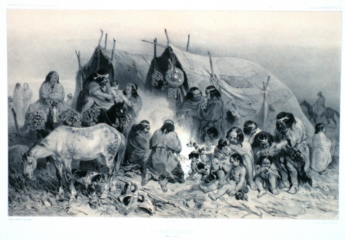
 1840s illustration (somewhat idealised) of indigenous Patagonians from near the Straits of Magellan; from "Voyage au pole sud et dans l'Oceanie ....." by French explorer Jules Dumont d'Urville
The main interest in the region sparked by Pigafetta's account came from his reports of their meeting with the local inhabitants, whom they claimed to measure some nine to twelve feet in height —"...so tall that we reached only to his waist"—, and hence the later idea that Patagonia meant "big feet". This supposed race of Patagonian giants or Patagones entered into the common European perception of this little-known and distant area, to be further fuelled by subsequent reports of other expeditions and famous-name travellers like Sir Francis Drake, which seemed to confirm these accounts. Early charts of the New World sometimes added the legend regio gigantum ("region of the giants") to the Patagonian area. By 1611 the Patagonian god Setebos (Settaboth in Pigafetta) was familiar to the hearers of The Tempest.
The concept and general belief persisted for a further 250 years, and was to be sensationally re-ignited in 1767 when an "official" (but anonymous) account was published of Commodore John Byron's recent voyage of global circumnavigation in HMS Dolphin. Byron and crew had spent some time along the coast, and the publication (Voyage Round the World in His Majesty's Ship the Dolphin) seemed to give proof positive of their existence; the publication became an overnight best-seller, thousands of extra copies were to be sold to a willing public, and other prior accounts of the region were hastily re-published (even those in which giant-like folk were not mentioned at all).
However, the Patagonian giant frenzy was to die down substantially only a few years later, when some more sober and analytical accounts were published. In 1773 John Hawkesworth published on behalf of the Admiralty a compendium of noted English southern-hemisphere explorers' journals, including that of James Cook and John Byron. In this publication, drawn from their official logs, it became clear that the people Byron's expedition had encountered were no taller than 6-foot-6-inch (1.98 m), very high but by no means giants. Interest soon subsided, although awareness of and belief in the myth persisted in some quarters even up into the 20th century.[21]
Scientific exploration (1764-1842)
In the second half of the 18th century, European knowledge of Patagonia was further augmented by the voyages of the previously-mentioned John Byron (1764–1765), Samuel Wallis (1766, in the same HMS Dolphin which Byron had earlier sailed in) and Louis Antoine de Bougainville (1766). Thomas Falkner, a Jesuit who resided near forty years in those parts, published his Description of Patagonia (Hereford, 1774); Francisco Viedma founded El Carmen, nowadays Carmen de Patagones and Antonio settled the area of San Julian Bay, where he founded the colony of Floridablanca and advanced inland to the Andes (1782). Basilio Villarino ascended the Rio Negro (1782).
Two hydrographic surveys of the coasts were of first-rate importance: the first expedition (1826–1830) including HMS Adventure and HMS Beagle under Phillip Parker King, and the second (1832–1836) being the voyage of the Beagle under Robert FitzRoy. The latter expedition is particularly noted for the participation of Charles Darwin who spent considerable time investigating various areas of Patagonia onshore, including long rides with gauchos in Río Negro, and who joined FitzRoy in a 200 miles (320 km) expedition taking ships boats up the course of the Santa Cruz river.
Chilean and Argentine expansion (1843-1902)
In the early 19th century the araucanization of the natives of northern Patagonia intensified and a lot of Mapuches migrated to Patagonia to live as nomads raising cattle or pillaging the Argentine countryside. The cattle stolen in the incursions (malones) would later be taken to Chile through the mountain passes and traded for goods, especially alcoholic beverages. The main trail for this trade was called Camino de los chilenos and run a length of about 1000 km from the Buenos Aires Province to the mountain passes of Neuquén Province. The lonco Calfucurá crossed the Andes from Chile to the Pampas around 1830 after a call from the governor of Buenos Aires, Juan Manuel de Rosas, to fight the Boroanos tribe. In 1859 he attacked Bahía Blanca in Argentina with 3,000 warriors. As in the case of Calfucura many other bands of Mapuches got involved the internal conflicts of Argentina until Conquest of the Desert. To counter the cattle raids a trench called Zanja de Alsina was built by Argentina in the pampas in the 1870s.
In the mid-19th century the newly-independent nations of Argentina and Chile began an aggressive phase of expansion into the south, increasing confrontation with the indigenous populations. In 1860, a French adventurer Orelie-Antoine de Tounens proclaimed himself king of The Kingdom of Araucania and Patagonia of the Mapuche.
 The establishment of Fuerte Bulnes in 1843 marked the start of Chilean expansion in Patagonia
 Map of the advance of the Argentina frontier until the establishment of zanja de Alsina
Following the last instructions of Bernardo O'Higgins, the Chilean president Manuel Bulnes sent an expedition to the Strait of Magellan and founded Fuerte Bulnes in 1843. Five years later, the Chilean government moved the main settlement to the current location of Punta Arenas, the oldest permanent settlement in Southern Patagonia. The creation of Punta Arenas was instrumental in making Chile's claim of the Strait of Magellan permanent. In the 1860s sheep from the Falkland Islands were introduced to the lands around the Straits of Magellan, and throughout the 19th century the sheepfarming grew to be the most important economic sector in southern Patagonia.
Captain George Chaworth Musters in 1869 wandered in company with a band of Tehuelches through the whole length of the country from the strait to the Manzaneros in the north-west, and collected a great deal of information about the people and their mode of life.
The Conquest of the Desert and the 1881 treaty
Main articles: Conquest of the Desert and 1881 Boundary TreatyArgentine authorities worried the strong connections araucanized tribes had with Chile that allegedly gave Chile certain influence over the pampas.[22] Argentine authorities feared an eventual war with Chile over Patagonia where the natives would side with the Chileans and that it would therefore be fought in the vicinities of Buenos Aires.[22]
The decision of planning and executing the Conquest of the Desert was probably triggered by the 1872 attack of Cufulcurá and his 6,000 followers on the cities of General Alvear, Veinticinco de Mayo and Nueve de Julio, where 300 criollos were killed, and 200,000 heads of cattle taken.
In the 1870s the Conquest of the Desert was a controversial campaign by the Argentine government, executed mainly by General Julio Argentino Roca, to subdue or, some claim, to exterminate the native peoples of the South. By the mid-1880s the campaign's objectives had largely been achieved. While fighting Peru and Bolivia in the War of the Pacific (1879–84) Chile waived most of its claim over the Patagonia in the Boundary treaty of 1881 between Chile and Argentina, in order to ensure Argentina's neutrality. Chilean popular belief sees this as a territorial loss of almost 500,000 square miles (1,300,000 km2).
In 1885 a mining expeditionary party under the Romanian adventurer Julius Popper landed in southern Patagonia in search of gold, which they found after travelling southwards towards the lands of Tierra del Fuego. This further opened up some of the area to prospectors. European missionaries and settlers arrived through the 19th and 20th centuries, notably the Welsh settlement of the Chubut Valley.
During the first years of the 20th century, the border between the two nations in Patagonia was established by the mediation of the British crown. But it has undergone a lot of modifications since then, and there is still one place (50 km long) where there is no border established (Southern Patagonia Icefield).
Until 1902, a large proportion of Patagonia's population were natives of Chiloé Archipelago (Chilotes) who worked as peons in large livestock farming estancias. As manual labour they had status below the gauchos and the Argentine, Chilean and European landowners and administrators.
Before and after 1902, when the boundaries were drawn, a lot of Chilotes were expelled from the Argentine side due to fear of what having a large Chilean population in Argentina could lead into in the future. These workers founded the first inland Chilean settlement in what is now the Aisén Region;[23][24] Balmaceda. Lacking good grasslands on the forest-covered Chilean side, the immigrants burned down the forest, setting fires that could last more than two years.[24]
Economy
The area's principal economic activities have been mining, whaling, livestock (notably sheep throughout) agriculture (wheat and fruit production near the Andes towards the north), and oil after its discovery near Comodoro Rivadavia in 1907.[25]
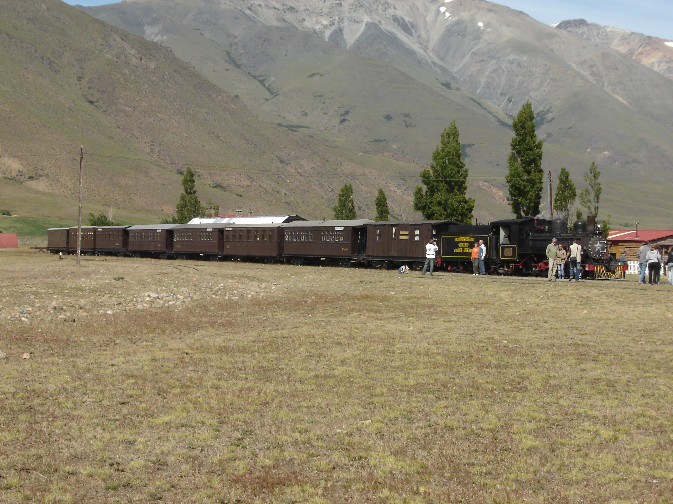
Energy production is also a crucial part of the local economy. Railways were planned to cover continental Argentine Patagonia to serve the oil, mining, agricultural and energy industries, and a line was built connecting San Carlos de Bariloche to Buenos Aires. Portions of other lines were built to the south, but the only lines still in use are La Trochita in Esquel, the 'Train of the End of the World' in Ushuaia, both heritage lines,[26] and a short run Tren Histórico de Bariloche to Perito Moreno.
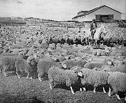 Tierra del Fuego (Argentina) sheep ranch, 1942. The region's primary activity then, it's been eclipsed by the decline in the global wool market as much as by petroleum and gas extraction.
In the western forest covered Patagonian Andes and archipelagoes wood lodging has historically been an important part of the economy, and was driving force behind the colonization of the areas of Nahuel Huapi and Lácar lakes in Argentina and Guaitecas Archipelago in Chile.
Livestock
Sheep farming introduced in the late 19th century has been a principal economic activity. After reaching its heights during the First World War, the decline in world wool prices affected sheep farming in Argentina. Nowadays about half of Argentina's 15 million sheep are in Patagonia, a percentage that is growing as sheep farming disappears in the Pampa (to the North). Chubut (mainly Merino) is the top wool producer with Santa Cruz (Corriedale and some Merino) second. Sheep farming revived in 2002 with the devaluation of the peso and firmer global demand for wool (led by China and the EU). Still there is little investment in new abbatoirs (mainly in Comodoro Rivadavia, Trelew and Rio Gallegos), and often there are phitosanitary restrictions to the export of sheep meat. Extensive valleys in the Cordilleran range have provided sufficient grazing lands, and the low humidity and weather of the southern region make raising Merino and Corriedale sheep common.
Livestock also includes small numbers of cattle, and in lesser numbers pigs and horses. Sheep farming provides small but important jobs located in rural areas where there is little else.
Tourism
In the second half of the 20th century, tourism became an ever more important part of Patagonia's economy. Originally a remote backpacking destination, the region has attracted increasing numbers of upmarket visitors, cruise passengers rounding Cape Horn or visiting Antarctica, and adventure and activity holiday-makers. Principal tourist attractions include the Perito Moreno glacier, the Valdés Peninsula, Torres del Paine national park, the Argentine Lake District and Ushuaia and Tierra del Fuego. Tourism has created new markets locally and for export for traditional crafts such as Mapuche handicrafts, guanaco textiles, and confectionery and preserves.[25]
A spin-off from increased tourism has been the buying of often enormous tracts of land by foreigners, often as a prestige purchase rather than for agriculture. Buyers have included Sylvester Stallone, Ted Turner and Christopher Lambert, and most notably Luciano Benetton, Patagonia's largest landowner.[25] His Compañia de Tierras Sud has brought new techniques to the ailing sheep-rearing industry and sponsored museums and community facilities, but has been controversial particularly for its treatment of local Mapuche communities.[27]
Energy
At the urging of the Chilean government, the Spanish company Endesa hopes to build a number of large hydro-electric dams in the Chilean Patagonia, which has raised environmental concerns from a large number of local and international NGOs. The first dams proposed would be built on the Baker and Pascua rivers, but dams have also been proposed on others, including the famed Futaleufú River in Chile and Santa Cruz river in Argentina. The dams will affect the minimum ecological flows and threaten the fishing, wilderness-tourism and agricultural interests along the river. The electricity would be fed into high-tension lines (to be built by a Canadian company) and taken 1,200 miles (1,900 km) north to the industry and mining hub around Santiago. The lines would cut through a number of previously pristine national parks and protected areas. The Chilean government considers the power to be essential for economic growth, while opponents claim it will destroy Patagonia's growing tourism industry. No evidence has been produced from the experience in other nations that the presence of electrical transmission lines has significantly affected tourism. In fact, opponents of the program have utilized billboard advertising in Chile which superimposes images of power lines over scenes of Torres del Paine National Park, where no proposals for such lines have been made.
 La Trochita on its Chubut Province route. Formerly the sole rapid transport means in the province, La Trochita is now a tourist attraction.
Cuisine
Argentine Patagonian cuisine is largely the same as the cuisine of Buenos Aires - grilled meats and pasta - with extensive[citation needed] use of local ingredients and less use of those products which have to be imported into the region. Lamb is considered the traditional Patagonian meat, grilled for several hours over an open fire. Some guide books[which?] have reported that game, especially guanaco and introduced deer and boar, are popular in restaurant cuisine. However, since the guanaco is a protected animal in both Chile and Argentina, it is unlikely to appear commonly as restaurant fare. Trout and centolla (king crab) are also common, though over-fishing of centolla has made it increasingly scarce. In the area around Bariloche, there is a noted Alpine cuisine tradition, with chocolate bars and even fondue restaurants, and tea rooms are a feature of the Welsh communities in Gaiman and Trevelin as well as in the mountains.[25]
Foreign land buyer's issue
Foreign investors, including Italian multimillionational Benetton Group, Ted Turner, Joseph Lewis[28] and the environmentalist Douglas Tompkins, own major land areas. This situation has caused several conflicts with local inhabitants and the governments of Chile and Argentina; for example the opposition by Douglas Tompkins to the planned route for Carretera Austral in Pumalín Park. A scandal is also brewing about two properties owned by Ted Turner: the estancia La Primavera, located inside Nahuel Huapi National Park; and the estancia Collón Cura.[28] Benetton has faced criticism from Mapuche organizations, including Mapuche International Link, over its purchase of traditional Mapuche lands in Patagonia. The Curiñanco-Nahuelquir family was evicted from their land in 2002 following Benetton's claim to it, but the land was restored in 2007.[29] During discussions with indigenous rights groups it was pointed out[citation needed] that the Mapuche had only acquired the disputed land through violence and armed confrontation that resulted in displacement of earlier tribes, and that a more modern model of displacement was hardly any more or less defensible than the means by which the historical Mapuche had acquired the lands during antiquity .[citation needed]
Further reading
- In Patagonia, Bruce Chatwin, 1977.
- The Last Cowboys at the End of the World: The Story of the Gauchos of Patagonia, Nick Reding, 2002. ISBN 0-609-81004-9
- The Old Patagonian Express, Paul Theroux, 1979.
- Patagonia: A Cultural History, Chris Moss, 2008. ISBN 978-1-904955-38-2
- Patagonia: A Forgotten Land: From Magellan to Peron, C. A. Brebbia, 2006. ISBN 978-1-84564-061-3
- The Wild Shores of Patagonia: The Valdés Peninsula & Punta Tombo, Jasmine Rossi, 2000. ISBN 0-8109-4352-2
Gallery
- Images and pictures of Patagonia
-
View of Corcovado Volcano and Patagonia from Quellón, Chiloé, Chile
-

Panoramic view of Coihaique, Chile
-

Nahuel Huapi Lake, near Bariloche, Argentina
-

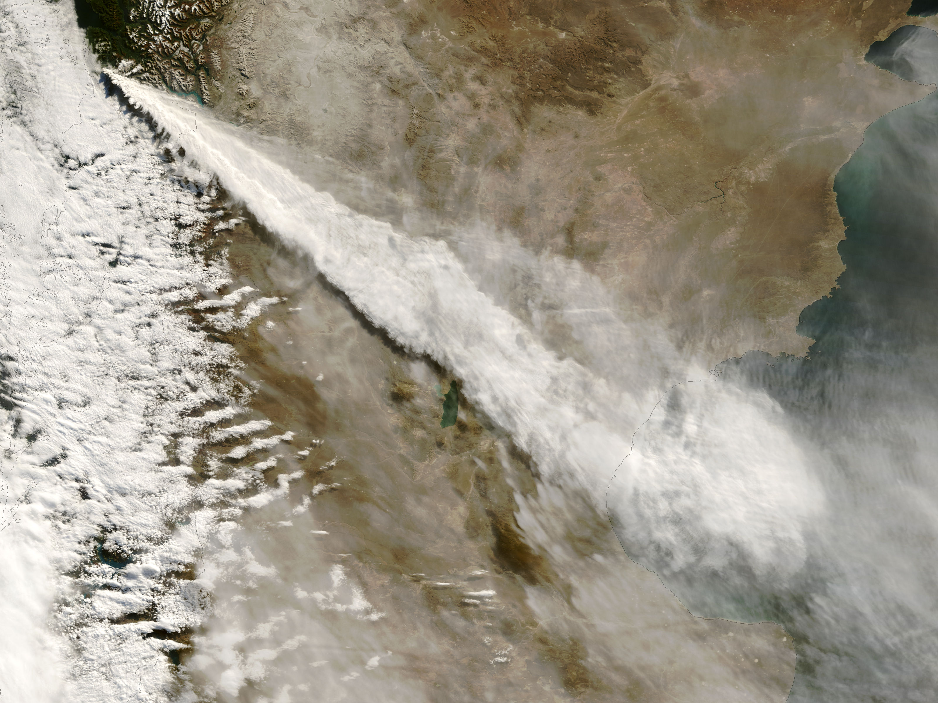
Ash cloud from the 2008 eruption of Chaitén volcano stretching across Patagonia into San Jorge Basin in the Atlantic Ocean
-

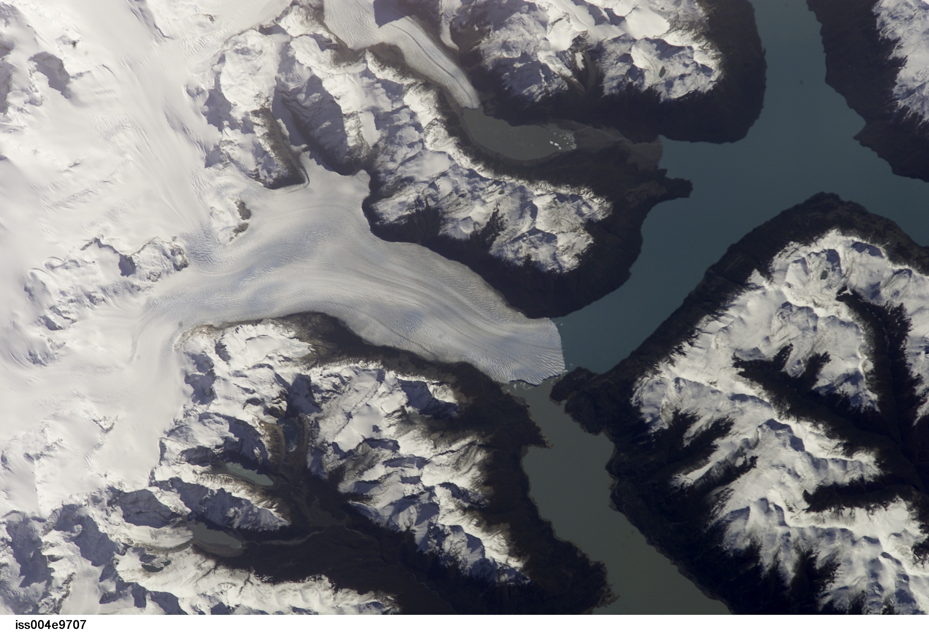
Satellite view of the Perito Moreno Glacier (Santa Cruz Province) and the Andean ice-sheet
-

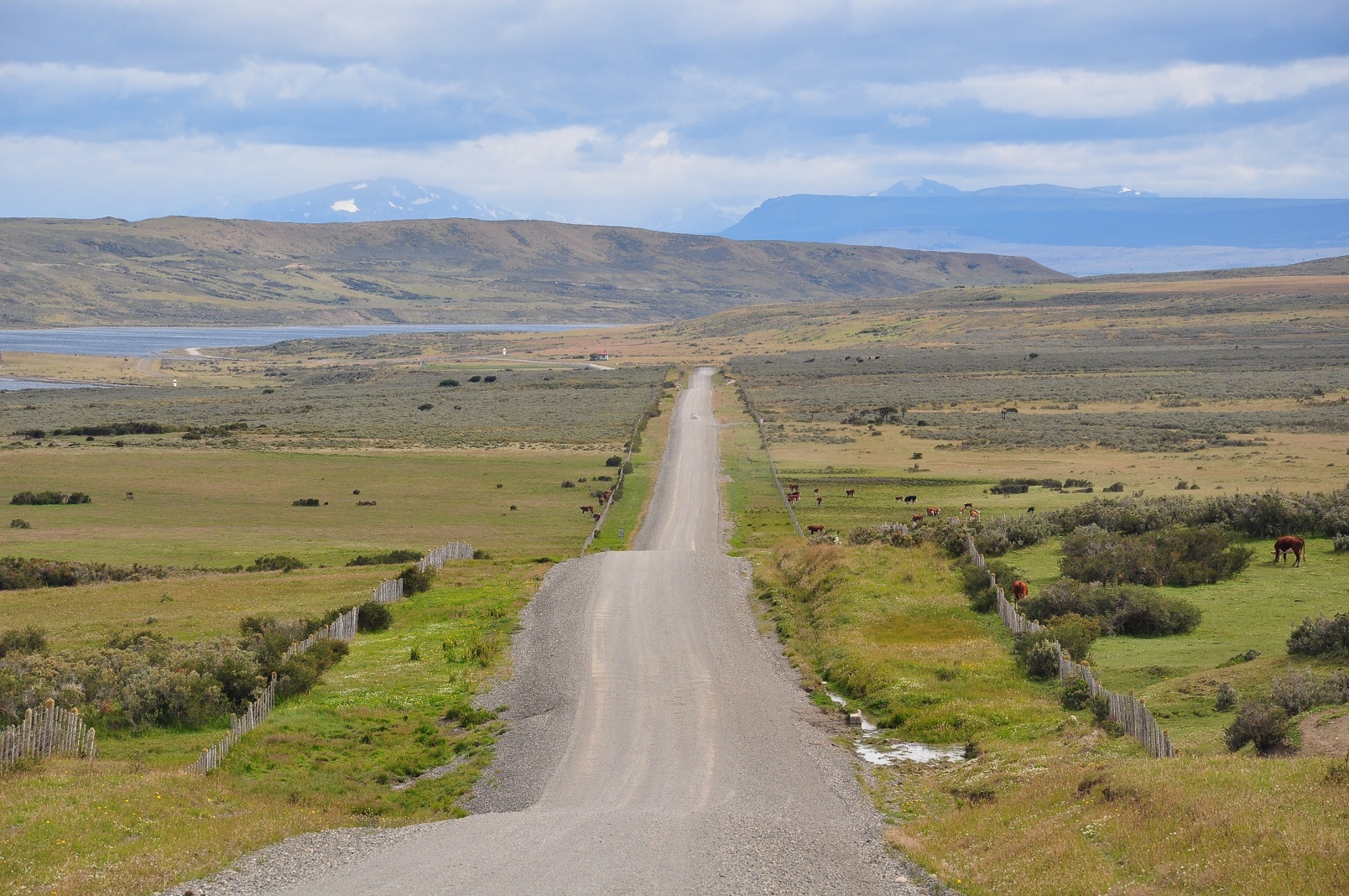
Road Y-50 towards Estancia Rio Verde, Magallanes, Chile
-

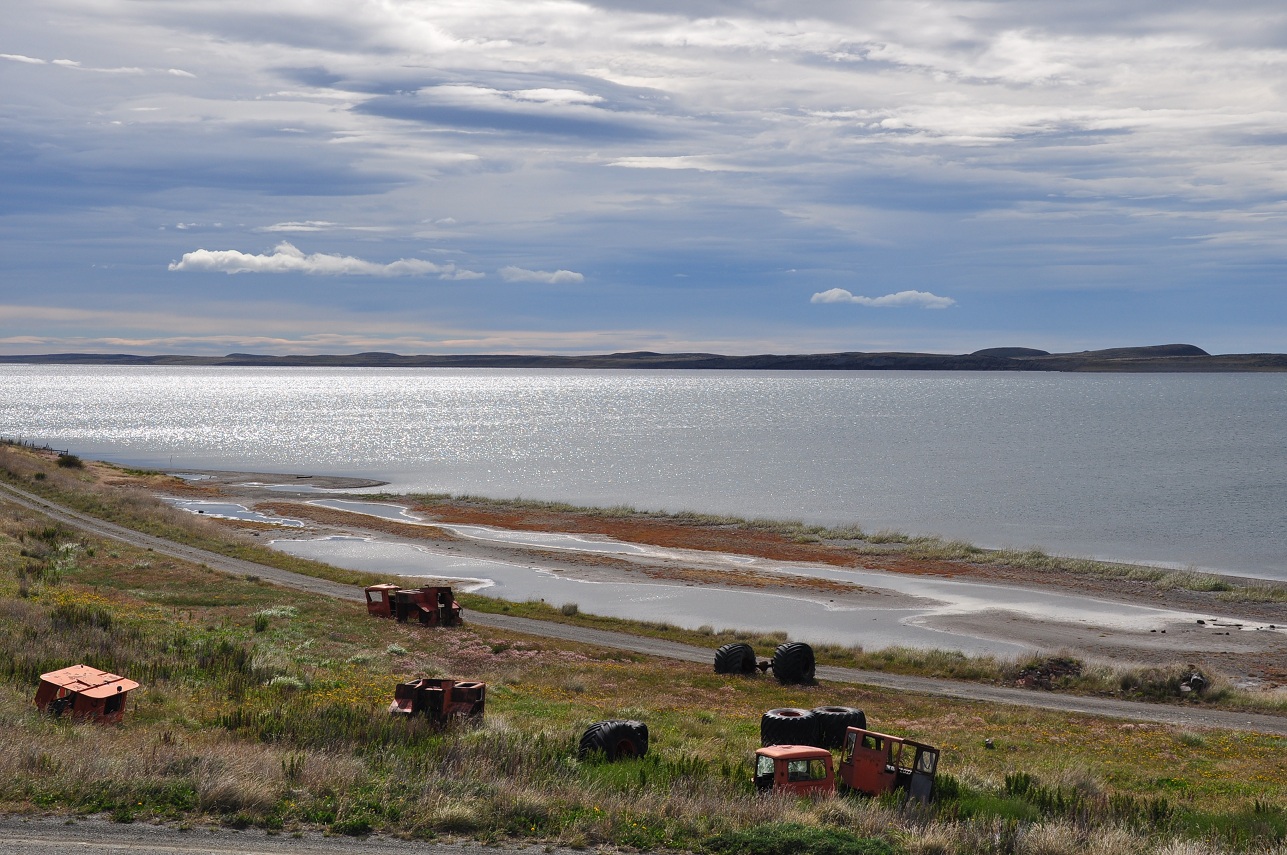
Laguna Cabeza de Mar, 50 km north of Punta Arenas, Magallanes, Chile
-

Perito Moreno Glacier, Santa Cruz Province, Argentina
-

The city of Trelew
-
MapPatagonia.gif
Map of Patagonia
See also
- Kingdom of Araucania and Patagonia
- Araucanization
- Cerro Hudson
- Conquest of the Desert
- List of deserts by area
- Patagonian Ice Sheet
- Southern Cone
- Domuyo Volcano
- Torres del Paine National Park
- Patagonian Expedition Race
References
- ^ a b c d e f g h i j k l m n Patagonia: Natural History, Prehistory and Ethnography at the Uttermost End of the Earth, C. McEwan, L.A. and A. Prieto (eds), Princeton University Press with British Museum Press, 1997. ISBN 0-691-05849-0
- ^ a b Antonio Pigafetta, Relazione del primo viaggio intorno al mondo, 1524: "Il capitano generale nominò questi popoli Patagoni." The original word would probably be in Magellan's native Portuguese (patagão) or the Spanish of his men (patagón). It has been interpreted later as "big foot" but the etymology refers to a literary character in a Spanish novel of the early XVI century (see text).
- ^ Fondebrider, Jorge (2003). "Chapter 1 – Ámbitos y voces" (in Spanish). Versiones de la Patagonia (1st edition ed.). Buenos Aires, Argentina: Emecé Editores S.A.. pp. 29. ISBN 950-04-2498-3.
- ^ Población y Economía (Spanish)
- ^ a b Patagonia chilena: historia. Santiago, Chile: Patagonia Media, 2007. ISBN 978-956-310-774-6
- ^ [1] Argentina: CIA The World Factbook, est Jul 2009.
- ^ [2] Chile: CIA The World Factbook, est Jul 2009.
- ^ Carlos Morla Vicuña and Perito Moreno 1835 study of the limits of Chile and Argentina.
- ^ Hans Steffen, analytical and geological data of Patagonia.
- ^ Palena lake national reserve article in Letsgochile.com
- ^ Pumalin Private park article in Letsgochile.com
- ^ Turismo retoma actividades en Palena tras erupción de volcán article La Tercera Newspaper
- ^ Patagonia Chilena without dams from Patagoniasinrepresas.cl
- ^ [3] from Dams for Patagonia in Science Magazine
- ^ Southern Chile warned of high radiation levels under ozone hole, CNN.com, October 10, 2000, accessed 2006-08-11
- ^ C. Michael Hogan (2008) Cueva del Milodon, The Megalithic Portal, ed. A. Burnham [4]
- ^ The Cambridge Encyclopedia of Human Growth and Development, By Stanley J. Ulijaszek, Francis E. Johnston, M. A. Preece. Cambridge University Press, 1998, p. 380: "Patagonian Giants: Myths and Possibilities."
- ^ Carolyne Ryan, "European Travel Writings and the Patagonian giants: How Patagonia got its name - among other things." Lawrence University Today magazine, Fall 2004.
- ^ Chatwin, Bruce. In Patagonia (1977). Ch. 49
- ^ http://dictionary.sensagent.com/ΠΑΤΑΓΟΣ/el-en/
- ^ Carolyne Ryan. "European Travel Writings and the Patagonian giants". Lawrence University. http://www.lawrence.edu/news/pubs/lt/fall04/giants.shtml. Retrieved August 15, 2005.
- ^ a b . JSTOR 981291.
- ^ Coihaique - Ciudades y Pueblos del sur de Chile
- ^ a b Luis Otero, La Huella del Fuego: Historia de los bosques y cambios en el paisaje del sur de Chile (Valdivia, Editorial Pehuen)
- ^ a b c d Time Out Patagonia, Cathy Runciman (ed), Penguin Books, 2002. ISBN 0-14-101240-4
- ^ History of the Old Patagonian Express, La Trochita, accessed 2006-08-11
- ^ 'The Invisible Colours of Benetton', Mapuche International Link, accessed 2006-08-11
- ^ a b "Rivers of bloodfrom Patagonia-argentina.com". http://www.patagonia-argentina.com/i/content/accesoalagosyrios.php.
- ^ "Recovered Mapuche territory in Patagonia: Benetton vs. Mapuche". MAPU Association. http://www.santarosarecuperada.com.ar/english/index.html. Retrieved 2008-04-07.
 This article incorporates text from a publication now in the public domain: Chisholm, Hugh, ed (1911). Encyclopædia Britannica (11th ed.). Cambridge University Press.
External links
- Patagon Journal, magazine about Patagonia
- Aborigines of Patagonia
- Santa Cruz Sub Secretary Of Tourism
- Patagonia SinRepresas (Spanish)
- Gallery of photos from Patagonia - February
- 'Race to the End of the Earth' - article about competing in Patagonian Expedition Race
Regions of the world 
Africa Northern · Sub-Saharan (Central · Southern · Western · Eastern) 
Oceania Australasia (Australia) · Melanesia · Micronesia · Polynesia 
America North (Northern • Middle • Central • Caribbean) · South (Southern • Northern • Western) · Anglo · Latin 
Polar Arctic · Antarctic 
Asia Central · Eastern (Northeastern) · Northern · Southeastern · Southern (Indian subcontinent) · Western (Middle East) 
Oceans World · Arctic · Atlantic · Indian · Pacific · Southern 
Europe Central · Eastern · Northern · Southeastern · Southern · Western Seas List of seas Related Continents of the world · List of seas · Physical Earth Coordinates: 41°48′37″S 68°54′23″W / 41.81015°S 68.90627°W
Categories:- Patagonia
- Regions of South America
- Deserts of Argentina
- Regions of Argentina
- Deserts of Chile
- Geography of Aisén Region
- Geography of Magellan and Chilean Antarctica Region


Wikimedia Foundation. 2010.